Broad Wood

Wood, Forest in Angus

Scotland

Broad Wood

View from the bench A bench on the side of the path at the Loch of Kinnordy gives way to this beautiful view of the swamp.
View from the bench Credit: Aleks Scholz

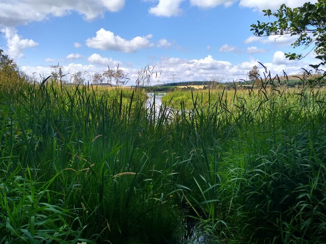
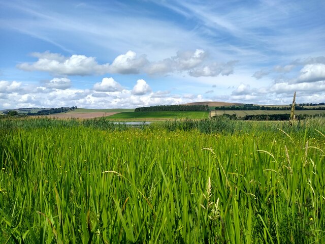
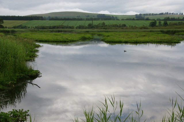
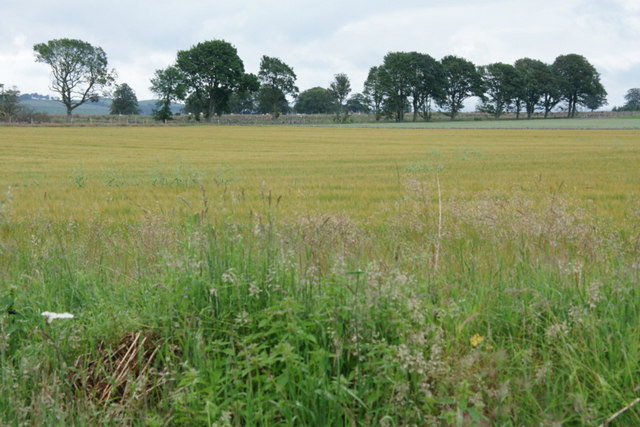
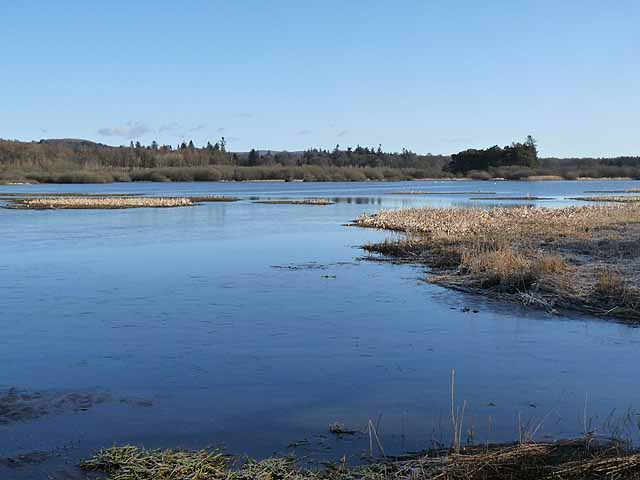
Broad Wood, located in Angus, Scotland, is a sprawling forest that is renowned for its natural beauty and diverse ecosystem. Covering an area of approximately 500 hectares, this enchanting woodland is a haven for wildlife and an ideal destination for nature enthusiasts.

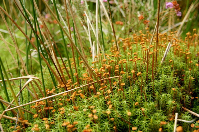
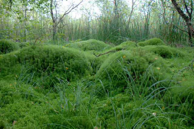
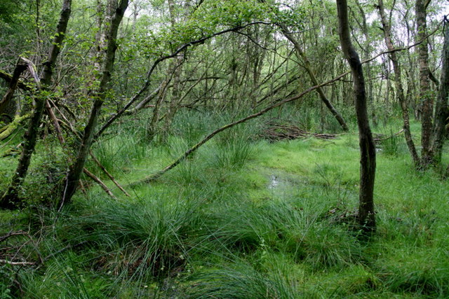
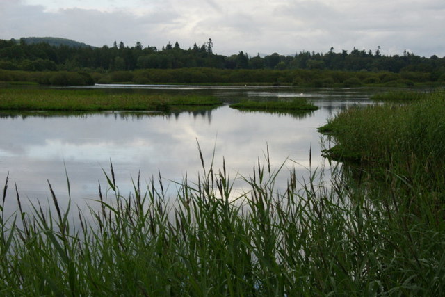
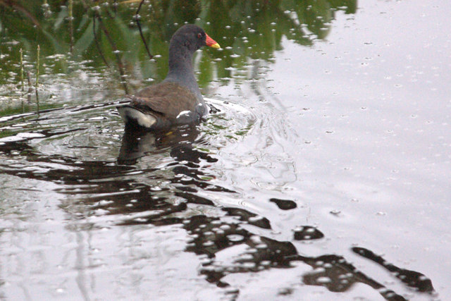
The forest boasts a rich variety of tree species, including oak, birch, and Scots pine, creating a picturesque landscape that changes with the seasons. The leafy canopy provides a sheltered habitat for a wide range of bird species, such as the great spotted woodpecker and the tawny owl. In addition, Broad Wood is home to several mammal species, including red squirrels, roe deer, and badgers.

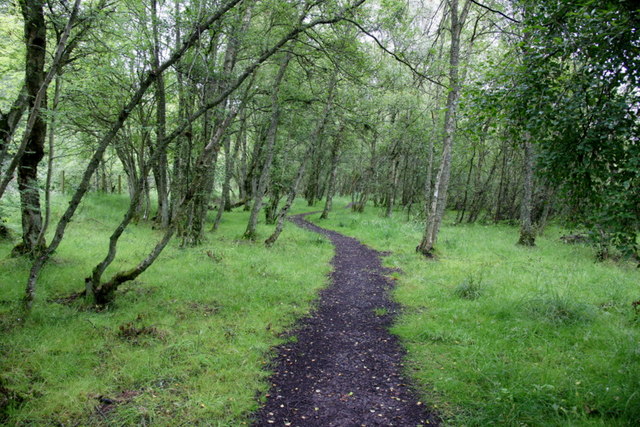
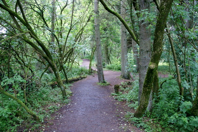
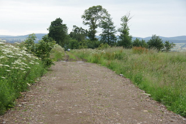
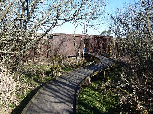
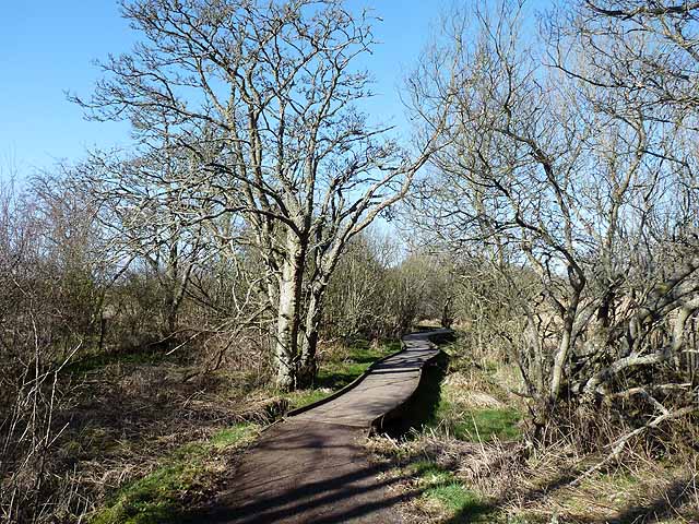
Traversing the forest, visitors can explore a network of well-maintained trails and paths that wind their way through the woodland. These pathways offer an opportunity to immerse oneself in the tranquil surroundings and enjoy the sights and sounds of nature. Along the way, one may come across babbling brooks, picturesque glens, and hidden waterfalls, adding to the allure of the forest.

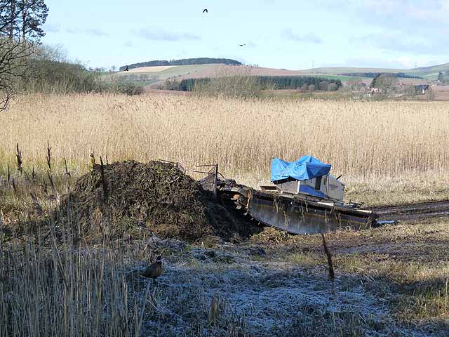
Broad Wood also caters to outdoor enthusiasts, with designated picnic areas and camping spots available for those who wish to spend more time in this idyllic setting. Nature lovers can engage in activities such as birdwatching, wildlife photography, or simply taking a leisurely stroll to soak in the serenity of the forest.

Overall, Broad Wood in Angus is a captivating destination that offers a profound connection to nature. With its diverse flora and fauna, tranquil trails, and picturesque landscapes, it is a place where visitors can escape the hustle and bustle of everyday life and find solace in the beauty of the natural world.

If you have any feedback on the listing, please let us know in the comments section below.
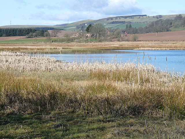
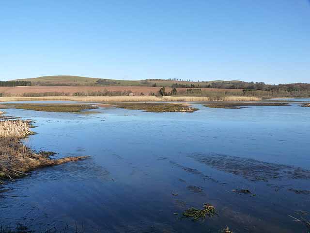
Broad Wood Images

Images are sourced within 2km of 56.661939/-3.0454932 or Grid Reference NO3652. Thanks to Geograph Open Source API. All images are credited.

View from the bench A bench on the side of the path at the Loch of Kinnordy gives way to this beautiful view of the swamp.
View from the bench
A bench on the side of the path at the Loch of Kinnordy gives way to this beautiful view of the swamp.
View from the hide This is the view over the western part of Loch of Kinnordy from the birdwatching hide at the western end of loch, called the 'Swamp Hide'. The green is a bit overwhelming.
View from the hide
This is the view over the western part of Loch of Kinnordy from the birdwatching hide at the western end of loch, called the 'Swamp Hide'. The green is a bit overwhelming.
Mosses in Westmuir Community Woodland
Mosses in Westmuir Community Woodland Fascinating tussocks of moss.
Mosses in Westmuir Community Woodland
Fascinating tussocks of moss.
Path in Westmuir Community Woodland
Westmuir Community Woodland Damp birch woodland.
Westmuir Community Woodland
Damp birch woodland.
Path in woodland at Loch of Kinnordy
East end of Loch of Kinnordy from the Gullery Hide
Loch of Kinnordy from the Gullery Hide
Moorhen (Gallinula chloropus), Loch of Kinnordy
Fields and trees, Egno Moss Most the woodland marked on maps as Reedie Strip has been cleared.
Fields and trees, Egno Moss
Most the woodland marked on maps as Reedie Strip has been cleared.
Track on to Egno Moss A small track which begins with tarmac but eventually peters out to nothing.
Track on to Egno Moss
A small track which begins with tarmac but eventually peters out to nothing.
Swamp Hide, RSPB Kinnordy One of three hides along the south side of the Loch of Kinnordy, an RSPB reserve.
Swamp Hide, RSPB Kinnordy
One of three hides along the south side of the Loch of Kinnordy, an RSPB reserve.
Loch of Kinnordy An RSPB wetland reserve. West Lochside Farm <a href="https://www.geograph.org.uk/gridref/NO3554">NO3554</a> can be seen beyond the loch.
Loch of Kinnordy
An RSPB wetland reserve. West Lochside Farm NO3554 can be seen beyond the loch.
Boardwalk at RSPB Kinnordy Boardwalk leading to Swanp Hide on this RSPB wetland reserve.
Boardwalk at RSPB Kinnordy
Boardwalk leading to Swanp Hide on this RSPB wetland reserve.
Loch of Kinnordy RSPB wetland reserve seen from the Gullery Hide.
Loch of Kinnordy
RSPB wetland reserve seen from the Gullery Hide.
Loch of Kinnordy RSPB wetland reserve, seen from the Gullery Hide.
Loch of Kinnordy
RSPB wetland reserve, seen from the Gullery Hide.
The Truxor at Loch of Kinnordy The Truxor is an amphibious weed-cutter, excavator and dredger, here seen on site at the RSPB wetland reserve at the Loch of Kinnordy where it is being used to chop up the bog-bean islands which have formed in the loch.
The Truxor at Loch of Kinnordy
The Truxor is an amphibious weed-cutter, excavator and dredger, here seen on site at the RSPB wetland reserve at the Loch of Kinnordy where it is being used to chop up the bog-bean islands which have formed in the loch.
Show me another place!

Broad Wood is located at Grid Ref: NO3652 (Lat: 56.661939, Lng: -3.0454932)

Unitary Authority: Angus

Police Authority: Tayside

What 3 Words

///punctured.angel.offshore. Near Kirriemuir, Angus

Nearby Locations

Broad Wood Westmuir

Related Wikis

Loch of Kinnordy

Loch of Kinnordy is a small loch located just west of town of Kirriemuir in Angus, Scotland, which is an important wildlife habitat. The loch itself is...

Kirriemuir Thistle F.C.

Kirriemuir Thistle Football Club are a Scottish junior football club based in Kirriemuir, Angus. Their home ground is Westview Park. Up until the end of...

Kinnordy House

Kinnordy House (alternative spellings: Kynnordy, Kinardy, Kinnordie and Kinorde) is an estate house near Kirriemuir in Angus, Scotland. The first house...

Webster's High School

Webster's High School is a secondary school in Kirriemuir, Angus, Scotland. The school has run for over 150 years, and there are over 650 pupils in the...

Nearby Amenities

Located within 500m of 56.661939,-3.0454932
Turning Circle
Lat/Long: 56.6626947/-3.0382726
Turning Circle
Lat/Long: 56.662074/-3.0376587
Bench
Lat/Long: 56.6607111/-3.0408347
Barrier: cycle_barrier
Lat/Long: 56.6602882/-3.0439482
Westmuir
Name Sco: Wastmuir
Place: village
Population: 500
Lat/Long: 56.6616444/-3.037339
Information: board
Tourism: information
Lat/Long: 56.6613605/-3.0375273
Bench
Lat/Long: 56.6614769/-3.0377016
Power: pole
Lat/Long: 56.6663252/-3.0445845
Power: pole
Lat/Long: 56.665921/-3.0443284
Power: pole
Lat/Long: 56.6652133/-3.0438113
Power: pole
Lat/Long: 56.6645056/-3.0433319
Power: pole
Lat/Long: 56.6643157/-3.043198
Power: pole
Lat/Long: 56.6595746/-3.0421334
Power: pole
Lat/Long: 56.6600822/-3.0410007
Power: pole
Lat/Long: 56.6605833/-3.0398586
Power: pole
Lat/Long: 56.6610754/-3.038082
The data included in this document is from www.openstreetmap.org. The data is made available under ODbL.

Have you been to Broad Wood?

Leave your review of Broad Wood below (or comments, questions and feedback).