Cohooley Wood

Wood, Forest in Midlothian

Scotland

Cohooley Wood

Lawfield Farm Sign Sign on public road for Lawfield Farm and Steading above Mayfield in Midlothian.
Lawfield Farm Sign Credit: Adam Ward

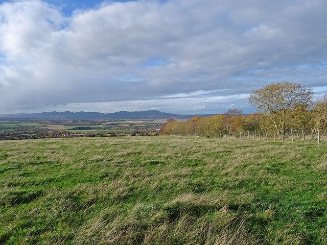
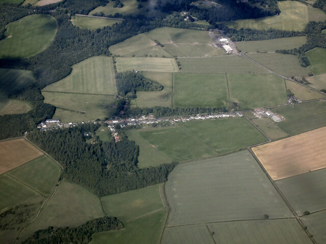
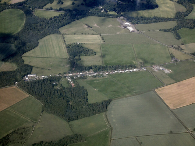
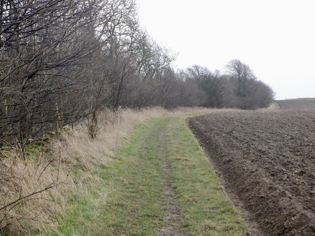
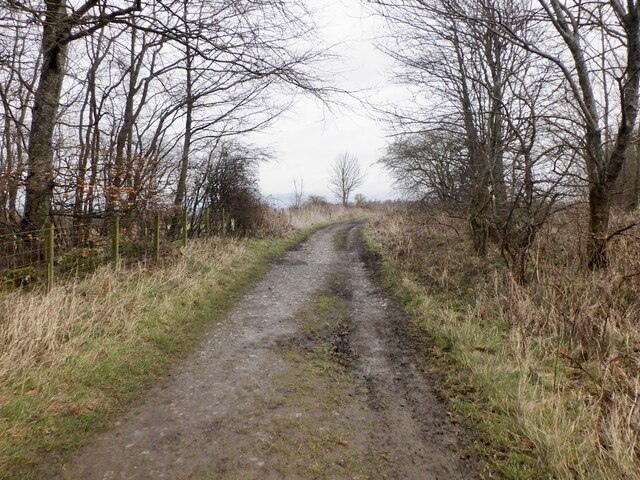
Cohooley Wood is a picturesque woodland located in the Midlothian region of Scotland. Spread across an area of approximately 100 acres, it is one of the most enchanting and serene forests in the area. The wood is predominantly composed of native Scottish trees, such as oak, birch, and pine, creating a diverse and vibrant ecosystem.

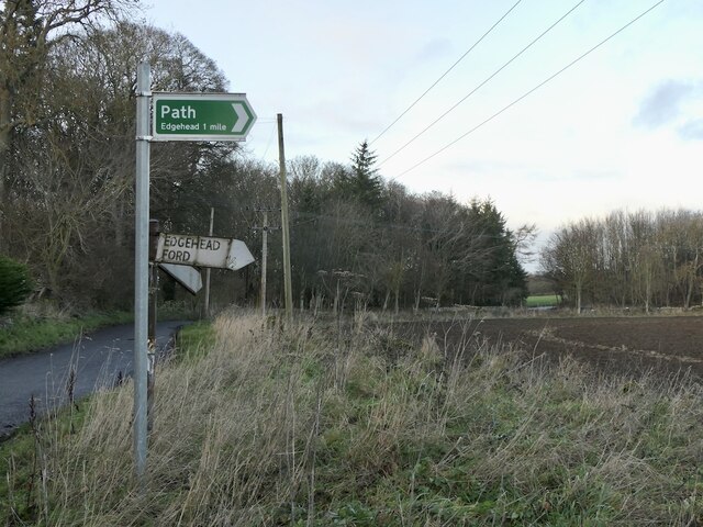
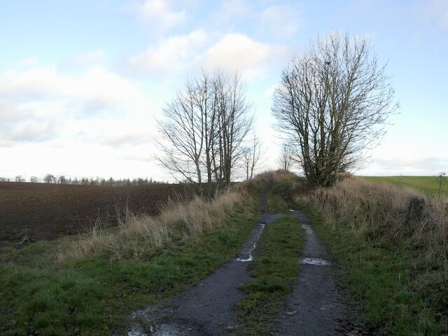
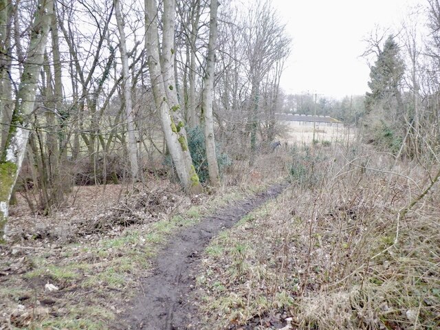
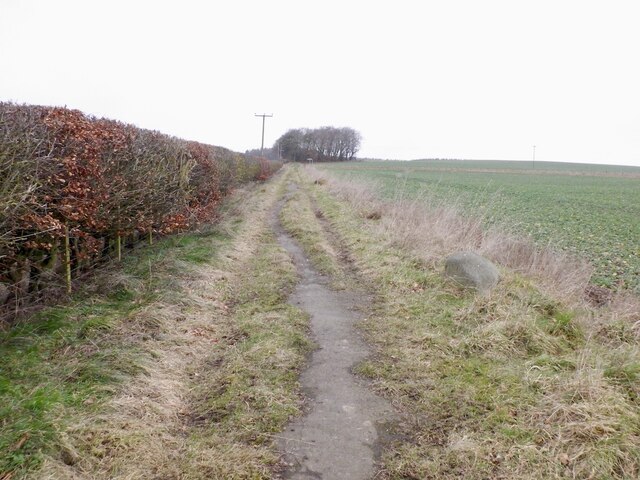
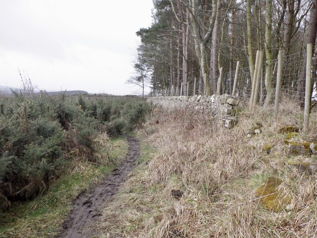
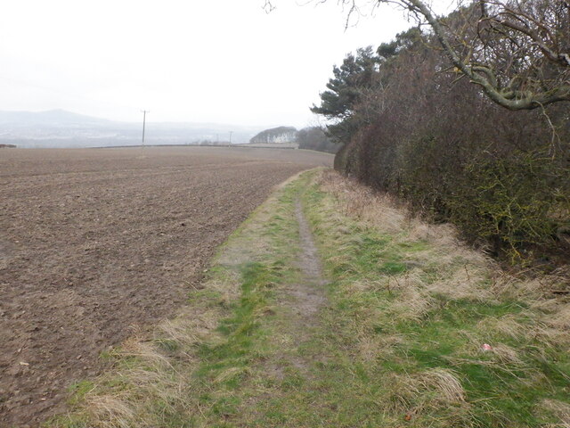
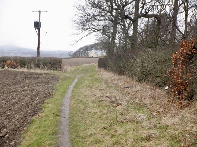
The wood is renowned for its natural beauty and is a popular destination for nature enthusiasts and hikers. The well-maintained trails that crisscross the woodland offer visitors the opportunity to explore its lush greenery, with breathtaking views at every turn. The tranquil atmosphere and peaceful ambiance make Cohooley Wood an ideal spot for those seeking solace and relaxation.

Wildlife is abundant in Cohooley Wood, providing nature lovers with the chance to spot various species of birds, squirrels, deer, and even the occasional fox. The forest is known for its rich biodiversity, with numerous rare and protected species finding refuge within its borders.

The wood is also steeped in history, with ancient ruins and remnants of settlements dating back centuries. Archaeological excavations have revealed evidence of human habitation in the area, adding another layer of intrigue to the woodland's charm.

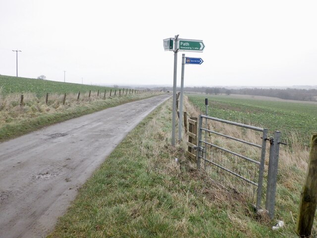
Cohooley Wood is easily accessible, with well-marked entrances and ample parking facilities. It offers a range of amenities, including picnic areas, benches, and information boards, ensuring visitors have a comfortable and enjoyable experience.

Whether you are a nature enthusiast, a history buff, or simply seeking a peaceful retreat, Cohooley Wood is a must-visit destination that promises to leave visitors in awe of its natural beauty and tranquility.

If you have any feedback on the listing, please let us know in the comments section below.

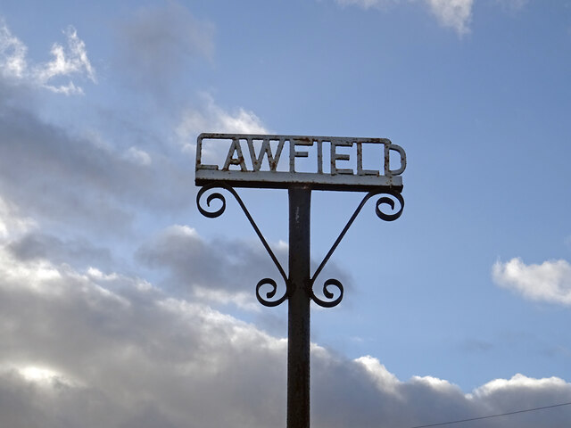
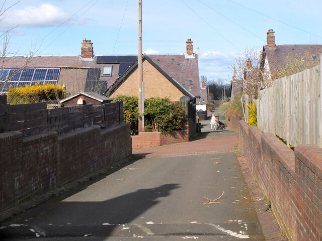
Cohooley Wood Images

Images are sourced within 2km of 55.866288/-3.0323223 or Grid Reference NT3564. Thanks to Geograph Open Source API. All images are credited.

Lawfield Farm Sign Sign on public road for Lawfield Farm and Steading above Mayfield in Midlothian.
Lawfield Farm Sign
Sign on public road for Lawfield Farm and Steading above Mayfield in Midlothian.
Lane, Newtongrange A lane between Fourth Street and Fifth Street in this 19th century mining village with a gridiron layout. Note the solar panels.
Lane, Newtongrange
A lane between Fourth Street and Fifth Street in this 19th century mining village with a gridiron layout. Note the solar panels.
Above Gorebridge From the high point of a walk called the Gorebridge Circular there is a fine view across to the Pentland Hills. Loanhead, Bonnyrigg and Lasswade can all be seen just above the trees in the foreground.
Info on the 8 mile walk here:-
<span class="nowrap"><a title="https://gorebridge.org.uk/wp-content/uploads/2021/01/Walk-8-Gorebridge-Circular-Page.pdf" rel="nofollow ugc noopener" href="https://gorebridge.org.uk/wp-content/uploads/2021/01/Walk-8-Gorebridge-Circular-Page.pdf">Link</a><img style="margin-left:2px;" alt="External link" title="External link - shift click to open in new window" src="https://s1.geograph.org.uk/img/external.png" width="10" height="10"/></span>
Above Gorebridge
From the high point of a walk called the Gorebridge Circular there is a fine view across to the Pentland Hills. Loanhead, Bonnyrigg and Lasswade can all be seen just above the trees in the foreground. Info on the 8 mile walk here:- LinkExternal link
Edgehead from the air Windmill Wood is in the left foreground.
Edgehead from the air
Windmill Wood is in the left foreground.
Edgehead from the air Windmill Wood is in the left foreground.
Edgehead from the air
Windmill Wood is in the left foreground.
Signpost near D' Arcy House The implication that the rough track to Edgehead was once a motor road.  This was once a small oilfield.
Signpost near D' Arcy House
The implication that the rough track to Edgehead was once a motor road. This was once a small oilfield.
D' Arcy to Edgehead road Once the Midlothian oilfield, the road like the oilwell (1919-22) is defunct. Still part of the path network.
D' Arcy to Edgehead road
Once the Midlothian oilfield, the road like the oilwell (1919-22) is defunct. Still part of the path network.
Road, Southside
Road, Southside
Path from Newlandrig to Chesters Wood
Path from Newlandrig to Chesters Wood Tarred, a legacy from open cast mining here.
Path from Newlandrig to Chesters Wood
Tarred, a legacy from open cast mining here.
Road - path junction, Blinkbonny Reclaimed open cast site.
Road - path junction, Blinkbonny
Reclaimed open cast site.
Path, Camp Wood From Newlandrig.
Path, Camp Wood
From Newlandrig.
Path beside Limekiln Wood It leads to Lawfield. There is a lot of litter in the wood on the right, probably blown in from nearby Mayfield.
Path beside Limekiln Wood
It leads to Lawfield. There is a lot of litter in the wood on the right, probably blown in from nearby Mayfield.
Path beside Limekiln Wood It leads to Lawfield. There is a lot of litter in the wood on the right, probably blown in from nearby Mayfield.
Path beside Limekiln Wood
It leads to Lawfield. There is a lot of litter in the wood on the right, probably blown in from nearby Mayfield.
Lawfield Newly built houses on the site of a farm.
Lawfield
Newly built houses on the site of a farm.
Lawfield Newly built houses on the site of a farm.
Lawfield
Newly built houses on the site of a farm.
Path near D'Arcy Climbing beside Spy Law Wood towards the site of the oilwell.
Path near D'Arcy
Climbing beside Spy Law Wood towards the site of the oilwell.
D'Arcy to Edgehead road Passing Spy Law Wood
D'Arcy to Edgehead road
Passing Spy Law Wood
Show me another place!

Cohooley Wood is located at Grid Ref: NT3564 (Lat: 55.866288, Lng: -3.0323223)

Unitary Authority: Midlothian

Police Authority: The Lothians and Scottish Borders

What 3 Words

///framework.gazed.disclose. Near Mayfield, Midlothian

Related Wikis

Mayfield, Midlothian

Mayfield is a community in Midlothian, Scotland, located just south of Dalkeith near Edinburgh between the A68 and the A7 south. It had an estimated population...

D'Arcy, Midlothian

D'Arcy is a hamlet in Midlothian, Scotland, located just south of Dalkeith near Edinburgh. It is ΒΌ mile east of Mayfield and lies within the Civil Parish...

Easthouses Lily Miners Welfare F.C.

Easthouses Lily Miners Welfare Football Club are a Scottish football club, based in the Midlothian town of Easthouses. The team currently plays in the...

Easthouses

Easthouses is a settlement in Midlothian, Scotland, lying to the east of Newtongrange and south of Dalkeith. It forms the northern extension of the settlement...

Nearby Amenities

Located within 500m of 55.866288,-3.0323223
Turning Circle
Lat/Long: 55.8645715/-3.0358704
Post Box
Collection Times: Mo-Fr 09:00; Sa 07:00
Operator: Royal Mail
Post Box Mounting: pier
Post Box Type: lamp
Ref: EH22 192D
Royal Cypher: scottish_crown
Source: survey
Lat/Long: 55.8672169/-3.0361276
Bus Stop
The Kilns
Bus: yes
Naptan AdministrativeAreaCode: 130
Naptan Area Name: Midlothian
Naptan AtcoAreaCode: 628
Naptan AtcoCode: 6280300935
Naptan Bearing: NE
Naptan CommonName: The Kilns
Naptan Indicator: NE-bound
Naptan Landmark: -
Naptan LocalityName: Mayfield
Naptan NaptanCode: 64323925
Naptan NptgLocalityCode: ES002569
Naptan QualifierName: Midlothian
Naptan SourceLocalityType: Lo
Naptan StopAreaCode: 628G300935
Naptan StopAreaType: GPBS
Naptan StopArea Name: The Kilns
Naptan Street: Unnamed Road
Naptan Verified: yes
Public Transport: platform
Shelter: yes
Source: NaPTAN + Survey
Lat/Long: 55.869072/-3.0341155
Bus Stop
The Kilns
Bus: yes
Naptan AdministrativeAreaCode: 130
Naptan Area Name: Midlothian
Naptan AtcoAreaCode: 628
Naptan AtcoCode: 6280326790
Naptan Bearing: SW
Naptan CommonName: The Kilns
Naptan Indicator: SW-bound
Naptan Landmark: -
Naptan LocalityName: Mayfield
Naptan NaptanCode: 64323892
Naptan NptgLocalityCode: ES002569
Naptan QualifierName: Midlothian
Naptan SourceLocalityType: Lo
Naptan StopAreaCode: 628G300935
Naptan StopAreaType: GPBS
Naptan StopArea Name: The Kilns
Naptan Street: Unnamed Road
Naptan Verified: yes
Public Transport: platform
Source: NaPTAN + Survey
Lat/Long: 55.8691399/-3.0336957
Communication Gsm: yes
Communication Lte: yes
Communication Mobile: yes
Communication Umts: yes
Man Made: tower
Tower Type: communication
Lat/Long: 55.864964/-3.0250273
Bus Stop
Westhouses Road
Bench: no
Bus: yes
Naptan AdministrativeAreaCode: 130
Naptan Area Name: Midlothian
Naptan AtcoAreaCode: 628
Naptan AtcoCode: 6280300939
Naptan Bearing: NE
Naptan CommonName: Westhouses Road
Naptan Indicator: at 56
Naptan Landmark: -
Naptan LocalityName: Mayfield
Naptan NaptanCode: 64324639
Naptan NptgLocalityCode: ES002569
Naptan QualifierName: Midlothian
Naptan SourceLocalityType: Lo
Naptan StopAreaCode: 628G326800
Naptan StopAreaType: GPBS
Naptan StopArea Name: Westhouses Avenue
Naptan Street: Westhouses Road
Naptan Verified: yes
Public Transport: platform
Shelter: no
Source: NaPTAN + Survey
Lat/Long: 55.8672851/-3.0358458
Midlothian Private Hire Taxis
Addr City: Dalkeith
Addr Housenumber: 62
Addr Postcode: EH22 5QP
Addr Street: Westhouses Road
Addr Suburb: Mayfield
Office: taxi
Phone: +44 131 454 0300
Taxi: airport transfers
Lat/Long: 55.8673565/-3.0362052
Addr Housenumber: 2
Addr Street: Hughes Crescent
Lat/Long: 55.8702687/-3.0298204
Bus Stop
Hill Place
Bus: yes
Naptan AdministrativeAreaCode: 130
Naptan Area Name: Midlothian
Naptan AtcoAreaCode: 628
Naptan AtcoCode: 6280326700
Naptan Bearing: NE
Naptan CommonName: Hill Place
Naptan Indicator: at 2
Naptan Landmark: -
Naptan LocalityName: Mayfield
Naptan NaptanCode: 64323865
Naptan NptgLocalityCode: ES002569
Naptan QualifierName: Midlothian
Naptan SourceLocalityType: Lo
Naptan StopAreaCode: 628G326700
Naptan StopAreaType: GPBS
Naptan StopArea Name: Hill Place
Naptan Street: Bogwood Road
Naptan Verified: yes
Public Transport: platform
Shelter: yes
Source: NaPTAN + Survey
Lat/Long: 55.8675426/-3.0379359
Bus Stop
Hill Place
Bus: yes
Naptan AdministrativeAreaCode: 130
Naptan Area Name: Midlothian
Naptan AtcoAreaCode: 628
Naptan AtcoCode: 6280300950
Naptan Bearing: SW
Naptan CommonName: Hill Place
Naptan Indicator: opp
Naptan Landmark: -
Naptan LocalityName: Mayfield
Naptan NaptanCode: 64323864
Naptan NptgLocalityCode: ES002569
Naptan QualifierName: Midlothian
Naptan SourceLocalityType: Lo
Naptan StopAreaCode: 628G326700
Naptan StopAreaType: GPBS
Naptan StopArea Name: Hill Place
Naptan Street: Bogwood Road
Naptan Verified: yes
Public Transport: platform
Source: NaPTAN + Survey
Lat/Long: 55.8672388/-3.0380362
Bus Stop
Cook Crescent
Bus: yes
Naptan AdministrativeAreaCode: 130
Naptan Area Name: Midlothian
Naptan AtcoAreaCode: 628
Naptan AtcoCode: 6280300945
Naptan Bearing: SW
Naptan CommonName: Cook Crescent
Naptan Indicator: opp
Naptan LocalityName: Mayfield
Naptan NaptanCode: 64325742
Naptan NptgLocalityCode: ES002569
Naptan QualifierName: Midlothian
Naptan SourceLocalityType: Lo
Naptan StopAreaCode: 628G300945
Naptan StopAreaType: GPBS
Naptan StopArea Name: Cook Crescent
Naptan Street: Bogwood Road
Naptan Verified: yes
Public Transport: platform
Source: NaPTAN + Survey
Lat/Long: 55.866494/-3.0397052
Bus Stop
Westhouses Drive
Bus: yes
Naptan AdministrativeAreaCode: 130
Naptan Area Name: Midlothian
Naptan AtcoAreaCode: 628
Naptan AtcoCode: 6280300940
Naptan Bearing: NE
Naptan CommonName: Westhouses Drive
Naptan Indicator: at
Naptan Landmark: opp John Humble Street
Naptan LocalityName: Mayfield
Naptan NaptanCode: 64323924
Naptan NptgLocalityCode: ES002569
Naptan QualifierName: Midlothian
Naptan SourceLocalityType: Lo
Naptan StopAreaCode: 628G300940
Naptan StopAreaType: GPBS
Naptan StopArea Name: Westhouses Drive
Naptan Street: Westhouses Road
Naptan Verified: yes
Public Transport: platform
Source: NaPTAN + Survey
Lat/Long: 55.8659882/-3.0375592
Bus Stop
Westhouses Drive
Bus: yes
Naptan AdministrativeAreaCode: 130
Naptan Area Name: Midlothian
Naptan AtcoAreaCode: 628
Naptan AtcoCode: 6280326810
Naptan Bearing: SW
Naptan CommonName: Westhouses Drive
Naptan Indicator: opp
Naptan Landmark: John Humble Street
Naptan LocalityName: Mayfield
Naptan NaptanCode: 64323923
Naptan NptgLocalityCode: ES002569
Naptan QualifierName: Midlothian
Naptan SourceLocalityType: Lo
Naptan StopAreaCode: 628G300940
Naptan StopAreaType: GPBS
Naptan StopArea Name: Westhouses Drive
Naptan Street: Westhouses Road
Naptan Verified: yes
Public Transport: platform
Source: NaPTAN + Survey
Lat/Long: 55.8662057/-3.0371132
Bus Stop
Westhouses Avenue
Bus: yes
Naptan AdministrativeAreaCode: 130
Naptan Area Name: Midlothian
Naptan AtcoAreaCode: 628
Naptan AtcoCode: 6280326800
Naptan Bearing: SW
Naptan CommonName: Westhouses Avenue
Naptan Indicator: opp
Naptan Landmark: park entrance
Naptan LocalityName: Mayfield
Naptan NaptanCode: 64323898
Naptan NptgLocalityCode: ES002569
Naptan QualifierName: Midlothian
Naptan SourceLocalityType: Lo
Naptan StopAreaCode: 628G326800
Naptan StopAreaType: GPBS
Naptan StopArea Name: Westhouses Avenue
Naptan Street: Westhouses Road
Naptan Verified: yes
Public Transport: platform
Source: NaPTAN + Survey
Lat/Long: 55.8679994/-3.0341414
Give Way
Direction: forward
Lat/Long: 55.8694804/-3.0331707
Give Way
Direction: forward
Lat/Long: 55.8696903/-3.0335771
Give Way
Direction: forward
Lat/Long: 55.8703548/-3.0347317
Generator Method: photovoltaic
Generator Output Electricity: yes
Generator Source: solar
Generator Type: solar_photovoltaic_panel
Power: generator
Lat/Long: 55.8668859/-3.0400348
Generator Method: photovoltaic
Generator Output Electricity: yes
Generator Source: solar
Generator Type: solar_photovoltaic_panel
Power: generator
Lat/Long: 55.8668505/-3.0400502
Addr Housenumber: 12
Addr Postcode: EH22 5TR
Addr Street: Beveridge Avenue
Lat/Long: 55.8645181/-3.0355323
Addr Housenumber: 16
Addr Street: Beveridge Avenue
Lat/Long: 55.8648104/-3.0353144
Addr Housenumber: 15
Addr Street: Beveridge Avenue
Lat/Long: 55.8647457/-3.035422
Addr Housenumber: 14
Addr Street: Beveridge Avenue
Lat/Long: 55.8646481/-3.0354695
Addr Housenumber: 13
Addr Street: Beveridge Avenue
Lat/Long: 55.8646317/-3.035498
Addr Housenumber: 11
Addr Street: Beveridge Avenue
Lat/Long: 55.8644532/-3.0356447
The data included in this document is from www.openstreetmap.org. The data is made available under ODbL.

Have you been to Cohooley Wood?

Leave your review of Cohooley Wood below (or comments, questions and feedback).