Cushat Wood

Wood, Forest in Dumfriesshire

Scotland

Cushat Wood

Below Little Hill During a very dry Summer.  This was the last hot day however.
Below Little Hill Credit: Richard Webb

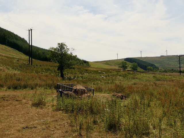
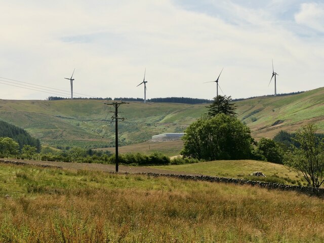
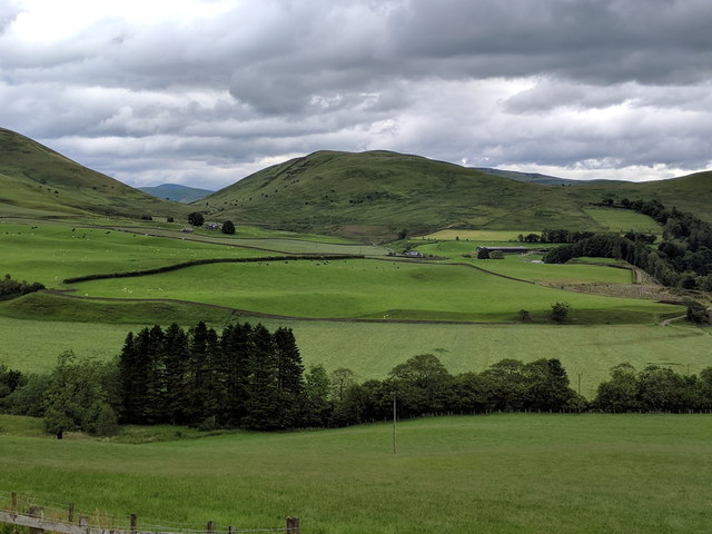
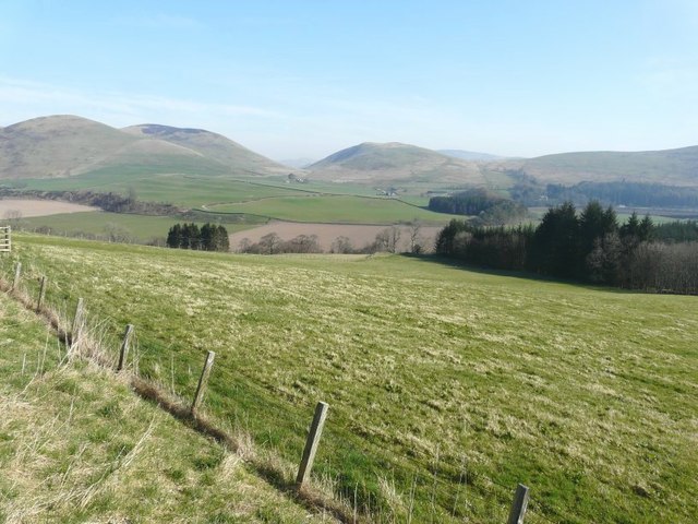
Cushat Wood, located in Dumfriesshire, Scotland, is a captivating forest that boasts breathtaking natural beauty and a rich history. Covering an area of approximately 200 acres, this woodland is a haven for nature enthusiasts and those seeking tranquility amidst the stunning Scottish landscape.

The wood is primarily composed of mixed deciduous trees, including oak, beech, and birch, which create a diverse and vibrant ecosystem. The dense canopy provides shade and shelter for a variety of wildlife, such as red squirrels, roe deer, and a range of bird species, including the elusive cuckoo.

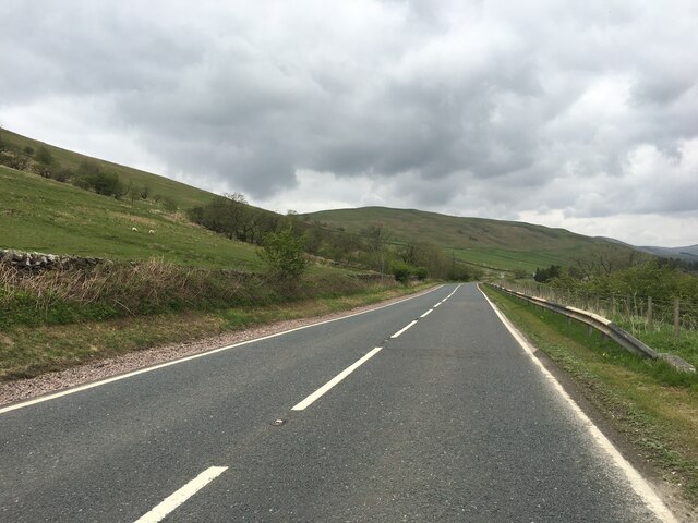
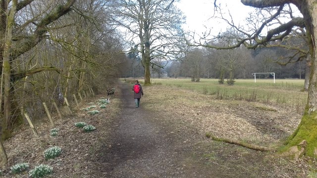
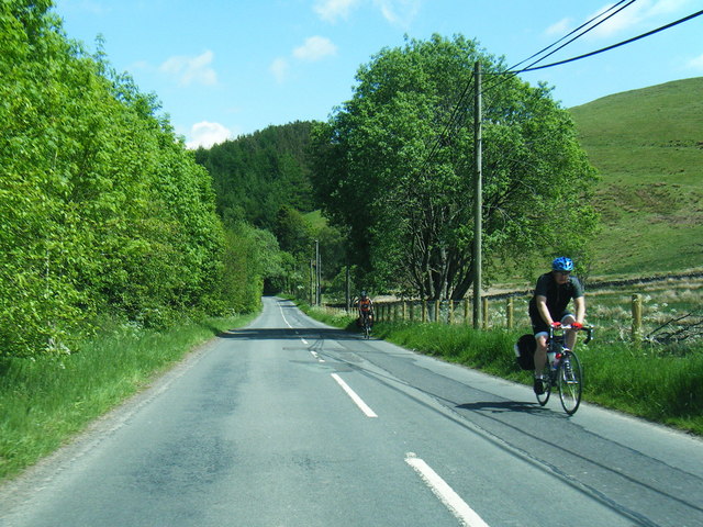
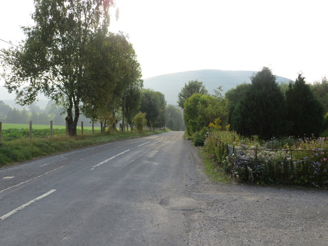
Nature lovers can explore the numerous walking trails that wind through the forest, offering stunning views of the surrounding countryside. The paths are well-maintained and suitable for all ages and abilities, making it a popular destination for families and avid hikers alike.

Cushat Wood has a rich historical significance, with traces of human activity dating back centuries. The remains of ancient settlements and stone circles can still be found within the forest, giving visitors a glimpse into the past. Additionally, the wood was once a vital resource for timber, providing materials for construction and fuel.

Today, Cushat Wood is a protected area, managed by local authorities to preserve its natural beauty and ecological importance. Visitors are encouraged to respect the environment and adhere to any guidelines or restrictions in place.

Overall, Cushat Wood offers a unique opportunity to connect with nature, absorb the tranquility of the forest, and immerse oneself in the captivating history of Dumfriesshire.

If you have any feedback on the listing, please let us know in the comments section below.

Cushat Wood Images

Images are sourced within 2km of 55.17422/-3.023902 or Grid Reference NY3487. Thanks to Geograph Open Source API. All images are credited.

Below Little Hill During a very dry Summer.  This was the last hot day however.
Below Little Hill
During a very dry Summer. This was the last hot day however.
View towards Craig windfarm
A7 near Wrae
A7 near Wrae
Public footpath Public footpath near Castle Holm.
Public footpath
Public footpath near Castle Holm.
The Esk valley, seen from the roadside
Milnholm Farm This farm on the north side of Langholm was viewed from Castle Hill.
Milnholm Farm
This farm on the north side of Langholm was viewed from Castle Hill.
Castle Hill The ridge of the hill consists of rough grazing while most of the lower flanks are forested. This is a view towards the River Esk with Golf Hill in the central background.
Castle Hill
The ridge of the hill consists of rough grazing while most of the lower flanks are forested. This is a view towards the River Esk with Golf Hill in the central background.
A small tree on Potholm Hill This small tree has survived the nibbling jaws of sheep and deer as a sapling and stands alone along the ridge of Castle Hill and Potholm Hill on the north side of Langholm.
A small tree on Potholm Hill
This small tree has survived the nibbling jaws of sheep and deer as a sapling and stands alone along the ridge of Castle Hill and Potholm Hill on the north side of Langholm.
The B709 south of Craigcleuch The trees mark the position of Craigcleuch, which is situated in Eskdale.
The B709 south of Craigcleuch
The trees mark the position of Craigcleuch, which is situated in Eskdale.
View from B709 north of Craigcleuch
B709 near Camra Cottages
Road (B709) at Camra Cottages Looking westward.
Road (B709) at Camra Cottages
Looking westward.
Ordnance Survey Flush Bracket S7360 This can be found on the wall of a private dwelling at Camra Cottages.
For more detail see : <span class="nowrap"><a title="http://www.bench-marks.org.uk/bm11286" rel="nofollow ugc noopener" href="http://www.bench-marks.org.uk/bm11286">Link</a><img style="margin-left:2px;" alt="External link" title="External link - shift click to open in new window" src="https://s1.geograph.org.uk/img/external.png" width="10" height="10"/></span>
Ordnance Survey Flush Bracket S7360
This can be found on the wall of a private dwelling at Camra Cottages. For more detail see : LinkExternal link
En Route To Potholme Hill Walking from Wrae Hill towards Potholme Hill.
En Route To Potholme Hill
Walking from Wrae Hill towards Potholme Hill.
Potholme Hill Parked by the cattle grid to the ENE on minor road then up Wrae Hill and onto Potholm Hill with Phil Cooper.
Name: Potholm Hill
Hill number: 5133
Height: 310m / 1017ft
Parent (Ma/M): 1920  Pikethaw Hill
Section: 28B: The River Tweed to the English Border
County/UA: Dumfries and Galloway (UA)
Class: HuMP, Tump (300-399m)
Grid ref: NY 36318 87354
Summit feature: no feature: ground near cairn E of wall
Drop: 138m
Col: 172m  NY361896
Potholme Hill
Parked by the cattle grid to the ENE on minor road then up Wrae Hill and onto Potholm Hill with Phil Cooper. Name: Potholm Hill Hill number: 5133 Height: 310m / 1017ft Parent (Ma/M): 1920 Pikethaw Hill Section: 28B: The River Tweed to the English Border County/UA: Dumfries and Galloway (UA) Class: HuMP, Tump (300-399m) Grid ref: NY 36318 87354 Summit feature: no feature: ground near cairn E of wall Drop: 138m Col: 172m NY361896
Esk Valley north of Langholm Esk Valley north of Langholm showing Golf, Bauchle and Wrae Hills
Esk Valley north of Langholm
Esk Valley north of Langholm showing Golf, Bauchle and Wrae Hills
Sheepfold by Mill Beck
Pasture Viewed from the Burnfoot Road. The wooded hill is Dowglen Hill with Golf Hill on the right.
Pasture
Viewed from the Burnfoot Road. The wooded hill is Dowglen Hill with Golf Hill on the right.
Show me another place!

Cushat Wood is located at Grid Ref: NY3487 (Lat: 55.17422, Lng: -3.023902)

Unitary Authority: Dumfries and Galloway

Police Authority: Dumfries and Galloway

What 3 Words

///newlyweds.indulges.moment. Near Langholm, Dumfries & Galloway

Related Wikis

Barntalloch Castle

Barntalloch Castle was a castle located at Staplegorton, in Dumfries and Galloway, Scotland. The castle was built in the 12th century by Galfrid de Coninsburgh...

Duchess Bridge

The Duchess Bridge is a cast iron footbridge over the River Esk in Dumfries and Galloway, Scotland. It was built for Charles Montagu-Scott, 4th Duke of...

Langholm Academy

Langholm Academy is a non-denominational, co-educational six-year comprehensive secondary school in Langholm, Scotland. Currently, the school has 240 pupils...

Langholm

Langholm , also known colloquially as the "Muckle Toon", is a burgh in Dumfries and Galloway, southern Scotland. Langholm lies between four hills in the...

Thomas Hope Hospital

Thomas Hope Hospital is a health facility in Strand Street, Langholm, Dumfries and Galloway, Scotland. It is managed by NHS Dumfries and Galloway. ��2...

Langholm Town Hall

Langholm Town Hall is a municipal building in the High Street in Langholm, Dumfries and Galloway, Scotland. The structure, which is used as a community...

Battle of Arkinholm

The Battle of Arkinholm was fought on 1 May 1455, at Arkinholm near Langholm in Scotland, during the reign of King James II of Scotland. Although a small...

Wauchope Castle

Wauchope Castle was a castle located at Wauchope, in Dumfries and Galloway, Scotland. The castle was a stronghold of the Lindsay family. It was the caput...

Nearby Amenities

Located within 500m of 55.17422,-3.023902
Clark Fell
Ele: 250
Natural: peak
Lat/Long: 55.1705049/-3.0235077
Abandoned: yes
Man Made: mineshaft
Lat/Long: 55.1716179/-3.020356
Power: pole
Lat/Long: 55.1752085/-3.0313255
Power: pole
Lat/Long: 55.175532/-3.0299376
Power: pole
Lat/Long: 55.1757276/-3.0290364
Power: pole
Lat/Long: 55.176032/-3.0277309
Power: pole
Lat/Long: 55.1763349/-3.0264511
Power: pole
Lat/Long: 55.1766348/-3.0251559
Power: pole
Lat/Long: 55.1769304/-3.0238916
Power: pole
Lat/Long: 55.1772671/-3.0224445
Power: pole
Lat/Long: 55.1776097/-3.0209845
Power: pole
Lat/Long: 55.1779214/-3.019643
The data included in this document is from www.openstreetmap.org. The data is made available under ODbL.

Have you been to Cushat Wood?

Leave your review of Cushat Wood below (or comments, questions and feedback).