Carlisle Wood

Wood, Forest in Midlothian

Scotland

Carlisle Wood

B6372 towards Gorebridge
B6372 towards Gorebridge Credit: Steven Brown

Carlisle Wood is a picturesque forest located in Midlothian, Scotland. Spanning over a vast area, this woodland is nestled in the beautiful countryside, offering visitors a serene and tranquil environment. With its rich biodiversity and natural beauty, Carlisle Wood is a popular destination for nature enthusiasts and outdoor lovers.

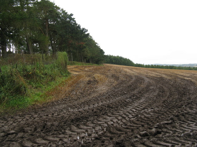
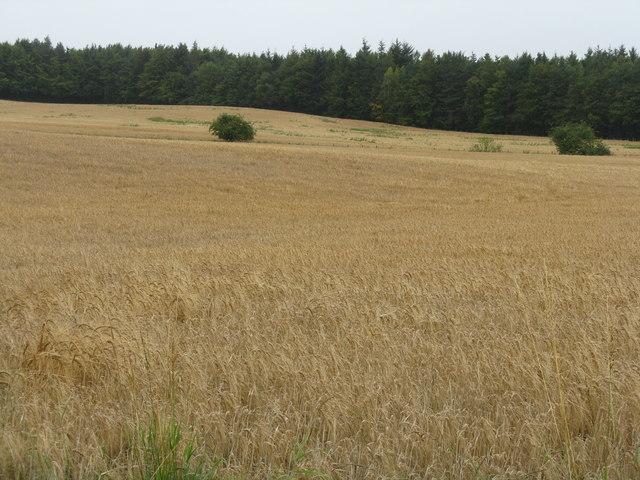
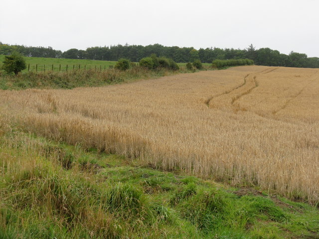
The woodland is characterized by a dense canopy of towering trees, including oak, beech, and birch, which provide a sheltered habitat for a variety of wildlife species. Visitors can expect to spot native birds such as woodpeckers, owls, and warblers, as well as elusive mammals like deer, foxes, and badgers. The forest floor is adorned with an array of wildflowers and ferns, adding to the overall splendor of the area.

Carlisle Wood boasts a network of well-maintained trails, allowing visitors to explore the forest at their own pace. These paths meander through the trees, offering glimpses of serene ponds and babbling brooks. The forest is also home to a number of picnic areas, providing the perfect spot for visitors to relax and enjoy the peaceful surroundings.

In addition to its natural beauty, Carlisle Wood holds historical significance. The remains of an ancient settlement, dating back to the Iron Age, can be found within the forest. Archaeological excavations have uncovered artifacts and structures that offer insight into the lives of the people who once inhabited the area.

Overall, Carlisle Wood is a haven for nature lovers and history enthusiasts alike. Its stunning landscapes, diverse wildlife, and historical significance make it a must-visit destination for anyone seeking a peaceful retreat in the heart of Midlothian.

If you have any feedback on the listing, please let us know in the comments section below.

Carlisle Wood Images

Images are sourced within 2km of 55.825433/-3.0427168 or Grid Reference NT3459. Thanks to Geograph Open Source API. All images are credited.
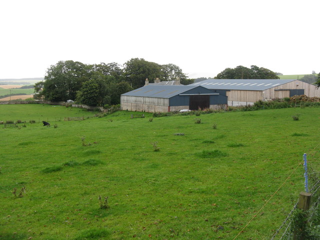
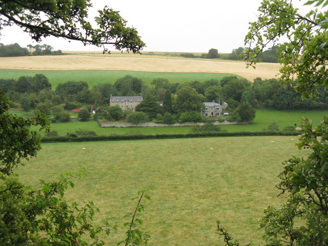
B6372 towards Gorebridge
Park farmland at Arniston Home Farm As seen from the Beech Avenue.
Park farmland at Arniston Home Farm
As seen from the Beech Avenue.
Ready to roll Large barley bales on Rylaw Knowe at Castleton.
Ready to roll
Large barley bales on Rylaw Knowe at Castleton.
Arniston Home Farm Looking across a grass field from the Gorebridge-Penicuik road [B6372].
Arniston Home Farm
Looking across a grass field from the Gorebridge-Penicuik road [B6372].
Halkerston farm buildings
Cemex - Temple Quarry Part of Middleton Lime Works. An aerial view of this site is at <a href="https://www.geograph.org.uk/photo/2107527">NT3558 : Middleton lime works and quarry</a>.
Cemex - Temple Quarry
Part of Middleton Lime Works. An aerial view of this site is at NT3558 : Middleton lime works and quarry.
Fields at Haughhead Looking across to Catcune House.
Fields at Haughhead
Looking across to Catcune House.
Path in The Cleuch at North Middleton This was the A7 Edinburgh-Carlisle trunk route until replaced by road improvements. Note the cat's-eye in the left foreground. This cleuch can be seen in the top left of the aerial view <a href="https://www.geograph.org.uk/photo/2107527">NT3558 : Middleton lime works and quarry</a>.
Path in The Cleuch at North Middleton
This was the A7 Edinburgh-Carlisle trunk route until replaced by road improvements. Note the cat's-eye in the left foreground. This cleuch can be seen in the top left of the aerial view NT3558 : Middleton lime works and quarry.
Borthwick Farm And bridge over the Gore Water. Other views for comparison, 4 and 6 years earlier, are <a href="https://www.geograph.org.uk/photo/608186">NT3659 : Borthwick Farm and the bridge over Gore Water</a> and <a href="https://www.geograph.org.uk/photo/105951">NT3659 : Borthwick village</a>.
Borthwick Farm
And bridge over the Gore Water. Other views for comparison, 4 and 6 years earlier, are NT3659 : Borthwick Farm and the bridge over Gore Water and NT3659 : Borthwick village.
Barley stubble and big bales near Castleton
Wet harvest at Castleton Barley stubble and big bales.
Wet harvest at Castleton
Barley stubble and big bales.
Animal pens near Castleton
Arniston Home Farm Combine header parked at the side of a harvested field.
Arniston Home Farm
Combine header parked at the side of a harvested field.
Muddy field entrance at Halterston Harvest over - obviously much coming and going.
Muddy field entrance at Halterston
Harvest over - obviously much coming and going.
Barley, looking towards Carlisle Wood
Farmland near North Middleton Barley ready for harvest and pasture.
Farmland near North Middleton
Barley ready for harvest and pasture.
Middleton Quarry An aerial view of this area can be seen in <a href="https://www.geograph.org.uk/photo/2107527">NT3558 : Middleton lime works and quarry</a>.
Middleton Quarry
An aerial view of this area can be seen in NT3558 : Middleton lime works and quarry.
Farmland at Middleton Just south of the quarry and lime works, and area than can see from above in the aerial photo <a href="https://www.geograph.org.uk/photo/2107527">NT3558 : Middleton lime works and quarry</a>.
Farmland at Middleton
Just south of the quarry and lime works, and area than can see from above in the aerial photo NT3558 : Middleton lime works and quarry.
Show me another place!

Carlisle Wood is located at Grid Ref: NT3459 (Lat: 55.825433, Lng: -3.0427168)

Unitary Authority: Midlothian

Police Authority: The Lothians and Scottish Borders

What 3 Words

///loyal.snoozing.prowess. Near Gorebridge, Midlothian

Nearby Locations

Carlisle Wood

Related Wikis

Arniston, Midlothian

Arniston is a village in Midlothian, Scotland. == People from Arniston == The plant collector, David Bowman, was born in Arniston in 1838. == See also... ==

Catcune Castle

Catcune Castle was a castle around 1 mile (1.6 km) south of Gorebridge, north of the Gore Water, in Midlothian, Scotland. == History == This was originally...

Fushiebridge railway station

Fushiebridge railway station served the area of Fushiebridge, Gorebridge, from 1847 to 1959 on the Waverley Route. == History == The station opened on...

Birkenside, Midlothian

Birkenside is a village, adjacent to the A7 road, at the south of Gorebridge in Midlothian, Scotland. == See also == List of places in Midlothian List...

Nearby Amenities

Located within 500m of 55.825433,-3.0427168
Power: pole
Lat/Long: 55.8289141/-3.0407886
Power: pole
Lat/Long: 55.8293165/-3.0398609
Noexit: yes
Lat/Long: 55.8253183/-3.0377088
Noexit: yes
Lat/Long: 55.8249486/-3.0370546
Power: pole
Lat/Long: 55.8275389/-3.0361068
Give Way
Direction: forward
Lat/Long: 55.8252508/-3.0364608
Give Way
Direction: forward
Lat/Long: 55.8249441/-3.0363838
The data included in this document is from www.openstreetmap.org. The data is made available under ODbL.

Have you been to Carlisle Wood?

Leave your review of Carlisle Wood below (or comments, questions and feedback).