Boglehill Wood

Wood, Forest in Fife

Scotland

Boglehill Wood

Grazing towards the River Eden
Grazing towards the River Eden Credit: JThomas

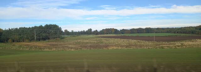
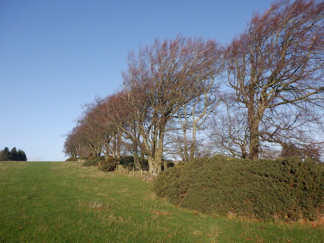
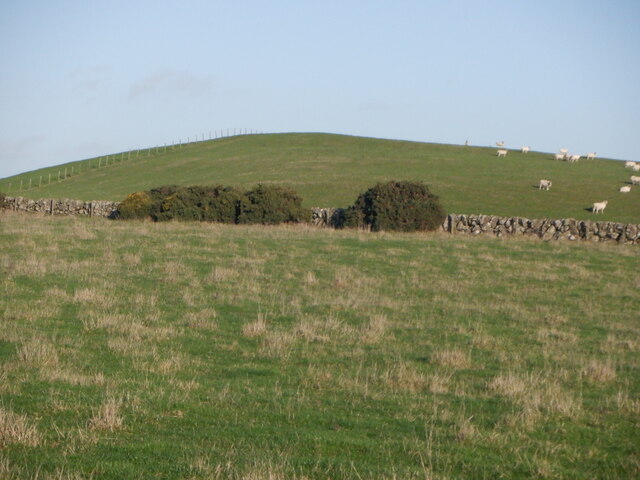
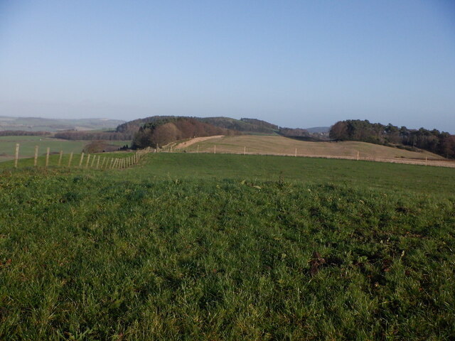
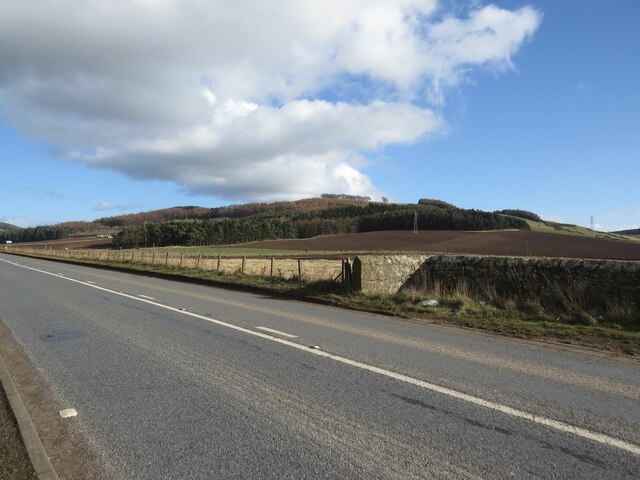
Boglehill Wood is a picturesque woodland located in Fife, Scotland. Covering an area of approximately 100 acres, it is nestled within the rolling hills and lush greenery of the region. The wood is composed primarily of native tree species such as oak, birch, and hazel, creating a diverse and vibrant ecosystem.

The wood features a network of well-maintained trails that wind their way through the trees, providing visitors with an opportunity to explore its natural beauty. These paths are suitable for both leisurely strolls and more challenging hikes, catering to a range of fitness levels and interests.

Boglehill Wood is home to a variety of wildlife, making it a popular spot for nature enthusiasts and birdwatchers. Visitors may catch a glimpse of squirrels darting among the branches, or even spot the elusive red deer that occasionally roam the area. The tranquil atmosphere of the wood also attracts a range of bird species, including woodpeckers, owls, and various songbirds.

In addition to its natural appeal, Boglehill Wood boasts a rich history. The wood is said to have been a popular hunting ground for Scottish royalty in the past, and remnants of ancient settlements can still be found within its boundaries.

Overall, Boglehill Wood offers a peaceful and enchanting escape from the hustle and bustle of everyday life. Its stunning scenery, diverse wildlife, and historical significance make it a must-visit destination for those seeking a true taste of Scotland's natural beauty.

If you have any feedback on the listing, please let us know in the comments section below.

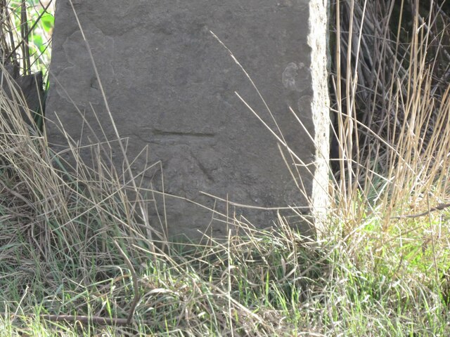
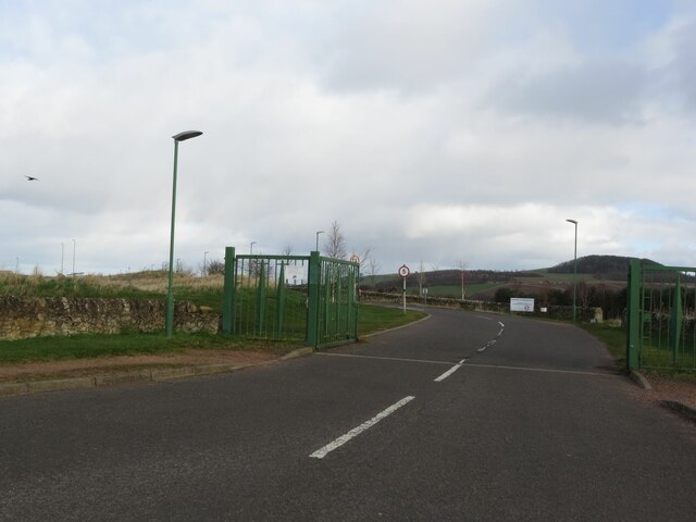
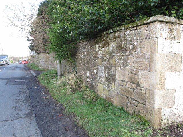
Boglehill Wood Images

Images are sourced within 2km of 56.283199/-3.0555975 or Grid Reference NO3410. Thanks to Geograph Open Source API. All images are credited.

Grazing towards the River Eden
Farm road towards Hospital Mill
1A91 Edinburgh to Aberdeen service at Springfield
Fields at Ballomill, Ladybank
Tod's Wood
Tod's Wood
Walton Hill
Walton Hill
Summit, Walton Hill
Summit, Walton Hill
Springfield View from Walton Hill.
Springfield
View from Walton Hill.
Benchmark on wall near Cults Mill Ordnance Survey benchmark on wall on A914 near Cults Mill. Database entry: <span class="nowrap"><a title="https://www.bench-marks.org.uk/bm163969" rel="nofollow ugc noopener" href="https://www.bench-marks.org.uk/bm163969">Link</a><img style="margin-left:2px;" alt="External link" title="External link - shift click to open in new window" src="https://s1.geograph.org.uk/img/external.png" width="10" height="10"/></span>
Benchmark on wall near Cults Mill
Ordnance Survey benchmark on wall on A914 near Cults Mill. Database entry: LinkExternal link
Entrance to Elmwood Golf Course
Boundary Wall, Crawley House, Springfield An Ordnance Survey benchmark can be seen at the bottom right of the photo. For close up photo, see <a title="https://www.geograph.org.uk/photo/6347903" href="https://www.geograph.org.uk/photo/6347903">Link</a> and for database entry, see <span class="nowrap"><a title="https://www.bench-marks.org.uk/bm114172" rel="nofollow ugc noopener" href="https://www.bench-marks.org.uk/bm114172">Link</a><img style="margin-left:2px;" alt="External link" title="External link - shift click to open in new window" src="https://s1.geograph.org.uk/img/external.png" width="10" height="10"/></span>. See also <a title="https://www.geograph.org.uk/photo/6347905" href="https://www.geograph.org.uk/photo/6347905">Link</a>.
Boundary Wall, Crawley House, Springfield
An Ordnance Survey benchmark can be seen at the bottom right of the photo. For close up photo, see Link and for database entry, see LinkExternal link. See also Link.
A914 near Cults Lady Mary's Wood in the background.
A914 near Cults
Lady Mary's Wood in the background.
Leaving Springfield Heading north.
Leaving Springfield
Heading north.
Level Crossing near Hospital Mill
Crawford Priory Mausoleum For the grisly story of this tomb's inhabitant, see <span class="nowrap"><a title="https://secretscotland829724255.wordpress.com/2022/08/08/crawford-priory-mausoleum/" rel="nofollow ugc noopener" href="https://secretscotland829724255.wordpress.com/2022/08/08/crawford-priory-mausoleum/">Link</a><img style="margin-left:2px;" alt="External link" title="External link - shift click to open in new window" src="https://s1.geograph.org.uk/img/external.png" width="10" height="10"/></span>
Crawford Priory Mausoleum
For the grisly story of this tomb's inhabitant, see LinkExternal link
Walk through the woods The mixed woodland to the west of Springfield is called The Moor.
Walk through the woods
The mixed woodland to the west of Springfield is called The Moor.
View towards Peterhead Farm
Trig point by the tracks Not every trig point is up a mountain...    Ballomill trig point (TP0996) in the classic concrete 'Hotine pillar' design (<span class="nowrap"><a title="https://en.wikipedia.org/wiki/Martin_Hotine" rel="nofollow ugc noopener" href="https://en.wikipedia.org/wiki/Martin_Hotine">Link</a><img style="margin-left:2px;" alt="External link" title="External link - shift click to open in new window" src="https://s1.geograph.org.uk/img/external.png" width="10" height="10"/></span> ) sits at an elevation of 41 metres and had "third order" status according to the trigpointing.uk web site.    The X50 sign behind it is a 50 mph 'wrong direction special speed restriction board': if a train is running 'wrong line' (in the opposite direction to normal, i.e., away from the photographer) on the track nearest to the fence, the sign warns of the need to slow down for a level crossing about 1 km ahead.
Trig point by the tracks
Not every trig point is up a mountain... Ballomill trig point (TP0996) in the classic concrete 'Hotine pillar' design (LinkExternal link ) sits at an elevation of 41 metres and had "third order" status according to the trigpointing.uk web site. The X50 sign behind it is a 50 mph 'wrong direction special speed restriction board': if a train is running 'wrong line' (in the opposite direction to normal, i.e., away from the photographer) on the track nearest to the fence, the sign warns of the need to slow down for a level crossing about 1 km ahead.
Show me another place!

Boglehill Wood is located at Grid Ref: NO3410 (Lat: 56.283199, Lng: -3.0555975)

Unitary Authority: Fife

Police Authority: Fife

What 3 Words

///note.corner.steady. Near Ladybank, Fife

Nearby Locations

Boglehill Wood

Related Wikis

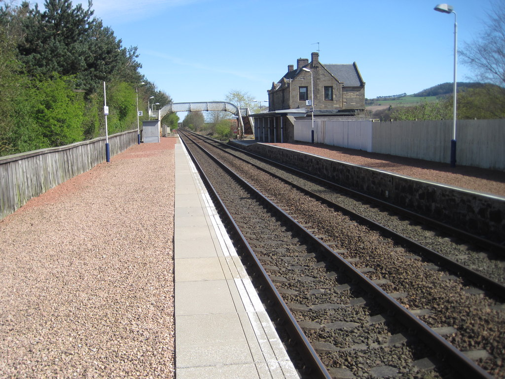
Springfield railway station (Scotland)

Springfield railway station serves the village of Springfield in Fife, Scotland. The station has two platforms and is unstaffed. Services are operated...

Springfield, Fife

Springfield is a village that lies at the edge of the Howe of Fife, to the south-west of the town of Cupar, Fife, Scotland. The origin of the community...

Priestfield House

Priestfield House was a Victorian Country House near Cults, Fife, Scotland. == History == The estate, originally an outlying property of Crawford Priory...

Pitlessie

Pitlessie is a small village in Cults, Fife, Scotland. It is roughly 4+1⁄2 miles (7 km) southwest of the nearest large town, Cupar, and 23 miles (37 kilometres...

St Andrews Burghs (UK Parliament constituency)

St Andrews Burghs was a district of burghs constituency, representing various burghs of Fife, Scotland, in the House of Commons of the Parliament of the...

Stratheden, Fife

Stratheden (Gaelic: Srath Aodainn) is a hamlet 2 miles west of Cupar, and just north of Springfield, in Fife, Scotland. Stratheden Hospital was built as...
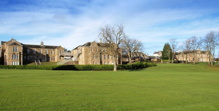
Stratheden Hospital

Stratheden Hospital is currently a small community hospital in Stratheden, Cupar, Fife which was originally called Fife and Kinross District Asylum. Its...

Scotstarvit Tower

Scotstarvit Tower is a tower house in Fife, Scotland. It is situated 2 miles (3.2 km) south of Cupar, between Tarvit Hill and Walton Hill, south of the...

Nearby Amenities

Located within 500m of 56.283199,-3.0555975
Crawford Priory Nurseries
Historic: ruins
Ruins: garden
Lat/Long: 56.2806601/-3.0620829
Power: pole
Lat/Long: 56.2863127/-3.0609727
Power: pole
Lat/Long: 56.2856728/-3.0614133
Power: pole
Lat/Long: 56.2851163/-3.0618024
Material: wood
Power: pole
Lat/Long: 56.2844512/-3.0622347
Power: pole
Lat/Long: 56.2839701/-3.0625888
Power: pole
Lat/Long: 56.283417/-3.0629697
Power: pole
Lat/Long: 56.2829382/-3.0633053
Power: pole
Lat/Long: 56.2829463/-3.0633307
Power: pole
Lat/Long: 56.2834246/-3.0629938
Power: pole
Lat/Long: 56.2839875/-3.0626115
Power: pole
Lat/Long: 56.2851223/-3.0618339
Power: pole
Lat/Long: 56.2856653/-3.0614386
Power: pole
Lat/Long: 56.2863433/-3.0609915
Power: pole
Lat/Long: 56.2859027/-3.0600844
Power: pole
Lat/Long: 56.2856258/-3.0595045
Bus Stop
Cults Mill Road End (adj.)
Bus: yes
Departures Board: no
Naptan AtcoCode: 6500N9748
Naptan NaptanCode: 34354897
Operator: Fife Council
Public Transport: platform
Ref: 34354897
Shelter: no
Lat/Long: 56.2815186/-3.0549602
Bus Stop
Cults Mill Road End (opp.)
Bus: yes
Departures Board: no
Naptan AtcoCode: 6500N9749
Naptan Bearing: SW
Naptan BusStopType: CUS
Naptan CommonName: Cults Mill Road End
Naptan Indicator: opp
Naptan NaptanCode: 34354945
Naptan Street: A914
Operator: Fife Council
Public Transport: platform
Ref: 34354945
Shelter: no
Lat/Long: 56.2814079/-3.0549502
Grit Bin
Lat/Long: 56.2848961/-3.0628872
The data included in this document is from www.openstreetmap.org. The data is made available under ODbL.

Have you been to Boglehill Wood?

Leave your review of Boglehill Wood below (or comments, questions and feedback).