Square Wood

Wood, Forest in Peeblesshire

Scotland

Square Wood

Track approaching Damhead farm The track from Damhead Rig passes through the farmyard. The buildings at Traquair village are in the middle distance.
Track approaching Damhead farm Credit: Jim Barton

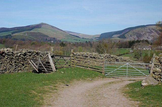
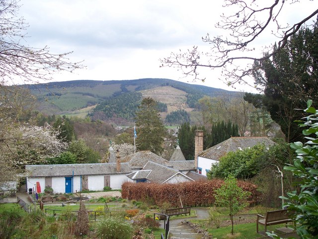
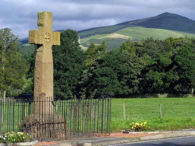
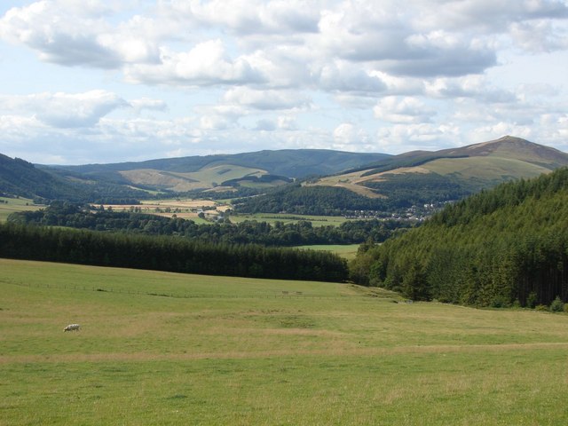
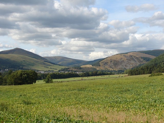
Square Wood is a beautiful forest located in Peeblesshire, Scotland. This enchanting woodland covers an area of approximately 100 acres and is situated near the village of Eddleston. It is known for its diverse range of wildlife and stunning natural scenery.

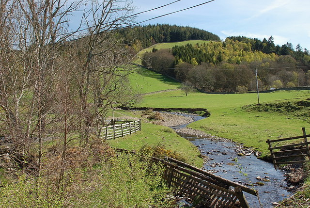
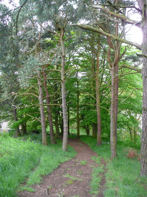
The forest is predominantly composed of native broadleaf trees, such as oak, beech, and birch, which create a rich and vibrant canopy. The dense undergrowth is home to a variety of plant species, including bluebells and wild garlic, which add to the area's charm.

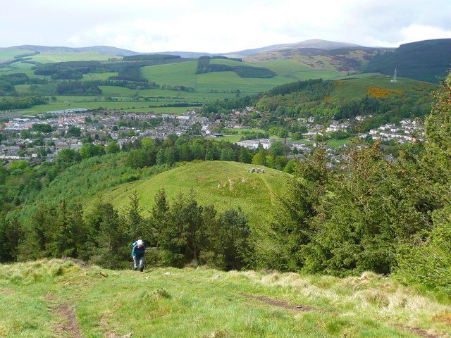
Square Wood is a haven for nature enthusiasts, offering numerous walking trails that meander through the woodland. These paths provide an opportunity to explore the forest's wildlife and take in the breathtaking views. Visitors may encounter various animal species, including roe deer, red squirrels, and a wide array of birdlife, making it a paradise for birdwatchers.

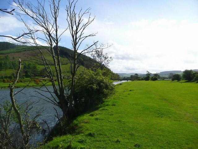
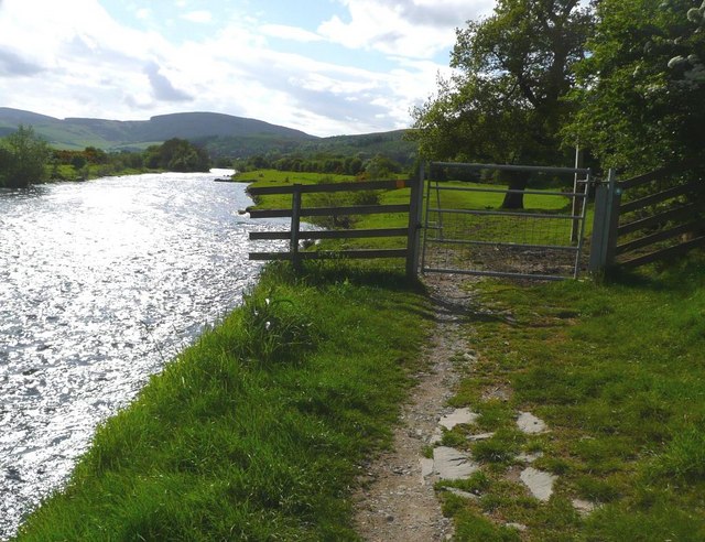
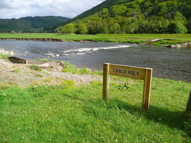
The forest also features a small stream that flows through its heart, adding to its serenity and providing a tranquil spot for picnics or relaxation. Additionally, there are designated areas within the wood for camping, allowing visitors to immerse themselves in the peaceful surroundings overnight.

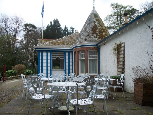
Square Wood is easily accessible by car, with a parking area available for visitors. It is open to the public year-round, providing a serene escape from the hustle and bustle of everyday life. Whether it is to appreciate the beauty of nature, engage in outdoor activities, or simply enjoy a peaceful retreat, Square Wood is a must-visit destination for nature lovers and explorers alike.

If you have any feedback on the listing, please let us know in the comments section below.

Square Wood Images

Images are sourced within 2km of 55.609795/-3.0491779 or Grid Reference NT3435. Thanks to Geograph Open Source API. All images are credited.

Track approaching Damhead farm The track from Damhead Rig passes through the farmyard. The buildings at Traquair village are in the middle distance.
Track approaching Damhead farm
The track from Damhead Rig passes through the farmyard. The buildings at Traquair village are in the middle distance.
Fingland Burn Seen from the road bridge, with Shaw Hill in the background.
Fingland Burn
Seen from the road bridge, with Shaw Hill in the background.
The Tweed at Innerleithen The disused railway bridge (the Haugh-head Viaduct, opened 1866 by North British Rail) in the distance.
The Tweed at Innerleithen
The disused railway bridge (the Haugh-head Viaduct, opened 1866 by North British Rail) in the distance.
Gate by the Tweed at Innerleithen
The Cauld Hole on the Tweed at Walkerburn The 'Weir Pool' above the weir where fish stop to rest before continuing on up the river.
The Cauld Hole on the Tweed at Walkerburn
The 'Weir Pool' above the weir where fish stop to rest before continuing on up the river.
Looking back on Pirn Hill and its viewpoint The seven stone plinths at the viewpoint above Innerleithen can be clarly seen.
Looking back on Pirn Hill and its viewpoint
The seven stone plinths at the viewpoint above Innerleithen can be clarly seen.
Path through the trees from Pirn Hill
Playing fields at Innerleithen
Coat of arms on St. Ronan's Well pavilion
St Ronans well pavilion from the rear garden
The Pavilion at St Ronan's well
War memorial at Traquair The solid looking memorial stands at a road junction; Lee Pen is the prominent hill beyond.
War memorial at Traquair
The solid looking memorial stands at a road junction; Lee Pen is the prominent hill beyond.
Minch Moor Bothy The Minch Moor Bothy stands exactly beside the Southern Upland Way, west of Pipers Knowe and on the way to (or from) the 'Marilyn' of Minch Moor.
Minch Moor Bothy
The Minch Moor Bothy stands exactly beside the Southern Upland Way, west of Pipers Knowe and on the way to (or from) the 'Marilyn' of Minch Moor.
View towards the River Tweed near Innerleithen A pleasant view of the River Tweed and surrounding farmland at the start of August.
View towards the River Tweed near Innerleithen
A pleasant view of the River Tweed and surrounding farmland at the start of August.
View towards Innerleithen Looking across from the S.U.W. pathway towards Pirn Craig, with Lee Pen on the far left.
View towards Innerleithen
Looking across from the S.U.W. pathway towards Pirn Craig, with Lee Pen on the far left.
St. James Roman Catholic Church, Innerleithen A sunny day in Innerleithen, the Church Spire makes a superb backdrop to the fruits of the tree.
St. James Roman Catholic Church, Innerleithen
A sunny day in Innerleithen, the Church Spire makes a superb backdrop to the fruits of the tree.
St. James Roman Catholic Church, Innerleithen A blue sky background to a dramatic subject, a very pretty church, in a lovely village by the River Tweed.
St. James Roman Catholic Church, Innerleithen
A blue sky background to a dramatic subject, a very pretty church, in a lovely village by the River Tweed.
D-Day commemorative trees, Innerleithen Trees by the car park in Hall Street. A plaque on the stone plinth reads:

Three Trees Were Planted By
The Chairman Of
Innerleithen Traquair & Glen
Community Council
On The 6th June 1994
To Commemorate The
50th Anniversary Of The D-Day
Landings In France
D-Day commemorative trees, Innerleithen
Trees by the car park in Hall Street. A plaque on the stone plinth reads: Three Trees Were Planted By The Chairman Of Innerleithen Traquair & Glen Community Council On The 6th June 1994 To Commemorate The 50th Anniversary Of The D-Day Landings In France
Show me another place!

Square Wood is located at Grid Ref: NT3435 (Lat: 55.609795, Lng: -3.0491779)

Unitary Authority: The Scottish Borders

Police Authority: The Lothians and Scottish Borders

What 3 Words

///padding.rooster.flamenco. Near Innerleithen, Scottish Borders

Related Wikis

Traquair House

Traquair House, approximately 7 miles southeast of Peebles, is claimed to be the oldest continually inhabited house in Scotland. Whilst not strictly a...

Innerleithen railway station

Innerleithen railway station served the town of Innerleithen, Scottish Borders, Scotland from 1864 to 1962 on the Peebles Railway. == History == The station...
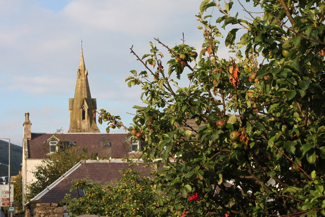
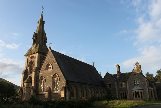
Innerleithen

Innerleithen (Scottish Gaelic: Inbhir Leitheann) is a civil parish and a small town in the committee area of Tweeddale, in the Scottish Borders. It was...

Leithen Water

Leithen Water (Scottish Gaelic: Leitheann / Abhainn Leitheinn) is a tributary of the River Tweed in Scotland. It rises in the Moorfoot Hills and joins...

Robert Smail's Printing Works

Robert Smail's Printing Works is a fully functional Victorian era letterpress printing works in the small Scottish Borders town of Innerleithen, now preserved...

Vale of Leithen F.C.

Vale of Leithen Football Club are a football club based in the town of Innerleithen, Scotland. They play in the East of Scotland League First Division...

Traquair

Traquair (Scottish Gaelic: Cille Bhrìghde) is a small village and civil parish in the Scottish Borders; until 1975 it was in the county of Peeblesshire...

Sir Walter Scott Way

The Sir Walter Scott Way is a 92-mile (148 km) long-distance footpath in the Scottish Borders. The route broadly follows the waymarked Southern Upland...

Nearby Amenities

Located within 500m of 55.609795,-3.0491779
Square Wood
Place: locality
Lat/Long: 55.6096419/-3.045481
Caddon Bank
Place: locality
Lat/Long: 55.6121076/-3.0465566
Caddonbank Wood
Place: locality
Lat/Long: 55.6141175/-3.0497833
Fixme: continue
Lat/Long: 55.6124476/-3.054024
Bench
Backrest: yes
Material: metal
Lat/Long: 55.6112546/-3.0549011
Bench
Backrest: yes
Check Date: 2022-02-23
Material: metal
Lat/Long: 55.6116288/-3.0553141
Covered: no
Leisure: picnic_table
Lat/Long: 55.6113365/-3.0563843
Covered: no
Leisure: picnic_table
Lat/Long: 55.6113683/-3.0563307
Leisure: picnic_table
Lat/Long: 55.6112486/-3.0554053
Leisure: picnic_table
Lat/Long: 55.6113077/-3.0554858
Material: wood
Power: pole
Lat/Long: 55.6117301/-3.0555903
Vending Machine
Vending: parking_tickets
Lat/Long: 55.6114043/-3.0562846
Information: board
Tourism: information
Lat/Long: 55.6116198/-3.0554002
Power: pole
Lat/Long: 55.610551/-3.0554681
Power: pole
Lat/Long: 55.6099943/-3.055466
Power: pole
Lat/Long: 55.6094638/-3.055483
Power: pole
Lat/Long: 55.6082785/-3.0555253
Power: pole
Lat/Long: 55.6077122/-3.0555549
The data included in this document is from www.openstreetmap.org. The data is made available under ODbL.

Have you been to Square Wood?

Leave your review of Square Wood below (or comments, questions and feedback).