Craigveg Plantation

Wood, Forest in Aberdeenshire

Scotland

Craigveg Plantation

Meadows by Water of Carvie Stroin is the house on the far side.
Meadows by Water of Carvie Credit: Alan Reid

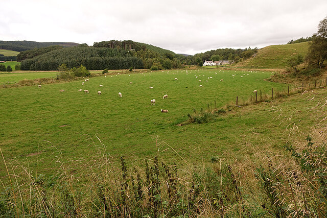
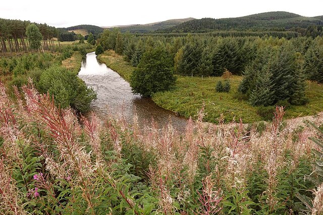
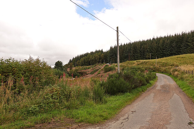
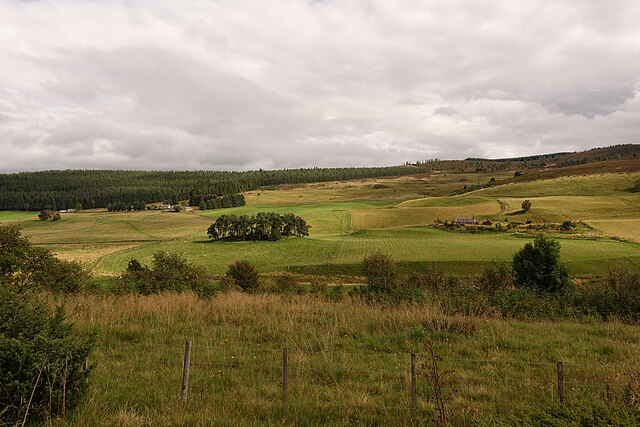
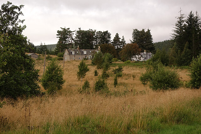
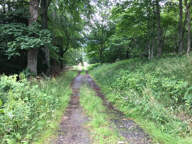
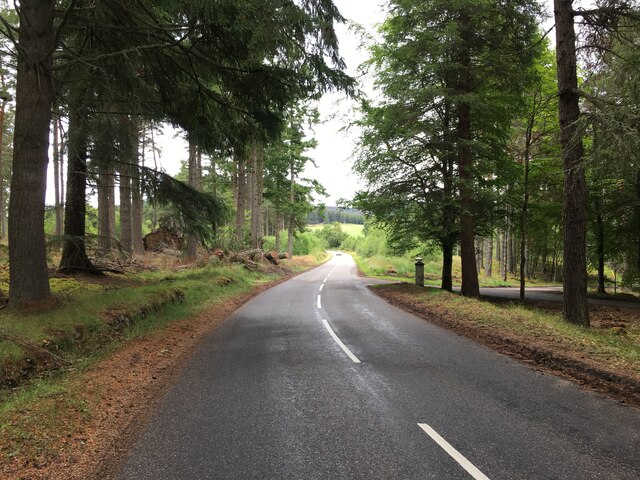
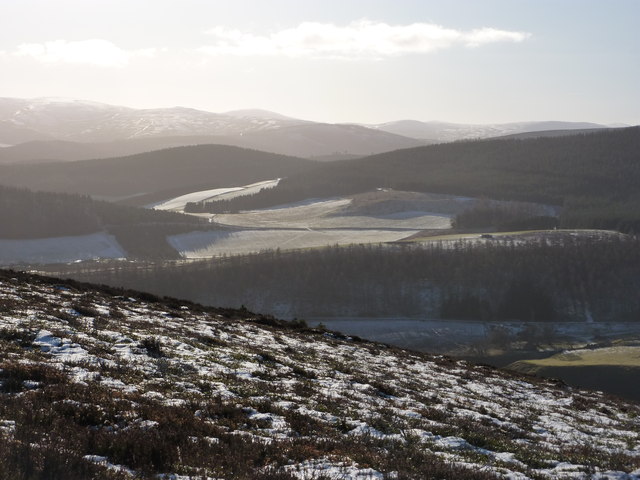
Craigveg Plantation is a picturesque woodland located in Aberdeenshire, Scotland. Covering an area of approximately 100 acres, it is a prominent feature of the local landscape. The plantation is situated near the village of Craigveg and is easily accessible via a network of well-maintained trails.

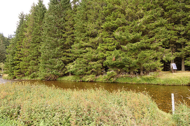
The woodland is characterized by a diverse range of tree species, including oak, birch, pine, and beech, creating a rich and vibrant ecosystem. The dense canopy provides a welcoming habitat for a variety of wildlife, such as deer, squirrels, and numerous species of birds. Nature enthusiasts are often drawn to this area for bird-watching and wildlife photography.

Visitors to Craigveg Plantation can enjoy a peaceful and tranquil experience amidst the beauty of nature. The well-marked trails cater to both leisurely strolls and more adventurous hikes, offering an opportunity for individuals of all ages and fitness levels to explore the plantation. Along the way, hikers can appreciate the stunning views of rolling hills, meandering streams, and occasional waterfalls.

The plantation is also a popular spot for outdoor activities such as picnicking, camping, and orienteering. Its strategic location, with easy access to nearby amenities, makes it an ideal destination for day trips or longer stays in the area. Moreover, the plantation is well-maintained, with regular upkeep and management to ensure its preservation and sustainability.

Overall, Craigveg Plantation in Aberdeenshire is a haven for nature lovers, offering a serene and scenic environment that allows visitors to immerse themselves in the beauty of the Scottish woodlands.

If you have any feedback on the listing, please let us know in the comments section below.

Craigveg Plantation Images

Images are sourced within 2km of 57.188584/-3.0952578 or Grid Reference NJ3311. Thanks to Geograph Open Source API. All images are credited.

Meadows by Water of Carvie Stroin is the house on the far side.
Meadows by Water of Carvie
Stroin is the house on the far side.
Sheep in Strathdon A flock of sheep grazes in a field beside the River Don. The house is at Brughs, in the next grid square.
Sheep in Strathdon
A flock of sheep grazes in a field beside the River Don. The house is at Brughs, in the next grid square.
River Don The river turns about 90º to the left here. This is looking upstream from above the bend.
River Don
The river turns about 90º to the left here. This is looking upstream from above the bend.
River Don Looking downstream from the road above where the river turns 90º to the left.
River Don
Looking downstream from the road above where the river turns 90º to the left.
Minor Road on Coulick Hill This is a very narrow minor road that gives access to various farms on the south side of Strathdon.
Minor Road on Coulick Hill
This is a very narrow minor road that gives access to various farms on the south side of Strathdon.
Camping Site A brightly coloured tent has been pitched on the camp site at Cairngorms Glamping <span class="nowrap"><a title="https://cairngormsglamping.com" rel="nofollow ugc noopener" href="https://cairngormsglamping.com">Link</a><img style="margin-left:2px;" alt="External link" title="External link - shift click to open in new window" src="https://s1.geograph.org.uk/img/external.png" width="10" height="10"/></span>.
Camping Site
A brightly coloured tent has been pitched on the camp site at Cairngorms Glamping LinkExternal link.
Glen Carvie The farm on the right is Stroin, and higher up on the left is Belnagauld.
Glen Carvie
The farm on the right is Stroin, and higher up on the left is Belnagauld.
Fields on Donside The River Don flows along this side of the smooth green field, its course marked by sporadic trees.
Fields on Donside
The River Don flows along this side of the smooth green field, its course marked by sporadic trees.
Knocklea The houses at Knocklea from the minor road along south Donside.
Knocklea
The houses at Knocklea from the minor road along south Donside.
Mill of Glenconrie This house, dating from 1768, is a Category B Listed building. It was originally a dower house for Inverernan, which is on the north bank of the River Don. See <span class="nowrap"><a title="http://portal.historicenvironment.scot/designation/LB16172" rel="nofollow ugc noopener" href="http://portal.historicenvironment.scot/designation/LB16172">Link</a><img style="margin-left:2px;" alt="External link" title="External link - shift click to open in new window" src="https://s1.geograph.org.uk/img/external.png" width="10" height="10"/></span> for a detailed description. The actual mill building has been demolished.
Mill of Glenconrie
This house, dating from 1768, is a Category B Listed building. It was originally a dower house for Inverernan, which is on the north bank of the River Don. See LinkExternal link for a detailed description. The actual mill building has been demolished.
River Don The white post on this side of the river is a depth gauge, but I'm not sure what is powered by the solar panel on the opposite bank.
River Don
The white post on this side of the river is a depth gauge, but I'm not sure what is powered by the solar panel on the opposite bank.
Disused Gravel Pit It looks like a quarry but the second edition of the 25-inch Ordnance Survey map labels it a gravel pit. Now handy for storing snowploughs in summer.
Disused Gravel Pit
It looks like a quarry but the second edition of the 25-inch Ordnance Survey map labels it a gravel pit. Now handy for storing snowploughs in summer.
River Meanders in Strathdon The River Don meanders across the strath as the strath itself winds round the foot of Lonach Hill.
River Meanders in Strathdon
The River Don meanders across the strath as the strath itself winds round the foot of Lonach Hill.
Farm track near Milton
A944 near Roughpark
A944 near Roughpark
A944 near Strathdon
A944 near Strathdon
Victorian Post Box near Inverernan Sited opposite the Strathdon turnoff.
Victorian Post Box near Inverernan
Sited opposite the Strathdon turnoff.
The valley of the River Don From about 3 miles N.E.
The valley of the River Don
From about 3 miles N.E.
Show me another place!

Craigveg Plantation is located at Grid Ref: NJ3311 (Lat: 57.188584, Lng: -3.0952578)

Unitary Authority: Aberdeenshire

Police Authority: North East

What 3 Words

///specifies.slimmer.landings. Near Ballater, Aberdeenshire

Related Wikis

Strathdon

Strathdon (; Gaelic: Srath Dheathain) is an area in Aberdeenshire, Scotland. It is situated in the strath of the River Don, 45 miles west of Aberdeen in...

Doune of Invernochty

The Doune of Invernochty is a 12th-century castle in the Cairngorms National Park in Scotland, of which only earthworks survive. The Royal Commission on...

Lost, Aberdeenshire

Lost (Lòsda in Scottish Gaelic; population: less than 24; grid reference NJ349132 or on 1869 map) is a hamlet in Aberdeenshire, Scotland. It lies 40 miles...

Bellabeg

Bellabeg (an anglicisation of Scottish Gaelic: Am Baile Beag, 'the small farmtown') is a small roadside settlement in Strathdon, Aberdeenshire, Scotland...

Colquhonnie Castle

Colquhonnie Castle is a ruined 16th-century tower house, about 10.5 miles (16.9 km) north of Ballater, Aberdeenshire, Scotland, around 1.0 mile (1.6 km...

Castle Newe

Castle Newe was a castellated mansion house, situated in Aberdeenshire, and designed in 1831 by Archibald Simpson. It was based on an existing Z-plan castle...

Corgarff

Corgarff (Scottish Gaelic: Corr Garaidh) is a hamlet in Aberdeenshire, Scotland, in the Grampian Mountains. The nearby Corgarff Castle was used as a military...

Glenbuchat Castle

Glenbuchat Castle is a historic Z plan Scottish castle built in 1590 for John Gordon of Cairnbarrow to mark his wedding. It is located above the River...

Nearby Amenities

Located within 500m of 57.188584,-3.0952578
Power: pole
Lat/Long: 57.1889/-3.0874759
Power: pole
Lat/Long: 57.1890842/-3.088292
Power: pole
Lat/Long: 57.1892417/-3.0889758
Power: pole
Lat/Long: 57.1896753/-3.0899043
Power: pole
Lat/Long: 57.1899654/-3.09053
Power: pole
Lat/Long: 57.1901708/-3.0909551
Power: pole
Lat/Long: 57.1895699/-3.0915527
Power: pole
Lat/Long: 57.1907695/-3.0903715
Power: pole
Lat/Long: 57.191379/-3.089772
Leisure: picnic_table
Lat/Long: 57.1855356/-3.0940913
The data included in this document is from www.openstreetmap.org. The data is made available under ODbL.

Have you been to Craigveg Plantation?

Leave your review of Craigveg Plantation below (or comments, questions and feedback).