Moffat Allers Wood

Wood, Forest in Peeblesshire

Scotland

Moffat Allers Wood

Innerleithen from Traquair A view from the Southern Upland Way to the town with Lee Pen in cloud beyond.
Innerleithen from Traquair Credit: Jim Barton

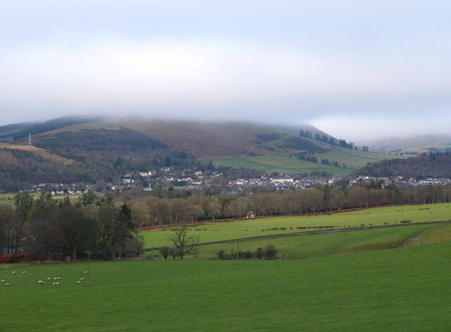
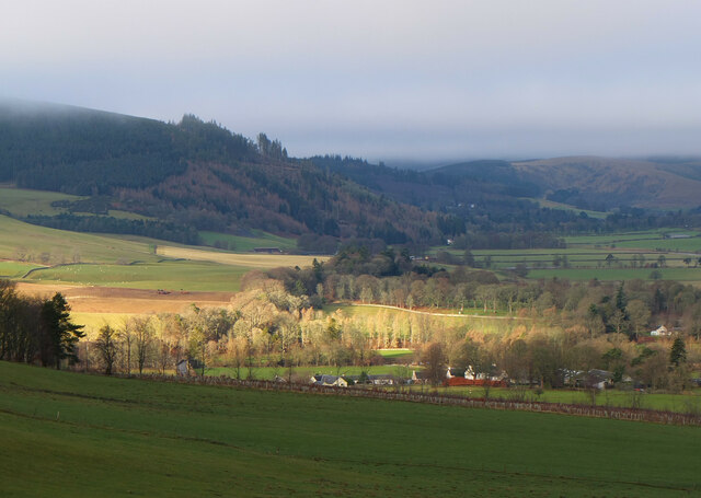
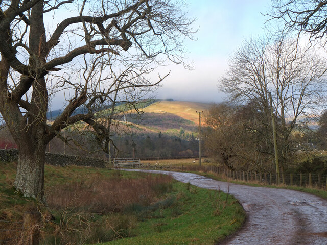
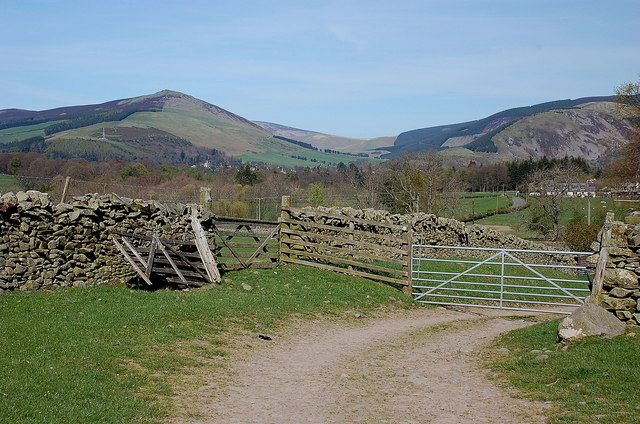
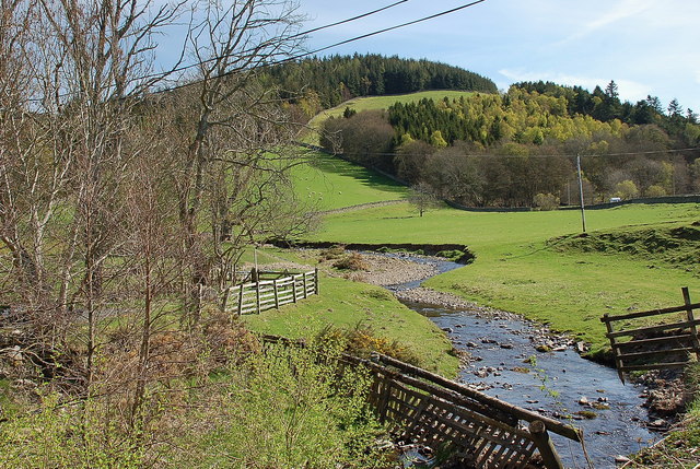
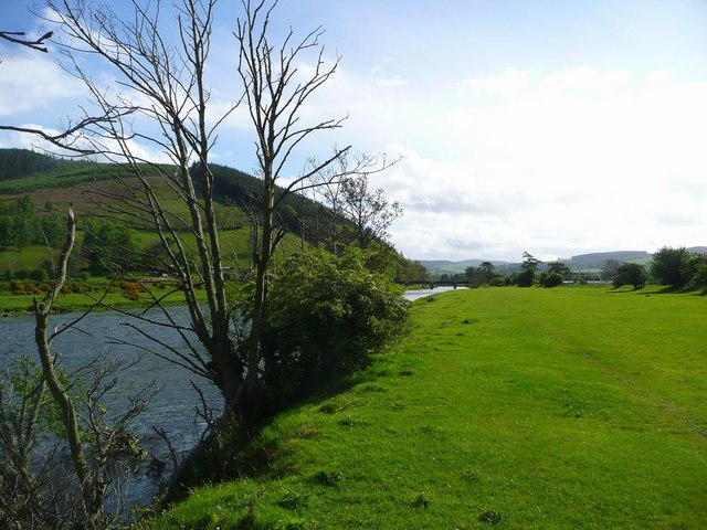
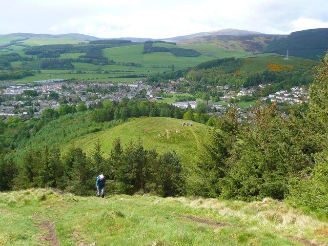
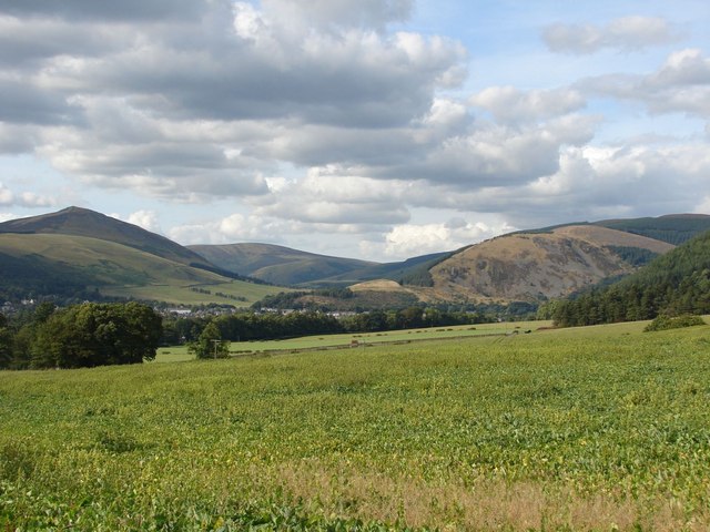
Moffat Allers Wood is a picturesque forest located in Peeblesshire, Scotland. The wood is situated near the town of Moffat, encompassing an area of approximately 500 hectares. It is a popular destination for nature enthusiasts and outdoor lovers due to its stunning natural beauty and diverse range of flora and fauna.

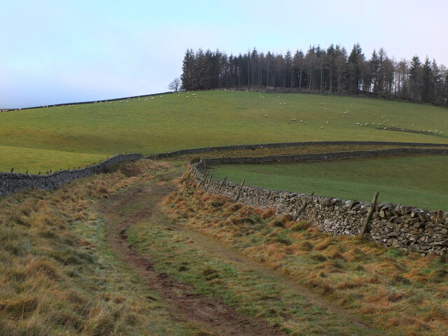
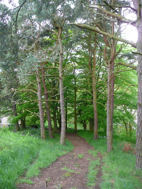
The wood is characterized by its dense and ancient woodland, composed mainly of native Scottish tree species such as oak, birch, and rowan. The towering trees create a serene and tranquil atmosphere, providing a perfect escape from the hustle and bustle of everyday life. The forest floor is covered with a lush carpet of ferns, bluebells, and wildflowers, adding to the ethereal charm of the place.

Moffat Allers Wood is home to a wide variety of wildlife, including red squirrels, roe deer, and a plethora of bird species. Birdwatchers can spot elusive species such as the great spotted woodpecker and the tawny owl among the trees. The forest also offers a habitat for numerous insects, including butterflies and beetles.

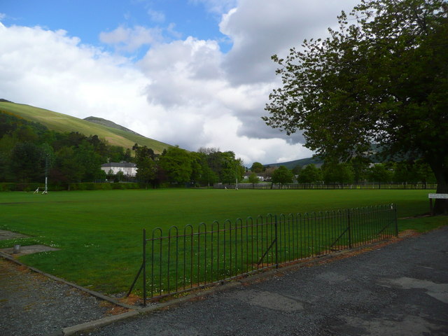
Visitors to Moffat Allers Wood can enjoy a range of activities, such as walking, cycling, and picnicking. The wood is crisscrossed by a network of well-maintained trails, allowing visitors to explore its hidden corners and discover its natural wonders. Moreover, the forest is equipped with picnic areas, providing an ideal spot to relax and enjoy a meal amidst nature.

Overall, Moffat Allers Wood is a captivating destination that showcases the beauty of Scotland's woodlands. It offers a unique and immersive experience for nature enthusiasts, providing a sanctuary where one can connect with the natural world.

If you have any feedback on the listing, please let us know in the comments section below.

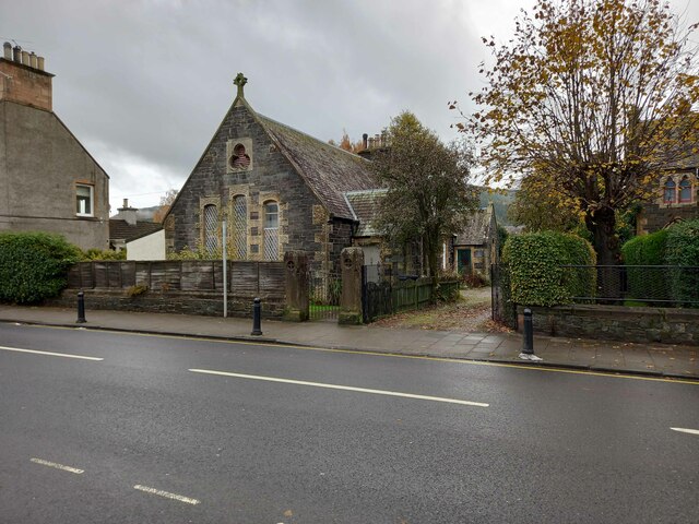
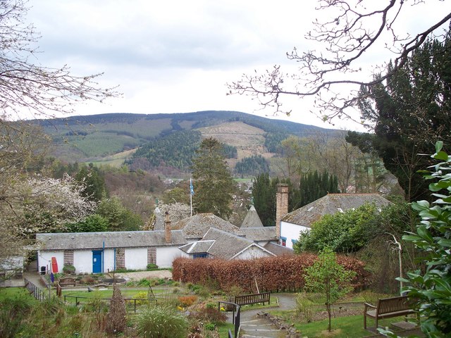
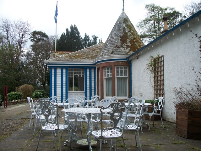
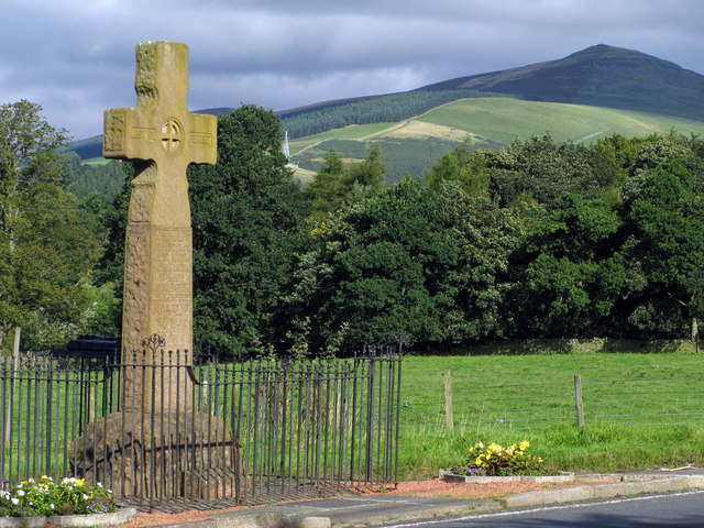
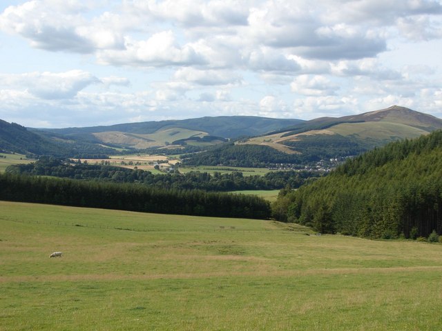
Moffat Allers Wood Images

Images are sourced within 2km of 55.608676/-3.0653082 or Grid Reference NT3235. Thanks to Geograph Open Source API. All images are credited.

Innerleithen from Traquair A view from the Southern Upland Way to the town with Lee Pen in cloud beyond.
Innerleithen from Traquair
A view from the Southern Upland Way to the town with Lee Pen in cloud beyond.
Sunlight at Traquair Patchy sunlight as a low-lying cloud layer thins out above the Tweed valley.
Sunlight at Traquair
Patchy sunlight as a low-lying cloud layer thins out above the Tweed valley.
Shaw Hill, Traquair The Southern Upland Way crosses the east side of the hill with Dean Plantation on its summit.
Shaw Hill, Traquair
The Southern Upland Way crosses the east side of the hill with Dean Plantation on its summit.
Track near Damhead The track to the B709 road to Traquair with Lee Pen catching the sun in the background.
Track near Damhead
The track to the B709 road to Traquair with Lee Pen catching the sun in the background.
Roman Catholic Church of St James, Innerleithen
Church Hall for Roman Catholic Church of St James,
Track approaching Damhead farm The track from Damhead Rig passes through the farmyard. The buildings at Traquair village are in the middle distance.
Track approaching Damhead farm
The track from Damhead Rig passes through the farmyard. The buildings at Traquair village are in the middle distance.
Fingland Burn Seen from the road bridge, with Shaw Hill in the background.
Fingland Burn
Seen from the road bridge, with Shaw Hill in the background.
The Tweed at Innerleithen The disused railway bridge (the Haugh-head Viaduct, opened 1866 by North British Rail) in the distance.
The Tweed at Innerleithen
The disused railway bridge (the Haugh-head Viaduct, opened 1866 by North British Rail) in the distance.
Looking back on Pirn Hill and its viewpoint The seven stone plinths at the viewpoint above Innerleithen can be clarly seen.
Looking back on Pirn Hill and its viewpoint
The seven stone plinths at the viewpoint above Innerleithen can be clarly seen.
Path through the trees from Pirn Hill
Playing fields at Innerleithen
Coat of arms on St. Ronan's Well pavilion
St Ronans well pavilion from the rear garden
The Pavilion at St Ronan's well
War memorial at Traquair The solid looking memorial stands at a road junction; Lee Pen is the prominent hill beyond.
War memorial at Traquair
The solid looking memorial stands at a road junction; Lee Pen is the prominent hill beyond.
View towards the River Tweed near Innerleithen A pleasant view of the River Tweed and surrounding farmland at the start of August.
View towards the River Tweed near Innerleithen
A pleasant view of the River Tweed and surrounding farmland at the start of August.
View towards Innerleithen Looking across from the S.U.W. pathway towards Pirn Craig, with Lee Pen on the far left.
View towards Innerleithen
Looking across from the S.U.W. pathway towards Pirn Craig, with Lee Pen on the far left.
Show me another place!

Moffat Allers Wood is located at Grid Ref: NT3235 (Lat: 55.608676, Lng: -3.0653082)

Unitary Authority: The Scottish Borders

Police Authority: The Lothians and Scottish Borders

What 3 Words

///label.mysteries.marginal. Near Innerleithen, Scottish Borders

Related Wikis

Traquair House

Traquair House, approximately 7 miles southeast of Peebles, is claimed to be the oldest continually inhabited house in Scotland. Whilst not strictly a...

Innerleithen railway station

Innerleithen railway station served the town of Innerleithen, Scottish Borders, Scotland from 1864 to 1962 on the Peebles Railway. == History == The station...

Leithen Water

Leithen Water (Scottish Gaelic: Leitheann / Abhainn Leitheinn) is a tributary of the River Tweed in Scotland. It rises in the Moorfoot Hills and joins...

Traquair

Traquair (Scottish Gaelic: Cille Bhrìghde) is a small village and civil parish in the Scottish Borders; until 1975 it was in the county of Peeblesshire...

Sir Walter Scott Way

The Sir Walter Scott Way is a 92-mile (148 km) long-distance footpath in the Scottish Borders. The route broadly follows the waymarked Southern Upland...

Quair Water

The Quair Water is a tributary of the River Tweed in the Scottish Borders area of Scotland. Its name is related to Traquair. == Etymology == The name Quair...

Innerleithen

Innerleithen (Scottish Gaelic: Inbhir Leitheann) is a civil parish and a small town in the committee area of Tweeddale, in the Scottish Borders. It was...

Robert Smail's Printing Works

Robert Smail's Printing Works is a fully functional Victorian era letterpress printing works in the small Scottish Borders town of Innerleithen, now preserved...

Nearby Amenities

Located within 500m of 55.608676,-3.0653082
Traquair House
Addr City: Innerleithen
Addr Postcode: EH44 6PW
Fhrs Id: 28410
Phone: +44 18 96 83 03 23
Tourism: guest_house
Website: https://www.traquair.co.uk/
Lat/Long: 55.6083811/-3.06397
Barrier: kissing_gate
Lat/Long: 55.6123783/-3.0651126
Cafe
Garden Cafe
Lat/Long: 55.6070318/-3.0661149
Noexit: yes
Lat/Long: 55.6083047/-3.063623
Noexit: yes
Lat/Long: 55.6082632/-3.063669
Noexit: yes
Lat/Long: 55.6084934/-3.0635074
Noexit: yes
Lat/Long: 55.608686/-3.0631153
Entrance: main
Lat/Long: 55.608555/-3.0636121
Entrance: exit
Lat/Long: 55.6085775/-3.0636122
Power: pole
Lat/Long: 55.6057382/-3.0600013
Power: pole
Lat/Long: 55.6059665/-3.0611478
Power: pole
Lat/Long: 55.6060812/-3.0618374
Power: pole
Lat/Long: 55.6058709/-3.0628845
Power: pole
Lat/Long: 55.6057346/-3.0636545
Power: pole
Lat/Long: 55.6055662/-3.0645619
Power: pole
Lat/Long: 55.6053786/-3.0656344
Power: pole
Lat/Long: 55.6051228/-3.0673351
Power: pole
Lat/Long: 55.6049388/-3.068928
Shop: gift
Lat/Long: 55.6083439/-3.0645325
Craft: brewery
Lat/Long: 55.6083952/-3.0644118
Place Of Worship
Denomination: catholic
Religion: christian
Lat/Long: 55.6084486/-3.0642954
Bench
Lat/Long: 55.6082519/-3.0645104
Bench
Lat/Long: 55.6081345/-3.0643589
Bench
Lat/Long: 55.608268/-3.0644683
Bench
Lat/Long: 55.6081492/-3.0643312
Bench
Lat/Long: 55.6080973/-3.0636116
Bench
Lat/Long: 55.6076657/-3.0632288
Bicycle Parking
Lat/Long: 55.6070234/-3.0662407
Leisure: picnic_table
Lat/Long: 55.6068388/-3.0659027
The data included in this document is from www.openstreetmap.org. The data is made available under ODbL.

Have you been to Moffat Allers Wood?

Leave your review of Moffat Allers Wood below (or comments, questions and feedback).