Damhead Strip

Wood, Forest in Peeblesshire

Scotland

Damhead Strip

Sunlight at Traquair Patchy sunlight as a low-lying cloud layer thins out above the Tweed valley.
Sunlight at Traquair Credit: Jim Barton

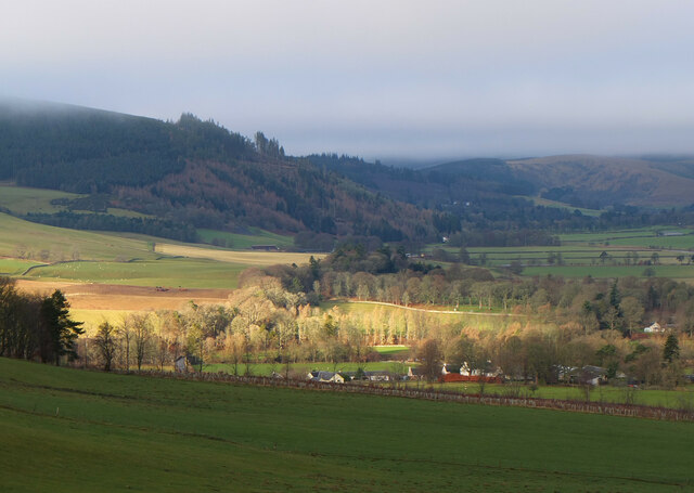
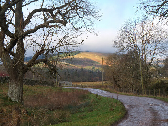
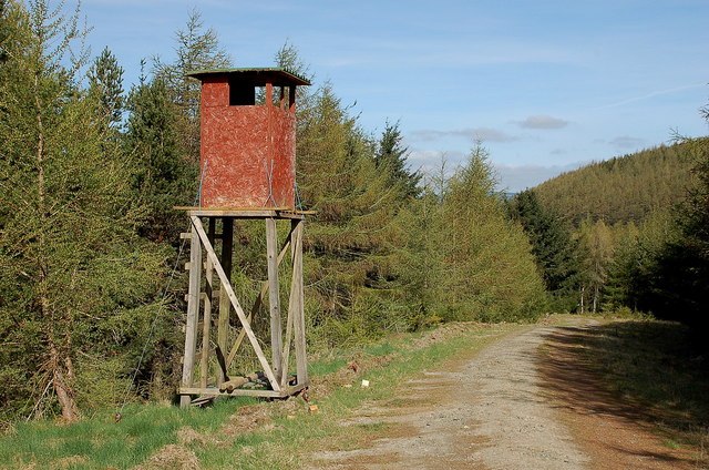
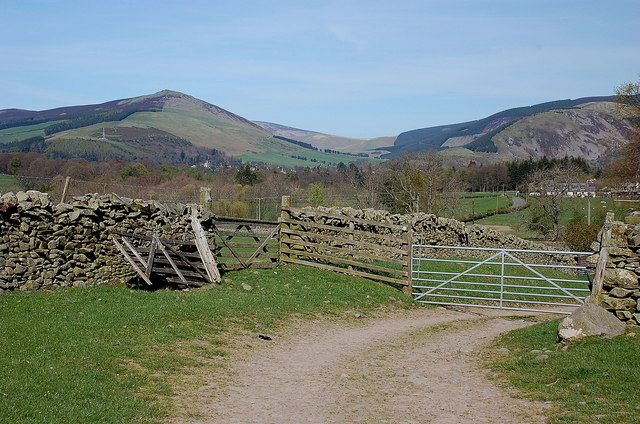
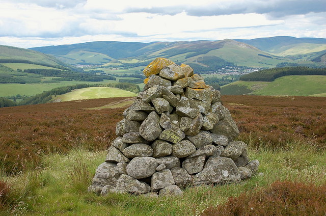
Damhead Strip is a picturesque woodland located in Peeblesshire, Scotland. Spanning over an area of approximately 100 acres, it is known for its natural beauty and rich biodiversity. The strip is situated close to the village of Eddleston, making it easily accessible to both locals and tourists alike.

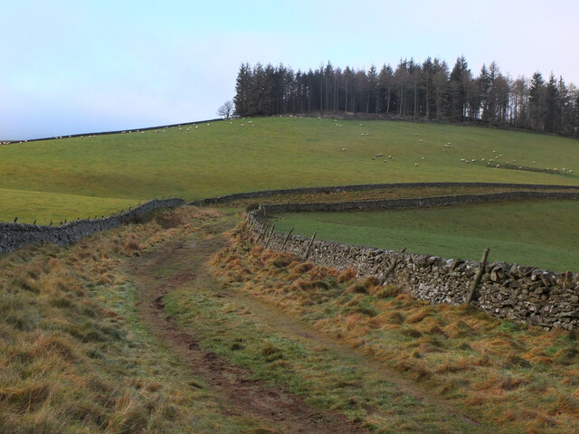
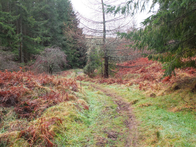
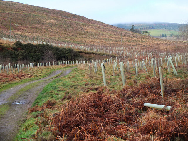
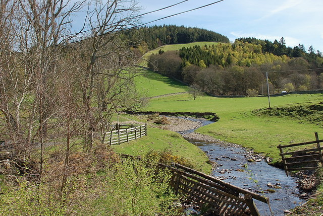
The woodland is predominantly composed of a variety of native tree species, including oak, birch, and beech. These trees form a dense canopy that provides a habitat for numerous wildlife species. The forest floor is covered in lush vegetation, such as ferns and mosses, creating a vibrant and enchanting atmosphere.

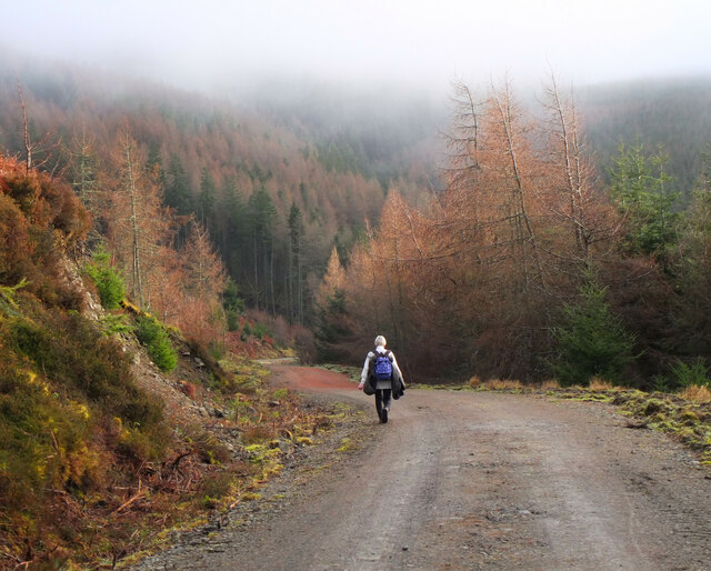
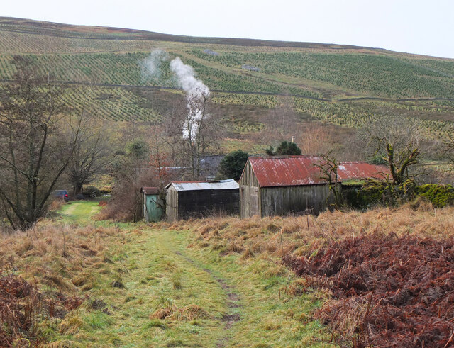
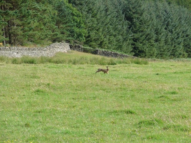
Damhead Strip offers several walking trails, allowing visitors to explore and immerse themselves in its tranquil environment. The paths are well-maintained and suitable for all levels of fitness, making it an ideal destination for families and nature enthusiasts. Along the trails, visitors may come across various wildlife species, including deer, squirrels, and a wide range of bird species.

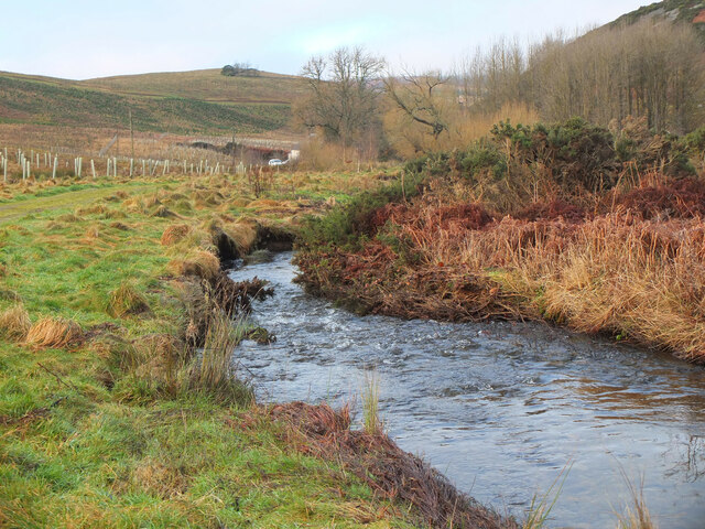
The woodland is also home to a small stream that meanders through the forest, adding to its natural charm. The stream provides a source of water for the local wildlife and adds to the overall beauty of the area.

Overall, Damhead Strip in Peeblesshire is a stunning woodland that offers a peaceful retreat from the hustle and bustle of everyday life. Its diverse ecosystem and well-preserved trails make it an excellent destination for nature lovers and those seeking a serene getaway.

If you have any feedback on the listing, please let us know in the comments section below.

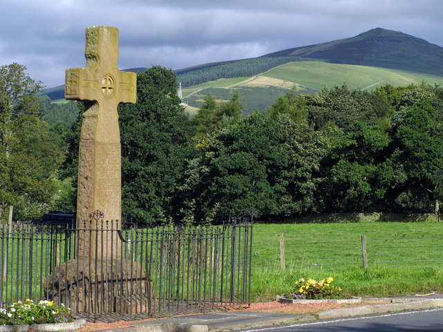
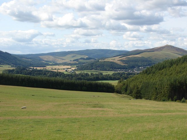
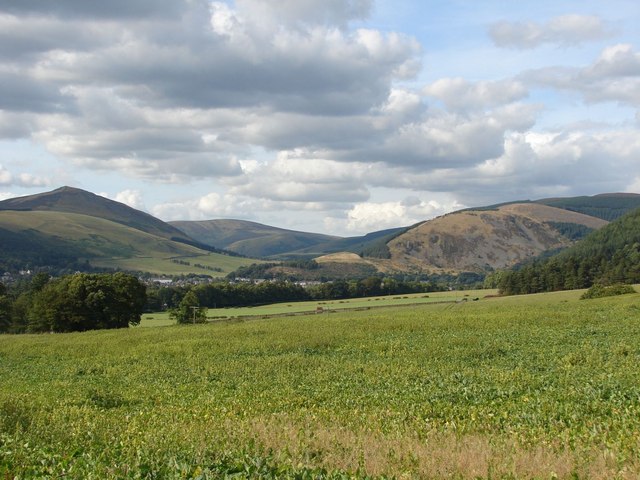
Damhead Strip Images

Images are sourced within 2km of 55.592493/-3.0683447 or Grid Reference NT3233. Thanks to Geograph Open Source API. All images are credited.

Sunlight at Traquair Patchy sunlight as a low-lying cloud layer thins out above the Tweed valley.
Sunlight at Traquair
Patchy sunlight as a low-lying cloud layer thins out above the Tweed valley.
Shaw Hill, Traquair The Southern Upland Way crosses the east side of the hill with Dean Plantation on its summit.
Shaw Hill, Traquair
The Southern Upland Way crosses the east side of the hill with Dean Plantation on its summit.
Forest road below Minch Moor A road contouring the western side of Elibank and Traquair Forest.
Forest road below Minch Moor
A road contouring the western side of Elibank and Traquair Forest.
Path to Camp Shiel A path, wet in places, connecting the forest road contouring Minch Moor with the track in the valley of the Fingland Burn.
Path to Camp Shiel
A path, wet in places, connecting the forest road contouring Minch Moor with the track in the valley of the Fingland Burn.
Cottage and outbuildings, Camp Shiel Compare with <a href="https://www.geograph.org.uk/photo/3590274">NT3432 : Path near Camp Shiel</a> taken in 2013 before the slope opposite was planted for forestry.
Cottage and outbuildings, Camp Shiel
Compare with NT3432 : Path near Camp Shiel taken in 2013 before the slope opposite was planted for forestry.
The Fingland Burn The burn drains the valley between Damhead Rig and west side of Minch Moor.
The Fingland Burn
The burn drains the valley between Damhead Rig and west side of Minch Moor.
New tree plantations, Damhead Coniferous and mixed woodlands have been planted over an area of nearly 300 hectares for Traquair House Charitable Trust - see the website <span class="nowrap"><a title="https://www.forestdirectltd.co.uk/project/damhead-traquair-estate/" rel="nofollow ugc noopener" href="https://www.forestdirectltd.co.uk/project/damhead-traquair-estate/">Link</a><img style="margin-left:2px;" alt="External link" title="External link - shift click to open in new window" src="https://s1.geograph.org.uk/img/external.png" width="10" height="10"/></span> for more details.
New tree plantations, Damhead
Coniferous and mixed woodlands have been planted over an area of nearly 300 hectares for Traquair House Charitable Trust - see the website LinkExternal link for more details.
Track near Damhead The track to the B709 road to Traquair with Lee Pen catching the sun in the background.
Track near Damhead
The track to the B709 road to Traquair with Lee Pen catching the sun in the background.
Shooting platform, White Rig A hide for culling deer that browse on the young trees in the plantations.
Shooting platform, White Rig
A hide for culling deer that browse on the young trees in the plantations.
Track approaching Damhead farm The track from Damhead Rig passes through the farmyard. The buildings at Traquair village are in the middle distance.
Track approaching Damhead farm
The track from Damhead Rig passes through the farmyard. The buildings at Traquair village are in the middle distance.
Fingland Burn Seen from the road bridge, with Shaw Hill in the background.
Fingland Burn
Seen from the road bridge, with Shaw Hill in the background.
Traquair Kirk Looking to the west.
Traquair Kirk
Looking to the west.
War memorial at Traquair The solid looking memorial stands at a road junction; Lee Pen is the prominent hill beyond.
War memorial at Traquair
The solid looking memorial stands at a road junction; Lee Pen is the prominent hill beyond.
Minch Moor Bothy The Minch Moor Bothy stands exactly beside the Southern Upland Way, west of Pipers Knowe and on the way to (or from) the 'Marilyn' of Minch Moor.
Minch Moor Bothy
The Minch Moor Bothy stands exactly beside the Southern Upland Way, west of Pipers Knowe and on the way to (or from) the 'Marilyn' of Minch Moor.
View towards the River Tweed near Innerleithen A pleasant view of the River Tweed and surrounding farmland at the start of August.
View towards the River Tweed near Innerleithen
A pleasant view of the River Tweed and surrounding farmland at the start of August.
View towards Innerleithen Looking across from the S.U.W. pathway towards Pirn Craig, with Lee Pen on the far left.
View towards Innerleithen
Looking across from the S.U.W. pathway towards Pirn Craig, with Lee Pen on the far left.
A brown hare A brown hare on the move across the field next to the pathway.
A brown hare
A brown hare on the move across the field next to the pathway.
Cairn on Damhead Rig (2) A cairn on the crest of the ridge line, not shown on the 1:25,000 map.
Cairn on Damhead Rig (2)
A cairn on the crest of the ridge line, not shown on the 1:25,000 map.
Show me another place!

Damhead Strip is located at Grid Ref: NT3233 (Lat: 55.592493, Lng: -3.0683447)

Unitary Authority: The Scottish Borders

Police Authority: The Lothians and Scottish Borders

What 3 Words

///insurance.rummage.remain. Near Innerleithen, Scottish Borders

Nearby Locations

Damhead Wood Damhead Strip

Related Wikis

Traquair

Traquair (Scottish Gaelic: Cille Bhrìghde) is a small village and civil parish in the Scottish Borders; until 1975 it was in the county of Peeblesshire...

Sir Walter Scott Way

The Sir Walter Scott Way is a 92-mile (148 km) long-distance footpath in the Scottish Borders. The route broadly follows the waymarked Southern Upland...

Quair Water

The Quair Water is a tributary of the River Tweed in the Scottish Borders area of Scotland. Its name is related to Traquair. == Etymology == The name Quair...

Traquair House

Traquair House, approximately 7 miles southeast of Peebles, is claimed to be the oldest continually inhabited house in Scotland. Whilst not strictly a...

Innerleithen railway station

Innerleithen railway station served the town of Innerleithen, Scottish Borders, Scotland from 1864 to 1962 on the Peebles Railway. == History == The station...

Leithen Water

Leithen Water (Scottish Gaelic: Leitheann / Abhainn Leitheinn) is a tributary of the River Tweed in Scotland. It rises in the Moorfoot Hills and joins...

Innerleithen

Innerleithen (Scottish Gaelic: Inbhir Leitheann) is a civil parish and a small town in the committee area of Tweeddale, in the Scottish Borders. It was...

Robert Smail's Printing Works

Robert Smail's Printing Works is a fully functional Victorian era letterpress printing works in the small Scottish Borders town of Innerleithen, now preserved...

Nearby Amenities

Located within 500m of 55.592493,-3.0683447
Ele: 271
Natural: peak
Lat/Long: 55.589485/-3.065863
Barrier: stile
Lat/Long: 55.5958756/-3.0644533
Power: pole
Lat/Long: 55.5964813/-3.0662288
Power: pole
Lat/Long: 55.5968196/-3.0665757
Power: pole
Lat/Long: 55.5965112/-3.0658057
Power: pole
Lat/Long: 55.5963893/-3.0672949
Power: pole
Lat/Long: 55.5963009/-3.0683864
Power: pole
Lat/Long: 55.5961096/-3.0707196
Power: pole
Lat/Long: 55.59602/-3.0719211
Power: pole
Lat/Long: 55.5959411/-3.0728709
Power: pole
Lat/Long: 55.5951762/-3.0739328
Power: pole
Lat/Long: 55.5944016/-3.0750476
Power: pole
Lat/Long: 55.5939379/-3.0756991
The data included in this document is from www.openstreetmap.org. The data is made available under ODbL.

Have you been to Damhead Strip?

Leave your review of Damhead Strip below (or comments, questions and feedback).