Binnie Wood

Wood, Forest in Peeblesshire

Scotland

Binnie Wood

Track approaching Damhead farm The track from Damhead Rig passes through the farmyard. The buildings at Traquair village are in the middle distance.
Track approaching Damhead farm Credit: Jim Barton

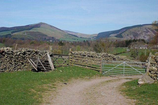
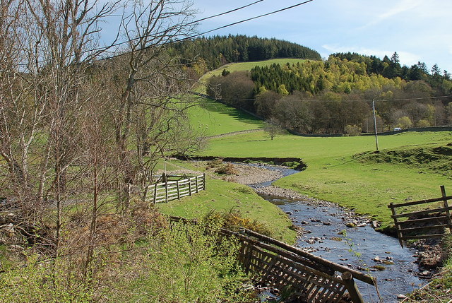
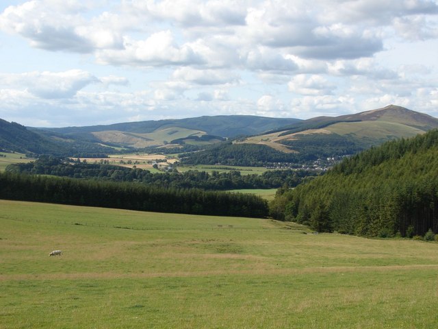
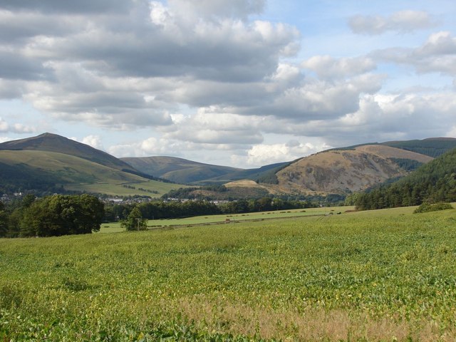
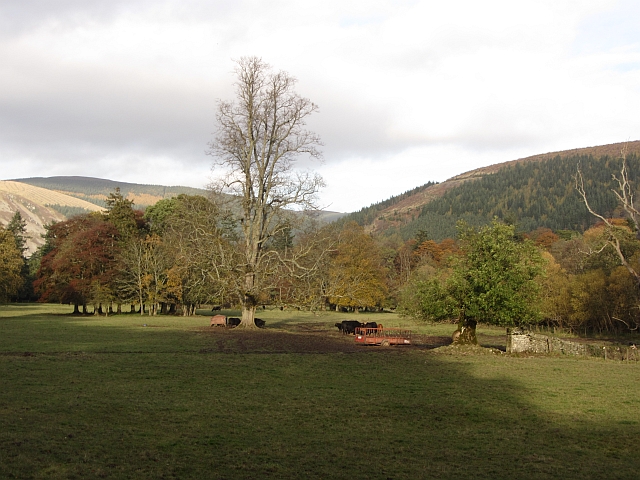
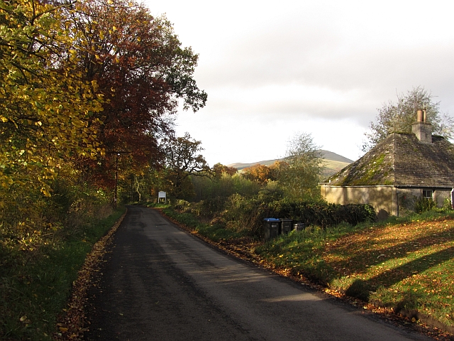
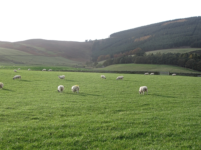
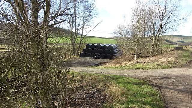
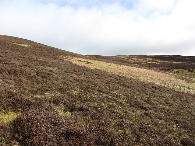
Binnie Wood is a picturesque forest located in the Peeblesshire region of Scotland. Stretching over an area of approximately 200 hectares, this woodland is renowned for its natural beauty and diverse ecosystem. Situated near the small village of Eddleston, Binnie Wood attracts nature enthusiasts, hikers, and birdwatchers alike.

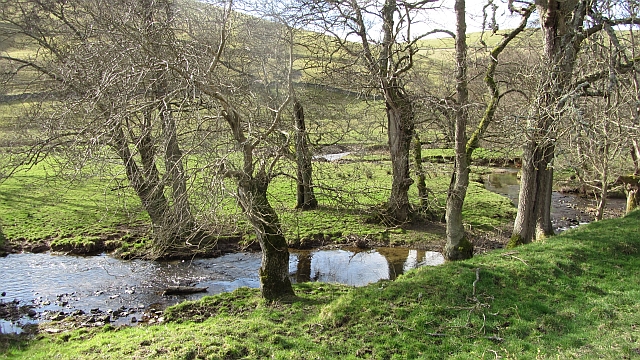
The forest is predominantly composed of native tree species, including oak, birch, and pine. These trees create a dense canopy that provides a habitat for a variety of wildlife. Visitors can expect to encounter red squirrels, roe deer, and a wide array of bird species, such as woodpeckers, owls, and various songbirds.

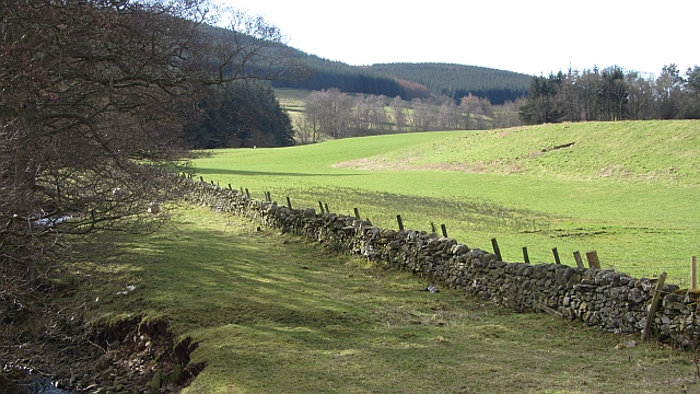
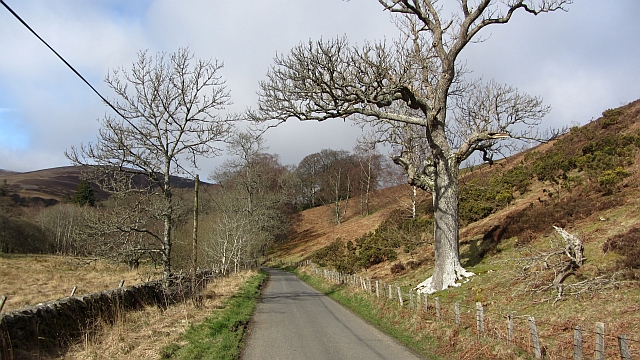
Binnie Wood offers several well-marked trails that wind through the forest, catering to both casual walkers and more experienced hikers. These paths provide opportunities to explore the woodland's enchanting features, including tranquil streams, old stone bridges, and hidden clearings. During spring and summer, the forest floor comes alive with vibrant wildflowers, adding a burst of color to the surroundings.

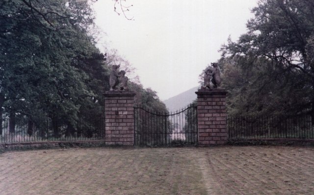
The wood is also home to a rich history. It is said that Binnie Wood was once part of the hunting grounds of the Scottish nobility, and remnants of ancient structures, such as stone walls and ruins, can still be found within the forest. These historical elements add a sense of intrigue and fascination for those interested in the region's past.

Overall, Binnie Wood offers a serene and captivating experience for nature lovers. With its diverse flora and fauna, well-maintained trails, and historical significance, this forest is a true gem nestled in the heart of Peeblesshire.

If you have any feedback on the listing, please let us know in the comments section below.

Binnie Wood Images

Images are sourced within 2km of 55.597503/-3.0821925 or Grid Reference NT3134. Thanks to Geograph Open Source API. All images are credited.

Track approaching Damhead farm The track from Damhead Rig passes through the farmyard. The buildings at Traquair village are in the middle distance.
Track approaching Damhead farm
The track from Damhead Rig passes through the farmyard. The buildings at Traquair village are in the middle distance.
Fingland Burn Seen from the road bridge, with Shaw Hill in the background.
Fingland Burn
Seen from the road bridge, with Shaw Hill in the background.
Traquair Kirk Looking to the west.
Traquair Kirk
Looking to the west.
War memorial at Traquair The solid looking memorial stands at a road junction; Lee Pen is the prominent hill beyond.
War memorial at Traquair
The solid looking memorial stands at a road junction; Lee Pen is the prominent hill beyond.
View towards the River Tweed near Innerleithen A pleasant view of the River Tweed and surrounding farmland at the start of August.
View towards the River Tweed near Innerleithen
A pleasant view of the River Tweed and surrounding farmland at the start of August.
View towards Innerleithen Looking across from the S.U.W. pathway towards Pirn Craig, with Lee Pen on the far left.
View towards Innerleithen
Looking across from the S.U.W. pathway towards Pirn Craig, with Lee Pen on the far left.
Gardener's Acre Parkland, grazed by cattle, Traquair.
Gardener's Acre
Parkland, grazed by cattle, Traquair.
B7062, Traquair Outside the famous shut gate - The Steekit Yetts  <a href="https://www.geograph.org.uk/photo/4678">NT3235 : The Steekit Yetts</a>. This road is a quiet and narrow alternative to the A72 on the other side of the Tweed.
B7062, Traquair
Outside the famous shut gate - The Steekit Yetts NT3235 : The Steekit Yetts. This road is a quiet and narrow alternative to the A72 on the other side of the Tweed.
Sheep below Grieston Hill Good grazing in Tweeddale.
Sheep below Grieston Hill
Good grazing in Tweeddale.
Traquair House, Innerleithen Traquair is Scotland's oldest inhabited house. It is privately owned and open to the public. It has been owned by a number of families since 1107, latterly the Stuarts, and has been a Roman Catholic stronghold.
Traquair House, Innerleithen
Traquair is Scotland's oldest inhabited house. It is privately owned and open to the public. It has been owned by a number of families since 1107, latterly the Stuarts, and has been a Roman Catholic stronghold.
The Steekit Yetts of Traquair The Steekit Yetts have remained shut since the second Jacobite Rebellion - we managed to resist the temptation to try and open them
The Steekit Yetts of Traquair
The Steekit Yetts have remained shut since the second Jacobite Rebellion - we managed to resist the temptation to try and open them
The maze at Traquair in 1983 See <a href="https://www.geograph.org.uk/photo/492940">NT3335 : The maze at Traquair</a> for how in appeared 24 years later
The maze at Traquair in 1983
See NT3335 : The maze at Traquair for how in appeared 24 years later
Fingland Bridge A silage store beside the bridge.
Fingland Bridge
A silage store beside the bridge.
Dyke beside the Curly Burn View upstream from the Kirk Bridge on the Traquair - Yarrow Water road.
Dyke beside the Curly Burn
View upstream from the Kirk Bridge on the Traquair - Yarrow Water road.
Quair Water A burn running between ash trees.
Quair Water
A burn running between ash trees.
The Glen Road The road into the Glen Estate and a fine ash tree. The Glen is home to some fine woodlands.
The Glen Road
The road into the Glen Estate and a fine ash tree. The Glen is home to some fine woodlands.
Moorland, Orchard Rig Some bracken as well as the heather.
Moorland, Orchard Rig
Some bracken as well as the heather.
Royal Observer Corps, Traquair Cold War observation bunker, I used to think they were waterboard properties although playground gossip did identify the locations of some "secret bunkers".
Royal Observer Corps, Traquair
Cold War observation bunker, I used to think they were waterboard properties although playground gossip did identify the locations of some "secret bunkers".
Show me another place!

Binnie Wood is located at Grid Ref: NT3134 (Lat: 55.597503, Lng: -3.0821925)

Unitary Authority: The Scottish Borders

Police Authority: The Lothians and Scottish Borders

What 3 Words

///works.lock.scrubbing. Near Innerleithen, Scottish Borders

Related Wikis

Traquair

Traquair (Scottish Gaelic: Cille Bhrìghde) is a small village and civil parish in the Scottish Borders; until 1975 it was in the county of Peeblesshire...

Sir Walter Scott Way

The Sir Walter Scott Way is a 92-mile (148 km) long-distance footpath in the Scottish Borders. The route broadly follows the waymarked Southern Upland...

Quair Water

The Quair Water is a tributary of the River Tweed in the Scottish Borders area of Scotland. Its name is related to Traquair. == Etymology == The name Quair...
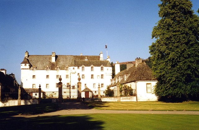
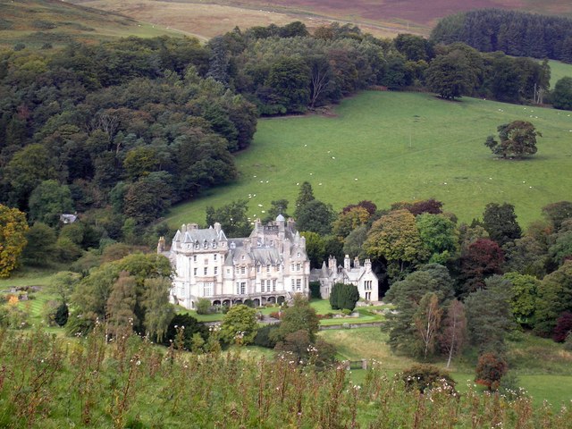
Traquair House

Traquair House, approximately 7 miles southeast of Peebles, is claimed to be the oldest continually inhabited house in Scotland. Whilst not strictly a...

Leithen Water

Leithen Water (Scottish Gaelic: Leitheann / Abhainn Leitheinn) is a tributary of the River Tweed in Scotland. It rises in the Moorfoot Hills and joins...

Innerleithen railway station

Innerleithen railway station served the town of Innerleithen, Scottish Borders, Scotland from 1864 to 1962 on the Peebles Railway. == History == The station...

The Glen, Scottish Borders

The Glen, also known as Glen House, is an estate and country house in the parish of Traquair, southern Scotland. It is located in the glen of the Quair...

Vale of Leithen F.C.

Vale of Leithen Football Club are a football club based in the town of Innerleithen, Scotland. They play in the East of Scotland League First Division...

Have you been to Binnie Wood?

Leave your review of Binnie Wood below (or comments, questions and feedback).