Wallacehill Wood

Wood, Forest in Selkirkshire

Scotland

Wallacehill Wood

Larches in Cardrona Forest Larches in this area have been selected as sources of seed for new plantings, as described by foresters in an interesting walk around the forest as part of Tweed Valley Forest Festival.
Larches in Cardrona Forest Credit: Jim Barton

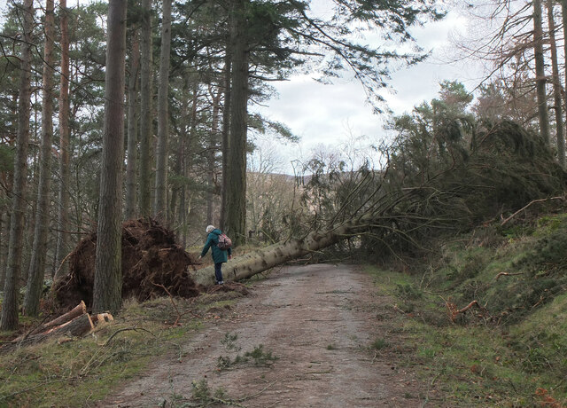
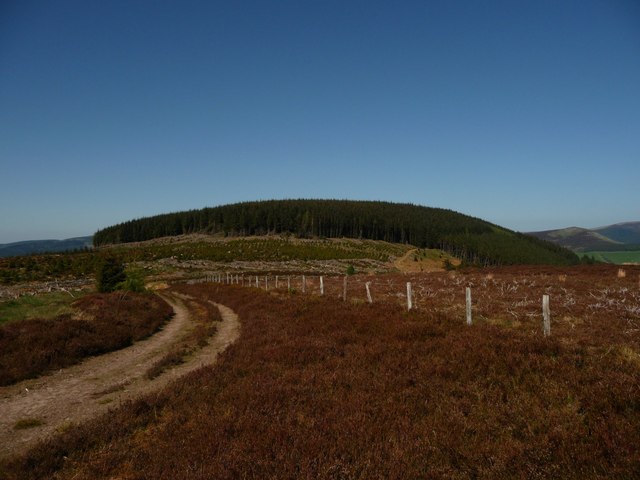
Wallacehill Wood is a picturesque forest located in Selkirkshire, Scotland. Spread over a vast area, this woodland is known for its natural beauty and diverse flora and fauna. The wood is situated in close proximity to the town of Selkirk, making it easily accessible to both locals and tourists.

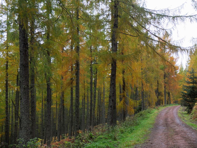
The woodland is primarily composed of native Scottish trees such as oak, birch, and rowan, which create a dense canopy providing shade and shelter. The forest floor is adorned with a carpet of vibrant wildflowers during the spring and summer months, adding to its aesthetic appeal.

Wallacehill Wood is a haven for wildlife enthusiasts as it is home to a wide variety of animals. Visitors can often spot red squirrels, roe deer, and numerous bird species, including woodpeckers and owls. It is also common to see small mammals like hedgehogs and rabbits darting through the undergrowth.

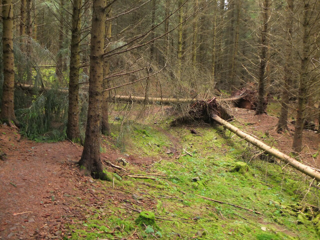
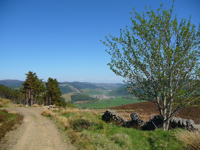
The wood offers several walking trails and paths that allow visitors to explore the area at their own pace. These paths are well-maintained and clearly marked, making it easy to navigate through the forest. Along the trails, there are information boards providing details about the flora and fauna, enhancing the educational experience.

Wallacehill Wood is a popular destination for outdoor activities such as hiking, picnicking, and birdwatching. The tranquil ambiance and natural beauty make it an ideal spot for relaxation and reconnecting with nature. Whether it's a leisurely stroll or an adventurous hike, visitors to Wallacehill Wood are sure to be captivated by its charm and serenity.

If you have any feedback on the listing, please let us know in the comments section below.

Wallacehill Wood Images

Images are sourced within 2km of 55.621667/-3.0972453 or Grid Reference NT3037. Thanks to Geograph Open Source API. All images are credited.

Larches in Cardrona Forest Larches in this area have been selected as sources of seed for new plantings, as described by foresters in an interesting walk around the forest as part of Tweed Valley Forest Festival.
Larches in Cardrona Forest
Larches in this area have been selected as sources of seed for new plantings, as described by foresters in an interesting walk around the forest as part of Tweed Valley Forest Festival.
Laverlaw farm Above the Kirk Burn valley.
Laverlaw farm
Above the Kirk Burn valley.
The valley of the Kirk Burn Looking across to larch and spruce plantations on Cardrona Hill.
The valley of the Kirk Burn
Looking across to larch and spruce plantations on Cardrona Hill.
Forestry on Pikes Knowe Looking across the Kirk Burn valley to larch and spruce plantations.
Forestry on Pikes Knowe
Looking across the Kirk Burn valley to larch and spruce plantations.
Forest track crossing the Highlandshiels Burn On the track south from Kirkburn car park.
Forest track crossing the Highlandshiels Burn
On the track south from Kirkburn car park.
Overgrown path, Cardrona Forest A signpost 'Cardrona Peebles' points to a path into the plantation to the west of the Highlandshiels Burn. The path looks very little used and is not marked on the 1:25,000 map.
Overgrown path, Cardrona Forest
A signpost 'Cardrona Peebles' points to a path into the plantation to the west of the Highlandshiels Burn. The path looks very little used and is not marked on the 1:25,000 map.
Woodland path, Cardrona Forest The path up from the Highlandshiels Burn to the forest edge at the ridge on Beards Hill.
Woodland path, Cardrona Forest
The path up from the Highlandshiels Burn to the forest edge at the ridge on Beards Hill.
Road junction, Cardrona Forest A junction above the Glenpeggy Burn.
Road junction, Cardrona Forest
A junction above the Glenpeggy Burn.
Old quarry, Cardrona Forest An oval space off the forest road, partly overgrown and no obvious rock face is evident.
Old quarry, Cardrona Forest
An oval space off the forest road, partly overgrown and no obvious rock face is evident.
Trees across the path, Cardona Forest An area of windthrown trees following Storm Arwen (26-27 November 2021). The storm force northerly winds particularly affected eastern coastal fringes of Scotland and northern England, but damage to forestry plantations occurred further inland as here.

The path is Fergus's Trail, here contouring the eastern side of Cardrona Hill. The path here is impassable but an alternative can be found keeping to the outside of the damaged area, rejoining the path further on.
Trees across the path, Cardona Forest
An area of windthrown trees following Storm Arwen (26-27 November 2021). The storm force northerly winds particularly affected eastern coastal fringes of Scotland and northern England, but damage to forestry plantations occurred further inland as here. The path is Fergus's Trail, here contouring the eastern side of Cardrona Hill. The path here is impassable but an alternative can be found keeping to the outside of the damaged area, rejoining the path further on.
Aftermath of Storm Arwen, Cardrona Forest Fergus's Trail is somewhere in here on the east side of Cardrona Hill, after the passage of Storm Arwen's northerly gales 26-27 November last year.
Aftermath of Storm Arwen, Cardrona Forest
Fergus's Trail is somewhere in here on the east side of Cardrona Hill, after the passage of Storm Arwen's northerly gales 26-27 November last year.
Trees across the path, Cardona Forest Windthrown pines on Fergus's Trail contouring the east side of Cardrona Hill, brought down in the northerly gales of Storm Arwen on 26-27 November last year.
Trees across the path, Cardona Forest
Windthrown pines on Fergus's Trail contouring the east side of Cardrona Hill, brought down in the northerly gales of Storm Arwen on 26-27 November last year.
Tree across the track, Cardrona A pine tree brought down in Storm Arwen (26-27 November 2021) across the forest track on the north side of Cardrona Hill.
Tree across the track, Cardrona
A pine tree brought down in Storm Arwen (26-27 November 2021) across the forest track on the north side of Cardrona Hill.
Mossy trees, Cardrona forest By Fergus's Trail on the east side of Cardrona Hill.
Mossy trees, Cardrona forest
By Fergus's Trail on the east side of Cardrona Hill.
Wallace's Hill At an altitude of 460 metres Wallace's Hill is in Cardrona Forest.  The name presumably refers to the exploits of the great Scottish patriot Sir William Wallace,(1270 - 1305) who was active in the area. There are many interesting walks in the forest which is  owned by the Forestry Commission
Wallace's Hill
At an altitude of 460 metres Wallace's Hill is in Cardrona Forest. The name presumably refers to the exploits of the great Scottish patriot Sir William Wallace,(1270 - 1305) who was active in the area. There are many interesting walks in the forest which is owned by the Forestry Commission
Castle Knowe This is the site of the iron age fort of Castle Knowe in Cardrona Forest. It covers a large area, perhaps 100 yards by 50 yards. As can be seen much of the old stonework has been re-used to build sheep fanks although vast sections of the ruined walls remain
Castle Knowe
This is the site of the iron age fort of Castle Knowe in Cardrona Forest. It covers a large area, perhaps 100 yards by 50 yards. As can be seen much of the old stonework has been re-used to build sheep fanks although vast sections of the ruined walls remain
Cardrona Tower This was one of the many towers along the Tweed Valley. Fortified homes necessary since reiving, plundering from your neighbours, was the way of life. In the mid 17th century it was the home of the Williamsons and later the Govans. Now in winter the tower is home to several varieties of bats.
Cardrona Tower
This was one of the many towers along the Tweed Valley. Fortified homes necessary since reiving, plundering from your neighbours, was the way of life. In the mid 17th century it was the home of the Williamsons and later the Govans. Now in winter the tower is home to several varieties of bats.
Forest walk Forest walk in Cardrona Forest with view over Tweed Valley to Peebles some 4 or 5 miles distant. Cardrona Forest which is owned by the Forestry Commission has many fine forest walks. It is also a haven for a great variety of wildlife including the recent welcome return of nesting Ospreys.
Forest walk
Forest walk in Cardrona Forest with view over Tweed Valley to Peebles some 4 or 5 miles distant. Cardrona Forest which is owned by the Forestry Commission has many fine forest walks. It is also a haven for a great variety of wildlife including the recent welcome return of nesting Ospreys.
Show me another place!

Wallacehill Wood is located at Grid Ref: NT3037 (Lat: 55.621667, Lng: -3.0972453)

Unitary Authority: The Scottish Borders

Police Authority: The Lothians and Scottish Borders

What 3 Words

///lace.sulk.frown. Near Innerleithen, Scottish Borders

Related Wikis

Cardrona Forest

The Cardrona Forest is a forest in the Scottish Borders area of Scotland, on the B7062, near Peebles. OS Grid Reference: NT292385. Cardrona Forest consists...

Leithen Water

Leithen Water (Scottish Gaelic: Leitheann / Abhainn Leitheinn) is a tributary of the River Tweed in Scotland. It rises in the Moorfoot Hills and joins...

Vale of Leithen F.C.

Vale of Leithen Football Club are a football club based in the town of Innerleithen, Scotland. They play in the East of Scotland League First Division...

Robert Smail's Printing Works

Robert Smail's Printing Works is a fully functional Victorian era letterpress printing works in the small Scottish Borders town of Innerleithen, now preserved...

Cardrona, Scottish Borders

Cardrona is a village on the A72 and B7062, between Peebles and Innerleithen, in the Scottish Borders area of Scotland. Places nearby include Glentress...

Cardrona railway station

Cardrona railway station served the village of Cardrona, Scottish Borders, Scotland from 1864 to 1962 on the Peebles Railway. == History == The station...

Innerleithen railway station

Innerleithen railway station served the town of Innerleithen, Scottish Borders, Scotland from 1864 to 1962 on the Peebles Railway. == History == The station...

Kirkburn, Scottish Borders

Kirkburn is a village on the B7062, close to Peebles and the River Tweed, in the Scottish Borders area of Scotland, at the edge of the Cardrona Forest...

Nearby Amenities

Located within 500m of 55.621667,-3.0972453
Information: guidepost
Tourism: information
Lat/Long: 55.6223654/-3.0915833
Bench
Lat/Long: 55.6223866/-3.0914331
Information: board
Tourism: information
Lat/Long: 55.622332/-3.0914516
Material: wood
Power: pole
Lat/Long: 55.6254776/-3.1002232
Material: wood
Power: pole
Lat/Long: 55.6249294/-3.0991611
Material: wood
Power: pole
Lat/Long: 55.6243782/-3.0980882
Material: wood
Power: pole
Lat/Long: 55.6239526/-3.0968061
Material: wood
Power: pole
Lat/Long: 55.623571/-3.095701
Material: wood
Power: pole
Lat/Long: 55.6231606/-3.0944511
Material: wood
Power: pole
Lat/Long: 55.6227486/-3.0932227
Material: wood
Power: pole
Lat/Long: 55.6223309/-3.0919014
Material: wood
Power: pole
Lat/Long: 55.6221247/-3.0910125
Material: wood
Power: pole
Lat/Long: 55.6219293/-3.0900791
Power: pole
Lat/Long: 55.6222401/-3.0919649
Power: pole
Lat/Long: 55.6217086/-3.0922737
Power: pole
Lat/Long: 55.6212547/-3.0925233
Power: pole
Lat/Long: 55.6239767/-3.0963288
Power: pole
Lat/Long: 55.6246145/-3.0955969
Power: pole
Lat/Long: 55.6253013/-3.0948016
The data included in this document is from www.openstreetmap.org. The data is made available under ODbL.

Have you been to Wallacehill Wood?

Leave your review of Wallacehill Wood below (or comments, questions and feedback).