Pittachope Plantation

Wood, Forest in Fife

Scotland

Pittachope Plantation

C46 (Fife) Road near Logie The C46 road heading west near Logie.
C46 (Fife) Road near Logie Credit: Scott Cormie

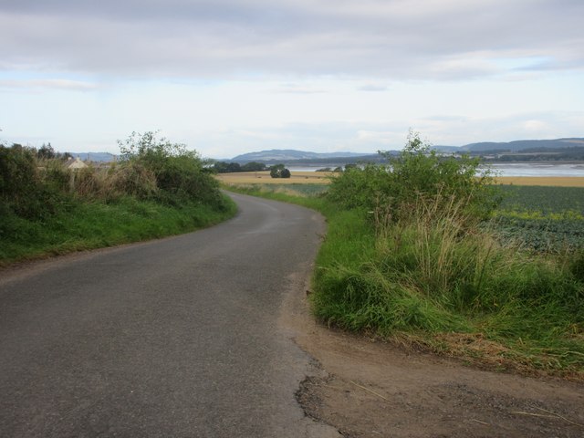
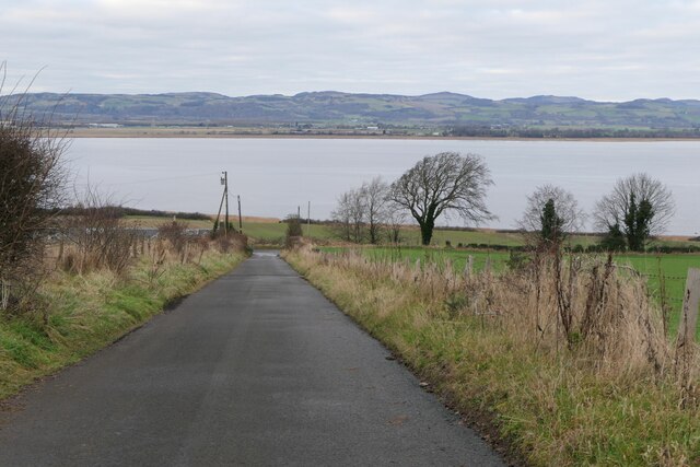
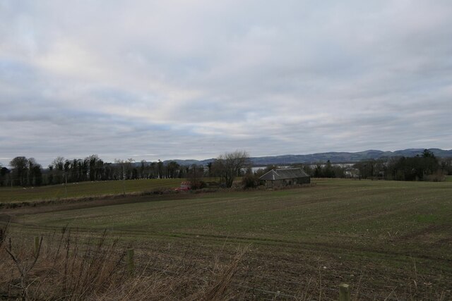
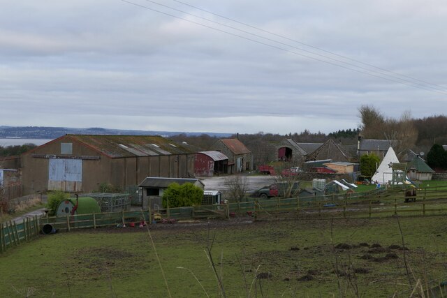
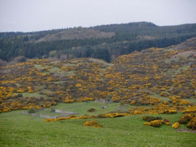
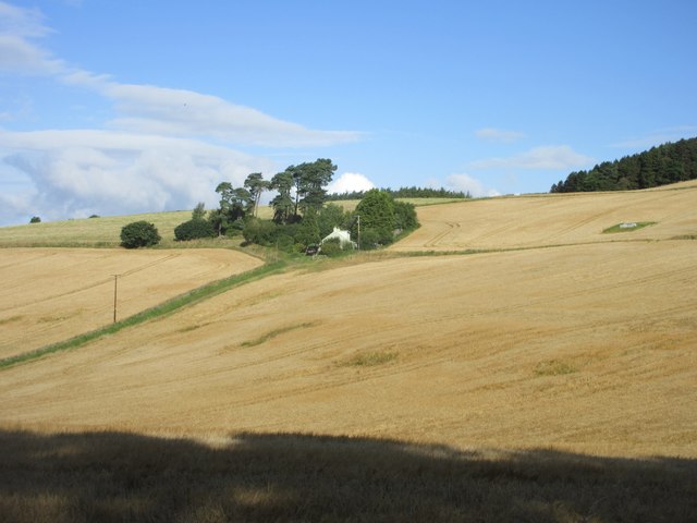
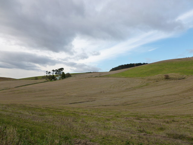
Pittachope Plantation is a picturesque wood located in the region of Fife, Scotland. Covering an area of approximately 200 acres, it is nestled within the rolling hills and stunning countryside of the area. The plantation is primarily composed of a diverse mix of native tree species, including oak, birch, beech, and Scots pine.

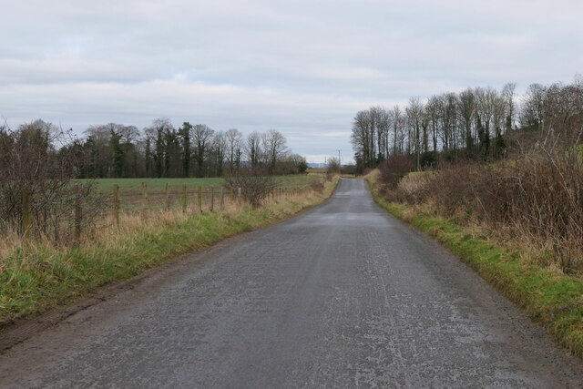
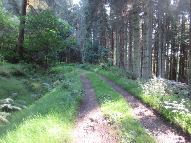
This enchanting forest offers a tranquil escape for nature enthusiasts and outdoor lovers alike. It boasts a range of walking trails that wind through the woodland, providing visitors with the opportunity to explore and immerse themselves in the natural beauty of the area. The paths are well-maintained, making it accessible for all ages and abilities.

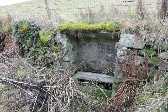
Pittachope Plantation is home to a rich variety of wildlife, with an abundance of bird species, including woodpeckers, owls, and songbirds. Visitors may also spot red squirrels, badgers, and deer roaming freely within the wood. The diverse habitat provides a sanctuary for these animals, allowing them to thrive in their natural environment.

Throughout the seasons, the plantation showcases its own unique charm. In the spring, vibrant bluebells carpet the forest floor, creating a stunning display of color. During the autumn months, the foliage transforms into a kaleidoscope of golden hues, captivating visitors with its beauty.

The plantation is easily accessible by car, with ample parking available nearby. It is a popular destination for local residents and tourists looking to escape the hustle and bustle of everyday life and reconnect with nature. Pittachope Plantation offers a serene and idyllic setting, making it a must-visit location for anyone seeking tranquility and natural beauty in Fife.

If you have any feedback on the listing, please let us know in the comments section below.

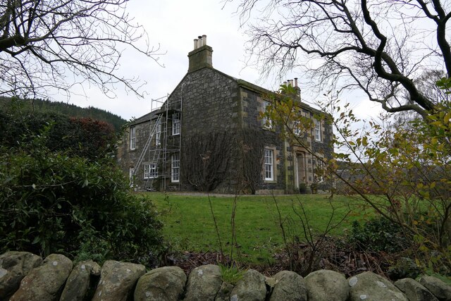
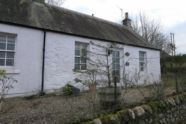
Pittachope Plantation Images

Images are sourced within 2km of 56.379279/-3.1224123 or Grid Reference NO3021. Thanks to Geograph Open Source API. All images are credited.

C46 (Fife) Road near Logie The C46 road heading west near Logie.
C46 (Fife) Road near Logie
The C46 road heading west near Logie.
Looking towards Tay Estuary at Fliskmillan
Well at West Flisk There is an Ordnance Survey benchmark on the right hand side of this former well. See also <a href="https://www.geograph.org.uk/photo/7687230">NO3122 : Benchmark on well at West Flisk</a>.
Well at West Flisk
There is an Ordnance Survey benchmark on the right hand side of this former well. See also NO3122 : Benchmark on well at West Flisk.
Benchmark on well at West Flisk Ordnance Survey benchmark. For database entry, see <span class="nowrap"><a title="https://www.bench-marks.org.uk/bm211339" rel="nofollow ugc noopener" href="https://www.bench-marks.org.uk/bm211339">Link</a><img style="margin-left:2px;" alt="External link" title="External link - shift click to open in new window" src="https://s1.geograph.org.uk/img/external.png" width="10" height="10"/></span>.  See also <a href="https://www.geograph.org.uk/photo/7687227">NO3122 : Well at West Flisk</a>.
Benchmark on well at West Flisk
Ordnance Survey benchmark. For database entry, see LinkExternal link. See also NO3122 : Well at West Flisk.
Benchmark, Carseview Cottage, Flisk Ordnance Survey benchmark.  For database entry, see <span class="nowrap"><a title="https://www.bench-marks.org.uk/bm211337" rel="nofollow ugc noopener" href="https://www.bench-marks.org.uk/bm211337">Link</a><img style="margin-left:2px;" alt="External link" title="External link - shift click to open in new window" src="https://s1.geograph.org.uk/img/external.png" width="10" height="10"/></span>.  See also <a href="https://www.geograph.org.uk/photo/7687279">NO3021 : Carseview Cottage, Flisk</a>.
Benchmark, Carseview Cottage, Flisk
Ordnance Survey benchmark. For database entry, see LinkExternal link. See also NO3021 : Carseview Cottage, Flisk.
Fliskmillan House There is an Ordnance Survey benchmark on the  left-hand side of this building. See <a href="https://www.geograph.org.uk/photo/7687274">NO3021 : Benchmark, Fliskmillan House</a>.
Fliskmillan House
There is an Ordnance Survey benchmark on the left-hand side of this building. See NO3021 : Benchmark, Fliskmillan House.
Balhelvie Cottage There is an Ordnance Survey benchmark on this cottage, just above fence line to the right of the drainpipe in this photo. See also <a href="https://www.geograph.org.uk/photo/7687265">NO3021 : Benchmark, Balhelvie Cottages</a>.
Balhelvie Cottage
There is an Ordnance Survey benchmark on this cottage, just above fence line to the right of the drainpipe in this photo. See also NO3021 : Benchmark, Balhelvie Cottages.
West Flisk
West Flisk
East Flisk Farm On south side of River Tay.
East Flisk Farm
On south side of River Tay.
Benchmark, Balhelvie Cottages Ordnance Survey benchmark, described on database at <span class="nowrap"><a title="https://www.bench-marks.org.uk/bm211338" rel="nofollow ugc noopener" href="https://www.bench-marks.org.uk/bm211338">Link</a><img style="margin-left:2px;" alt="External link" title="External link - shift click to open in new window" src="https://s1.geograph.org.uk/img/external.png" width="10" height="10"/></span>.  See also <a href="https://www.geograph.org.uk/photo/7687247">NO3021 : Balhelvie Cottage</a>.
Benchmark, Balhelvie Cottages
Ordnance Survey benchmark, described on database at LinkExternal link. See also NO3021 : Balhelvie Cottage.
Road leading north-east from Balhelvie
Benchmark, Fliskmillan House Ordnance Survey benchmark, described on database at <span class="nowrap"><a title="https://www.bench-marks.org.uk/bm211336" rel="nofollow ugc noopener" href="https://www.bench-marks.org.uk/bm211336">Link</a><img style="margin-left:2px;" alt="External link" title="External link - shift click to open in new window" src="https://s1.geograph.org.uk/img/external.png" width="10" height="10"/></span>.  See also <a href="https://www.geograph.org.uk/photo/7687243">NO3021 : Fliskmillan House</a>.
Benchmark, Fliskmillan House
Ordnance Survey benchmark, described on database at LinkExternal link. See also NO3021 : Fliskmillan House.
Cottages at Flisk There is an Ordnance Survey benchmark on the nearest cottage.
Cottages at Flisk
There is an Ordnance Survey benchmark on the nearest cottage.
Carseview Cottage, Flisk There is an Ordnance Survey benchmark on this building.
Carseview Cottage, Flisk
There is an Ordnance Survey benchmark on this building.
Denmuirhill A ruin on Norman's Law
Denmuirhill
A ruin on Norman's Law
Inland section of the Fife Coastal Path Well inland wooded section of the Fife Coastal Path south-west of Norman's Law.
Inland section of the Fife Coastal Path
Well inland wooded section of the Fife Coastal Path south-west of Norman's Law.
October Cottage October Cottage on Ayton Hill, viewed from the Fife Coastal Path.
October Cottage
October Cottage on Ayton Hill, viewed from the Fife Coastal Path.
Ayton-Hill The house lower down the track is called Aytounhill House, but this farm is named on the map as Ayton-Hill.
Ayton-Hill
The house lower down the track is called Aytounhill House, but this farm is named on the map as Ayton-Hill.
Show me another place!

Pittachope Plantation is located at Grid Ref: NO3021 (Lat: 56.379279, Lng: -3.1224123)

Unitary Authority: Fife

Police Authority: Fife

What 3 Words

///abstracts.slips.permit. Near Errol, Perth & Kinross

Related Wikis

Norman's Law

Norman's Law is a prominent hill at the far eastern end of the Ochil Fault, Scotland. It sits above the south bank of the River Tay, around four miles...

Flisk

Flisk (Scottish Gaelic: Fleasg meaning "Stalk" or "Rod") was a parish in Fife, Scotland. According to the 1853 Gazetteer, in part: "Flisk parish is bounded...

Creich, Fife

Creich (Scottish Gaelic: Craoich, pronounced [kʰɾɯːç]; OS: Criech), is a hamlet in Fife, Scotland.The local parish is named after Creich. The ruins of...

Inner Tay Estuary

The Inner Tay Estuary is the inner, western part of the Firth of Tay, from the Tay Railway Bridge in the east to the Queen's Bridge over the River Tay...

Nearby Amenities

Located within 500m of 56.379279,-3.1224123
Material: wood
Power: pole
Lat/Long: 56.3773059/-3.1296846
Material: wood
Power: pole
Lat/Long: 56.3777515/-3.128711
Material: wood
Power: pole
Lat/Long: 56.3781822/-3.1278259
Material: wood
Power: pole
Lat/Long: 56.3786619/-3.1268603
Material: wood
Power: pole
Lat/Long: 56.3791356/-3.1258893
Material: wood
Power: pole
Lat/Long: 56.3796465/-3.125031
Material: wood
Power: pole
Lat/Long: 56.3802168/-3.1241137
Material: wood
Power: pole
Lat/Long: 56.3806801/-3.1233573
Material: wood
Power: pole
Lat/Long: 56.3811494/-3.1225634
Material: wood
Power: pole
Lat/Long: 56.3816038/-3.1218016
Material: wood
Power: pole
Lat/Long: 56.3820553/-3.1210399
Material: wood
Power: pole
Lat/Long: 56.3825453/-3.1202191
Material: wood
Power: pole
Lat/Long: 56.3831185/-3.1193286
Power: pole
Lat/Long: 56.3818389/-3.12877
Power: pole
Lat/Long: 56.3812457/-3.1283801
Power: pole
Lat/Long: 56.3808449/-3.1281216
Power: pole
Lat/Long: 56.3803754/-3.1278258
Power: pole
Lat/Long: 56.3798887/-3.127255
Power: pole
Lat/Long: 56.3795062/-3.1265662
Power: pole
Lat/Long: 56.3824516/-3.122806
Power: pole
Lat/Long: 56.3827092/-3.1222827
Power: pole
Lat/Long: 56.3829314/-3.1218338
Power: pole
Lat/Long: 56.3829898/-3.1217201
Power: pole
Lat/Long: 56.383181/-3.1213499
Power: pole
Lat/Long: 56.3832886/-3.1211658
Power: pole
Lat/Long: 56.3830115/-3.1210313
The data included in this document is from www.openstreetmap.org. The data is made available under ODbL.

Have you been to Pittachope Plantation?

Leave your review of Pittachope Plantation below (or comments, questions and feedback).