Catworth

Settlement in Huntingdonshire Huntingdonshire

England

Catworth

The former Fox pub, next to the A14 near Brington
The former Fox pub, next to the A14 near Brington Credit: Christopher Hilton

Catworth is a charming village located in the district of Huntingdonshire, Cambridgeshire, England. Situated approximately 12 miles northwest of Huntingdon, Catworth is a small and close-knit community with a population of around 400 residents.

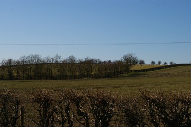
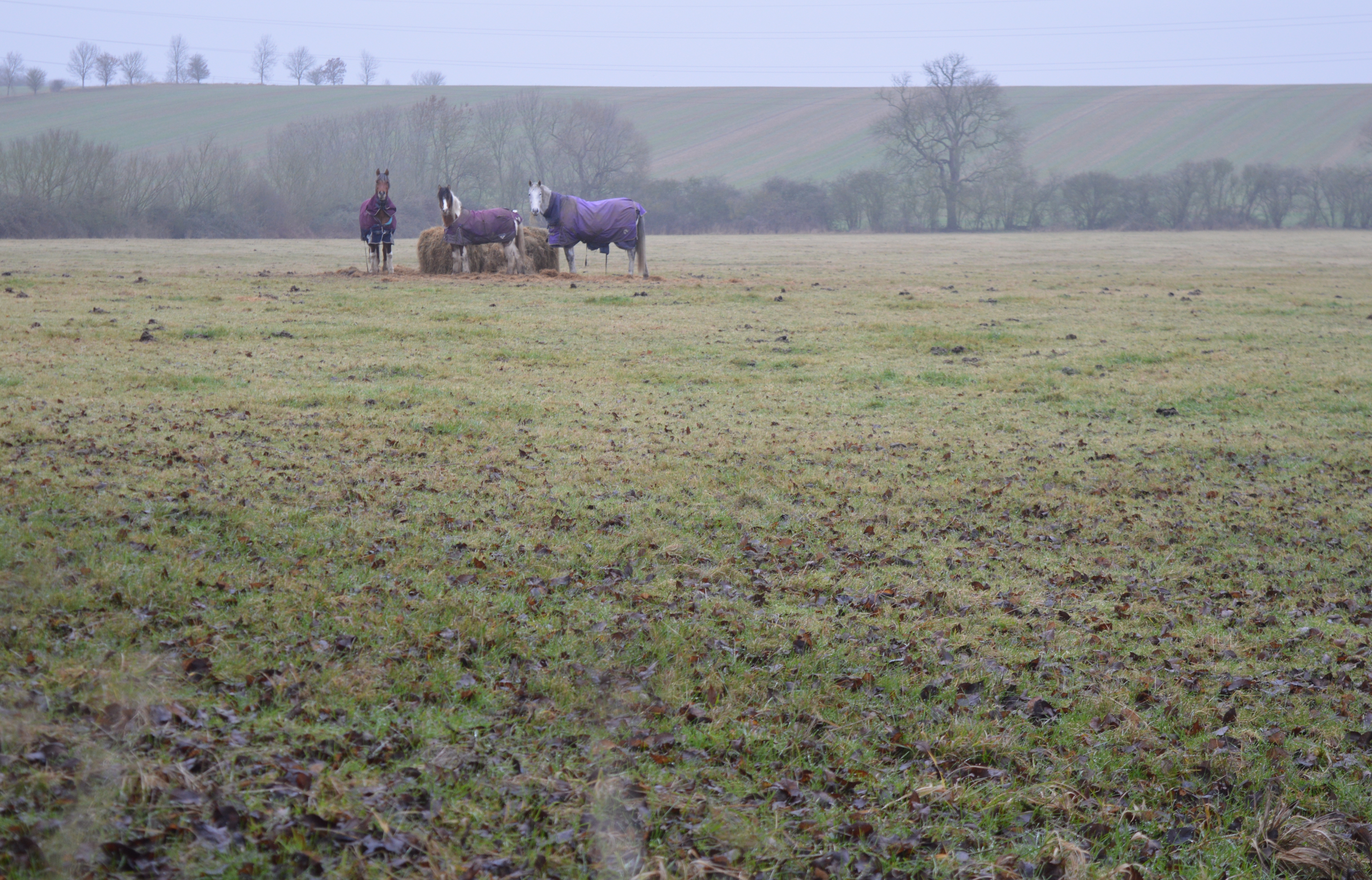
The village is known for its picturesque countryside, with rolling hills, meadows, and lush green fields surrounding it. Catworth offers a tranquil and idyllic setting, making it a popular destination for nature lovers and those seeking a peaceful retreat.

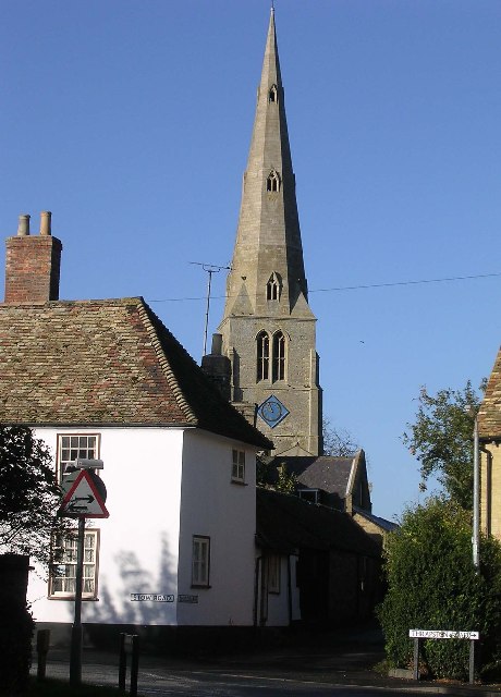
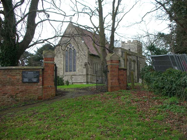
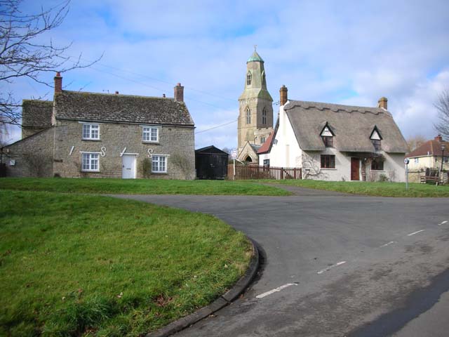
One of the notable landmarks in Catworth is the St. Leonard's Church. This beautiful medieval church, dating back to the 14th century, stands proudly in the heart of the village. Its historic architecture and serene atmosphere make it a place of interest for both locals and visitors.

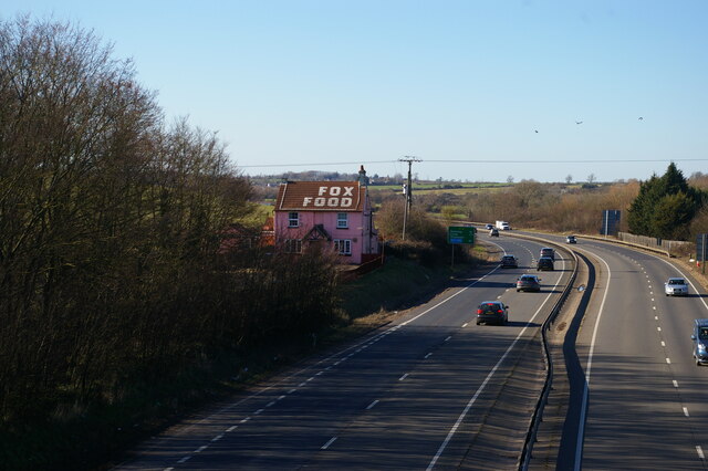
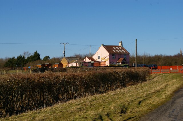
Catworth also boasts a traditional village pub, The Racehorse Inn, which offers a warm and welcoming ambiance. The pub serves a range of delicious meals and local ales, providing a perfect spot to unwind and socialize with friends and neighbors.

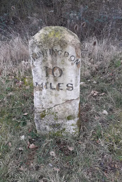
The village is well-connected to nearby towns and cities, with good transportation links. It is within easy reach of major roads, including the A14 and A1, making it convenient for commuting and exploring the wider region.

Overall, Catworth is a hidden gem in the Huntingdonshire district, offering a peaceful and picturesque setting, rich history, and a strong sense of community.

If you have any feedback on the listing, please let us know in the comments section below.

Catworth Images

Images are sourced within 2km of 52.345795/-0.405061 or Grid Reference TL0873. Thanks to Geograph Open Source API. All images are credited.

The former Fox pub, next to the A14 near Brington
Looking east along the A14 from the bridge at Brington
The former Fox pub, next to the A14 near Brington Seen from the truncated stub of Fox Road, which used to lead to a crossing of the A14 but is now superseded by a new road and bridge.
The former Fox pub, next to the A14 near Brington
Seen from the truncated stub of Fox Road, which used to lead to a crossing of the A14 but is now superseded by a new road and bridge.
Looking west near the former Fox pub Seen from the stub of Fox Road that leads to the former pub and formerly to a crossing of the road that is now the A14.
Looking west near the former Fox pub
Seen from the stub of Fox Road that leads to the former pub and formerly to a crossing of the road that is now the A14.
High Street, Catworth
Fox Road Interchange, Brington Connecting to the A14
Fox Road Interchange, Brington
Connecting to the A14
Old Milestone by the A14 Carved stone post by the A14, in parish of CATWORTH (HUNTINGDONSHIRE District), on slip road, near junction with B660, on the verge (DC reinstated close to original place), on Northwest side of road. Huntingdon stone, erected by the Market Harborough & Brampton turnpike trust in the 19th century. An earlier photograph can be found here <a title="https://www.geograph.org.uk/photo/6038244" href="https://www.geograph.org.uk/photo/6038244">Link</a>.

Inscription reads:-
: TO / THRAPSTON / 7 / MILES : : TO / HUNTINGDON / 10 / MILES : 

Milestone Society National ID: HU_HUTH10.
Old Milestone by the A14
Carved stone post by the A14, in parish of CATWORTH (HUNTINGDONSHIRE District), on slip road, near junction with B660, on the verge (DC reinstated close to original place), on Northwest side of road. Huntingdon stone, erected by the Market Harborough & Brampton turnpike trust in the 19th century. An earlier photograph can be found here Link. Inscription reads:- : TO / THRAPSTON / 7 / MILES : : TO / HUNTINGDON / 10 / MILES : Milestone Society National ID: HU_HUTH10.
A14 looking towards Thrapston Traffic thunders past a lay-by on the eastbound carriageway of the A14; in common with other lay-bys on this stretch an SOS telephone is provided.
A14 looking towards Thrapston
Traffic thunders past a lay-by on the eastbound carriageway of the A14; in common with other lay-bys on this stretch an SOS telephone is provided.
B660 at the A14 junction Fox Road B660 at the A14 junction
B660 at the A14 junction
Fox Road B660 at the A14 junction
Three Shires Way just below Molly Rose Lodge
Recently planted trees by the Three Shires Way This part of the Three Shires Way has received a bit of a makeover with French drains installed, trees planted and overgrown scrub reined in.
Recently planted trees by the Three Shires Way
This part of the Three Shires Way has received a bit of a makeover with French drains installed, trees planted and overgrown scrub reined in.
Track to Molly Rose Lodge Part of the Three Shires Way
Track to Molly Rose Lodge
Part of the Three Shires Way
No Through Road Just happens to be facing the wrong way, pedestrian and horse access allowed as this is part of the Three Shires Way.
No Through Road
Just happens to be facing the wrong way, pedestrian and horse access allowed as this is part of the Three Shires Way.
Tilbrook Grange One of those unique farms where the road passes through the farmyard. The grain store is now complete <a href="https://www.geograph.org.uk/photo/747172">TL0871 : Grain Store Construction, Tilbrook Grange</a>
Tilbrook Grange
One of those unique farms where the road passes through the farmyard. The grain store is now complete TL0871 : Grain Store Construction, Tilbrook Grange
Old Milepost Old milepost near to Brington, Cambridgeshire. The correct location would have been half a mile further east but must have been moved with the creation of the A.14. For overall view see <a title="https://www.geograph.org.uk/photo/2880795" href="https://www.geograph.org.uk/photo/2880795">Link</a>
Old Milepost
Old milepost near to Brington, Cambridgeshire. The correct location would have been half a mile further east but must have been moved with the creation of the A.14. For overall view see Link
To Thrapston 7 Old milepost near to Brington, Cambridgeshire. The correct location would have been half a mile further east but must have been moved with the creation of the A.14. For close up view see <a title="https://www.geograph.org.uk/photo/2880782" href="https://www.geograph.org.uk/photo/2880782">Link</a>
To Thrapston 7
Old milepost near to Brington, Cambridgeshire. The correct location would have been half a mile further east but must have been moved with the creation of the A.14. For close up view see Link
No Through Road Modern sign and old Pre-Worboys No Through Road sign near to Catworth, Cambridgeshire. For close up view see <a title="https://www.geograph.org.uk/photo/2883400" href="https://www.geograph.org.uk/photo/2883400">Link</a>
No Through Road
Modern sign and old Pre-Worboys No Through Road sign near to Catworth, Cambridgeshire. For close up view see Link
Pre-Worboys Sign Old Pre-Worboys No Through Road sign near to Catworth, Cambridgeshire. For overall view see <a title="https://www.geograph.org.uk/photo/2883397" href="https://www.geograph.org.uk/photo/2883397">Link</a>
Pre-Worboys Sign
Old Pre-Worboys No Through Road sign near to Catworth, Cambridgeshire. For overall view see Link
Show me another place!

Catworth is located at Grid Ref: TL0873 (Lat: 52.345795, Lng: -0.405061)

Administrative County: Cambridgeshire

District: Huntingdonshire

Police Authority: Cambridgeshire

What 3 Words

///contents.pacifist.mimed. Near Kimbolton, Cambridgeshire

Related Wikis

Catworth

Catworth is a village and civil parish in Cambridgeshire, England. Catworth lies approximately 9 miles (14 km) west of Huntingdon. The civil parish covers...

Little Catworth Meadow

Little Catworth Meadow is a 5.2-hectare (13-acre) biological Site of Special Scientific Interest between Catworth and Spaldwick in Cambridgeshire.The meadow...

Kimbolton railway station

Kimbolton railway station was a railway station in Kimbolton, Cambridgeshire. The station and its line closed in 1959. The journey from London St. Pancras...

Brington, Cambridgeshire

Brington is a village and former civil parish, now in the parish of Brington and Molesworth, in Cambridgeshire, England. Brington lies approximately 9...

Stow Longa

Stow Longa is a village and civil parish in Cambridgeshire, England. Stow Longa lies approximately 8 miles (13 km) west of Huntingdon and two miles north...

Molesworth, Cambridgeshire

Molesworth is a village and former civil parish, now in the parish of Brington and Molesworth in Cambridgeshire, England. Molesworth is 10 miles (16 km...

Bythorn and Keyston

Bythorn and Keyston is a civil parish in the Huntingdonshire district of Cambridgeshire, England. According to the 2001 census the parish had a population...

Bythorn

Bythorn is a village and former civil parish, now in the parish of Bythorn and Keyston, in Cambridgeshire, England. Bythorn lies approximately 11 miles...

Nearby Amenities

Located within 500m of 52.345795,-0.405061
Catworth
Place: village
Lat/Long: 52.3466971/-0.4078164
Bus Stop
Church Road
Bus: yes
Naptan AtcoCode: 0500HCATW001
Naptan Bearing: N
Naptan BusStopType: CUS
Naptan CommonName: Church Road
Naptan Indicator: opp
Naptan Landmark: Church Road
Naptan NaptanCode: cmbdmtwm
Naptan ShortCommonName: Church Road
Naptan Street: Station Road
Naptan Verified: no
Public Transport: platform
Source: naptan_import
Lat/Long: 52.3456008/-0.4050732
Bus Stop
Church Road
Bus: yes
Naptan AtcoCode: 0500HCATW002
Naptan Bearing: S
Naptan CommonName: Church Road
Naptan Indicator: near
Naptan Landmark: Church Road
Naptan NaptanCode: cmbdmtwp
Naptan ShortCommonName: Church Road
Naptan Street: Station Road
Public Transport: platform
Source: naptan_import; survey
Lat/Long: 52.3456095/-0.4049615
Pub
The Racehorse Inn
Addr City: Huntingdon
Addr Housenumber: 43
Addr Postcode: PE28 0PF
Addr Street: High Street
Url: http://www.racehorsecatworth.co.uk/
Village: Catworth
Lat/Long: 52.3464283/-0.407685
Post Box
Post Box Type: wall
Ref: PE28 148
Royal Cypher: GVIR
Royal Cypher Wikidata: Q33102169
Lat/Long: 52.3464417/-0.407413
Catworth Stores
Shop: convenience
Lat/Long: 52.346412/-0.4074677
Telephone
Defibrillator
Booth: K6
Covered: booth
Defibrillator Location: inside red phone box, High Street, Catworth
Emergency: defibrillator
Listed Status: Grade II
Man Made: telephone_box
Old Phone: +44 1832 710291
Lat/Long: 52.3463498/-0.4071375
Fuel
Operator: UK Petroleum
Lat/Long: 52.3450314/-0.4048892
Church End
Note: mentioned on sign at end of road, but located by NPE
Place: locality
Lat/Long: 52.3492628/-0.403088
Power: pole
Lat/Long: 52.3470532/-0.4108733
Power: pole
Lat/Long: 52.3466792/-0.4080579
Power: pole
Lat/Long: 52.3468599/-0.409441
Power: pole
Lat/Long: 52.3449226/-0.4114084
Power: pole
Lat/Long: 52.3459653/-0.4110396
Power: pole
Lat/Long: 52.3480981/-0.4106786
Note: the right of way just ends
Path: end
Lat/Long: 52.3458652/-0.4077331
Barrier: kissing_gate
Lat/Long: 52.3459243/-0.4042405
Barrier: kissing_gate
Lat/Long: 52.3436926/-0.4036477
Barrier: kissing_gate
Lat/Long: 52.3462569/-0.3985944
Barrier: kissing_gate
Lat/Long: 52.346973/-0.3991818
Post Box
Ref: PE28 218
Lat/Long: 52.348415/-0.401655
Post Office
Catworth Mobile Post Office Service
Addr City: Huntingdon
Addr Housename: Racehorse Inn Car Park
Addr Postcode: PE28 0PF
Addr Street: High Street
Addr Village: Catworth
Opening Hours: Mo,Tu,Th,Fr 11:30-12:45
Ref Pol Id: 110446
Source: pol_branch_list_2018-02
Lat/Long: 52.346258/-0.4078084
Man Made: village_sign
Lat/Long: 52.3466308/-0.4077312
Historic: milestone
Inscription: 4 miles from Kimbolton
Wikidata: Q66479282
Lat/Long: 52.3494741/-0.4076636
The data included in this document is from www.openstreetmap.org. The data is made available under ODbL.

Have you been to Catworth?

Leave your review of Catworth below (or comments, questions and feedback).