Wallfield Wood

Wood, Forest in Morayshire

Scotland

Wallfield Wood

Gulls on grassland A grassy field with sandy hills beyond. A change from the vast acreage of barley grown here.
Gulls on grassland Credit: Richard Webb

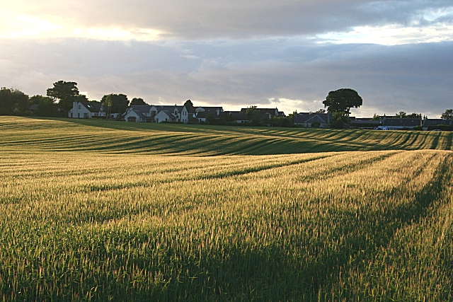
Wallfield Wood is a picturesque woodland area located in Morayshire, Scotland. Covering an expansive area of approximately 50 hectares, it is nestled within the beautiful countryside and is easily accessible from nearby towns and villages.

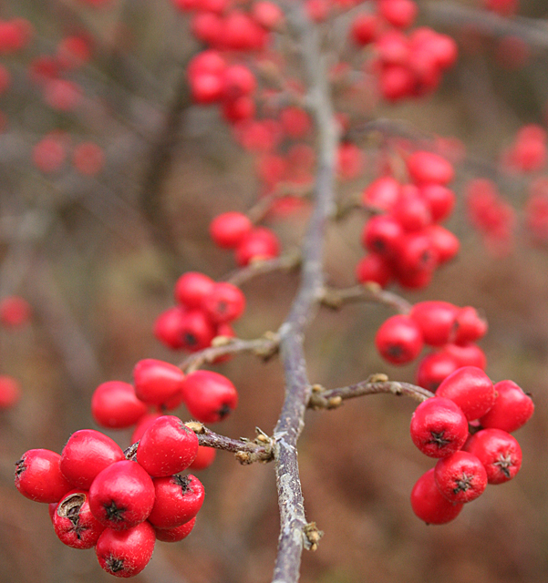
The woodland is predominantly made up of a variety of deciduous trees, including oak, birch, and beech. These trees create a dense canopy, providing a shady and tranquil environment for visitors to explore. The forest floor is covered in a lush carpet of mosses, ferns, and wildflowers, adding to the natural beauty of the area.

In addition to its aesthetic appeal, Wallfield Wood is home to a diverse range of wildlife. Birdwatchers will find a plethora of species, including woodpeckers, owls, and various songbirds. Mammals such as red squirrels, roe deer, and badgers can also be spotted in the woodland. The presence of these animals adds to the sense of wilderness and natural habitat that Wallfield Wood provides.

The woodland offers a network of well-maintained walking trails, allowing visitors to explore its enchanting beauty at their own pace. These trails vary in difficulty, catering to both casual walkers and more experienced hikers. Along the way, interpretive signs provide information on the flora and fauna that can be found in the area, enhancing the educational experience.

For those seeking a peaceful retreat in nature or a place to reconnect with the outdoors, Wallfield Wood in Morayshire is a prime destination. Its natural beauty, diverse wildlife, and well-maintained trails make it a delightful place to explore and appreciate the wonders of the Scottish countryside.

If you have any feedback on the listing, please let us know in the comments section below.

Wallfield Wood Images

Images are sourced within 2km of 57.667875/-3.1728709 or Grid Reference NJ3064. Thanks to Geograph Open Source API. All images are credited.

Gulls on grassland A grassy field with sandy hills beyond. A change from the vast acreage of barley grown here.
Gulls on grassland
A grassy field with sandy hills beyond. A change from the vast acreage of barley grown here.
Minor road near Garmouth A quiet road (it was before 7am) between a grassy field and a barley field. The soils are sandy here, near the Lossie dune complex.
A quail was calling from the barley.
Minor road near Garmouth
A quiet road (it was before 7am) between a grassy field and a barley field. The soils are sandy here, near the Lossie dune complex. A quail was calling from the barley.
Binn Hill woodland Conifer plantation on sandy hills near Garmouth.
Binn Hill woodland
Conifer plantation on sandy hills near Garmouth.
Woodland extension Wallfield Wood is being extended with new broadleafed plantations.
Woodland extension
Wallfield Wood is being extended with new broadleafed plantations.
Tank Traps and Pillbox This is part of the coastal defences built during the Second World War to prevent invasion via the low-lying parts of the east coast.
Tank Traps and Pillbox
This is part of the coastal defences built during the Second World War to prevent invasion via the low-lying parts of the east coast.
Tank Traps and Pillbox This is part of the coastal defences built during the Second World War to prevent invasion via the low-lying parts of the east coast. Notice the stunted pine in the foreground - the wind tends to keep down all the vegetation close to the sea here.
Tank Traps and Pillbox
This is part of the coastal defences built during the Second World War to prevent invasion via the low-lying parts of the east coast. Notice the stunted pine in the foreground - the wind tends to keep down all the vegetation close to the sea here.
Doing the Twist Usually Scots Pines grow pretty straight when they are close together in a forest plantation, but these ones have a definite twist in their trunks for some reason.
Doing the Twist
Usually Scots Pines grow pretty straight when they are close together in a forest plantation, but these ones have a definite twist in their trunks for some reason.
Sea of Stones The 'Sea of Stones' is an extensive series of shingle (or rather, pebble and cobble) ridges parallel to the coastline and stretching inland about half a mile (800 metres). They provide evidence that the land is rising relative to the sea. During the last Ice Age, Scotland was under many hundreds of metres of ice, and the weight of the ice was enough to press the crust of the Earth here down into the mantle. Since the ice melted about 10,000 years ago, the land has continued to rise very slowly, about 1.5 millimetres a year. Each of these ridges is a storm beach piled up by the sea, and then fossilised as the sea retreated and could no longer reach and rearrange successive ridges. What used to be the foot of the cliff is now some 15 metres above sea level.
Sea of Stones
The 'Sea of Stones' is an extensive series of shingle (or rather, pebble and cobble) ridges parallel to the coastline and stretching inland about half a mile (800 metres). They provide evidence that the land is rising relative to the sea. During the last Ice Age, Scotland was under many hundreds of metres of ice, and the weight of the ice was enough to press the crust of the Earth here down into the mantle. Since the ice melted about 10,000 years ago, the land has continued to rise very slowly, about 1.5 millimetres a year. Each of these ridges is a storm beach piled up by the sea, and then fossilised as the sea retreated and could no longer reach and rearrange successive ridges. What used to be the foot of the cliff is now some 15 metres above sea level.
Fallen Pine One of two Scots Pines that have fallen alongside the path during the windy winter of 2013/4.
Fallen Pine
One of two Scots Pines that have fallen alongside the path during the windy winter of 2013/4.
Sowing near Corbiewell At least I assume that the tractor is sowing something, because the ground has already been ploughed and harrowed. This field on the Binn Hill near Garmouth enjoys a fine view across Spey Bay to the Bin of Cullen and Hill of Maud in the distance.
Sowing near Corbiewell
At least I assume that the tractor is sowing something, because the ground has already been ploughed and harrowed. This field on the Binn Hill near Garmouth enjoys a fine view across Spey Bay to the Bin of Cullen and Hill of Maud in the distance.
Sowing near Corbiewell Probably sowing a cereal crop. If I remember I'll come back to see later in the year. on the skyline is Slorach's Wood, south-east of Fochabers.
Sowing near Corbiewell
Probably sowing a cereal crop. If I remember I'll come back to see later in the year. on the skyline is Slorach's Wood, south-east of Fochabers.
Following the Line The tractor has retractable pole extending beside each rear wheel; the one on the side towards the ground still to be seeded is extended. The end of the pole makes a groove in the soil, and on the next time he crosses the field the tractorman follows the groove made by the pole on the previous crossing, which is how the lines of sown crop are kept straight. You can see the two grooves , one in front of the tractor and one behind it.
Following the Line
The tractor has retractable pole extending beside each rear wheel; the one on the side towards the ground still to be seeded is extended. The end of the pole makes a groove in the soil, and on the next time he crosses the field the tractorman follows the groove made by the pole on the previous crossing, which is how the lines of sown crop are kept straight. You can see the two grooves , one in front of the tractor and one behind it.
Rural Coincidence It's got to be a coincidence that the line of the path here seems to be continued by the line of the field boundary.
Rural Coincidence
It's got to be a coincidence that the line of the path here seems to be continued by the line of the field boundary.
A Red Bush This hawthorn bush has lost all its leaves, but not, apparently, any of its berries. In a normal winter I would have expected birds to take most of them, but it has been so mild that presumably their preferred foods have been readily available.
A Red Bush
This hawthorn bush has lost all its leaves, but not, apparently, any of its berries. In a normal winter I would have expected birds to take most of them, but it has been so mild that presumably their preferred foods have been readily available.
Haws A cluster of haws on the <a href="https://www.geograph.org.uk/photo/3890403">NJ3165 : A Red Bush</a>, apparently untouched by birds or other wildlife.
Haws
A cluster of haws on the NJ3165 : A Red Bush, apparently untouched by birds or other wildlife.
Berried Branch A hawthorn branch, still well laden with berries after a mild winter. If it hadn't been whopping about in a brisk breeze I'd have tried a longer exposure for greater depth of field.
Berried Branch
A hawthorn branch, still well laden with berries after a mild winter. If it hadn't been whopping about in a brisk breeze I'd have tried a longer exposure for greater depth of field.
Larch and Whin The larch trees in the background are just showing green leaf buds, though the green doesn't show from this distance. Whins, of course, can be found in flower just about every day of the year.
Larch and Whin
The larch trees in the background are just showing green leaf buds, though the green doesn't show from this distance. Whins, of course, can be found in flower just about every day of the year.
The Sea of Stones The extent of the long grey ridges of stones that form the flat land is best seen from up here, on the highest part of the ridge of the Binn Hill. The strip of grass that crosses the stones is a military rifle range.
The Sea of Stones
The extent of the long grey ridges of stones that form the flat land is best seen from up here, on the highest part of the ridge of the Binn Hill. The strip of grass that crosses the stones is a military rifle range.
Show me another place!

Wallfield Wood is located at Grid Ref: NJ3064 (Lat: 57.667875, Lng: -3.1728709)

Unitary Authority: Moray

Police Authority: North East

What 3 Words

///narrates.master.sprouting. Near Lhanbryde, Moray

Nearby Locations

Wallfield Wood

Related Wikis

Urquhart railway station

Urquhart railway station was a railway station serving the village of Urquhart, parish of Urquhart, Moray. The railway station was opened by the Great...

Burniestrype

Burniestrype is a hamlet in Moray, Scotland.

Urquhart Priory

Urquhart Priory was a Benedictine monastic community in Moray; the priory was dedicated to the Holy Trinity. It was founded by King David I of Scotland...

Urquhart, Moray

Urquhart ( ; Scottish Gaelic: Urchard) is a small village in Moray, Scotland. It is approximately 5 miles (8 km) east of Elgin, between the villages of...

Have you been to Wallfield Wood?

Leave your review of Wallfield Wood below (or comments, questions and feedback).