Markinch Hill Plantation

Wood, Forest in Fife

Scotland

Markinch Hill Plantation

Road junction beside Balgonie Cottage
Road junction beside Balgonie Cottage Credit: James Allan

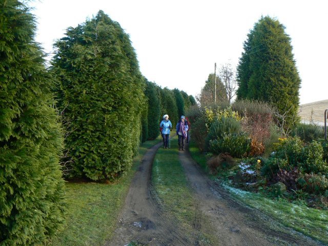
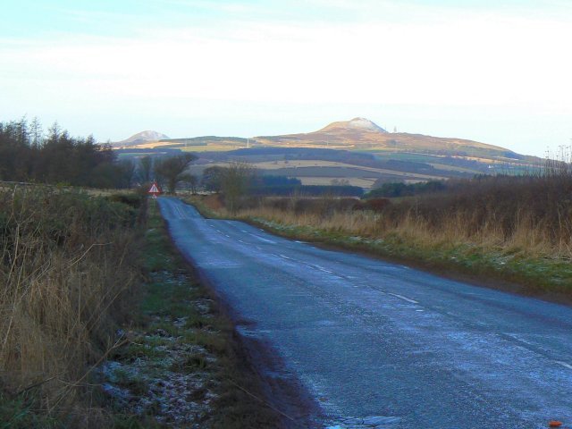
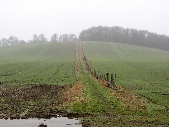
Markinch Hill Plantation is a sprawling woodland located in Fife, Scotland. Covering an area of approximately 200 acres, it is characterized by its lush greenery, diverse tree species, and tranquil atmosphere. The plantation is nestled atop Markinch Hill, offering visitors breathtaking panoramic views of the surrounding countryside.

The woodland is predominantly composed of broadleaf trees, including oak, beech, and birch, which provide a rich habitat for various wildlife species. The diverse ecosystem supports a wide array of flora and fauna, making it a haven for nature enthusiasts and photographers.

Markinch Hill Plantation offers a network of well-maintained walking trails, allowing visitors to explore the woodland at their own pace. The trails wind through the enchanting forest, leading to hidden waterfalls, picturesque ponds, and secluded picnic spots. The plantation also boasts a designated area for birdwatching, attracting bird species such as woodpeckers, thrushes, and owls.

In addition to its natural beauty, the plantation plays a significant role in the local community. It serves as an educational resource, hosting guided tours and workshops on conservation and sustainable forestry practices. The woodland is also utilized for recreational purposes, with organized events such as orienteering and forest bathing.

Markinch Hill Plantation is a cherished natural gem in Fife, offering a peaceful retreat from the bustle of everyday life. Its breathtaking scenery, diverse wildlife, and community involvement make it a must-visit destination for anyone seeking solace in nature.

If you have any feedback on the listing, please let us know in the comments section below.

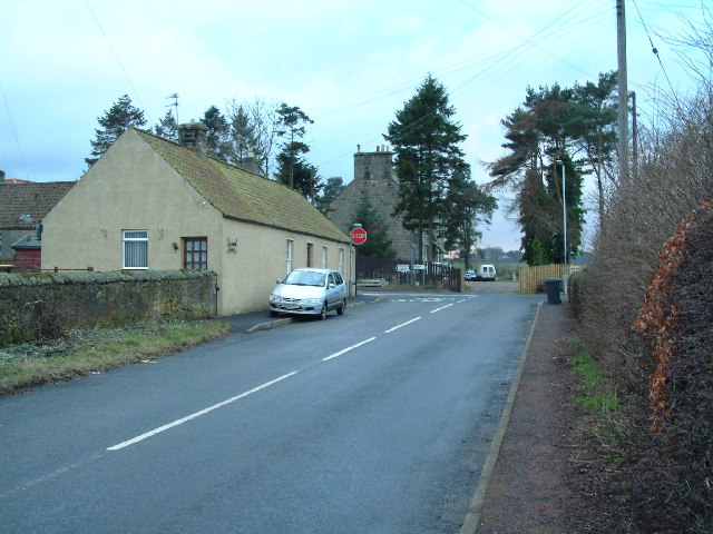
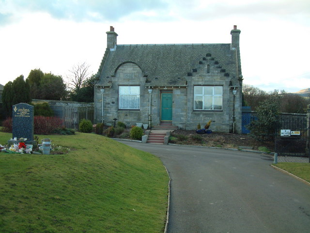
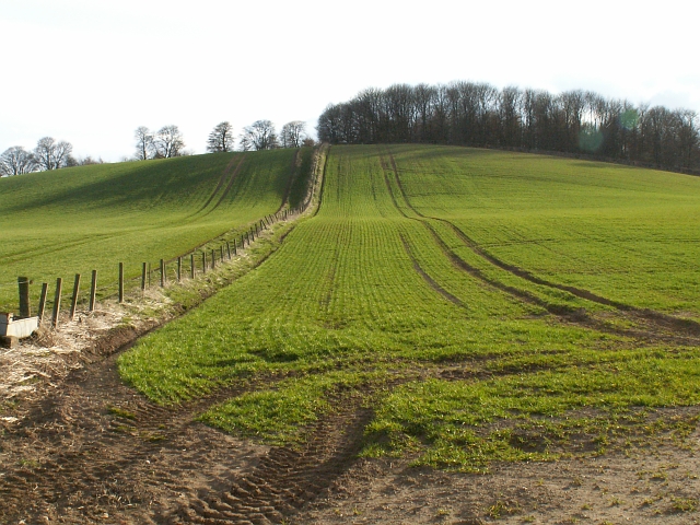
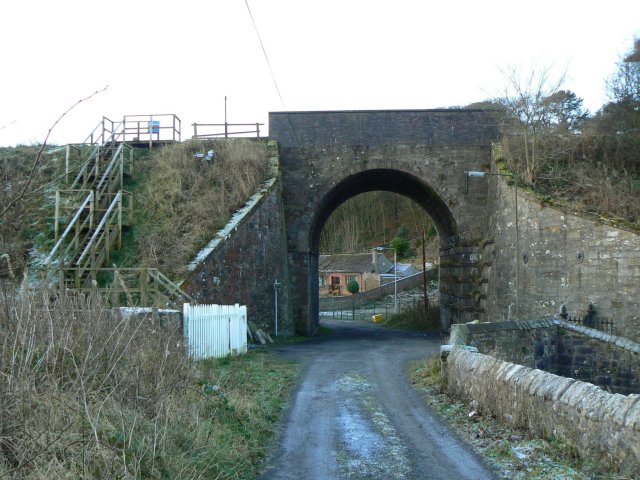
Markinch Hill Plantation Images

Images are sourced within 2km of 56.207806/-3.1338241 or Grid Reference NO2902. Thanks to Geograph Open Source API. All images are credited.

Road junction beside Balgonie Cottage
Cemetery gatehouse The gatehouse in Markinch Cemetery
Cemetery gatehouse
The gatehouse in Markinch Cemetery
Path to Markinch by Star The path to Markinch runs to the left of the fence line straight over this small rise to Markinch just over and down the other side. Fields starting to grow green in the warm Spring sunshine.
Path to Markinch by Star
The path to Markinch runs to the left of the fence line straight over this small rise to Markinch just over and down the other side. Fields starting to grow green in the warm Spring sunshine.
Path to Star looking down from the highground and along the line of the Star to Markinch path.
Path to Star
looking down from the highground and along the line of the Star to Markinch path.
Farmland by Broomfield Broomfield farm lies just to the west of Star.
Farmland by Broomfield
Broomfield farm lies just to the west of Star.
By Dalginch Looking south along a field line by Dalginch.
By Dalginch
Looking south along a field line by Dalginch.
Solid arch A substantially constructed bridge carrying the Markinch to Perth railway over a very minor road, near Northhall.
Solid arch
A substantially constructed bridge carrying the Markinch to Perth railway over a very minor road, near Northhall.
Cypress avenue An avenue lined by cypresses near North Lodge, between Markinch and Star.
Cypress avenue
An avenue lined by cypresses near North Lodge, between Markinch and Star.
Icy road The tops of the Lomond Hills were catching the early sun but this stretch of minor road was still in shadow and frozen.
Icy road
The tops of the Lomond Hills were catching the early sun but this stretch of minor road was still in shadow and frozen.
Star dwellings Cottages in the village known as Star of Markinch.
Star dwellings
Cottages in the village known as Star of Markinch.
Forlorn looking farm A derelict farm building in the village of Star of Markinch.
Forlorn looking farm
A derelict farm building in the village of Star of Markinch.
No pies today A group of walkers on a cold morning at the small pavilion beside Star Hearts Amateur Football Club ground. Sadly, Shane's Shack Pie Shop was closed!
No pies today
A group of walkers on a cold morning at the small pavilion beside Star Hearts Amateur Football Club ground. Sadly, Shane's Shack Pie Shop was closed!
Rob's How Isolated cottages between Markinch and Star, with the snow-dusted Lomond Hills in the background.
Rob's How
Isolated cottages between Markinch and Star, with the snow-dusted Lomond Hills in the background.
Rob's How Seen from the corner of the oddly-named street, Clyde View.
Rob's How
Seen from the corner of the oddly-named street, Clyde View.
Track to Dalginch farm
Soggy field entrance Near Dalginch farm.
Soggy field entrance
Near Dalginch farm.
Soggy field entrance Cereals beside a stripwood which extends some distance to Star. Treaton Park football ground is on the other side of the wood.
Soggy field entrance
Cereals beside a stripwood which extends some distance to Star. Treaton Park football ground is on the other side of the wood.
Cuinin Hill A path climbs modest Cuinin Hill, which is quite prominent when viewed from East Lothian.
Cuinin Hill
A path climbs modest Cuinin Hill, which is quite prominent when viewed from East Lothian.
Show me another place!

Markinch Hill Plantation is located at Grid Ref: NO2902 (Lat: 56.207806, Lng: -3.1338241)

Unitary Authority: Fife

Police Authority: Fife

What 3 Words

///rear.agreed.fancy. Near Markinch, Fife

Related Wikis

Markinch

Markinch (, (Scottish Gaelic: Marc Innis) is both a village and a parish in the heart of Fife, Scotland. According to an estimate taken in 2008, the village...
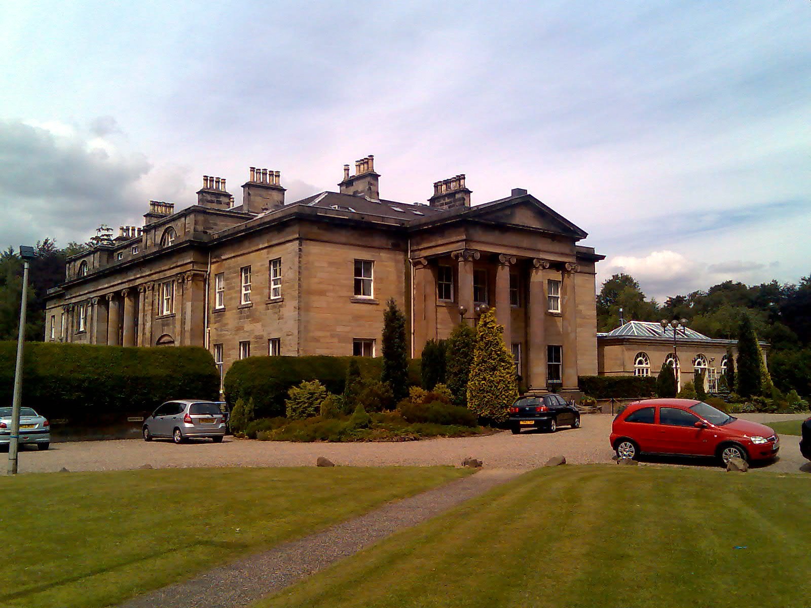
Balbirnie House

Balbirnie House is an early 19th-century country house in Glenrothes, in central Fife, Scotland. The present house was completed in 1817 as a rebuild of...

Markinch railway station

Markinch railway station is a railway station in Markinch, Fife, Scotland, which serves the Glenrothes, Leslie and Levenmouth areas of Fife. The station...

Kingdom FM

Kingdom FM is an Independent Local Radio station serving Fife. It is owned and operated by DC Thomson Media and broadcasts from studios at Elizabeth House...

Balbirnie Stone Circle

Balbirnie Stone Circle is an archaeological site, a stone circle on the north-eastern edge of Glenrothes, in Fife, Scotland. The site was in use from the...

Kennoway Star Hearts F.C.

Kennoway Star Hearts Football Club are a football club from the village of Star near Kennoway in Fife, Scotland. Currently competing in the East of Scotland...

Balfarg

Balfarg is a prehistoric monument complex in Glenrothes, Fife, Scotland. It is protected as a scheduled monument. With the development of Glenrothes new...

Star, Fife

Star, also known as Star of Markinch (and historically as Star of Brunton or Star of Dalginch)), is a small village in Fife, Scotland. The name of Star...

Nearby Amenities

Located within 500m of 56.207806,-3.1338241
Post Box
Collection Times: Mo-Fr 16:45; Sa 11:45
Operator: Royal Mail
Operator Wikidata: Q638098
Post Box Type: lamp
Ref: KY7 103
Royal Cypher: scottish_crown
Source: survey
Lat/Long: 56.2035881/-3.1340576
Parking
Lat/Long: 56.2034982/-3.1321676
Markinch War Memorial
Historic: monument
Lat/Long: 56.2034423/-3.1343212
Post Box
Collection Times: Mo-Fr 09:00; Sa 07:00
Operator: Royal Mail
Post Box Mounting: wall
Ref: KY7 68
Royal Cypher: VR
Royal Cypher Wikidata: Q33102356
Source: survey
Lat/Long: 56.2062631/-3.1323956
Post Box
Collection Times: Mo-Fr 16:45; Sa 11:45
Operator: Royal Mail
Ref: KY7 125
Source: survey
Lat/Long: 56.2058609/-3.1372533
Atm
Lat/Long: 56.2037042/-3.1340046
Bus Stop
Bench: yes
Bin: yes
Naptan AtcoCode: 6500K0624
Naptan NaptanCode: 34329483
Shelter: yes
Tactile Paving: no
Lat/Long: 56.2035777/-3.1345729
Bus Stop
Naptan AtcoCode: 6500K0623
Naptan NaptanCode: 34329485
Shelter: yes
Lat/Long: 56.2036381/-3.1348832
Railway: signal
Railway Signal Direction: forward
Railway Signal Main: GB-NR:main
Ref: ER607
Lat/Long: 56.211211/-3.1325358
Markinch Hill
Natural: peak
Lat/Long: 56.2077227/-3.1329959
Board Type: history
Check Date: 2021-06-26
Information: board
Tourism: information
Lat/Long: 56.2056899/-3.1348447
Recycling
Source: survey Oct 2016
Lat/Long: 56.2042824/-3.134709
Fife Pilgrim Way
Board Type: map
Information: board
Tourism: information
Lat/Long: 56.205657/-3.1348057
Crossing
Crossing: zebra
Crossing Island: no
Kerb: flush
Tactile Paving: yes
Lat/Long: 56.2035715/-3.1355775
Traffic Calming: cushion
Lat/Long: 56.2034879/-3.1353678
Stop
Lat/Long: 56.2035489/-3.1353773
Stop
Lat/Long: 56.2036345/-3.135384
Stob Cross
Historic: monument
Lat/Long: 56.2071844/-3.1363533
Bench
Backrest: yes
Lat/Long: 56.2069059/-3.1328612
Playground: structure
Lat/Long: 56.206941/-3.1346247
Bench
Backrest: yes
Lat/Long: 56.2068848/-3.132447
Bench
Backrest: yes
Lat/Long: 56.2068825/-3.132137
Barrier: cycle_barrier
Cycle Barrier: double
Cycle Barrier Installation: fixed
Lat/Long: 56.2068272/-3.1316924
The Laurel Bank Hotel
Addr City: Markinch
Addr Country: GB
Addr Housenumber: 1
Addr Postcode: KY7 6DB
Addr Street: Balbirnie Street
Fhrs Id: 58885
Tourism: hotel
Website: https://www.laurelbankhotel.co.uk/
Lat/Long: 56.2034799/-3.1351412
Disused Amenity: post_box
Post Box Type: wall
Royal Cypher: EVIIR
Lat/Long: 56.2037621/-3.1329136
Material: wood
Power: pole
Lat/Long: 56.2119632/-3.1307633
Power: pole
Lat/Long: 56.2121274/-3.1320232
Material: wood
Power: pole
Lat/Long: 56.2082547/-3.1291061
Power: pole
Lat/Long: 56.2074617/-3.1289308
Power: pole
Lat/Long: 56.2066722/-3.1286971
Power: pole
Lat/Long: 56.2059863/-3.1285565
Power: pole
Lat/Long: 56.2051643/-3.1286127
Power: pole
Lat/Long: 56.2044927/-3.1287317
Traffic Calming: cushion
Lat/Long: 56.2067888/-3.1360127
Generator Method: photovoltaic
Generator Output Electricity: yes
Generator Source: solar
Generator Type: solar_photovoltaic_panel
Power: generator
Lat/Long: 56.2044666/-3.1365173
Addr City: Markinch
Addr Housename: 1 Croft Villas
Addr Postcode: KY7 6DE
Addr Street: Commercial Street
Entrance: home
Lat/Long: 56.2056476/-3.1362308
Addr City: Markinch
Addr Housename: 2 Croft Villas
Addr Postcode: KY7 6DE
Addr Street: Commercial Street
Entrance: home
Lat/Long: 56.2056942/-3.1363483
Generator Method: photovoltaic
Generator Output Electricity: yes
Generator Source: solar
Generator Type: solar_photovoltaic_panel
Power: generator
Lat/Long: 56.2066584/-3.1343806
Generator Method: photovoltaic
Generator Output Electricity: yes
Generator Source: solar
Generator Type: solar_photovoltaic_panel
Power: generator
Lat/Long: 56.2062958/-3.1319171
Addr Housenumber: 35
Addr Street: School Street
Lat/Long: 56.2062987/-3.1327738
Addr Housenumber: 6
Addr Street: Craik Terrace
Lat/Long: 56.2066856/-3.1332246
Addr Housenumber: 27
Addr Street: Commercial Street
Lat/Long: 56.2051191/-3.1355376
Addr Housenumber: 39
Addr Street: Commercial Street
Lat/Long: 56.2054213/-3.1354282
Addr Housenumber: 25
Addr Street: School Street
Lat/Long: 56.2063562/-3.1331288
Addr Housenumber: 1
Addr Street: Stobcross Road
Lat/Long: 56.2059027/-3.1351088
Addr Housenumber: 8
Addr Street: Craik Terrace
Lat/Long: 56.2067787/-3.1330045
Addr Housenumber: 23
Addr Street: School Street
Lat/Long: 56.2063226/-3.1331927
Addr Housenumber: 10
Addr Street: Northall Road
Lat/Long: 56.206625/-3.1321752
Addr Housenumber: 2
Addr Street: Craik Terrace
Lat/Long: 56.2064498/-3.1336237
Addr Housenumber: 9
Addr Street: School Street
Lat/Long: 56.2061805/-3.1344207
Addr Housenumber: 31
Addr Street: Commercial Street
Lat/Long: 56.2052061/-3.1355201
Addr Housenumber: 39
Addr Street: School Street
Lat/Long: 56.2063017/-3.1326828
Addr Housenumber: 7
Addr Street: Craik Terrace
Lat/Long: 56.2067401/-3.1331242
Addr Housenumber: 8
Addr Street: Northall Road
Lat/Long: 56.2065758/-3.1322562
Addr Housenumber: 2
Addr Street: Northall Road
Lat/Long: 56.2063819/-3.1323633
Addr Housenumber: 33
Addr Street: School Street
Lat/Long: 56.2065416/-3.1328312
Addr Housenumber: 43
Addr Street: Commercial Street
Lat/Long: 56.2055896/-3.1353509
Addr Housenumber: 6
Addr Street: Northall Road
Lat/Long: 56.2065229/-3.1323508
Addr Housenumber: 19
Addr Street: School Street
Lat/Long: 56.2062608/-3.133955
Addr Housenumber: 47
Addr Street: School Street
Lat/Long: 56.2063368/-3.1325215
Addr Housenumber: 1
Addr Street: Commercial Street
Lat/Long: 56.2036549/-3.1355227
Addr Housenumber: 43
Addr Street: School Street
Lat/Long: 56.2063128/-3.1326007
Addr Housenumber: 2
Addr Street: Commercial Street
Lat/Long: 56.203777/-3.1352726
Addr Housenumber: 15
Addr Street: School Street
Lat/Long: 56.2062385/-3.1341328
Addr Housenumber: 27
Addr Street: School Street
Lat/Long: 56.2063956/-3.1330681
Addr Housenumber: 1
Addr Street: Craik Terrace
Lat/Long: 56.206411/-3.1336994
Addr Housenumber: 3
Addr Street: Craik Terrace
Lat/Long: 56.2065094/-3.1335232
Addr Housenumber: 4
Addr Street: Craik Terrace
Lat/Long: 56.206559/-3.1334617
Addr Housenumber: 29
Addr Street: Commercial Street
Lat/Long: 56.2051636/-3.1355292
Addr Housenumber: 31
Addr Street: School Street
Lat/Long: 56.2065028/-3.1328949
Addr Housenumber: 16
Addr Street: School Street
Lat/Long: 56.2061473/-3.1339543
Addr Housenumber: 10
Addr Street: School Street
Lat/Long: 56.2060865/-3.1341403
Addr Housenumber: 12
Addr Street: Northall Road
Lat/Long: 56.2066744/-3.1321032
Addr Housenumber: 5
Addr Street: Craik Terrace
Lat/Long: 56.2066438/-3.1333346
Addr Housenumber: 29
Addr Street: School Street
Lat/Long: 56.2064305/-3.1329988
Addr Housenumber: 45
Addr Street: Commercial Street
Lat/Long: 56.2058/-3.1351554
Restaurant
Chopsticks
Cuisine: chinese
Lat/Long: 56.2053669/-3.1354883
Addr Housenumber: 32
Addr Street: Balbirnie Street
Entrance: yes
Lat/Long: 56.2036258/-3.1357057
Addr Housenumber: 34
Addr Street: Balbirnie Street
Entrance: yes
Lat/Long: 56.2036174/-3.135883
Addr Housenumber: 36
Addr Street: Balbirnie Street
Entrance: yes
Lat/Long: 56.2036094/-3.1360543
Restaurant
Grace
Cuisine: chinese
Lat/Long: 56.2037621/-3.1334082
The Curator
Shop: gift
Lat/Long: 56.203502/-3.135518
Railway: signal
Railway Signal Direction: forward
Railway Signal Main: GB-NR:main
Ref: ER606
Lat/Long: 56.2084419/-3.1296357
The data included in this document is from www.openstreetmap.org. The data is made available under ODbL.

Have you been to Markinch Hill Plantation?

Leave your review of Markinch Hill Plantation below (or comments, questions and feedback).