Blackburn Wood

Wood, Forest in Morayshire

Scotland

Blackburn Wood

Bride's Loch Revisited Known as the Bride's Loch or Bridesfauld loch because of the grief stricken bride who, jilted at the altar decided to end it all here.
Bride's Loch Revisited Credit: Des Colhoun

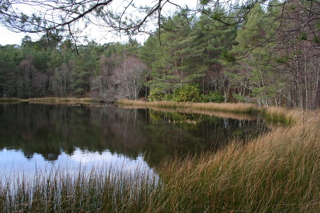
Blackburn Wood is a picturesque forest located in Morayshire, Scotland. Covering an area of approximately 100 acres, this woodland paradise offers visitors a tranquil escape from the hustle and bustle of everyday life.

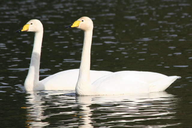
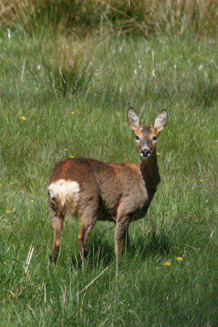
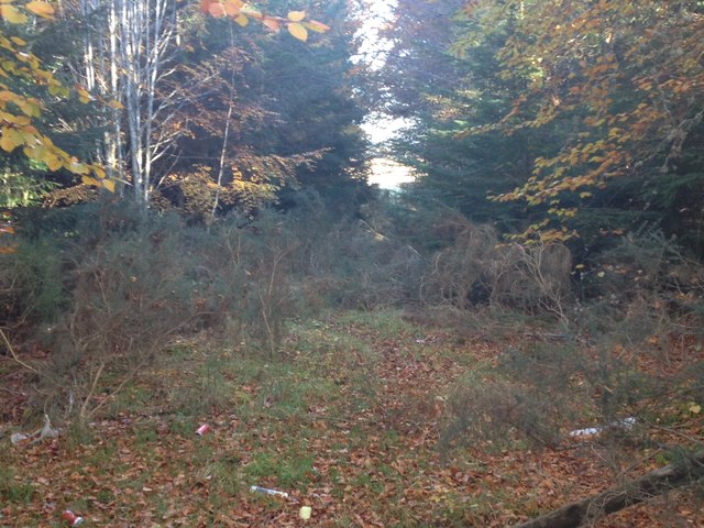
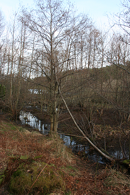
The wood is primarily composed of native Scottish trees, such as oak, birch, and pine, which create a diverse and enchanting landscape. The dense canopy provides shade and shelter for a variety of wildlife, including red squirrels, roe deer, and a plethora of bird species.

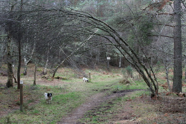
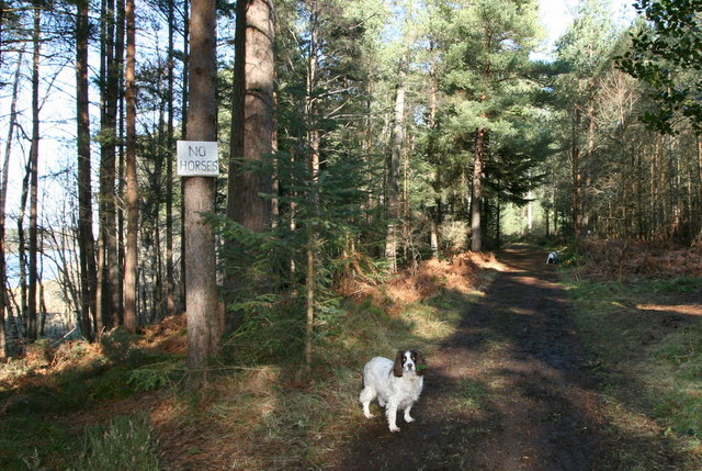
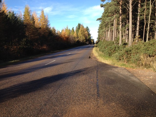
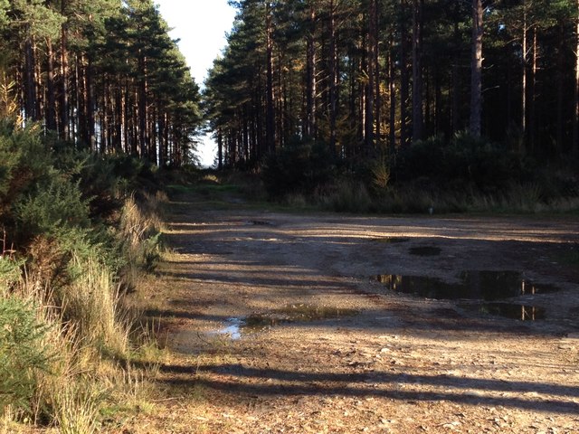
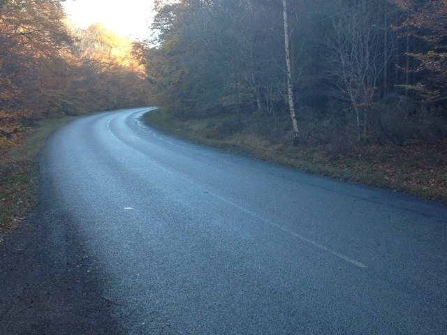
As visitors explore the forest, they will come across a network of well-maintained trails that wind their way through the wood. These paths cater to both casual strollers and more adventurous hikers, offering different levels of difficulty and lengths to suit all preferences.

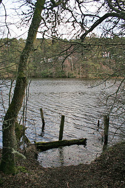
One of the highlights of Blackburn Wood is the picturesque Blackburn Burn, a small river that meanders through the forest. The gentle sound of running water adds to the overall sense of tranquility and offers a serene backdrop for picnics or quiet contemplation.

The wood is a popular destination for nature enthusiasts, birdwatchers, and photographers, who can capture the beauty of the woodland throughout the changing seasons. In spring, the forest floor comes alive with a vibrant carpet of bluebells, while autumn paints the trees in a stunning array of red, orange, and gold hues.

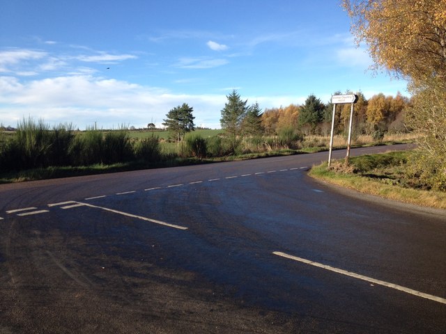
Blackburn Wood is easily accessible, with ample parking and well-marked entrances. The wood is open to the public year-round and offers a wonderful opportunity to reconnect with nature and enjoy the peace and serenity of this stunning Scottish forest.

If you have any feedback on the listing, please let us know in the comments section below.

Blackburn Wood Images

Images are sourced within 2km of 57.611512/-3.178034 or Grid Reference NJ2958. Thanks to Geograph Open Source API. All images are credited.

Bride's Loch Revisited Known as the Bride's Loch or Bridesfauld loch because of the grief stricken bride who, jilted at the altar decided to end it all here.
Bride's Loch Revisited
Known as the Bride's Loch or Bridesfauld loch because of the grief stricken bride who, jilted at the altar decided to end it all here.
Whoop, Whoop!! The Whooper swan (Cygnus cygnus) is fairly similar to a goose and amongst other distinctions differs from the Mute swan with its straight neck whilst swimming or walking.
Whoop, Whoop!!
The Whooper swan (Cygnus cygnus) is fairly similar to a goose and amongst other distinctions differs from the Mute swan with its straight neck whilst swimming or walking.
An impulse from a vernal wood..... The woodland of Loch na Bo is a magnificent place to witness the changes of season.
An impulse from a vernal wood.....
The woodland of Loch na Bo is a magnificent place to witness the changes of season.
Get me outa here... it stinks!! These are aptly named Skunk Cabbage and it must be murder here for the spaniel with its acute scenting talent!
<a href="https://www.geograph.org.uk/photo/175600">NJ2859 : "Aliens" on the marge of Loch na Bo!!</a>
Get me outa here... it stinks!!
These are aptly named Skunk Cabbage and it must be murder here for the spaniel with its acute scenting talent! NJ2859 : "Aliens" on the marge of Loch na Bo!!
Doe a deer, a female Roe A Lochnabo Roe doe is caught unawares on a sunny afternoon by the loch.
Doe a deer, a female Roe
A Lochnabo Roe doe is caught unawares on a sunny afternoon by the loch.
Not the Year of the Horse! Taken on the path to the south of Loch na Bo whose waters you can see on the left of the picture.
Not the Year of the Horse!
Taken on the path to the south of Loch na Bo whose waters you can see on the left of the picture.
Road junction near Cranloch
Farmland near Cranloch
B9103 past Badentinan Wood
Track into Badentinan Wood
B9103 past Teindland Wood
Overgrown track in Teindland Wood
Boggy Margin The Burn of Blackhills enters Loch na Bo through a very boggy patch
Boggy Margin
The Burn of Blackhills enters Loch na Bo through a very boggy patch
Loch na Bo Was there a jetty here at one time? This is one of the few spots where you can get close to the water on firm ground at the south end of the locah.
Loch na Bo
Was there a jetty here at one time? This is one of the few spots where you can get close to the water on firm ground at the south end of the locah.
Which Way? The path I had been following was well waymarked with white-topped posts, but here there are waymarks to both right and left! On closer inspection, the nearest post has two grooves beneath the white top, one red and one green. The post to the right has one green groove, and the post to the left has one red groove. I followed, or tried to follow, the green, though I did have to backtrack once or twice.
Which Way?
The path I had been following was well waymarked with white-topped posts, but here there are waymarks to both right and left! On closer inspection, the nearest post has two grooves beneath the white top, one red and one green. The post to the right has one green groove, and the post to the left has one red groove. I followed, or tried to follow, the green, though I did have to backtrack once or twice.
Kettle Loch Said to be called the Kettle Loch because it is shaped like a kettle. It is probably also a kettle hole. Kettle holes form when a large block of ice stands intact while moraines and glacial debris are dumped around it, and when it melts it leaves a depression free of such deposits, which then fills with water.
Kettle Loch
Said to be called the Kettle Loch because it is shaped like a kettle. It is probably also a kettle hole. Kettle holes form when a large block of ice stands intact while moraines and glacial debris are dumped around it, and when it melts it leaves a depression free of such deposits, which then fills with water.
Margin of the Kettle Loch Looking along the shore of <a href="https://www.geograph.org.uk/photo/3877120">NJ2859 : Kettle Loch</a>.
Margin of the Kettle Loch
Looking along the shore of NJ2859 : Kettle Loch.
Bridesfauld Loch Also, apparently, known as the Bride's Loch to commemorate a jilted bride who drowned in it. This, like <a href="https://www.geograph.org.uk/photo/3877120">NJ2859 : Kettle Loch</a>, is probably a kettle hole.
Bridesfauld Loch
Also, apparently, known as the Bride's Loch to commemorate a jilted bride who drowned in it. This, like NJ2859 : Kettle Loch, is probably a kettle hole.
Show me another place!

Blackburn Wood is located at Grid Ref: NJ2958 (Lat: 57.611512, Lng: -3.178034)

Unitary Authority: Moray

Police Authority: North East

What 3 Words

///hires.broad.spooked. Near Lhanbryde, Moray

Nearby Locations

Blackburn Wood Blackburn

Related Wikis

Orbliston Junction railway station

Orbliston Junction railway station served the settlement of Orbliston, Moray, Scotland from 1858 to 1964 on the Inverness and Aberdeen Junction Railway...

Dipple, Moray

Dipple (Scottish Gaelic: Diopal) is a village in the Parish of Speymouth, in Moray, Scotland, approximately 8 miles (13 km) east of Elgin and is located...

Balnacoul Halt railway station

Balnacoul Halt railway station served the village of Mosstodloch, Moray, Scotland from 1893 to 1931 on the Inverness and Aberdeen Junction Railway. �...

Lhanbryde

Lhanbryde (Gaelic: Lann Brìghde) is a village that lies 4 miles (6.4 km) east of Elgin in Moray, Scotland. Previously bisected by the A96, it was bypassed...

Lhanbryde railway station

Lhanbryde railway station served the village of Lhanbryde, Moray, Scotland from 1858 to 1964 on the Inverness and Aberdeen Junction Railway. == History... ==

Coxton Tower

Coxton Tower is a late sixteenth-century tower house in Moray, Scotland. Heavily fortified, it was built around 1590, with substantive repairs in 1635...

Mosstodloch

Mosstodloch (Scottish Gaelic: Mos Tudlach) is a small village in Moray, Scotland, lying near the A96 between Fochabers and Elgin on the west bank of the...

Fochabers Town railway station

Fochabers Town railway station served the village of Fochabers, Moray, Scotland from 1893 to 1966 on the Inverness and Aberdeen Junction Railway. ��2...

Nearby Amenities

Located within 500m of 57.611512,-3.178034
Power: pole
Lat/Long: 57.6086239/-3.1837203
Power: pole
Lat/Long: 57.6084619/-3.1823143
Power: pole
Lat/Long: 57.6082935/-3.1807736
Power: pole
Lat/Long: 57.608129/-3.1792022
Power: pole
Lat/Long: 57.6079619/-3.1776497
Power: pole
Lat/Long: 57.6077517/-3.1753316
Power: pole
Lat/Long: 57.6078264/-3.1740958
Power: pole
Lat/Long: 57.6077365/-3.1753364
Power: tower
Lat/Long: 57.6079929/-3.1791433
Power: tower
Lat/Long: 57.6096841/-3.1837042
The data included in this document is from www.openstreetmap.org. The data is made available under ODbL.

Have you been to Blackburn Wood?

Leave your review of Blackburn Wood below (or comments, questions and feedback).