Haveral Wood

Wood, Forest in Midlothian

Scotland

Haveral Wood

View over Lasswade
View over Lasswade Credit: Richard Webb

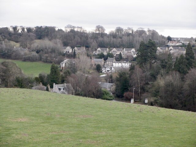
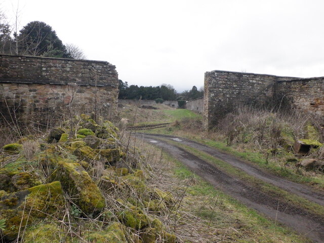
Haveral Wood is a vast forest located in Midlothian, Scotland. Covering an impressive area of approximately 100 hectares, the wood is well-known for its natural beauty and diverse wildlife. It is situated near the village of Rosewell, just a short distance from the city of Edinburgh.

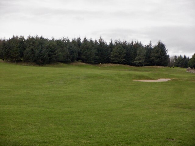
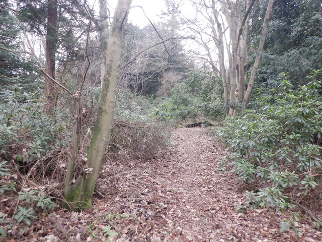
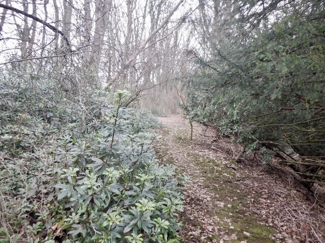
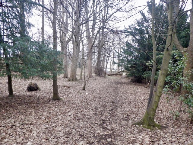
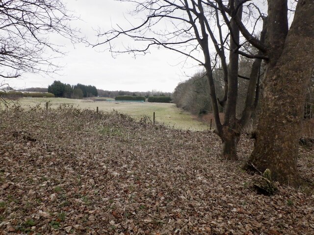
The wood boasts an assortment of tree species, including oak, birch, beech, and conifers, which provide a picturesque and serene environment for visitors. The dense foliage creates a cool and shady atmosphere, perfect for a tranquil walk or a peaceful picnic. The forest floor is adorned with a carpet of wildflowers, adding a splash of color to the landscape.

Haveral Wood is also home to a wide variety of wildlife. Bird enthusiasts will be delighted by the sight of various species, such as woodpeckers, owls, and finches, while mammal lovers may spot red squirrels, roe deer, and badgers. The forest is an important habitat for these creatures, providing a safe haven and abundant food sources.

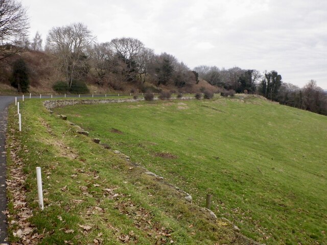
Apart from its natural wonders, Haveral Wood offers a network of well-maintained trails and paths, allowing visitors to explore the forest at their leisure. These paths are suitable for both walkers and cyclists, making the wood a popular destination for outdoor enthusiasts. Additionally, the wood has a dedicated picnic area and a small car park for the convenience of visitors.

Haveral Wood is a true gem in the heart of Midlothian, offering a peaceful retreat from the hustle and bustle of daily life. Its stunning scenery, rich biodiversity, and recreational facilities make it a must-visit destination for nature lovers and those seeking a rejuvenating experience in the great outdoors.

If you have any feedback on the listing, please let us know in the comments section below.
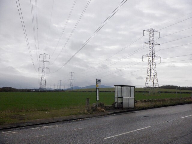
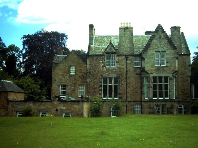
Haveral Wood Images

Images are sourced within 2km of 55.884739/-3.1310998 or Grid Reference NT2966. Thanks to Geograph Open Source API. All images are credited.

View over Lasswade
View over Lasswade
Road to Kings Acre golf courses
Golf course, King's Acre
Ruin near Melville Castle Beside the site of the gardens, now King's Acre golf.
Ruin near Melville Castle
Beside the site of the gardens, now King's Acre golf.
Former Melville Castle garden Walls near the King's Acre Driving Range on the plateau above Melville Castle.
Former Melville Castle garden
Walls near the King's Acre Driving Range on the plateau above Melville Castle.
Woodland above Melville Castle The usual rhododendrons near a large house.
Woodland above Melville Castle
The usual rhododendrons near a large house.
Woodland above Melville Castle
Woodland above Melville Castle There is a path through a stripwood from here which comes out on Gilmerton Road near Dobbies.
Woodland above Melville Castle
There is a path through a stripwood from here which comes out on Gilmerton Road near Dobbies.
Bus stop, Gilmerton Road
Former school building, Bonnyrigg Most of the buildings on the site have been demolished.
Former school building, Bonnyrigg
Most of the buildings on the site have been demolished.
Union Park, Bonnyrigg
Centre of Bonnyrigg
Centre of Bonnyrigg
Church, Lasswade. Lasswade clings to the steep sides of the North Esk glens. The church building here dates to 1830
Church, Lasswade.
Lasswade clings to the steep sides of the North Esk glens. The church building here dates to 1830
Bonnyrigg Start of the shopping street. The wonderful Co-op building. Somehow the Scotmid colourscheme just fits it perfectly.

(The building was demolished in 2019)
Bonnyrigg
Start of the shopping street. The wonderful Co-op building. Somehow the Scotmid colourscheme just fits it perfectly. (The building was demolished in 2019)
Melville Grange Ripening barley, not long to go now, surrounds a farm just by the Edinburgh City By-pass.
Melville Grange
Ripening barley, not long to go now, surrounds a farm just by the Edinburgh City By-pass.
Melville Grange 24 Days later the crop is harvested.  (see <a href="https://www.geograph.org.uk/photo/32408">NT3067 : Melville Grange</a>)
Melville Grange
24 Days later the crop is harvested. (see NT3067 : Melville Grange)
Pittendreich House, Lasswade On the site of Mary, Queen of Scots' stables, Pittendreich House was built in 1857 in the Jacobean baronial style for the Hon. Sir George Deas, Lord of Session.  By 1871 it was occupied by the gardener and his family with no record of what became of Sir George.  Subsequently a girls'school and now a nursing home.
Pittendreich House, Lasswade
On the site of Mary, Queen of Scots' stables, Pittendreich House was built in 1857 in the Jacobean baronial style for the Hon. Sir George Deas, Lord of Session. By 1871 it was occupied by the gardener and his family with no record of what became of Sir George. Subsequently a girls'school and now a nursing home.
Show me another place!

Haveral Wood is located at Grid Ref: NT2966 (Lat: 55.884739, Lng: -3.1310998)

Unitary Authority: Midlothian

Police Authority: The Lothians and Scottish Borders

What 3 Words

///snows.thigh.teeth. Near Loanhead, Midlothian

Nearby Locations

Haveral Wood Wadingburn

Related Wikis

Lasswade

Lasswade is a village and civil parish in Midlothian, Scotland, on the River North Esk, nine miles (14.5 kilometres) south of Edinburgh city centre, contiguous...

Lasswade railway station

Lasswade railway station served the village of Lasswade, Midlothian, Scotland from 1868 to 1964 on the Esk Valley Railway. == History == The station opened...

Loanhead railway station

Loanhead railway station served the town of Loanhead, Midlothian, Scotland, from 1874 to 1968 on the Edinburgh, Loanhead and Roslin Railway. == History... ==

Lasswade and Rosewell Parish Church

Lasswade and Rosewell Parish Church serves the communities of Lasswade, Poltonhall and Rosewell, Midlothian, Scotland. It is a congregation of the Church...

Nearby Amenities

Located within 500m of 55.884739,-3.1310998
Traffic Signals
Lat/Long: 55.8831012/-3.1248283
Post Box
Collection Times: Mo-Fr 14:00; Sa 11:00
Operator: Royal Mail
Post Box Type: lamp
Postal Code: EH18
Ref: EH18 83
Source: drive-by survey
Lat/Long: 55.8816697/-3.1256446
Bus Stop
Kevock Road
Bus: yes
Naptan AdministrativeAreaCode: 130
Naptan Area Name: Midlothian
Naptan AtcoAreaCode: 628
Naptan AtcoCode: 6280301360
Naptan Bearing: E
Naptan CommonName: Kevock Road
Naptan Indicator: opp
Naptan Landmark: at 16a
Naptan LocalityName: Wadingburn
Naptan NaptanCode: 64324578
Naptan NptgLocalityCode: ES002299
Naptan SourceLocalityType: Pa
Naptan StopAreaCode: 628G301360
Naptan StopAreaType: GPBS
Naptan StopArea Name: Wadingburn
Naptan Street: Wadingburn Road
Naptan Verified: yes
Public Transport: platform
Shelter: yes
Source: NaPTAN + Survey
Lat/Long: 55.8812578/-3.128017
Bus Stop
Kevock Road
Bench: yes
Bin: no
Bus: yes
Naptan AdministrativeAreaCode: 130
Naptan Area Name: Midlothian
Naptan AtcoAreaCode: 628
Naptan AtcoCode: 6280326090
Naptan Bearing: W
Naptan CommonName: Kevock Road
Naptan Indicator: at
Naptan Landmark: opp 20
Naptan LocalityName: Wadingburn
Naptan NaptanCode: 64324579
Naptan NptgLocalityCode: ES002299
Naptan SourceLocalityType: Pa
Naptan StopAreaCode: 628G301360
Naptan StopAreaType: GPBS
Naptan StopArea Name: Wadingburn
Naptan Street: Wadingburn Road
Naptan Verified: yes
Public Transport: platform
Shelter: yes
Source: NaPTAN + Survey
Lat/Long: 55.8811423/-3.1288317
Barrier: kissing_gate
Bicycle: yes
Foot: yes
Maxwidth: 0.5
Lat/Long: 55.8841096/-3.1344373
Bus Stop
Haveral Wood
Bin: yes
Bus: yes
Naptan AdministrativeAreaCode: 130
Naptan Area Name: Midlothian
Naptan AtcoAreaCode: 628
Naptan AtcoCode: 6280326075
Naptan Bearing: N
Naptan CommonName: Haveral Wood
Naptan Indicator: at
Naptan Landmark: -
Naptan LocalityName: Lasswade
Naptan NaptanCode: 64329325
Naptan NptgLocalityCode: N0071588
Naptan SourceLocalityType: Add
Naptan StopAreaCode: 628G301369
Naptan StopAreaType: GPBS
Naptan StopArea Name: Wester Melville
Naptan Street: Lasswade Road
Naptan Verified: yes
Public Transport: platform
Source: NaPTAN + Survey
Lat/Long: 55.8865876/-3.1280286
Bus Stop
Wester Melville
Bus: yes
Naptan AdministrativeAreaCode: 130
Naptan Area Name: Midlothian
Naptan AtcoAreaCode: 628
Naptan AtcoCode: 6280301369
Naptan Bearing: S
Naptan CommonName: Wester Melville
Naptan Indicator: opp
Naptan Landmark: -
Naptan LocalityName: Lasswade
Naptan NaptanCode: 64324583
Naptan NptgLocalityCode: N0071588
Naptan SourceLocalityType: Add
Naptan StopAreaCode: 628G301369
Naptan StopAreaType: GPBS
Naptan StopArea Name: Wester Melville
Naptan Street: Lasswade Road
Naptan Verified: yes
Public Transport: platform
Source: NaPTAN + Survey
Lat/Long: 55.8877801/-3.1276881
Addr Housenumber: 2
Addr Street: Wadingburn Lane
Lat/Long: 55.8825583/-3.1256104
Addr Housenumber: 4
Addr Street: Wadingburn Lane
Lat/Long: 55.8826366/-3.125829
Generator Method: photovoltaic
Generator Output Electricity: yes
Generator Source: solar
Generator Type: solar_photovoltaic_panel
Power: generator
Lat/Long: 55.8813941/-3.1280855
Frequency: 50
Phases: 2
Power: pole
Transformer: distribution
Voltage Primary: 11000
Voltage Secondary: 400
Lat/Long: 55.888444/-3.1334665
Power: pole
Lat/Long: 55.8888396/-3.1323172
Power: pole
Lat/Long: 55.8891306/-3.1311826
Power: pole
Lat/Long: 55.881111/-3.1349628
Power: pole
Lat/Long: 55.8811729/-3.1334939
Power: pole
Lat/Long: 55.8812442/-3.1320478
Power: pole
Lat/Long: 55.8813027/-3.1305746
Power: pole
Lat/Long: 55.8813412/-3.1296265
The data included in this document is from www.openstreetmap.org. The data is made available under ODbL.

Have you been to Haveral Wood?

Leave your review of Haveral Wood below (or comments, questions and feedback).