Gamescleuch Wood

Wood, Forest in Selkirkshire

Scotland

Gamescleuch Wood

The moorland ridge to the southwest of Annelshope Hill This low, rounded ridge extends southwest from Annelshope hill in the direction of Eskdalemuir Forest separating the valleys of Ettrick Water to the west and the Rankie Burn to the east.  The low hill in the background is Gamescleuch Hill.
The moorland ridge to the southwest of Annelshope Hill Credit: Morley Sewell

Gamescleuch Wood is a picturesque forest located in Selkirkshire, Scotland. Covering an area of approximately 300 acres, it is nestled in the beautiful rolling hills of the Scottish Borders region. The wood is easily accessible, situated just a few miles southeast of the town of Selkirk.

Gamescleuch Wood boasts a diverse range of tree species, including a mixture of broadleaf and coniferous trees, creating a rich and varied ecosystem. The forest is primarily composed of oak, birch, and pine trees, with their towering canopies providing a home to numerous bird species, such as woodpeckers and owls.

The wood is crisscrossed with a network of well-maintained trails and paths, making it a popular destination for outdoor enthusiasts. Hikers and nature lovers can enjoy leisurely strolls through the serene woodland, immersing themselves in the peaceful ambiance and natural beauty of the surroundings.

Wildlife is abundant in Gamescleuch Wood, offering visitors the opportunity to spot various creatures in their natural habitat. Foxes, badgers, and deer are frequently sighted, while the forest's streams and ponds provide a habitat for amphibians and small fish.

The wood also has historical significance, with remnants of old stone walls and ruins scattered throughout the area. These remnants serve as a reminder of the wood's past, which was once used for timber production and as grazing land for livestock.

Overall, Gamescleuch Wood is a captivating destination for those seeking tranquility, natural beauty, and a chance to connect with Scotland's rich history and wildlife.

If you have any feedback on the listing, please let us know in the comments section below.

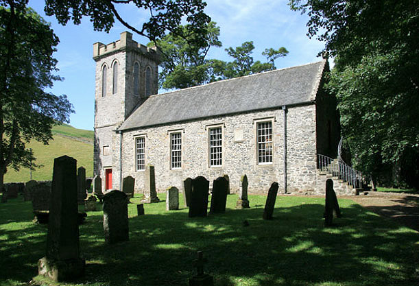
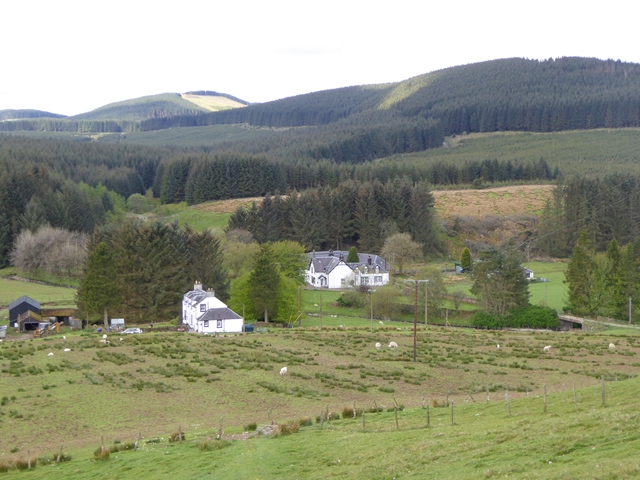
Gamescleuch Wood Images

Images are sourced within 2km of 55.417847/-3.1346516 or Grid Reference NT2814. Thanks to Geograph Open Source API. All images are credited.

The moorland ridge to the southwest of Annelshope Hill This low, rounded ridge extends southwest from Annelshope hill in the direction of Eskdalemuir Forest separating the valleys of Ettrick Water to the west and the Rankie Burn to the east.  The low hill in the background is Gamescleuch Hill.
The moorland ridge to the southwest of Annelshope Hill
This low, rounded ridge extends southwest from Annelshope hill in the direction of Eskdalemuir Forest separating the valleys of Ettrick Water to the west and the Rankie Burn to the east. The low hill in the background is Gamescleuch Hill.
Harvested area in forestry at Greyhound Law
Boardwalk In The Ettrick Marshes A snow-covered boardwalk at the Ettrick Marshes leads to a small bird hide.
Boardwalk In The Ettrick Marshes
A snow-covered boardwalk at the Ettrick Marshes leads to a small bird hide.
Ditch In The Ettrick Marshes One of numerous ditches which penetrate the marshes.
Ditch In The Ettrick Marshes
One of numerous ditches which penetrate the marshes.
Ettrick Water A view of the Ettrick Water looking downstream from Ramseycleuch Bridge.
Ettrick Water
A view of the Ettrick Water looking downstream from Ramseycleuch Bridge.
Lichen Mosaic A view of fruticose lichen-encrusted trees at the Ettrick Marshes.
Lichen Mosaic
A view of fruticose lichen-encrusted trees at the Ettrick Marshes.
Snowdrops at Thirlestane In a wooded area near Thirlestane Tower in the Ettrick Valley.
Snowdrops at Thirlestane
In a wooded area near Thirlestane Tower in the Ettrick Valley.
Thirlestane Tower The remains of this 16th century tower are on the northeast side of the Thirlestane Burn. A tree has fallen over the tower but doesn’t appear to have caused much damage. For a view of the tree before it fell through a gap in the tower wall, see <a href="https://www.geograph.org.uk/photo/2174692">NT2815 : Remains of Thirlestane Tower, Ettrick Valley</a>.
Thirlestane Tower
The remains of this 16th century tower are on the northeast side of the Thirlestane Burn. A tree has fallen over the tower but doesn’t appear to have caused much damage. For a view of the tree before it fell through a gap in the tower wall, see NT2815 : Remains of Thirlestane Tower, Ettrick Valley.
A track on Thirlestane Hill This is on the northeast side of the Thirlestane Burn in a wooded area.
A track on Thirlestane Hill
This is on the northeast side of the Thirlestane Burn in a wooded area.
Trees on Thirlestane Hill This woodland on the northeast side of the Thirlestane Burn was viewed from a grass track.
Trees on Thirlestane Hill
This woodland on the northeast side of the Thirlestane Burn was viewed from a grass track.
Black Spout Waterfall This atmospheric small waterfall is on the Thirlestane Burn.
Black Spout Waterfall
This atmospheric small waterfall is on the Thirlestane Burn.
A sheepfold below Thirlestane Hill This old sheepfold is on the north side of the Thirlestane Burn with new forestry planting behind.
A sheepfold below Thirlestane Hill
This old sheepfold is on the north side of the Thirlestane Burn with new forestry planting behind.
Trees by the Thirlestane Burn This is on the north side of the burn in a woodland strip between Ramseycleuch Hill and Thirlestane Hill.
Trees by the Thirlestane Burn
This is on the north side of the burn in a woodland strip between Ramseycleuch Hill and Thirlestane Hill.
Woodland on Thirlestane Hill
B709 through the Borders A less well used route through the Borders
B709 through the Borders
A less well used route through the Borders
Bridge over unnamed burn on the B709
House on the B709 near Ettrick
B709 south of Deephope
Show me another place!

Gamescleuch Wood is located at Grid Ref: NT2814 (Lat: 55.417847, Lng: -3.1346516)

Unitary Authority: The Scottish Borders

Police Authority: The Lothians and Scottish Borders

What 3 Words

///bongo.horn.snowmen. Near Ettrick, Scottish Borders

Nearby Locations

Hay Hill Gamescleuch Wood

Related Wikis

Ettrick, Scotland

Ettrick (Scottish Gaelic: Eadaraig, IPA: [ˈet̪əɾɪkʲ]) is a small village and civil parish in the Scottish Borders area of Scotland. It is located on the...

Tushielaw Tower

Tushielaw Tower is a 16th-century tower house, about 2.5 miles (4.0 km) north and east of Ettrick, Scottish Borders, Scotland, and west of Ettrick Water...

Buccleuch, Scottish Borders

East and West Buccleuch ( bə-KLOO) are two homesteads in the Scottish Borders, in the Ettrick parish of historic Selkirkshire. They are located off the...
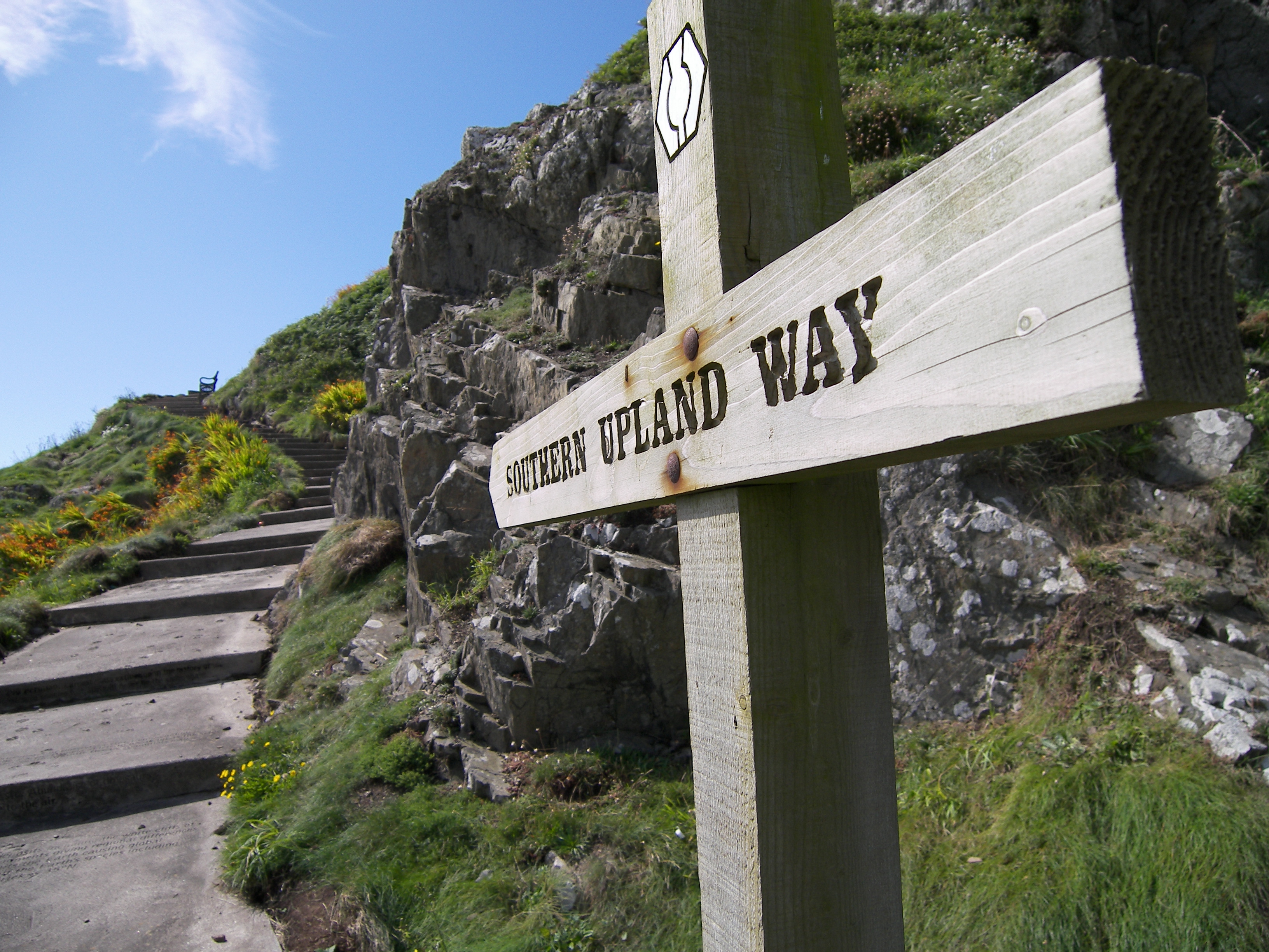
Southern Upland Way

The Southern Upland Way is a 344-kilometre (214 mi) coast-to-coast long-distance footpath in southern Scotland. The route links Portpatrick in the west...

Nearby Amenities

Located within 500m of 55.417847,-3.1346516
Communication 3G: yes
Communication 4G: yes
Communication Microwave: yes
Communication Mobile Phone: yes
Height: 20
Man Made: mast
Tower Construction: lattice_steel
Tower Type: communication
Lat/Long: 55.4156002/-3.1320571
Deephope Hill
Ele: 380
Natural: peak
Lat/Long: 55.4135116/-3.1330193
The data included in this document is from www.openstreetmap.org. The data is made available under ODbL.

Have you been to Gamescleuch Wood?

Leave your review of Gamescleuch Wood below (or comments, questions and feedback).