Smithy Plantation

Wood, Forest in Midlothian

Scotland

Smithy Plantation

Parking area, Gladhouse Reservoir A rather muddy lay-by near Gladhouse Reservoir on the access road to Moorfoot farm, with the escarpment of the Moorfoot Hills beyond.
Parking area, Gladhouse Reservoir Credit: Jim Barton

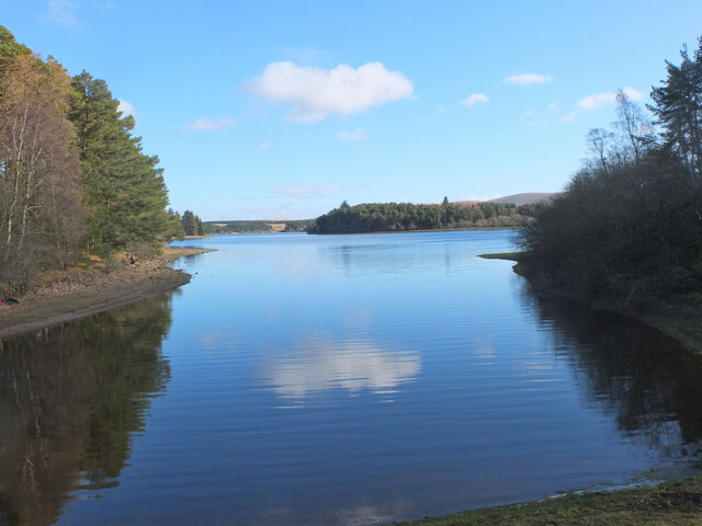
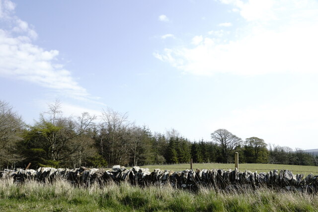
Smithy Plantation is a picturesque woodland located in Midlothian, Scotland. With its lush greenery and serene atmosphere, it offers a tranquil escape from the hustle and bustle of city life. Covering an area of approximately 200 acres, the plantation is a perfect destination for nature lovers and outdoor enthusiasts.

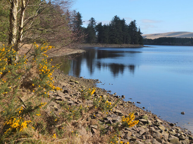
The plantation is primarily composed of dense woodland, dominated by a variety of tree species including oak, beech, and birch. These towering trees provide a canopy of shade, creating a cool and peaceful environment. The forest floor is covered with a rich layer of moss, ferns, and wildflowers, adding to the natural beauty of the area.

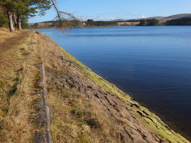
The plantation is crisscrossed with several well-maintained walking trails, allowing visitors to explore the area at their leisure. The trails wind through the woodland, offering breathtaking views of the surrounding landscape. Along the way, visitors may come across various wildlife species such as red squirrels, deer, and a wide range of birdlife.

One of the key features of Smithy Plantation is its historical significance. The plantation was once home to a traditional blacksmith's workshop, hence the name. Although the workshop is no longer operational, remnants of its existence can still be seen, adding an intriguing historical element to the site.

Overall, Smithy Plantation in Midlothian is a true haven for nature enthusiasts, providing a peaceful retreat amidst the scenic beauty of the Scottish countryside. Whether for a leisurely walk, birdwatching, or simply enjoying the tranquility of the woodland, this plantation offers an unforgettable experience for visitors of all ages.

If you have any feedback on the listing, please let us know in the comments section below.

Smithy Plantation Images

Images are sourced within 2km of 55.768216/-3.1453834 or Grid Reference NT2853. Thanks to Geograph Open Source API. All images are credited.

Parking area, Gladhouse Reservoir A rather muddy lay-by near Gladhouse Reservoir on the access road to Moorfoot farm, with the escarpment of the Moorfoot Hills beyond.
Parking area, Gladhouse Reservoir
A rather muddy lay-by near Gladhouse Reservoir on the access road to Moorfoot farm, with the escarpment of the Moorfoot Hills beyond.
Aqueduct for Gladhouse Reservoir A straight concrete-lined channel taking water to the west end of the reservoir.
Aqueduct for Gladhouse Reservoir
A straight concrete-lined channel taking water to the west end of the reservoir.
Aqueduct for Gladhouse Reservoir (2) Further downstream along the channel shown in <a href="https://www.geograph.org.uk/photo/7112091">NT2853 : Aqueduct for Gladhouse Reservoir</a>.
Aqueduct for Gladhouse Reservoir (2)
Further downstream along the channel shown in NT2853 : Aqueduct for Gladhouse Reservoir.
Bay at the west end of Gladhouse Reservoir A tranquil bay surrounded by woodland.
Bay at the west end of Gladhouse Reservoir
A tranquil bay surrounded by woodland.
Shoreline at Gladhouse Reservoir The NW shoreline of this reservoir, completed in 1879 as a water supply for Edinburgh - see <span class="nowrap"><a title="https://en.wikipedia.org/wiki/Gladhouse_Reservoir" rel="nofollow ugc noopener" href="https://en.wikipedia.org/wiki/Gladhouse_Reservoir">Link</a><img style="margin-left:2px;" alt="External link" title="External link - shift click to open in new window" src="https://s1.geograph.org.uk/img/external.png" width="10" height="10"/></span> for more details.
Shoreline at Gladhouse Reservoir
The NW shoreline of this reservoir, completed in 1879 as a water supply for Edinburgh - see LinkExternal link for more details.
Bank of Gladhouse Reservoir Stone facing on the bank of this reservoir, completed in 1879 by engineer James Leslie - see <span class="nowrap"><a title="https://en.wikipedia.org/wiki/Gladhouse_Reservoir" rel="nofollow ugc noopener" href="https://en.wikipedia.org/wiki/Gladhouse_Reservoir">Link</a><img style="margin-left:2px;" alt="External link" title="External link - shift click to open in new window" src="https://s1.geograph.org.uk/img/external.png" width="10" height="10"/></span> for more details.
Bank of Gladhouse Reservoir
Stone facing on the bank of this reservoir, completed in 1879 by engineer James Leslie - see LinkExternal link for more details.
Stubble field near Gladhouse Reservoir A field near Moorfoot farm.
Stubble field near Gladhouse Reservoir
A field near Moorfoot farm.
Car park sign, Gladhouse Reservoir The only car park on the access road to Moorfoot farm. Over the years, car parking provision around the reservoir has decreased - see <a href="https://www.geograph.org.uk/photo/1713001">NT3054 : Gladhouse Reservoir from closed car park</a> and <a href="https://www.geograph.org.uk/photo/7113022">NT3054 : Blocked lay-by, Gladhouse Reservoir</a>. At least walkers are allowed here! The sign is fairly recent.
Car park sign, Gladhouse Reservoir
The only car park on the access road to Moorfoot farm. Over the years, car parking provision around the reservoir has decreased - see NT3054 : Gladhouse Reservoir from closed car park and NT3054 : Blocked lay-by, Gladhouse Reservoir. At least walkers are allowed here! The sign is fairly recent.
Track from Moorfoot farm Plenty of sheep and lambs around this farm by Gladhouse Reservoir. The track heads south to the valley of the River South Esk. Compare with <a href="https://www.geograph.org.uk/photo/5263921">NT2952 : Track to the South Esk</a> taken in 2017.
Track from Moorfoot farm
Plenty of sheep and lambs around this farm by Gladhouse Reservoir. The track heads south to the valley of the River South Esk. Compare with NT2952 : Track to the South Esk taken in 2017.
Woolly fence, Moorfoot farm Sheep's wool built up on the fence by the track to the South Esk.
Woolly fence, Moorfoot farm
Sheep's wool built up on the fence by the track to the South Esk.
Tweeddale Burn Wood Tweeddale Burn Wood, a small narrow strip of native woodland.
Tweeddale Burn Wood
Tweeddale Burn Wood, a small narrow strip of native woodland.
Woodland near Gladhouse Reservoir
Road beside Gladhouse Reservoir
Gladhouse Reservoir
Gladhouse Reservoir
Sheep near Gladhouse Reservoir
Plantation near Gladhouse Reservoir
South end of Gladhouse Reservoir
Minor road towards Temple
Show me another place!

Smithy Plantation is located at Grid Ref: NT2853 (Lat: 55.768216, Lng: -3.1453834)

Unitary Authority: Midlothian

Police Authority: The Lothians and Scottish Borders

What 3 Words

///lightly.tungsten.mostly. Near Penicuik, Midlothian

Related Wikis

Gladhouse Reservoir

Gladhouse Reservoir, formerly known as Moorfoot Loch, is a reservoir in Midlothian, Scotland, five miles (8 km) south of Penicuik. It is the most southerly...

Northshield Rings

Northshield Rings is a prehistoric site, a hillfort near the village of Eddleston and about 6 miles (10 km) north of Peebles, in the Scottish Borders,...

Earlyvale Gate railway station

Earlyvale Gate railway station served the Dundas family residence in Earlyvale, Scottish Borders, Scotland for 8 months (June 1856 - February 1857) on...

Leadburn railway station

Leadburn railway station served the hamlet of Leadburn, Midlothian, Scotland from 1855 to 1962 on the Peebles Railway. == History == The station opened...

Nearby Amenities

Located within 500m of 55.768216,-3.1453834
Power: pole
Lat/Long: 55.7640924/-3.1478727
Power: pole
Lat/Long: 55.7647926/-3.1483394
Power: pole
Lat/Long: 55.7655079/-3.1488329
Power: pole
Lat/Long: 55.7662442/-3.1493855
Power: pole
Lat/Long: 55.7675328/-3.1502438
Power: pole
Lat/Long: 55.7690025/-3.1512791
Power: pole
Lat/Long: 55.7697569/-3.1518048
Power: pole
Lat/Long: 55.7704449/-3.1523037
Power: pole
Lat/Long: 55.7641709/-3.1475669
Power: pole
Lat/Long: 55.7649194/-3.1481516
Power: pole
Lat/Long: 55.7656708/-3.1486452
Power: pole
Lat/Long: 55.7665008/-3.1492084
Power: pole
Lat/Long: 55.7675208/-3.1499273
Power: pole
Lat/Long: 55.7682481/-3.150394
Power: pole
Lat/Long: 55.7690568/-3.150968
Power: pole
Lat/Long: 55.7698625/-3.151601
Power: pole
Lat/Long: 55.7705626/-3.1520784
Power: pole
Lat/Long: 55.7723038/-3.1439873
Power: pole
Lat/Long: 55.7717025/-3.1435226
Power: pole
Lat/Long: 55.7710368/-3.1430225
Power: pole
Lat/Long: 55.7704414/-3.1425641
Power: pole
Lat/Long: 55.7698225/-3.1421203
Power: pole
Lat/Long: 55.7695084/-3.1411764
Power: pole
Lat/Long: 55.7692868/-3.1405138
Power: pole
Lat/Long: 55.768852/-3.1392115
Power: pole
Lat/Long: 55.7685191/-3.1381634
Power: pole
Lat/Long: 55.7683421/-3.1376591
The data included in this document is from www.openstreetmap.org. The data is made available under ODbL.

Have you been to Smithy Plantation?

Leave your review of Smithy Plantation below (or comments, questions and feedback).