Cattawade

Settlement in Suffolk Babergh

England

Cattawade

View across the Stour estuary from The Walls at dusk Looking north-northwest.
View across the Stour estuary from The Walls at dusk Credit: Robert Lamb

Cattawade is a charming village located in the county of Suffolk, England. Situated on the eastern bank of the River Stour, it is part of the Babergh district. The village is nestled amidst the picturesque countryside, offering stunning views and a tranquil atmosphere.

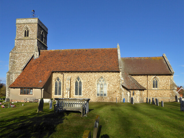
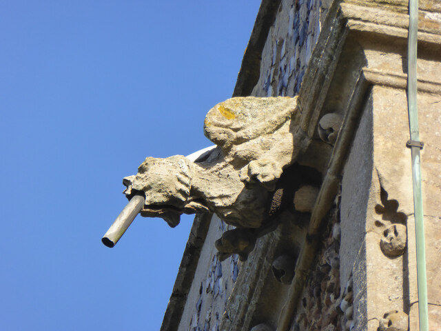
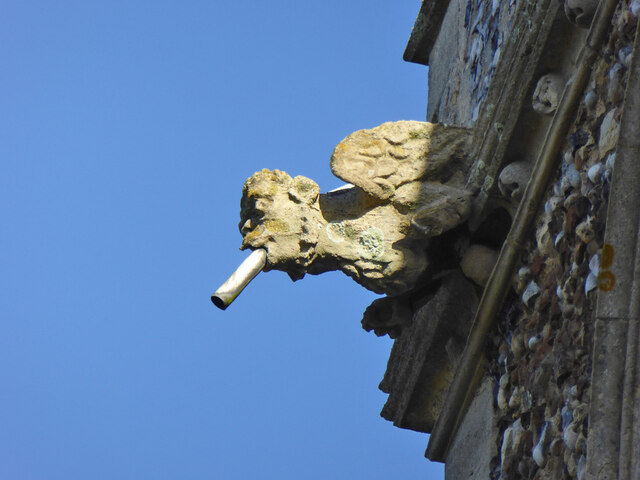
Cattawade is known for its historical significance, with evidence of human settlement dating back to the Roman period. The village features several well-preserved buildings from different eras, including the iconic St. Margaret's Church, which dates back to the 14th century. This beautiful church boasts stunning architecture and is a testament to the village's rich heritage.

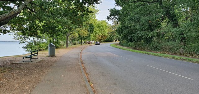
The village is surrounded by lush green fields and meadows, making it an ideal location for nature enthusiasts. The River Stour, which flows through Cattawade, provides opportunities for boating, fishing, and scenic walks along its banks. The village also has a small marina, attracting boaters and water sports enthusiasts from near and far.

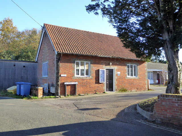
Cattawade offers a close-knit community feel, with a range of amenities available for residents and visitors alike. These include a local pub, village hall, and a primary school. The village is well-connected to nearby towns and cities, with good transport links ensuring easy access to the wider region.

With its idyllic setting, rich history, and friendly community, Cattawade is a hidden gem in Suffolk. It offers a peaceful retreat for those seeking a slower pace of life, with a range of recreational activities and natural beauty to explore.

If you have any feedback on the listing, please let us know in the comments section below.

Cattawade Images

Images are sourced within 2km of 51.956322/1.057806 or Grid Reference TM1033. Thanks to Geograph Open Source API. All images are credited.

View across the Stour estuary from The Walls at dusk Looking north-northwest.
View across the Stour estuary from The Walls at dusk
Looking north-northwest.
View across the River Stour estuary from The Walls Looking north-northwest.
View across the River Stour estuary from The Walls
Looking north-northwest.
View of St. Mary & St. Michael's Church in Mistley from The Walls Looking south-southeast.
View of St. Mary & St. Michael's Church in Mistley from The Walls
Looking south-southeast.
View of Mistley Towers from the village square Looking north-northeast.
View of Mistley Towers from the village square
Looking north-northeast.
View of the fingerpost sign on a bench in the village square Looks like a vehicle has crashed into the traditional fingerpost sign (as well as a nearby lamp post) on Mistley's village square and, rather ingeniously, the sign has been maintained by someone placing it on the nearby bench. Looking south-southwest.
View of the fingerpost sign on a bench in the village square
Looks like a vehicle has crashed into the traditional fingerpost sign (as well as a nearby lamp post) on Mistley's village square and, rather ingeniously, the sign has been maintained by someone placing it on the nearby bench. Looking south-southwest.
Brantham church The Church of St Michael and All Angels is a grade II*(star) listed building. Medieval with extensive 19th century rebuilding and restorations.
Brantham church
The Church of St Michael and All Angels is a grade II*(star) listed building. Medieval with extensive 19th century rebuilding and restorations.
Gargoyle, Brantham church tower Draining the tower roof at the SW corner.
Gargoyle, Brantham church tower
Draining the tower roof at the SW corner.
Gargoyle, Brantham church tower Draining the tower roof at the NW corner.
Gargoyle, Brantham church tower
Draining the tower roof at the NW corner.
St. Michael's Pre-school, Brantham Mapped as an 'Institute'.
St. Michael's Pre-school, Brantham
Mapped as an 'Institute'.
Mistley, St Mary & St Michael
Old Milestone, B1352, High Street, Mistley The milestone was originally located on the High Street, Mistley at TM 1181 3178. It was later moved against the wall of a building on Mistley Quay, see <a title="https://www.geograph.org.uk/photo/6045295" href="https://www.geograph.org.uk/photo/6045295">Link</a> , then temporarily put in to store during property development, and has now been re-installed in the Swan Basin, High Street. Parish of Mistley (Tendring District), Carved stone post, originally erected in the 19th century. A replacement for the cast iron post that would later have been fitted to the milestone is located close by, see <a title="https://www.geograph.org.uk/photo/7148738" href="https://www.geograph.org.uk/photo/7148738">Link</a>

Inscription reads:-
LXI / Colchester / 10 / Mistley  : : (Harwich / 11)

Milestone Society National ID: EX_COHH61
Old Milestone, B1352, High Street, Mistley
The milestone was originally located on the High Street, Mistley at TM 1181 3178. It was later moved against the wall of a building on Mistley Quay, see Link , then temporarily put in to store during property development, and has now been re-installed in the Swan Basin, High Street. Parish of Mistley (Tendring District), Carved stone post, originally erected in the 19th century. A replacement for the cast iron post that would later have been fitted to the milestone is located close by, see Link Inscription reads:- LXI / Colchester / 10 / Mistley : : (Harwich / 11) Milestone Society National ID: EX_COHH61
Replacement Milestone, B1352, High St, Mistley, Swan Basin This milestone is located in the Swan Basin, against the far wall to the right of the original stone milestone EX_COHH61, <a title="https://www.geograph.org.uk/photo/7148662" href="https://www.geograph.org.uk/photo/7148662">Link</a>. Parish of Mistley (Tendring District). It is a replacement for the original cast iron post, Bendall iron casting design, erected by the Essex Second District turnpike trust in the 19th century. Cast iron posts on this Colchester to Harwich route were made to be bolted on to the original stone milestones.

Inscription reads:-
HARWICH / 11  : : COLCHESTER / 10  : :  MISTLEY / TO / LONDON / 61  :  : BENDALL / IRON AND BRASS / FOUNDERS / PLOUGH AND MACHINE / MAKER / LAWFORD / ESSEX /1834

Milestone Society National ID: EX_COHH61AR
Replacement Milestone, B1352, High St, Mistley, Swan Basin
This milestone is located in the Swan Basin, against the far wall to the right of the original stone milestone EX_COHH61, Link. Parish of Mistley (Tendring District). It is a replacement for the original cast iron post, Bendall iron casting design, erected by the Essex Second District turnpike trust in the 19th century. Cast iron posts on this Colchester to Harwich route were made to be bolted on to the original stone milestones. Inscription reads:- HARWICH / 11 : : COLCHESTER / 10 : : MISTLEY / TO / LONDON / 61 : : BENDALL / IRON AND BRASS / FOUNDERS / PLOUGH AND MACHINE / MAKER / LAWFORD / ESSEX /1834 Milestone Society National ID: EX_COHH61AR
The Walls, Manningtree
Mistley war memorial and Mistley Tower
High Street, Manningtree
Farmland by the Stour Estuary
Saltmarshes The River Stour is in East Anglia. It is 47 miles long and forms most of the county boundary between Suffolk to the north, and Essex to the south. It rises in eastern Cambridgeshire, passes to the east of Haverhill, through Cavendish, Bures, Sudbury, Nayland, Stratford St Mary, Dedham and flows through the Dedham Vale Area of Outstanding Natural Beauty. It becomes tidal just before Manningtree in Essex and joins the North Sea at Harwich.
Saltmarshes
The River Stour is in East Anglia. It is 47 miles long and forms most of the county boundary between Suffolk to the north, and Essex to the south. It rises in eastern Cambridgeshire, passes to the east of Haverhill, through Cavendish, Bures, Sudbury, Nayland, Stratford St Mary, Dedham and flows through the Dedham Vale Area of Outstanding Natural Beauty. It becomes tidal just before Manningtree in Essex and joins the North Sea at Harwich.
Show me another place!

Cattawade is located at Grid Ref: TM1033 (Lat: 51.956322, Lng: 1.057806)

Administrative County: Suffolk

District: Babergh

Police Authority: Suffolk

What 3 Words

///seaside.rhino.among. Near Manningtree, Essex

Nearby Locations

Cattawade

Related Wikis

Brantham Athletic F.C.

Brantham Athletic Football Club is a football club based in Brantham, Suffolk, England. They are currently members of the Eastern Counties League Premier...

Cattawade Marshes

Cattawade Marshes is an 88.2-hectare (218-acre) biological Site of Special Scientific Interest between East Bergholt and Manningtree in Essex and Suffolk...

Manningtree railway station

Manningtree railway station is on the Great Eastern Main Line (GEML) in the East of England, serving the town of Manningtree, Essex. It is 59 miles 35...

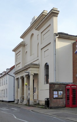
Corn Exchange, Manningtree

The Corn Exchange is a commercial building in the High Street in Manningtree, Essex, England. The structure, which is now used as a public library, is...

Nearby Amenities

Located within 500m of 51.956322,1.057806
Cattawade
Created By: Potlatch 0.10b
Place: village
Source: NPE
Wikidata: Q3122198
Lat/Long: 51.9580471/1.0589959
Barrier: bollard
Bicycle: yes
Foot: yes
Motor Vehicle: no
Lat/Long: 51.9562652/1.0576412
Barrier: bollard
Bicycle: yes
Bollard: fixed
Foot: yes
Motor Vehicle: no
Lat/Long: 51.9559346/1.057189
Source: Landsat photo
Lat/Long: 51.9536859/1.0553643
Source: Landsat photo
Lat/Long: 51.9536516/1.0547633
Post Box
Collection Times: Mo-Fr 09:00; Sa 07:00
Operator: Royal Mail
Operator Wikidata: Q638098
Post Box Type: lamp
Postal Code: CO11 1RH
Ref: CO11 55
Royal Cypher: EIIR
Royal Cypher Wikidata: Q33102113
Lat/Long: 51.9592994/1.0575756
Created By: Potlatch 0.10f
Tourism: picnic_site
Lat/Long: 51.9566212/1.0562715
Bus Stop
Bus Shelter
Bench: yes
Bin: yes
Bus: yes
Lit: yes
Naptan AtcoCode: 390010061
Naptan Bearing: E
Naptan CommonName: Slip Road
Naptan Indicator: adj
Naptan Landmark: Slip Road
Naptan NaptanCode: sufadgdp
Naptan Street: Slip Road
Naptan Verified: no
Public Transport: platform
Shelter: yes
Source: naptan_import
Tactile Paving: no
Lat/Long: 51.9576853/1.0571359
Bus Stop
Bus Shelter
Naptan AtcoCode: 390010062
Naptan Bearing: W
Naptan BusStopType: CUS
Naptan CommonName: Slip Road
Naptan Indicator: opp
Naptan Landmark: Slip Road
Naptan NaptanCode: sufadgdt
Naptan Street: Slip Road
Naptan Verified: no
Public Transport: platform
Source: naptan_import
Lat/Long: 51.9574579/1.0572804
Bus Stop
Main Road
Naptan AtcoCode: 390010063
Naptan Bearing: E
Naptan CommonName: Main Road
Naptan Indicator: adj
Naptan Landmark: Main Road
Naptan NaptanCode: sufadgdw
Naptan Street: Main Road
Naptan Verified: no
Public Transport: platform
Source: naptan_import
Lat/Long: 51.9602106/1.0595475
Bus Stop
Main Road
Naptan AtcoCode: 390010064
Naptan Bearing: W
Naptan BusStopType: CUS
Naptan CommonName: Main Road
Naptan Indicator: opp
Naptan Landmark: Main Road
Naptan NaptanCode: sufadgja
Naptan Street: Main Road
Naptan Verified: no
Public Transport: platform
Source: naptan_import
Lat/Long: 51.9601081/1.0595688
Bus Stop
Temple Pattle
Naptan AtcoCode: 390010864
Naptan Bearing: E
Naptan CommonName: Temple Pattle
Naptan Indicator: opp
Naptan Landmark: Temple Pattle
Naptan NaptanCode: sufjpwpt
Naptan Street: Brooklands Road
Naptan Verified: no
Public Transport: platform
Source: naptan_import
Lat/Long: 51.9595217/1.0606615
Bus Stop
Temple Pattle
Naptan AtcoCode: 390010865
Naptan Bearing: W
Naptan CommonName: Temple Pattle
Naptan Indicator: adj
Naptan Landmark: Temple Pattle
Naptan NaptanCode: sufjpwpw
Naptan Street: Brooklands Road
Naptan Verified: no
Public Transport: platform
Source: naptan_import
Lat/Long: 51.9593545/1.0615702
Waterway: weir
Lat/Long: 51.9530461/1.0538557
Power: pole
Lat/Long: 51.9572107/1.0629192
Material: wood
Power: pole
Lat/Long: 51.9538204/1.0573161
Power: pole
Lat/Long: 51.9559974/1.059419
Material: wood
Power: pole
Lat/Long: 51.9543759/1.0570854
Power: pole
Lat/Long: 51.9571429/1.0629407
Power: tower
Lat/Long: 51.9539295/1.0636998
Location Transition: yes
Power: pole
Lat/Long: 51.9537441/1.0560354
Power: pole
Lat/Long: 51.9529443/1.0564819
Power: tower
Lat/Long: 51.9526534/1.0589898
Power: pole
Lat/Long: 51.956809/1.0600841
Power: pole
Lat/Long: 51.9547412/1.0582281
Power: pole
Lat/Long: 51.9549759/1.0580966
Power: pole
Lat/Long: 51.9569826/1.0614762
Location Transition: yes
Power: pole
Lat/Long: 51.9536681/1.0561629
Power: pole
Lat/Long: 51.9567687/1.0605257
Waterway: weir
Lat/Long: 51.9554431/1.0579874
Waterway: weir
Lat/Long: 51.95571/1.0580476
Railway: switch
Lat/Long: 51.9520405/1.0578015
Railway: switch
Lat/Long: 51.952222/1.0584207
Railway: switch
Lat/Long: 51.9523597/1.059054
Barrier: bollard
Lat/Long: 51.9557478/1.0573943
Barrier: bollard
Lat/Long: 51.9558184/1.0583535
Cattawade Tidal Slipway
Leisure: slipway
Lat/Long: 51.9556832/1.0585232
Cattawade Slipway
Leisure: slipway
Lat/Long: 51.955958/1.057985
Barrier: bollard
Bicycle: yes
Foot: yes
Motor Vehicle: no
Lat/Long: 51.955651/1.0565305
Barrier: bollard
Bicycle: yes
Foot: yes
Motor Vehicle: no
Lat/Long: 51.9563668/1.0577687
Give Way
Lat/Long: 51.9576103/1.0575062
Give Way
Lat/Long: 51.9574996/1.057192
Give Way
Traffic Signals Direction: forward
Lat/Long: 51.9575433/1.0575703
Access: no
Barrier: bollard
Foot: yes
Motor Vehicle: no
Lat/Long: 51.95979/1.060648
Power: substation
Substation: minor_distribution
Lat/Long: 51.9600365/1.0606995
Power: transformer
Lat/Long: 51.9567272/1.0634355
Power: transformer
Lat/Long: 51.9567751/1.0636032
Power: pole
Lat/Long: 51.9587815/1.0634852
Constable Park Holiday & Leisure Park
Addr City: Manningtree
Addr Postcode: CO11 1QR
Addr Street: Bergholt Road
Tourism: chalet
Website: https://www.constablepark.co.uk/
Lat/Long: 51.9576984/1.0516229
Cafe
Constable Park Cafe
Addr City: Manningtree
Addr Postcode: CO11 1QR
Addr Street: Bergholt Road
Opening Hours: Mo-Su 09:00-17:00
Outdoor Seating: yes
Phone: +44 7307 210104
Website: https://www.constablepark.co.uk/
Lat/Long: 51.9575397/1.0523417
Defibrillator
Defibrillator Location: on left wall of building as you enter the car park
Emergency: defibrillator
Lat/Long: 51.9586639/1.0595882
The data included in this document is from www.openstreetmap.org. The data is made available under ODbL.

Have you been to Cattawade?

Leave your review of Cattawade below (or comments, questions and feedback).