Mòine Chailleach

Wood, Forest in Aberdeenshire

Scotland

Mòine Chailleach

River Don Looking downstream from the bridge that carries the A939.
River Don Credit: Anne Burgess

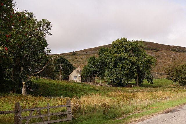
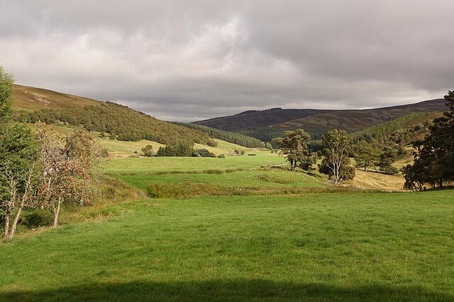
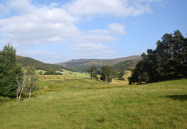
Mòine Chailleach, located in Aberdeenshire, Scotland, is a captivating wood or forest that offers visitors a serene and enchanting experience. With a rich history and diverse ecosystems, this natural gem attracts nature enthusiasts, photographers, and those seeking tranquility.

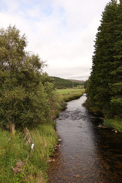
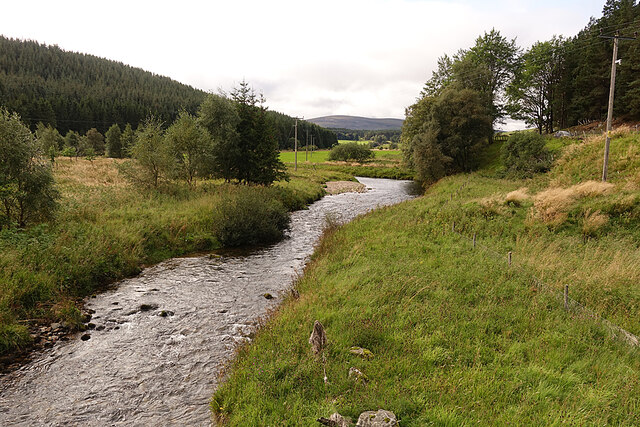
Covering an area of approximately 500 hectares, Mòine Chailleach is characterized by its ancient Caledonian pine trees, which stand tall and majestic throughout the forest. These ancient trees, some of which are several centuries old, create a unique and mystical atmosphere, transporting visitors back in time. The forest floor is adorned with a lush carpet of mosses, ferns, and wildflowers, adding splashes of vibrant colors to the surroundings.

The forest also boasts a variety of wildlife, making it a haven for animal lovers. Red deer, roe deer, and wild boar are often spotted roaming freely in the forest, while birdwatchers can delight in the sight of golden eagles, ospreys, and capercaillie. Mòine Chailleach is also home to several rare and endangered species, including the Scottish wildcat and pine marten.

Walking trails wind through the forest, offering visitors the chance to immerse themselves in nature and explore the breathtaking surroundings. These trails provide opportunities for both leisurely strolls and more challenging hikes, catering to all levels of fitness and ability.

Overall, Mòine Chailleach is a captivating woodland that offers a unique blend of natural beauty, history, and wildlife. Whether you seek solace in the tranquility of the forest or wish to discover the wonders of Scottish nature, a visit to Mòine Chailleach is sure to leave a lasting impression.

If you have any feedback on the listing, please let us know in the comments section below.

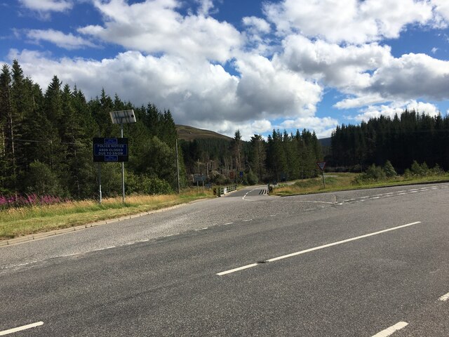
Mòine Chailleach Images

Images are sourced within 2km of 57.158402/-3.1971653 or Grid Reference NJ2708. Thanks to Geograph Open Source API. All images are credited.

River Don Looking downstream from the bridge that carries the A939.
River Don
Looking downstream from the bridge that carries the A939.
River Don Looking upstream from the A939 bridge.
River Don
Looking upstream from the A939 bridge.
Colnabaichin Toll House Instantly recognisable as a toll house because of the windows set at 45º to the road, so that the toll keeper could easily see approaching traffic. It is a Category C Listed building. See <span class="nowrap"><a title="http://portal.historicenvironment.scot/designation/LB16174" rel="nofollow ugc noopener" href="http://portal.historicenvironment.scot/designation/LB16174">Link</a><img style="margin-left:2px;" alt="External link" title="External link - shift click to open in new window" src="https://s1.geograph.org.uk/img/external.png" width="10" height="10"/></span> for details and some history.
Colnabaichin Toll House
Instantly recognisable as a toll house because of the windows set at 45º to the road, so that the toll keeper could easily see approaching traffic. It is a Category C Listed building. See LinkExternal link for details and some history.
Post Box A rural post box still in regular use. It is a type manufactured by the Carron Company, near Falkirk.
Post Box
A rural post box still in regular use. It is a type manufactured by the Carron Company, near Falkirk.
House at Colnabaichin A small house just off the A944 close to its junction with the A939.
House at Colnabaichin
A small house just off the A944 close to its junction with the A939.
Sheep in Strathdon Pasture land beside the River Don.
Sheep in Strathdon
Pasture land beside the River Don.
Warning Notice The roads authority finally realised that <a href="https://www.geograph.org.uk/photo/3559672">NJ2900 : Trouble at the bridge!</a>, built in the 1740s, is totally unsuitable for use by large and heavy vehicles. I have more than once waited there while a tour bus has decanted its passengers to inch gingerly across the hump and round the right-angled bend immediately north of it. And of course it's always necessary to tell drivers not to trust their SatNav. The tall new road signs at the actual junction are shrouded in cloth so I can't tell what they are saying.
Warning Notice
The roads authority finally realised that NJ2900 : Trouble at the bridge!, built in the 1740s, is totally unsuitable for use by large and heavy vehicles. I have more than once waited there while a tour bus has decanted its passengers to inch gingerly across the hump and round the right-angled bend immediately north of it. And of course it's always necessary to tell drivers not to trust their SatNav. The tall new road signs at the actual junction are shrouded in cloth so I can't tell what they are saying.
Pasture Land in Strath Don Looking down the strath from outside the community hall.
Pasture Land in Strath Don
Looking down the strath from outside the community hall.
Corgarff Hall In summer the hall contains an exhibition of photographs by locally based photographer Gerard Murphy <span class="nowrap"><a title="https://gerardmurphy.co.uk/" rel="nofollow ugc noopener" href="https://gerardmurphy.co.uk/">Link</a><img style="margin-left:2px;" alt="External link" title="External link - shift click to open in new window" src="https://s1.geograph.org.uk/img/external.png" width="10" height="10"/></span>.
Corgarff Hall
In summer the hall contains an exhibition of photographs by locally based photographer Gerard Murphy LinkExternal link.
Corgarff War Memorial Situated close to the community hall at Corgarff.
Corgarff War Memorial
Situated close to the community hall at Corgarff.
Corgarff community hall A hub of activity for the remote village sited to the south of the A939 road.
Corgarff community hall
A hub of activity for the remote village sited to the south of the A939 road.
Strathdon vista View down the River Don valley at the edge of the Highlands.  The A939 road can be seen in the blown-up photo.
Strathdon vista
View down the River Don valley at the edge of the Highlands. The A939 road can be seen in the blown-up photo.
Corgarff war memorial A fine setting in the upper valley of the River Don. Twelve men were lost in WW1 and two in WW2.  For 'the men behind the names', see: <span class="nowrap"><a title="http://www.lostancestors.eu/memwar/C/CorgarffSold.htm#13" rel="nofollow ugc noopener" href="http://www.lostancestors.eu/memwar/C/CorgarffSold.htm#13">Link</a><img style="margin-left:2px;" alt="External link" title="External link - shift click to open in new window" src="https://s1.geograph.org.uk/img/external.png" width="10" height="10"/></span> .
Corgarff war memorial
A fine setting in the upper valley of the River Don. Twelve men were lost in WW1 and two in WW2. For 'the men behind the names', see: LinkExternal link .
Former Corgarff Parish Kirk The B-listed (LB16176 <span class="nowrap"><a title="http://portal.historicenvironment.scot/designation/LB16176" rel="nofollow ugc noopener" href="http://portal.historicenvironment.scot/designation/LB16176">Link</a><img style="margin-left:2px;" alt="External link" title="External link - shift click to open in new window" src="https://s1.geograph.org.uk/img/external.png" width="10" height="10"/></span> ) granite kirk dates from ca. 1835 and is oriented roughly north-south.  Designed for reformed worship, the windowless west wall accommodated box pews and a gallery with the pulpit at the centre of the east wall, which has four large pointed windows.
Former Corgarff Parish Kirk
The B-listed (LB16176 LinkExternal link ) granite kirk dates from ca. 1835 and is oriented roughly north-south. Designed for reformed worship, the windowless west wall accommodated box pews and a gallery with the pulpit at the centre of the east wall, which has four large pointed windows.
Corgarff view The Old Smithy beside the A939 and farther back, West Corriehoul farmstead.  According to Celtic Place-names in Aberdeenshire by John Milne, 'corriehoul' means 'corry of the howe', which in turn means 'cirque of the tumulus' (or cairn) and the 1900 25-inch OS map shows a cairn a few hundred metres to the north-east.
Corgarff view
The Old Smithy beside the A939 and farther back, West Corriehoul farmstead. According to Celtic Place-names in Aberdeenshire by John Milne, 'corriehoul' means 'corry of the howe', which in turn means 'cirque of the tumulus' (or cairn) and the 1900 25-inch OS map shows a cairn a few hundred metres to the north-east.
Junction of the A939 and A944
Corgarff Cemetery
Corgarff Cemetery
Parking and picnic site, Corgarff
Show me another place!

Mòine Chailleach is located at Grid Ref: NJ2708 (Lat: 57.158402, Lng: -3.1971653)

Unitary Authority: Aberdeenshire

Police Authority: North East

What 3 Words

///negotiators.provoking.expansion. Near Ballater, Aberdeenshire

Nearby Locations

Corgarff Mòine Chailleach

Related Wikis

Corgarff

Corgarff (Scottish Gaelic: Corr Garaidh) is a hamlet in Aberdeenshire, Scotland, in the Grampian Mountains. The nearby Corgarff Castle was used as a military...

Cock Bridge (Aberdeenshire)

Cock Bridge is a settlement in Aberdeenshire, Scotland, located in the Cairngorms National Park, on the A939 road near Corgarff and Corgarff Castle, between...

Corgarff Castle

Corgarff Castle is located slightly west of the village of Corgarff, in Aberdeenshire, north-east Scotland. It stands by the Lecht road, which crosses...
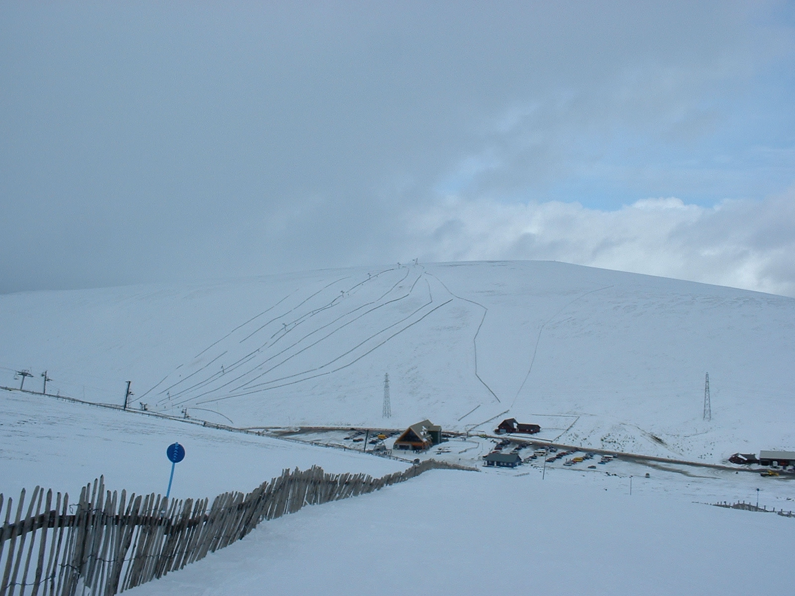
Lecht Ski Centre

The Lecht Ski Centre is an alpine ski area in the Cairngorms in the Scottish Highlands. The ski slopes are set around the mountains Beinn a' Chruinnich...

Delnadamph Lodge

Delnadamph Lodge was located on the Balmoral Estate about 8 miles (13 km) north of the castle. The lodge and its estate lands were bought by Queen Elizabeth...
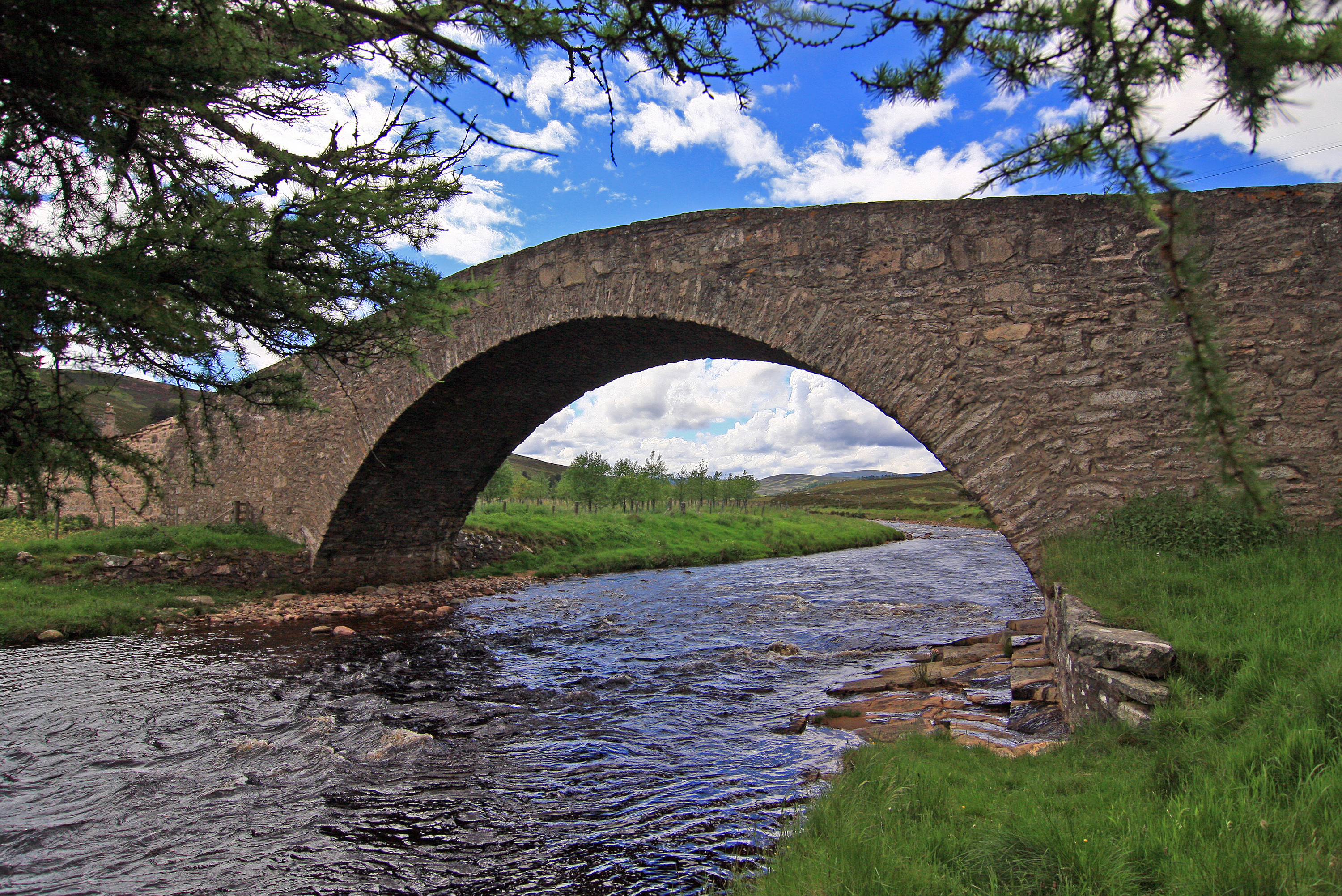
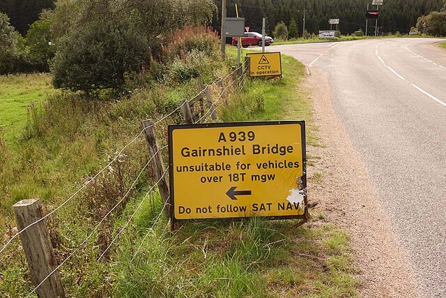
Gairnshiel Bridge

Gairnshiel Bridge is a road bridge that crosses the River Gairn in Aberdeenshire, Scotland. The bridge was built the mid-18th century. It is Category A...

Strathdon

Strathdon (; Gaelic: Srath Dheathain) is an area in Aberdeenshire, Scotland. It is situated in the strath of the River Don, 45 miles west of Aberdeen in...

Doune of Invernochty

The Doune of Invernochty is a 12th-century castle in the Cairngorms National Park in Scotland, of which only earthworks survive. The Royal Commission on...

Nearby Amenities

Located within 500m of 57.158402,-3.1971653
Corgarff
Name Gd: Còrr Gairbh
Place: hamlet
Source: bing
Wikidata: Q5170492
Wikipedia: en:Corgarff
Lat/Long: 57.1612667/-3.1946429
Post Box
Brand: Royal Mail
Brand Wikidata: Q638098
Operator: Royal Mail
Operator Wikidata: Q638098
Post Box Design: 2010_pattern
Post Box Type: lamp
Ref: AB36 354
Royal Cypher: scottish_crown
Source: survey
Lat/Long: 57.1610178/-3.1947358
Clashmore
Place: locality
Lat/Long: 57.1572122/-3.1907485
Parking
Lat/Long: 57.1607609/-3.1949809
Tourism: picnic_site
Lat/Long: 57.1607699/-3.1955519
Gerard Murphy Photography
Tourism: gallery
Lat/Long: 57.1607952/-3.1943869
Power: pole
Lat/Long: 57.1620069/-3.1925533
Power: pole
Lat/Long: 57.161868/-3.1935784
Power: pole
Lat/Long: 57.1617234/-3.1946242
Power: pole
Lat/Long: 57.1615891/-3.1956356
Power: pole
Lat/Long: 57.1616432/-3.1962066
Power: pole
Lat/Long: 57.1610891/-3.1951333
Power: pole
Lat/Long: 57.1604297/-3.1947618
Power: pole
Lat/Long: 57.1617346/-3.1972834
Power: pole
Lat/Long: 57.1618306/-3.1983618
Power: pole
Lat/Long: 57.1619286/-3.1994299
Power: pole
Lat/Long: 57.1620219/-3.200474
Power: pole
Lat/Long: 57.1621011/-3.2013082
Power: pole
Lat/Long: 57.1555054/-3.1920459
Power: pole
Lat/Long: 57.1561556/-3.1919668
Power: pole
Lat/Long: 57.1567871/-3.1918705
Power: pole
Lat/Long: 57.1577871/-3.1922385
Power: pole
Lat/Long: 57.1583365/-3.192426
Power: pole
Lat/Long: 57.1588328/-3.1929145
Power: pole
Lat/Long: 57.1594046/-3.1934821
Power: pole
Lat/Long: 57.159996/-3.1940686
Historic: memorial
Lat/Long: 57.1605782/-3.1938965
Information: board
Tourism: information
Lat/Long: 57.1610733/-3.1943415
Telephone
Booth: KX100
Covered: booth
Operator: BT
Operator Wikidata: Q593786
Payment Coins: yes
Lat/Long: 57.1609225/-3.1951315
The data included in this document is from www.openstreetmap.org. The data is made available under ODbL.

Have you been to Mòine Chailleach?

Leave your review of Mòine Chailleach below (or comments, questions and feedback).