Craigarter Plantation

Wood, Forest in Fife

Scotland

Craigarter Plantation

Benchmark, Lambswell Wood Ordnance Survey benchmark, described on database at <span class="nowrap"><a title="https://www.bench-marks.org.uk/bm147458" rel="nofollow ugc noopener" href="https://www.bench-marks.org.uk/bm147458">Link</a><img style="margin-left:2px;" alt="External link" title="External link - shift click to open in new window" src="https://s1.geograph.org.uk/img/external.png" width="10" height="10"/></span>. sEE ALSO <a href="https://www.geograph.org.uk/photo/7005710">NT2391 : Lambswell Wood, near Newbigging</a>.
Benchmark, Lambswell Wood Credit: Becky Williamson

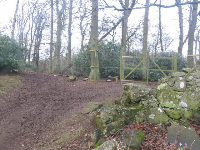
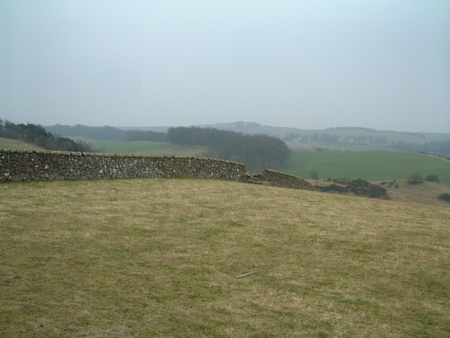
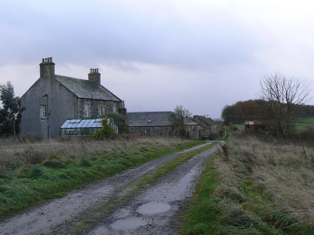
Craigarter Plantation is a picturesque woodland located in Fife, Scotland. Spread across a sprawling area, it is situated in close proximity to the small village of Craigarter. The plantation is renowned for its stunning natural beauty and rich biodiversity.

Covering an area of approximately 100 acres, Craigarter Plantation is predominantly composed of a mix of broadleaf and coniferous trees. The woodland features a diverse range of species, including oak, beech, pine, and spruce, which create a lush and vibrant environment throughout the year.

Visitors to Craigarter Plantation can enjoy a network of well-maintained trails that wind their way through the woodland. These paths provide opportunities for leisurely walks, hikes, and birdwatching, allowing visitors to immerse themselves in the tranquility and serenity of nature.

The plantation is also home to a variety of wildlife, making it an ideal spot for nature enthusiasts. Deer, foxes, badgers, and a wide array of bird species can be spotted within the woodland. The plantation's diverse ecosystem supports a thriving community of flora and fauna, creating a harmonious balance between the natural environment and its inhabitants.

Craigarter Plantation is a popular destination for locals and tourists alike, offering a serene escape from the bustling city life. Its beauty, tranquility, and abundant wildlife make it a cherished natural treasure in the heart of Fife.

If you have any feedback on the listing, please let us know in the comments section below.

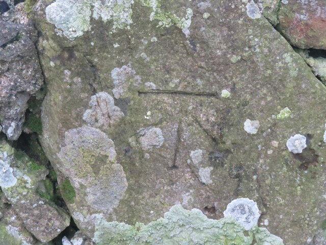
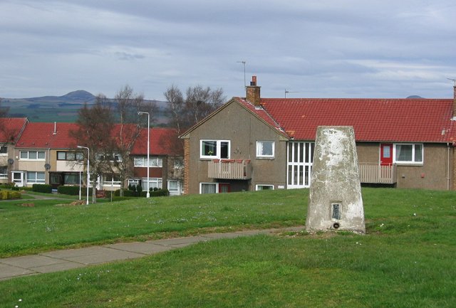
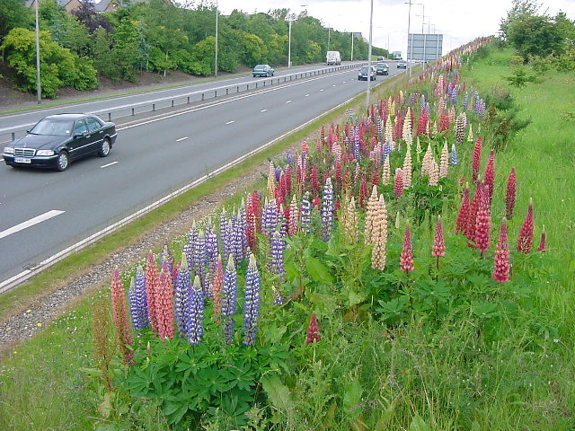
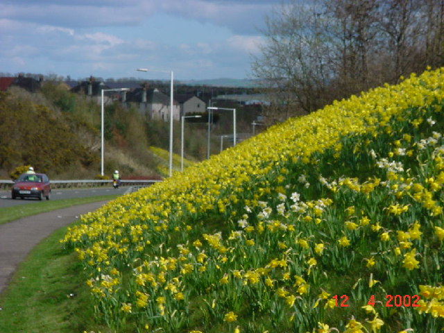
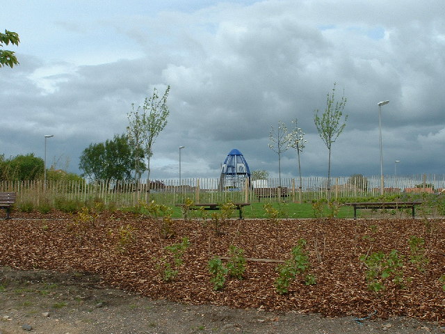
Craigarter Plantation Images

Images are sourced within 2km of 56.121258/-3.2043993 or Grid Reference NT2592. Thanks to Geograph Open Source API. All images are credited.

Benchmark, Lambswell Wood Ordnance Survey benchmark, described on database at <span class="nowrap"><a title="https://www.bench-marks.org.uk/bm147458" rel="nofollow ugc noopener" href="https://www.bench-marks.org.uk/bm147458">Link</a><img style="margin-left:2px;" alt="External link" title="External link - shift click to open in new window" src="https://s1.geograph.org.uk/img/external.png" width="10" height="10"/></span>. sEE ALSO <a href="https://www.geograph.org.uk/photo/7005710">NT2391 : Lambswell Wood, near Newbigging</a>.
Benchmark, Lambswell Wood
Ordnance Survey benchmark, described on database at LinkExternal link. sEE ALSO NT2391 : Lambswell Wood, near Newbigging.
Lambswell Wood, near Newbigging There is an Ordnance Survey benchmark on this crumbling wall in the wood (just visible if you look closely). See <a href="https://www.geograph.org.uk/photo/7005679">NT2391 : Benchmark, Lambswell Wood</a>.
Lambswell Wood, near Newbigging
There is an Ordnance Survey benchmark on this crumbling wall in the wood (just visible if you look closely). See NT2391 : Benchmark, Lambswell Wood.
Electric vehicle charging point In the car park of the Spiral Weave, Kirkcaldy. This one also offers an airline for inflating tyres.
The vehicle with 'St Andrews Shuttle' on its side is an airport taxi.
Electric vehicle charging point
In the car park of the Spiral Weave, Kirkcaldy. This one also offers an airline for inflating tyres. The vehicle with 'St Andrews Shuttle' on its side is an airport taxi.
Electric vehicle charging point In the car park of the Spiral Weave, Kirkcaldy. This one also offers an airline for inflating tyres.
Electric vehicle charging point
In the car park of the Spiral Weave, Kirkcaldy. This one also offers an airline for inflating tyres.
Chapel, Kirkcaldy Once this was Bogie Mains farm, that's when the pillar would have been built. It survived the big housing expansion on the north west of Kirkcaldy and now sits on its hill top just by a bus stop.
Chapel, Kirkcaldy
Once this was Bogie Mains farm, that's when the pillar would have been built. It survived the big housing expansion on the north west of Kirkcaldy and now sits on its hill top just by a bus stop.
Kirkcaldy : Chapel : A910: Lupins flowering The second season of the lupins flowering. These were planted as part of the road dualling. They provide a burst of colour during June. It will be interesting to see how long they flower and if they naturalise.
Kirkcaldy : Chapel : A910: Lupins flowering
The second season of the lupins flowering. These were planted as part of the road dualling. They provide a burst of colour during June. It will be interesting to see how long they flower and if they naturalise.
Kirkcaldy : Wester Bogie Road : Daffodils 300,000 daffodils in full bloom, planted in November 2001. Planted at a density of 30 bulbs per metre square, to give this intense effect.
Kirkcaldy : Wester Bogie Road : Daffodils
300,000 daffodils in full bloom, planted in November 2001. Planted at a density of 30 bulbs per metre square, to give this intense effect.
Kirkcaldy : Templehall Millennium Park A new community park created by  the efforts of the local community. On the site of Kirkcaldy High School part of the site was sold off for housing. The park includes a wildlife garden, a fruit garden (the trees in the picture are apple) and a play area with climbing structure.
Kirkcaldy : Templehall Millennium Park
A new community park created by the efforts of the local community. On the site of Kirkcaldy High School part of the site was sold off for housing. The park includes a wildlife garden, a fruit garden (the trees in the picture are apple) and a play area with climbing structure.
Kirkcaldy : Raith Lake View of Raith Lake looking towards Raith House.
Kirkcaldy : Raith Lake
View of Raith Lake looking towards Raith House.
Kirkcaldy : Torbain Farm from Torbain Road looking towards the Tower at the Farm. The Tower is a schedule B listed monument.
Kirkcaldy : Torbain Farm
from Torbain Road looking towards the Tower at the Farm. The Tower is a schedule B listed monument.
Kirkcaldy: Rabbit Braes from Bennochy Road, looking over the big field at Rabbit Braes, to Templehall and the Lomond Hills in the background. Kirkcaldy like this part of Fife is a series of hill ridges, the underlying rock is old red sandstone. The fields here are remnant of the Bogie Mains Farm.
Kirkcaldy: Rabbit Braes
from Bennochy Road, looking over the big field at Rabbit Braes, to Templehall and the Lomond Hills in the background. Kirkcaldy like this part of Fife is a series of hill ridges, the underlying rock is old red sandstone. The fields here are remnant of the Bogie Mains Farm.
Dunvegan Ave by Raith Modern housing on the former grounds of the old Raith House.
Dunvegan Ave by Raith
Modern housing on the former grounds of the old Raith House.
Dilapidated dyke
Dilapidated dyke
Cottages on Boglily Road
Gas pumping station Installation on the north of the A925
Gas pumping station
Installation on the north of the A925
Entering Kirkcaldy Looking east along the A925
Entering Kirkcaldy
Looking east along the A925
Field and trees A view across the square showing that it covers both forestry and arable land.
Field and trees
A view across the square showing that it covers both forestry and arable land.
Bankhead of Raith An isolated farm, located some two miles west of where the football team of the same name (Raith Rovers) has its stadium.
Bankhead of Raith
An isolated farm, located some two miles west of where the football team of the same name (Raith Rovers) has its stadium.
Show me another place!

Craigarter Plantation is located at Grid Ref: NT2592 (Lat: 56.121258, Lng: -3.2043993)

Unitary Authority: Fife

Police Authority: Fife

What 3 Words

///boxing.solved.dime. Near Kirkcaldy, Fife

Related Wikis

Battle of Raith

The Battle of Raith was the theory of E. W. B. Nicholson, librarian at the Bodleian Library, Oxford. He was aware of the poem Y Gododdin in the Book of...

A921 road

The A921 road is a road that connects Kirkcaldy with the M90 motorway in Fife, Scotland. Before 1990, the road was classed as the A92. == References ==

Raith, Fife

Raith (Scottish Gaelic: rĂ th, "fort" or "fortified residence"), as an area of Fife, once stretched from the lands of Little Raith (earlier Wester Raith...

Kirkcaldy railway station

Kirkcaldy railway station is a railway station in the town of Kirkcaldy, Fife, Scotland. The station is managed by ScotRail and is on the Fife Circle Line...

Kirkcaldy High School

Kirkcaldy High School is a 6-year co-educational comprehensive state school in Kirkcaldy, Fife, Scotland. == History == The school was established in 1582...

Kirkcaldy

Kirkcaldy ( kur-KAW-dee; Scots: Kirkcaldy; Scottish Gaelic: Cair Chaladain) is a town and former royal burgh in Fife, on the east coast of Scotland. It...

Kirkcaldy Galleries

Kirkcaldy Galleries is the main museum, library and exhibition space in Kirkcaldy in Fife, Scotland. The land for the town's museum and art gallery was...

Fife Opera

Fife Opera is a semi-professional grand opera company dating back to 1976, and based in Kirkcaldy, Scotland. It has produced over 40 full-scale productions...

Nearby Amenities

Located within 500m of 56.121258,-3.2043993
Crossing
Bicycle: yes
Button Operated: yes
Crossing: traffic_signals
Crossing Island: no
Crossing Ref: toucan
Kerb: lowered
Tactile Paving: yes
Lat/Long: 56.1223197/-3.2003231
Newliston
Is In: Kirkcaldy
Place: suburb
Lat/Long: 56.1256301/-3.2040831
Crossing
Bicycle: yes
Crossing: uncontrolled
Crossing Markings: yes
Crossing Ref: toucan
Tactile Paving: yes
Traffic Calming: table
Lat/Long: 56.1231507/-3.1976697
Traffic Calming: cushion
Lat/Long: 56.1255985/-3.2059373
Bus Stop
Forres Drive
Bench: yes
Bus: yes
Naptan AtcoCode: 6500K1412
Naptan Bearing: SW
Naptan CommonName: Forres Drive
Naptan Indicator: Westbound
Naptan Landmark: Ellon Road
Naptan NaptanCode: 34326592
Naptan Street: Forres Drive
Public Transport: platform
Ref: 34326592
Shelter: yes
Lat/Long: 56.125661/-3.2056373
Artwork Type: carving
Tourism: artwork
Lat/Long: 56.1231606/-3.197419
Artwork Type: carving
Tourism: artwork
Lat/Long: 56.1231198/-3.1973868
Post Box
Post Box Type: lamp
Ref: KY2 337
Lat/Long: 56.1243985/-3.2017899
Material: wood
Power: pole
Lat/Long: 56.122692/-3.1996514
Power: pole
Lat/Long: 56.123124/-3.1983791
Power: pole
Lat/Long: 56.1227295/-3.1968143
Power: pole
Lat/Long: 56.122559/-3.2002491
Power: pole
Lat/Long: 56.1220702/-3.2086026
Power: pole
Lat/Long: 56.1223167/-3.2097181
Power: pole
Lat/Long: 56.1226014/-3.2107865
Power: pole
Lat/Long: 56.1228523/-3.2118548
Traffic Calming: cushion
Lat/Long: 56.1238892/-3.2038334
Generator Method: photovoltaic
Generator Output Electricity: yes
Generator Source: solar
Generator Type: solar_photovoltaic_panel
Power: generator
Lat/Long: 56.1239016/-3.2054033
Traffic Calming: cushion
Lat/Long: 56.1243484/-3.2029213
Traffic Calming: cushion
Lat/Long: 56.1241339/-3.2055817
Traffic Calming: cushion
Lat/Long: 56.1249112/-3.2080704
Traffic Calming: cushion
Lat/Long: 56.1253401/-3.2076505
Traffic Calming: cushion
Lat/Long: 56.124491/-3.2011566
Traffic Calming: cushion
Lat/Long: 56.1228759/-3.2017838
Traffic Calming: cushion
Lat/Long: 56.1228458/-3.2035071
Generator Method: photovoltaic
Generator Output Electricity: yes
Generator Source: solar
Generator Type: solar_photovoltaic_panel
Power: generator
Lat/Long: 56.1229592/-3.2061876
Generator Method: photovoltaic
Generator Output Electricity: yes
Generator Source: solar
Generator Type: solar_photovoltaic_panel
Power: generator
Lat/Long: 56.1226779/-3.2010622
Generator Method: photovoltaic
Generator Output Electricity: yes
Generator Source: solar
Generator Type: solar_photovoltaic_panel
Power: generator
Lat/Long: 56.1226946/-3.2007507
Generator Method: photovoltaic
Generator Output Electricity: yes
Generator Source: solar
Generator Type: solar_photovoltaic_panel
Power: generator
Lat/Long: 56.1232359/-3.2005532
Generator Method: photovoltaic
Generator Output Electricity: yes
Generator Source: solar
Generator Type: solar_photovoltaic_panel
Power: generator
Lat/Long: 56.1232424/-3.2006175
Generator Method: photovoltaic
Generator Output Electricity: yes
Generator Source: solar
Generator Type: solar_photovoltaic_panel
Power: generator
Lat/Long: 56.1226658/-3.2030667
Power: pole
Lat/Long: 56.1223088/-3.2013138
Power: pole
Lat/Long: 56.1222168/-3.2037327
Power: pole
Lat/Long: 56.1221805/-3.2049018
Power: pole
Lat/Long: 56.1220811/-3.2072389
Generator Method: photovoltaic
Generator Output Electricity: yes
Generator Source: solar
Generator Type: solar_photovoltaic_panel
Power: generator
Lat/Long: 56.1247456/-3.1995648
Bus Stop
Mellerstain Road
Bus: yes
Naptan AtcoCode: 6500K0176
Naptan Bearing: E
Naptan CommonName: Mellerstain Road
Naptan Indicator: Adj
Naptan Landmark: Broom Rooad
Naptan NaptanCode: 34326487
Naptan Street: Bennochy Road
Public Transport: platform
Ref: 34326487
Shelter: no
Lat/Long: 56.1229797/-3.198565
Bus Stop
Broom Road
Naptan AtcoCode: 6500K1432
Naptan Bearing: S
Naptan CommonName: Broom Road
Naptan Indicator: Southbound
Naptan Landmark: Bennochy Road Junction
Naptan NaptanCode: 34326529
Naptan Street: Broom Road (Southend)
Ref: 34326529
Lat/Long: 56.1236867/-3.1976113
Bus Stop
Mellerstain Road
Bus: yes
Naptan AtcoCode: 6500K0177
Naptan Bearing: W
Naptan CommonName: Mellerstain Road
Naptan Indicator: opp
Naptan Landmark: Oriel Road
Naptan NaptanCode: 34326478
Naptan Street: Bennochy Road
Public Transport: platform
Ref: 34326478
Shelter: yes
Lat/Long: 56.1227773/-3.1988486
The data included in this document is from www.openstreetmap.org. The data is made available under ODbL.

Have you been to Craigarter Plantation?

Leave your review of Craigarter Plantation below (or comments, questions and feedback).