Correffie Plantation

Wood, Forest in Angus

Scotland

Correffie Plantation

Last gate before the bend For several kilometres, the western shore of Backwater Reservoir is pretty much straight. Here the reservoir makes a turn to the east. A sheep field sits on the peninsula. The path meanders through the field and then disappears into the woods. This is the last gate before the turn.
Last gate before the bend Credit: Aleks Scholz

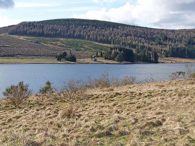
Correffie Plantation is a sprawling woodland located in the Angus region of Scotland. Situated in the heart of the countryside, it covers an expansive area of land and is renowned for its natural beauty and diverse ecosystem. The plantation, also known as Correffie Wood or Correffie Forest, is a popular destination for nature enthusiasts and outdoor enthusiasts alike.

The woodland consists primarily of native tree species, including oak, birch, and pine. These trees create a dense canopy that provides shelter for a wide range of wildlife, including various bird species, deer, and small mammals. The plantation is also home to a number of rare and protected species, making it an important conservation area.

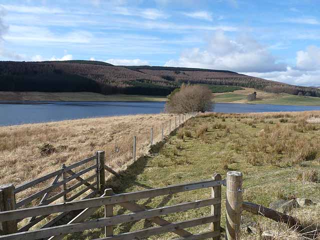
Visitors to Correffie Plantation can enjoy a variety of recreational activities. There are numerous walking trails that wind through the woodland, offering stunning views of the surrounding landscape. These trails cater to all levels of fitness and are a great opportunity to explore the diverse flora and fauna of the area.

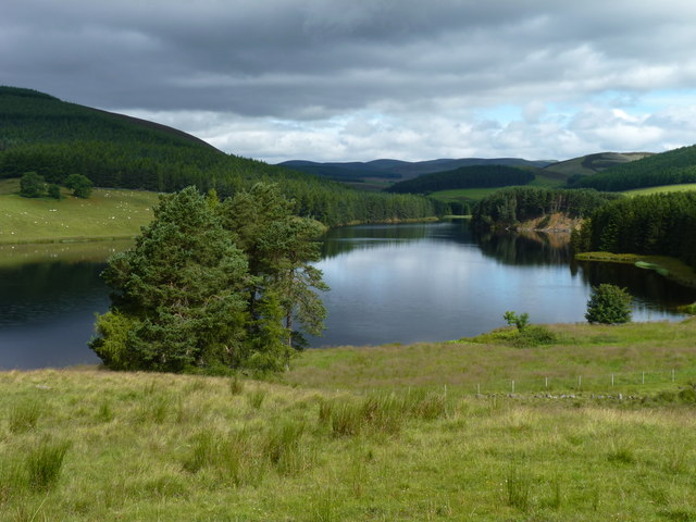
Additionally, Correffie Plantation is a popular spot for birdwatching, with many species of birds making their home in the trees. The peaceful atmosphere and pristine surroundings make it an ideal location for nature photography and picnics.

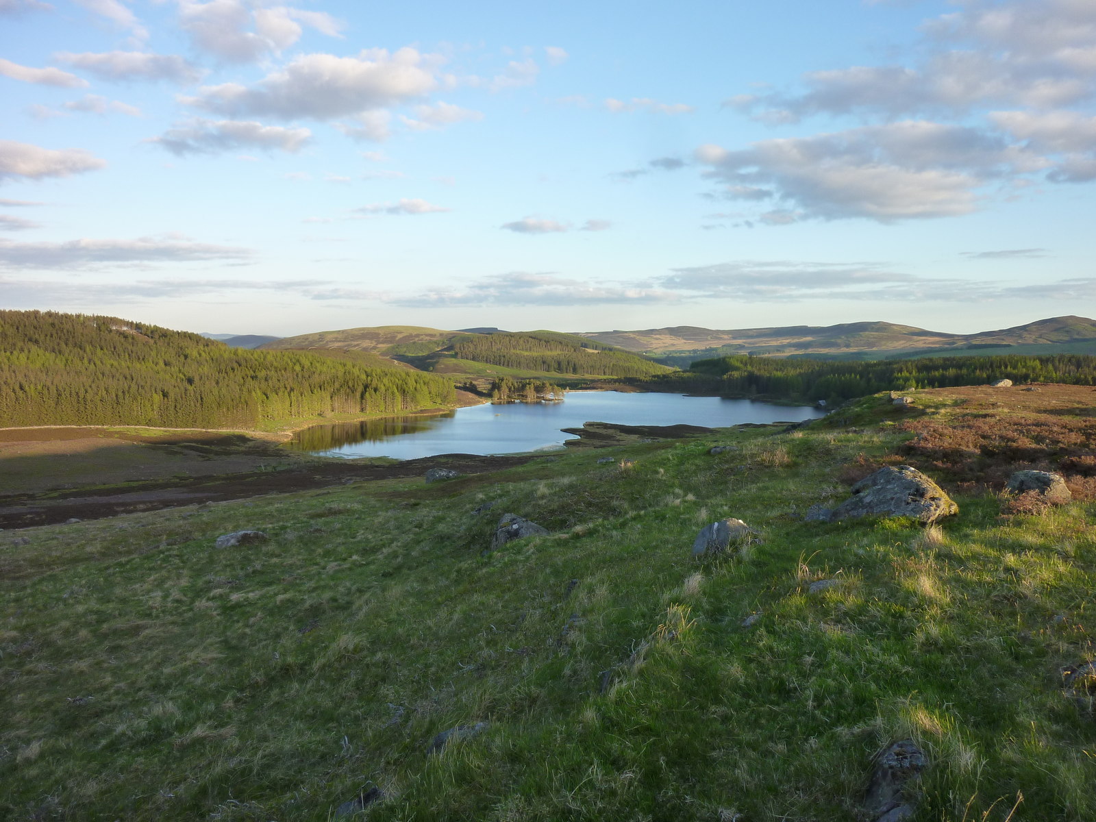
Overall, Correffie Plantation is a natural paradise that offers a unique and enriching experience for visitors. Its stunning woodland, diverse wildlife, and recreational activities make it a must-visit destination for anyone seeking to immerse themselves in the beauty of the Scottish countryside.

If you have any feedback on the listing, please let us know in the comments section below.

Correffie Plantation Images

Images are sourced within 2km of 56.74582/-3.2318854 or Grid Reference NO2462. Thanks to Geograph Open Source API. All images are credited.

Last gate before the bend For several kilometres, the western shore of Backwater Reservoir is pretty much straight. Here the reservoir makes a turn to the east. A sheep field sits on the peninsula. The path meanders through the field and then disappears into the woods. This is the last gate before the turn.
Last gate before the bend
For several kilometres, the western shore of Backwater Reservoir is pretty much straight. Here the reservoir makes a turn to the east. A sheep field sits on the peninsula. The path meanders through the field and then disappears into the woods. This is the last gate before the turn.
Glendamff Farm
Glendamff Farm
Looking south down the Blackwater reservoir
The house is gone On a gloomy Saturday evening I found out that the colourful wooden shack that has been here until recently is gone, RIP. <a href="https://www.geograph.org.uk/photo/6295939">NO2560 : Western shore of Backwater Reservoir</a>
The house is gone
On a gloomy Saturday evening I found out that the colourful wooden shack that has been here until recently is gone, RIP. NO2560 : Western shore of Backwater Reservoir
Footpath around Hare Cairn The footpath is slightly higher than shown on the OS maps. It is currently a viable footpath.
Footpath around Hare Cairn
The footpath is slightly higher than shown on the OS maps. It is currently a viable footpath.
Path to north ridge of Hare Cairn The path shown on the OS map is just discernible and slightly better than just walking over rough ground.
Path to north ridge of Hare Cairn
The path shown on the OS map is just discernible and slightly better than just walking over rough ground.
Looking across the Backwater Reservoir The Backwater Reservoir supplies Dundee, and was opened by the Queen in 1969.
Looking across the Backwater Reservoir
The Backwater Reservoir supplies Dundee, and was opened by the Queen in 1969.
Backwater Reservoir The Backwater Reservoir supplies Dundee, and was opened by the Queen in 1969.
Backwater Reservoir
The Backwater Reservoir supplies Dundee, and was opened by the Queen in 1969.
Top carpark and picnic area, Backwater Reservoir The Backwater Reservoir supplies Dundee, and was opened by the Queen in 1969. Redundant metal noticeboards have been bolted to the table tops as a base for portable barbecues.
Top carpark and picnic area, Backwater Reservoir
The Backwater Reservoir supplies Dundee, and was opened by the Queen in 1969. Redundant metal noticeboards have been bolted to the table tops as a base for portable barbecues.
North end of the reservoir Although it didn't exist until the late 1960s, the Backwater reservoir has blended well into the countryside around it.
North end of the reservoir
Although it didn't exist until the late 1960s, the Backwater reservoir has blended well into the countryside around it.
Glenhead farm With forested Cuilt Hill rising behind it.
Glenhead farm
With forested Cuilt Hill rising behind it.
Glenhead farm road The cottage is just inside the neighbouring NO2562 square.
Glenhead farm road
The cottage is just inside the neighbouring NO2562 square.
Soggy field The sheep are keeping their feet dry by staying away from the softest spot.
Soggy field
The sheep are keeping their feet dry by staying away from the softest spot.
Milldewan plantation East of Glenhead Farm.
Milldewan plantation
East of Glenhead Farm.
Valley of Hole Burn from Glenhead Farm
Glenhead Farm Above Backwater Reservoir, and with its distinctive kiwi-roofed barn.
Glenhead Farm
Above Backwater Reservoir, and with its distinctive kiwi-roofed barn.
Hole Burn at Glenhead Farm Just before it flows into Backwater Reservoir.
Hole Burn at Glenhead Farm
Just before it flows into Backwater Reservoir.
Sheep near Backwater Reservoir
Show me another place!

Correffie Plantation is located at Grid Ref: NO2462 (Lat: 56.74582, Lng: -3.2318854)

Unitary Authority: Angus

Police Authority: Tayside

What 3 Words

///regarding.dilute.suckle. Near Alyth, Perth & Kinross

Related Wikis

Knockshannoch Lodge

Knockshannoch Lodge is a Category B listed building in the Scottish village of Glenisla, Angus, built around 1888. It is a small, single-storey cottage...

Backwater Reservoir

Backwater Reservoir is a reservoir in north west Angus, Scotland. The reservoir's sole purpose is to provide drinking water, and as such, it supplies Angus...

Kirkton of Glenisla

Kirkton of Glenisla consists of a church and graveyard, a hotel, hall and several homes forming the largest concentration of habitation in Glenisla, Angus...

Balintore, Angus

Balintore (Scottish Gaelic: Baile an Todhair) is a village in Angus, Scotland. It lies in Glen Isla, four miles north of the Loch of Lintrathen and seven...

Brewlands Bridge

Brewlands Bridge is a hamlet in Glen Isla, Angus, Scotland. It is lies situated on the River Isla, eleven miles north-west of Kirriemuir and ten miles...

Balintore Castle

Balintore Castle is a Victorian Category A listed building in Scotland. The castle occupies an elevated site in moorland above Balintore village, a few...

Auchinleish

Auchinleish is a village in Angus, Scotland. == References ==

Auchintaple Loch

Auchintaple Loch also known as Auchenchapel Loch, is a small shallow freshwater loch that is located in Glen Isla in Angus, Scotland. == See also == List...

Nearby Amenities

Located within 500m of 56.74582,-3.2318854
Hare Cairn
Corbett: no
Ele: 516
Graham: no
Marilyn: yes
Munro: no
Natural: peak
Prominence: 180
Lat/Long: 56.7463689/-3.2400061
Correffie Plantation
Place: locality
Lat/Long: 56.7428512/-3.2363255
The data included in this document is from www.openstreetmap.org. The data is made available under ODbL.

Have you been to Correffie Plantation?

Leave your review of Correffie Plantation below (or comments, questions and feedback).