Gill Wood

Wood, Forest in Peeblesshire

Scotland

Gill Wood

St Mary's Loch Looking across to Cappercleuch.
St Mary's Loch Credit: Gordon Brown

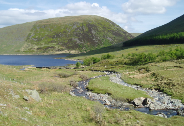
Gill Wood is a picturesque forest located in Peeblesshire, Scotland. This enchanting woodland covers an area of approximately 50 hectares, offering visitors a serene and tranquil escape from the hustle and bustle of everyday life. The forest is situated near the town of Peebles, just a short drive from the Scottish Borders.

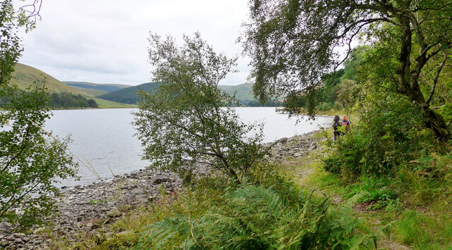
Gill Wood is renowned for its diverse range of flora and fauna, making it a haven for nature enthusiasts and wildlife lovers. The woodland is predominantly composed of native tree species, including oak, birch, and ash, creating a rich and vibrant canopy overhead. The forest floor is adorned with an array of wildflowers, ferns, and mosses, providing a stunning display of colors throughout the seasons.

Visitors to Gill Wood can explore a network of well-maintained trails, allowing them to immerse themselves in the beauty of nature. The trails cater to varying levels of difficulty, making the forest accessible to all ages and fitness levels. Along these paths, visitors may encounter a variety of bird species, such as woodpeckers and owls, as well as small mammals like red squirrels and badgers.

The forest also offers recreational activities such as picnicking, birdwatching, and photography. There are designated picnic areas with benches and tables, providing a perfect spot to enjoy a packed lunch amidst the peaceful surroundings. Additionally, the forest's diverse bird population makes it a prime location for birdwatching enthusiasts, who can spot and document various species throughout the year.

In summary, Gill Wood is a captivating forest in Peeblesshire, Scotland, offering a serene and diverse natural environment for visitors to explore and enjoy. Whether it's a leisurely stroll, a picnic with loved ones, or an opportunity to observe wildlife, Gill Wood provides an idyllic setting for a day immersed in nature.

If you have any feedback on the listing, please let us know in the comments section below.

Gill Wood Images

Images are sourced within 2km of 55.496428/-3.2044863 or Grid Reference NT2423. Thanks to Geograph Open Source API. All images are credited.

St Mary's Loch Looking across to Cappercleuch.
St Mary's Loch
Looking across to Cappercleuch.
Looking over St Mary's Loch to Rodono House
Sculpture by St Mary's Loch This is part of Matt Baker's sculpture "Shinglehook".  This is one of the original oak anchors
Sculpture by St Mary's Loch
This is part of Matt Baker's sculpture "Shinglehook". This is one of the original oak anchors
Entering the forest By St Mary's Loch.
Entering the forest
By St Mary's Loch.
Footbridge approaching Bowerhope On "The Ring of the Loch" walk round St Mary's Loch.
Footbridge approaching Bowerhope
On "The Ring of the Loch" walk round St Mary's Loch.
On the Ring of the Loch walk around St Mary's Loch
The Kirkyard of St Mary's of the Lowes A calm and evocative place.
The Kirkyard of St Mary's of the Lowes
A calm and evocative place.
On the Ring of the Loch walk around St Mary's Loch
War memorial at the road junction The minor road up to the Megget Reservoir and Talla meets the A708 here.
War memorial at the road junction
The minor road up to the Megget Reservoir and Talla meets the A708 here.
The A708 crosses the Megget Water St Mary's Loch is just visible in the distance.
The A708 crosses the Megget Water
St Mary's Loch is just visible in the distance.
On the Ring of the Loch walk around St Mary's Loch At this point there is just room for a path between the A708 and St Mary's Loch itself.
On the Ring of the Loch walk around St Mary's Loch
At this point there is just room for a path between the A708 and St Mary's Loch itself.
On the Ring of the Loch walk around St Mary's Loch At this point the path follows the shore of the loch closely.  If the water level is high walking on the road would be required.  After the period of drought just experienced, this is not a problem here.
On the Ring of the Loch walk around St Mary's Loch
At this point the path follows the shore of the loch closely. If the water level is high walking on the road would be required. After the period of drought just experienced, this is not a problem here.
Large boathouse by St Mary's Loch
St. Mary's Loch from Bowerhope This image has been captured from the Ring of the Loch walking trail.
St. Mary's Loch from Bowerhope
This image has been captured from the Ring of the Loch walking trail.
A signpost at Henderland This lichen-covered signpost giving directions to Cockburn’s Grave at Chapelhope is on the north side of the road at Henderland. For more information on Cockburn’s Tomb, see <a href="https://www.geograph.org.uk/photo/1257004">NT2323 : An information plaque at Cockburn's Tomb</a> and <a href="https://www.geograph.org.uk/photo/6429365">NT2323 : Cockburn's Tombe on Chapel Knowe</a>.
A signpost at Henderland
This lichen-covered signpost giving directions to Cockburn’s Grave at Chapelhope is on the north side of the road at Henderland. For more information on Cockburn’s Tomb, see NT2323 : An information plaque at Cockburn's Tomb and NT2323 : Cockburn's Tombe on Chapel Knowe.
St Mary’s Loch This was taken on a day of changeable weather in early February. Capper Law is the hill in the background. St Mary’s Loch, at 3 miles long and with a maximum depth of 46m, is the largest natural loch in the Scottish Borders.
St Mary’s Loch
This was taken on a day of changeable weather in early February. Capper Law is the hill in the background. St Mary’s Loch, at 3 miles long and with a maximum depth of 46m, is the largest natural loch in the Scottish Borders.
Forestry clear fell at Bowerhope Law
Calm conditions on St Mary’s Loch Rodono House is in the central background. This former hotel was originally built as a shooting lodge in 1866. St Mary’s Angling Club boathouse is on the far right.
Calm conditions on St Mary’s Loch
Rodono House is in the central background. This former hotel was originally built as a shooting lodge in 1866. St Mary’s Angling Club boathouse is on the far right.
Show me another place!

Gill Wood is located at Grid Ref: NT2423 (Lat: 55.496428, Lng: -3.2044863)

Unitary Authority: The Scottish Borders

Police Authority: The Lothians and Scottish Borders

What 3 Words

///snowstorm.folk.bluffs. Near Ettrick, Scottish Borders

Related Wikis

Cappercleuch

Cappercleuch is a settlement on the A708, at St. Mary's Loch in the Scottish Borders area of Scotland, in the historic county of Selkirkshire. Places nearby...

Megget Water

Megget Water is a river in the parish of Yarrow, Selkirkshire in the Scottish Borders area of Scotland. The Water rises at Broad Law (2,760 ft), passes...
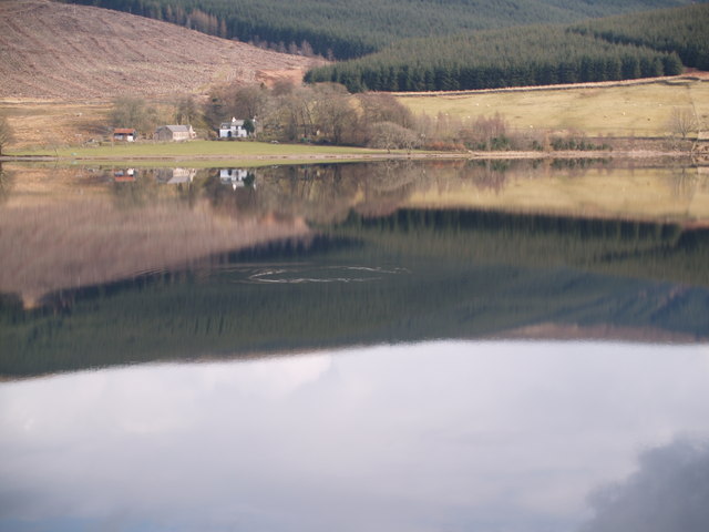
St Mary's Loch

St Mary's Loch is the largest natural loch in the Scottish Borders, and is situated on the south side of the A708 road between Selkirk and Moffat, about...

Bowerhope

Bowerhope is a village off the A708, in the Scottish Borders area of Scotland, on the banks of St Mary's Loch in Ettrick Forest. == See also == List of...

Dryhope

Dryhope is a village in the Scottish Borders area of Scotland, by St. Mary's Loch, on the A708. Known for its rolling green hills and ample walking paths...
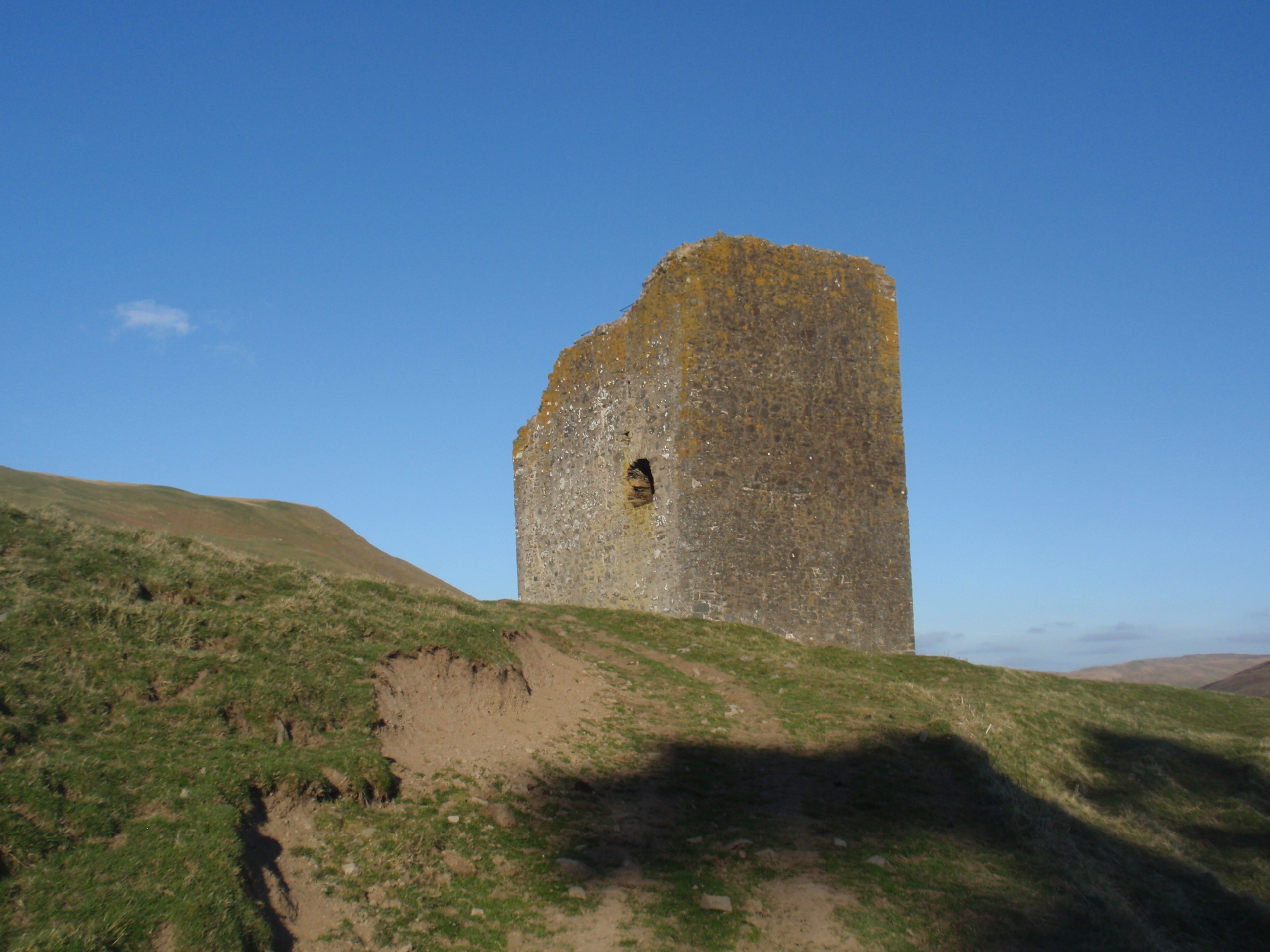
Dryhope Tower

Dryhope Tower is a ruined Scottish peel tower in the valley of the Yarrow Water, in the historic county of Selkirkshire, now part of the Scottish Borders...

Craigierig

Craigierig is a village on the Megget Reservoir, in the Scottish Borders area of Scotland, in the former Selkirkshire. Places nearby include the Glengaber...
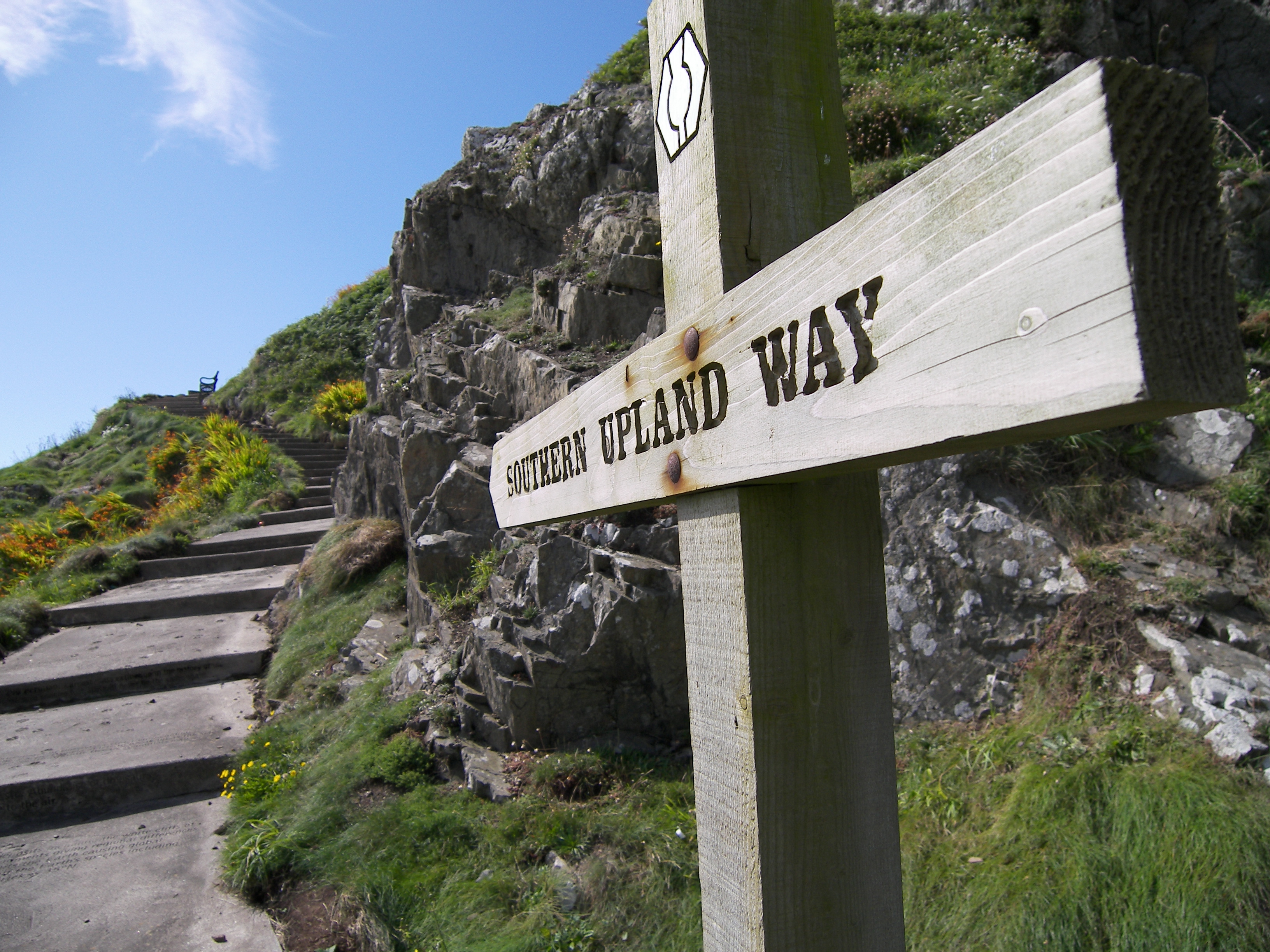
Southern Upland Way

The Southern Upland Way is a 344-kilometre (214 mi) coast-to-coast long-distance footpath in southern Scotland. The route links Portpatrick in the west...

Nearby Amenities

Located within 500m of 55.496428,-3.2044863
Cappercleuch
Place: hamlet
Wikidata: Q5036153
Wikipedia: en:Cappercleuch
Lat/Long: 55.4961596/-3.2010444
War Memorial
Historic: memorial
Wikidata: Q114168148
Lat/Long: 55.4956558/-3.2033535
Disused Amenity: post_box
Note: The owner of the White House messaged that the box is sealed and painted black
Operator: Royal Mail
Post Box Type: wall
Ref: TD7 95
Royal Cypher: GR
Lat/Long: 55.4958665/-3.1985996
Colour: black and yellow
Disused Emergency: telephone
Heritage: yes
Heritage Operator: Historic Environment Scotland
Heritage Website: https://portal.historicenvironment.scot/designation/LB49228
Listed Status: Category B
Man Made: telephone_box
Operator: AA
Ref: 723
Ref GB Hs: LB49228
Wikidata: Q17850182
Lat/Long: 55.4957489/-3.2039443
Parking
Parking: layby
Lat/Long: 55.4956125/-3.2014892
Parking
Parking: layby
Lat/Long: 55.4954666/-3.2005397
Power: pole
Lat/Long: 55.4924945/-3.2010924
Power: pole
Lat/Long: 55.4931104/-3.2009845
Power: pole
Lat/Long: 55.4937216/-3.2008893
Power: pole
Lat/Long: 55.4943291/-3.2007984
Power: pole
Lat/Long: 55.4949678/-3.200682
Power: pole
Lat/Long: 55.4957982/-3.2005382
Power: pole
Lat/Long: 55.4964968/-3.2004049
Power: pole
Lat/Long: 55.4958581/-3.205835
Power: pole
Lat/Long: 55.4959024/-3.2049338
Power: pole
Lat/Long: 55.4959492/-3.2038296
Power: pole
Lat/Long: 55.4960606/-3.2018179
Power: pole
Lat/Long: 55.4962727/-3.2011495
Power: pole
Lat/Long: 55.4964572/-3.1991294
Power: pole
Lat/Long: 55.4963877/-3.1969231
Power: pole
Lat/Long: 55.4964141/-3.1978792
Power: pole
Lat/Long: 55.4961505/-3.2069624
Power: pole
Lat/Long: 55.4964429/-3.2081533
Power: pole
Lat/Long: 55.4965878/-3.2092385
Power: pole
Lat/Long: 55.4967388/-3.2103279
Power: pole
Lat/Long: 55.4968766/-3.2113581
Power: pole
Lat/Long: 55.4970048/-3.2122994
Post Box
Operator: Royal Mail
Post Box Mounting: pier
Post Box Type: lamp
Ref: TD7 95
Royal Cypher: scottish_crown
Lat/Long: 55.4957405/-3.2039195
The data included in this document is from www.openstreetmap.org. The data is made available under ODbL.

Have you been to Gill Wood?

Leave your review of Gill Wood below (or comments, questions and feedback).