Bog Wood

Wood, Forest in Midlothian

Scotland

Bog Wood

River North Esk at Valleyfield, Penicuik Looking upstream where the river bends on its way alongside the housing development at Valleyfield, a former mill site.
River North Esk at Valleyfield, Penicuik Credit: Jim Barton

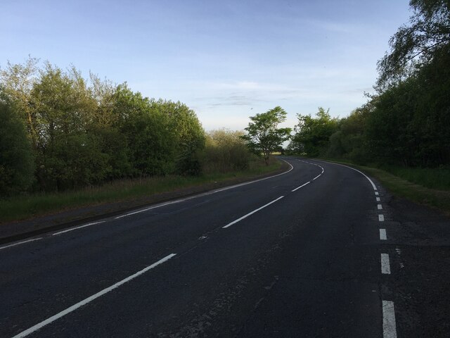
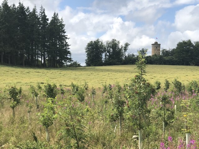
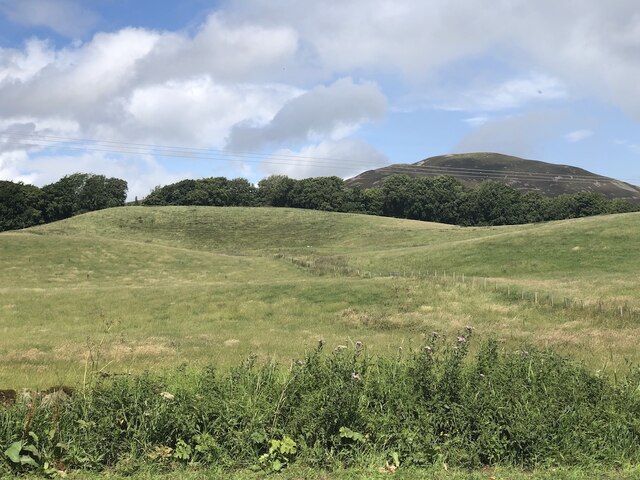
Bog Wood, located in Midlothian, Scotland, is a picturesque woodland area renowned for its unique landscape and diverse ecosystem. Stretching across a vast expanse, this ancient forest is a hidden gem, tucked away from the hustle and bustle of urban life.

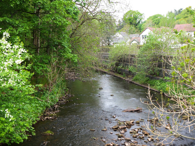
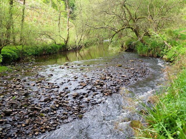
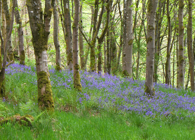
The wood derives its name from the presence of boggy areas within its boundaries, which lend a distinct character to the landscape. These wetlands are created by the accumulation of waterlogged peat, forming a habitat for various flora and fauna. The boggy environment is home to a variety of plant species, including sphagnum moss, cotton grass, and heather. These plants thrive in the nutrient-rich peat, creating a carpet of vibrant colors that change with the seasons.

The woodland itself boasts a diverse range of tree species, including oak, birch, and pine. These trees provide a natural canopy that shelters an array of wildlife, such as red squirrels, deer, and a wide variety of bird species. Visitors to Bog Wood can often catch a glimpse of these creatures as they go about their daily activities.

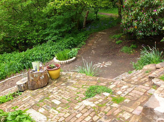
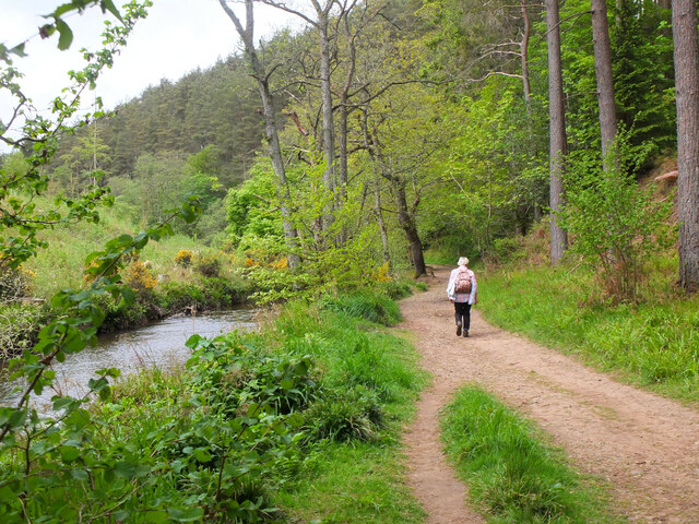
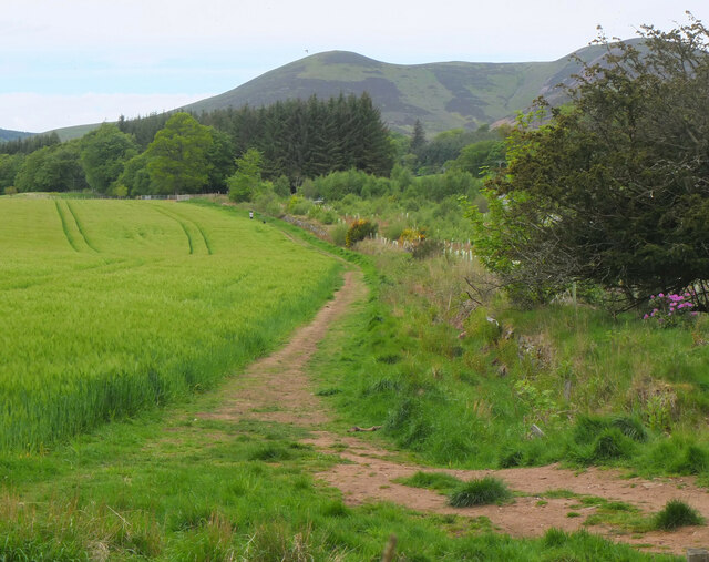
The wood offers numerous walking trails and pathways, allowing visitors to immerse themselves in the tranquility of nature. The peaceful atmosphere and stunning views make Bog Wood a popular destination for nature enthusiasts, hikers, and photographers. The wood also serves as an educational resource, with interpretive signs and guided tours available to help visitors learn about the unique ecosystem and the importance of conservation efforts.

In conclusion, Bog Wood in Midlothian is a natural haven, offering a glimpse into Scotland's rich biodiversity. With its boggy landscapes, diverse flora and fauna, and peaceful ambiance, it provides a perfect retreat for those seeking solace in nature.

If you have any feedback on the listing, please let us know in the comments section below.

Bog Wood Images

Images are sourced within 2km of 55.826907/-3.233071 or Grid Reference NT2259. Thanks to Geograph Open Source API. All images are credited.

River North Esk at Valleyfield, Penicuik Looking upstream where the river bends on its way alongside the housing development at Valleyfield, a former mill site.
River North Esk at Valleyfield, Penicuik
Looking upstream where the river bends on its way alongside the housing development at Valleyfield, a former mill site.
Decorated space, path to Penicuik Estate Brick steps and plant pots on the path by the North Esk from the A701 to Penicuik Estate grounds.
Decorated space, path to Penicuik Estate
Brick steps and plant pots on the path by the North Esk from the A701 to Penicuik Estate grounds.
Path by the North Esk, Penicuik A path on the north side of the river to the surroundings of Penicuik House.
Path by the North Esk, Penicuik
A path on the north side of the river to the surroundings of Penicuik House.
River North Esk near Penicuik The North Esk rises in the Pentland Hills above Carlops. It joins the South Esk, which starts life in the Lammermuir Hills, at Dalkeith.
River North Esk near Penicuik
The North Esk rises in the Pentland Hills above Carlops. It joins the South Esk, which starts life in the Lammermuir Hills, at Dalkeith.
Bluebells in Serpentine Wood, Penicuik
Farmland on Penicuik Estate South Black Hill is in the background.
Farmland on Penicuik Estate
South Black Hill is in the background.
Spear Gate Lodge, Penicuik Estate A lodge house where one of the estate access roads meets the A766.
Spear Gate Lodge, Penicuik Estate
A lodge house where one of the estate access roads meets the A766.
Shopfront refurbishment, Penicuik High Street The Penicuik Storehouse undergoing renovation as part of a programme to improve the appearance of shops in the town.
Shopfront refurbishment, Penicuik High Street
The Penicuik Storehouse undergoing renovation as part of a programme to improve the appearance of shops in the town.
Vaucluse Place, Penicuik A block of flats in Jackson Street.
Vaucluse Place, Penicuik
A block of flats in Jackson Street.
A701 south of Penicuik
Field, Penicuik Estate The roadside conifers are long gone allowing a view of the folly.
Field, Penicuik Estate
The roadside conifers are long gone allowing a view of the folly.
Hummocky ground near Penicuik Glacial deposition beside the Pentland Hills.
Hummocky ground near Penicuik
Glacial deposition beside the Pentland Hills.
Pen-y-Coe Press, Penicuik A long-established stationery and printing shop with an adjoining museum of papermaking in Bridge Street. In the early 19th century Penicuik became an important centre for papermaking, with mills along the River North Esk.
Pen-y-Coe Press, Penicuik
A long-established stationery and printing shop with an adjoining museum of papermaking in Bridge Street. In the early 19th century Penicuik became an important centre for papermaking, with mills along the River North Esk.
Parkend, Penicuik A striking corner terrace by the architect Thomas Pilkington c. 1860. He also designed the nearby Penicuik South Kirk and terraced cottages in the mill village of Walkerburn - see <a href="https://www.geograph.org.uk/photo/2231809">NT3537 : Millworkers' cottages, Walkerburn</a>.
Parkend, Penicuik
A striking corner terrace by the architect Thomas Pilkington c. 1860. He also designed the nearby Penicuik South Kirk and terraced cottages in the mill village of Walkerburn - see NT3537 : Millworkers' cottages, Walkerburn.
Demolition and rebuilding, Penicuik Old premises on Bridge Street are being demolished and construction appears to be the next step. The flag is flying from the Belgian Consulate on the corner with West Street - see also <a href="https://www.geograph.org.uk/photo/3332421">NT2359 : Belgian Consulate, Penicuik</a>.
Demolition and rebuilding, Penicuik
Old premises on Bridge Street are being demolished and construction appears to be the next step. The flag is flying from the Belgian Consulate on the corner with West Street - see also NT2359 : Belgian Consulate, Penicuik.
Papermaking Museum, Penicuik The museum is next door to the Pen-y-Coe Press on Bridge Street.  It is currently open on Saturday afternoons or at other times by arrangement for groups and entry is free. See the museum's website at <span class="nowrap"><a title="https://penicuikcdt.co.uk/index.php/penicuik-papermaking-heritage-museum/" rel="nofollow ugc noopener" href="https://penicuikcdt.co.uk/index.php/penicuik-papermaking-heritage-museum/">Link</a><img style="margin-left:2px;" alt="External link" title="External link - shift click to open in new window" src="https://s1.geograph.org.uk/img/external.png" width="10" height="10"/></span>.
Papermaking Museum, Penicuik
The museum is next door to the Pen-y-Coe Press on Bridge Street. It is currently open on Saturday afternoons or at other times by arrangement for groups and entry is free. See the museum's website at LinkExternal link.
Making paper by hand (1) Visitors to the Papermaking Museum at Penicuik have a chance to help make a sheet of paper. Pulp is caught on a rectangular mesh and carefully removed and transferred to the screw press to squeeze out the excess water.
Making paper by hand (1)
Visitors to the Papermaking Museum at Penicuik have a chance to help make a sheet of paper. Pulp is caught on a rectangular mesh and carefully removed and transferred to the screw press to squeeze out the excess water.
Making paper by hand (2) The process of making a sheet of paper from pulp being demonstrated at the Papermaking Museum, Penicuik. The sheet is being separated from its carrying cloth and is ready for drying.
Making paper by hand (2)
The process of making a sheet of paper from pulp being demonstrated at the Papermaking Museum, Penicuik. The sheet is being separated from its carrying cloth and is ready for drying.
Show me another place!

Bog Wood is located at Grid Ref: NT2259 (Lat: 55.826907, Lng: -3.233071)

Unitary Authority: Midlothian

Police Authority: The Lothians and Scottish Borders

What 3 Words

///allergy.elephant.saved. Near Penicuik, Midlothian

Related Wikis

Penicuik Athletic F.C.

Penicuik Athletic Football Club are a Scottish football club. They were formed in 1888 and are based at Montgomery Park (formerly known as Penicuik Park...

Penicuik Town Hall

Penicuik Town Hall, formerly the Cowan Institute, is a municipal building in the High Street, Penicuik, Midlothian, Scotland. The structure, which was...

Penicuik

Penicuik ( PEN-i-kuuk; Scots: Penicuik; Scottish Gaelic: Peighinn na Cuthaig) is a town and former burgh in Midlothian, Scotland, lying on the west bank...

Penicuik railway station

Penicuik railway station served the town of Penicuik, Midlothian, Scotland from 1872 to 1951 on the Penicuik Railway. == History == The station opened...

Nearby Amenities

Located within 500m of 55.826907,-3.233071
Give Way
Direction: backward
Lat/Long: 55.8291635/-3.2306813
Traffic Calming: hump
Lat/Long: 55.8277771/-3.2267405
Give Way
Lat/Long: 55.825951/-3.2264016
Give Way
Lat/Long: 55.8253509/-3.2255797
Kindergarten
The Penicuik Nursery
Lat/Long: 55.8311344/-3.2354665
Bus Stop
Clerk Road
Bus: yes
Naptan AdministrativeAreaCode: 130
Naptan Area Name: Midlothian
Naptan AtcoAreaCode: 628
Naptan AtcoCode: 6280302435
Naptan Bearing: E
Naptan CommonName: Clerk Road
Naptan Indicator: at
Naptan Landmark: -
Naptan LocalityName: Deanburn
Naptan NaptanCode: 64324276
Naptan NptgLocalityCode: N0071917
Naptan SourceLocalityType: Add
Naptan StopAreaCode: 628G302435
Naptan StopAreaType: GPBS
Naptan StopArea Name: Clerk Road
Naptan Street: Rullion Road
Naptan Verified: yes
Public Transport: platform
Shelter: yes
Source: NaPTAN + Survey
Lat/Long: 55.8288727/-3.237373
Bus Stop
Clerk Road
Bus: yes
Naptan AdministrativeAreaCode: 130
Naptan Area Name: Midlothian
Naptan AtcoAreaCode: 628
Naptan AtcoCode: 6280325230
Naptan Bearing: W
Naptan CommonName: Clerk Road
Naptan Indicator: opp
Naptan Landmark: -
Naptan LocalityName: Deanburn
Naptan NaptanCode: 64324275
Naptan NptgLocalityCode: N0071917
Naptan SourceLocalityType: Add
Naptan StopAreaCode: 628G302435
Naptan StopAreaType: GPBS
Naptan StopArea Name: Clerk Road
Naptan Street: Rullion Road
Naptan Verified: yes
Public Transport: platform
Source: NaPTAN + Survey
Lat/Long: 55.8287461/-3.2375409
Broomhill
Place: suburb
Lat/Long: 55.8275485/-3.2260438
Post Box
Collection Times: Mo-Fr 09:00; Sa 07:00
Operator: Royal Mail
Post Box Type: lamp
Ref: EH26 140D
Royal Cypher: scottish_crown
Lat/Long: 55.82896/-3.2327094
The Penicuik Centre
Leisure: sports_centre
Sport: swimming
Lat/Long: 55.8308746/-3.2300384
Parking
Lat/Long: 55.8279845/-3.2290812
Bus Stop
Ravendean Gardens
Bus: yes
Naptan AdministrativeAreaCode: 130
Naptan Area Name: Midlothian
Naptan AtcoAreaCode: 628
Naptan AtcoCode: 6280325235
Naptan Bearing: NW
Naptan CommonName: Ravendean Gardens
Naptan Indicator: opp
Naptan Landmark: -
Naptan LocalityName: Deanburn
Naptan NaptanCode: 64324364
Naptan NptgLocalityCode: N0071917
Naptan SourceLocalityType: Add
Naptan StopAreaCode: 628G302430
Naptan StopAreaType: GPBS
Naptan StopArea Name: Ravendean Gardens
Naptan Street: Rullion Road
Naptan Verified: yes
Public Transport: platform
Source: NaPTAN + Survey
Lat/Long: 55.8290972/-3.2395558
Crossing
Bicycle: yes
Button Operated: yes
Crossing: traffic_signals
Crossing Island: no
Crossing Ref: toucan
Kerb: lowered
Tactile Paving: yes
Lat/Long: 55.830425/-3.2285082
Crossing
Crossing: zebra
Lat/Long: 55.830384/-3.2287692
Entrance: yes
Lat/Long: 55.8308461/-3.2296866
Access: private
Barrier: bollard
Lat/Long: 55.8304819/-3.2286068
Cornbank
Place: suburb
Lat/Long: 55.8298147/-3.2315862
Barrier: stile
Foot: yes
Material: wood
Stile: stepover
Lat/Long: 55.8229582/-3.2293266
Stop
Direction: backward
Stop: minor
Lat/Long: 55.8275969/-3.2266272
Stop
Direction: backward
Stop: minor
Lat/Long: 55.8276525/-3.2264829
Give Way
Direction: forward
Lat/Long: 55.8281519/-3.2254418
Description: Mobile phone mast
Man Made: tower
Tower Type: communication
Lat/Long: 55.8241384/-3.2300134
Barrier: stile
Foot: yes
Material: wood
Stile: stepover
Lat/Long: 55.8247464/-3.2291067
Barrier: kissing_gate
Lat/Long: 55.8280422/-3.236416
Turning Circle
Lat/Long: 55.8290085/-3.233863
Bus Stop
Craigiebield Crescent
Bus: yes
Naptan AdministrativeAreaCode: 130
Naptan Area Name: Midlothian
Naptan AtcoAreaCode: 628
Naptan AtcoCode: 6280302610
Naptan Bearing: NW
Naptan CommonName: Craigiebield Crescent
Naptan Indicator: at
Naptan Landmark: -
Naptan LocalityName: Penicuik
Naptan NaptanCode: 64324278
Naptan NptgLocalityCode: ES002994
Naptan SourceLocalityType: Lo
Naptan StopAreaCode: 628G302610
Naptan StopAreaType: GPBS
Naptan StopArea Name: Craigiebield Crescent
Naptan Street: Bog Road
Naptan Verified: yes
Public Transport: platform
Source: NaPTAN + Survey
Lat/Long: 55.8273143/-3.2262939
Bus Stop
Craigiebield Crescent
Bus: yes
Naptan AdministrativeAreaCode: 130
Naptan Area Name: Midlothian
Naptan AtcoAreaCode: 628
Naptan AtcoCode: 6280325060
Naptan Bearing: SE
Naptan CommonName: Craigiebield Crescent
Naptan Indicator: opp
Naptan Landmark: -
Naptan LocalityName: Penicuik
Naptan NaptanCode: 64324279
Naptan NptgLocalityCode: ES002994
Naptan SourceLocalityType: Lo
Naptan StopAreaCode: 628G302610
Naptan StopAreaType: GPBS
Naptan StopArea Name: Craigiebield Crescent
Naptan Street: Bog Road
Naptan Verified: yes
Public Transport: platform
Source: NaPTAN + Survey
Lat/Long: 55.8279847/-3.2269228
Bus Stop
Harlaw Grove
Bus: yes
Naptan AdministrativeAreaCode: 130
Naptan Area Name: Midlothian
Naptan AtcoAreaCode: 628
Naptan AtcoCode: 6280302436
Naptan Bearing: NE
Naptan CommonName: Harlaw Grove
Naptan Indicator: at
Naptan Landmark: -
Naptan LocalityName: Penicuik
Naptan NaptanCode: 64324643
Naptan NptgLocalityCode: ES002994
Naptan SourceLocalityType: Lo
Naptan StopAreaCode: 628G325220
Naptan StopAreaType: GPBS
Naptan StopArea Name: Penicuik Carlops Road
Naptan Street: Carlops Road
Naptan Verified: yes
Public Transport: platform
Shelter: yes
Source: NaPTAN + Survey
Lat/Long: 55.8288573/-3.2321734
Bus Stop
Harlaw Grove
Bench: no
Bin: no
Bus: yes
Naptan AdministrativeAreaCode: 130
Naptan Area Name: Midlothian
Naptan AtcoAreaCode: 628
Naptan AtcoCode: 6280325220
Naptan Bearing: SW
Naptan CommonName: Harlaw Grove
Naptan Indicator: opp
Naptan Landmark: Rullion Road
Naptan LocalityName: Penicuik
Naptan NaptanCode: 64324368
Naptan NptgLocalityCode: ES002994
Naptan SourceLocalityType: Lo
Naptan StopAreaCode: 628G325220
Naptan StopAreaType: GPBS
Naptan StopArea Name: Penicuik Carlops Road
Naptan Street: Carlops Road
Naptan Verified: yes
Passenger Information Display: no
Public Transport: platform
Shelter: no
Source: NaPTAN + Survey
Lat/Long: 55.8287719/-3.2318444
Traffic Calming: hump
Lat/Long: 55.8270372/-3.2258733
Traffic Calming: hump
Lat/Long: 55.8283383/-3.2278221
Give Way
Direction: backward
Lat/Long: 55.827119/-3.2277228
Give Way
Direction: backward
Lat/Long: 55.8271959/-3.2278293
Power: pole
Lat/Long: 55.8268855/-3.2410199
The data included in this document is from www.openstreetmap.org. The data is made available under ODbL.

Have you been to Bog Wood?

Leave your review of Bog Wood below (or comments, questions and feedback).