Serpentine Wood

Wood, Forest in Midlothian

Scotland

Serpentine Wood

River North Esk at Valleyfield, Penicuik Looking upstream where the river bends on its way alongside the housing development at Valleyfield, a former mill site.
River North Esk at Valleyfield, Penicuik Credit: Jim Barton

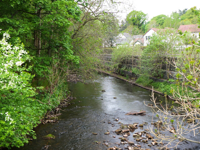
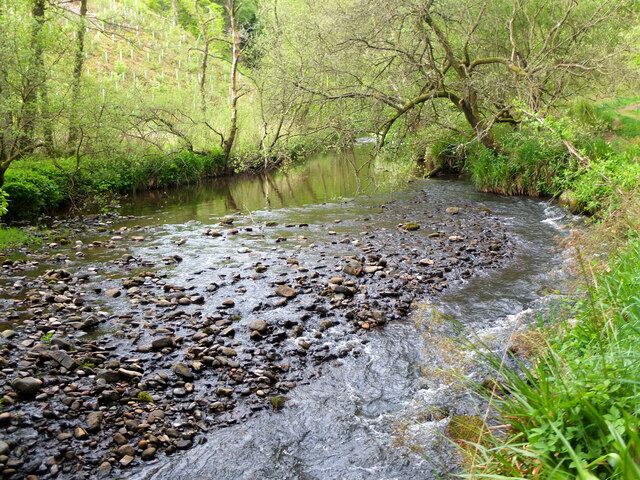
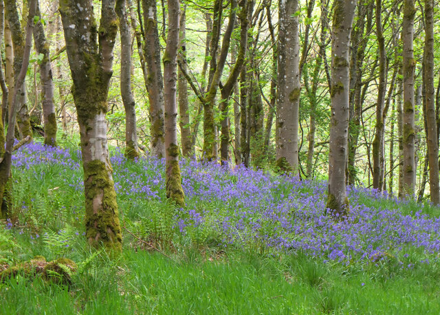
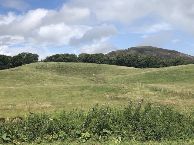
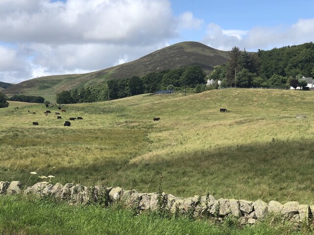
Serpentine Wood is a picturesque forest located in Midlothian, Scotland. Covering an area of approximately 100 acres, this wood is a popular destination for nature enthusiasts and outdoor adventurers alike. The forest is characterized by its dense population of serpentine trees, which give the wood its name.

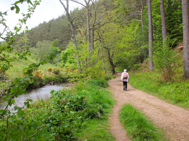
The serpentine trees, also known as oak serpents or twisted oaks, are a unique species that are native to this region. These trees have a distinctive twisted trunk and branches, creating a surreal and enchanting atmosphere within the wood. The wood is also home to a diverse range of flora and fauna, including various species of birds, insects, and small mammals.

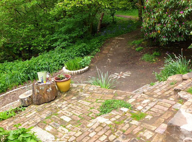
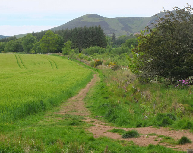
Visitors to Serpentine Wood can enjoy a variety of activities. There are several well-maintained trails that wind through the forest, offering a chance to explore the beauty of the wood on foot or by bicycle. The trails are suitable for all levels of fitness and provide opportunities for both leisurely walks and more challenging hikes.

The wood is also a popular spot for picnics and family outings, with designated areas equipped with picnic tables and benches. There is ample space for children to play and explore, making it an ideal destination for a day out in nature.

Overall, Serpentine Wood in Midlothian offers a serene and tranquil escape from the hustle and bustle of city life. Its unique serpentine trees, abundant wildlife, and well-maintained trails make it a must-visit destination for nature lovers in the area.

If you have any feedback on the listing, please let us know in the comments section below.

Serpentine Wood Images

Images are sourced within 2km of 55.82242/-3.233376 or Grid Reference NT2259. Thanks to Geograph Open Source API. All images are credited.

River North Esk at Valleyfield, Penicuik Looking upstream where the river bends on its way alongside the housing development at Valleyfield, a former mill site.
River North Esk at Valleyfield, Penicuik
Looking upstream where the river bends on its way alongside the housing development at Valleyfield, a former mill site.
Decorated space, path to Penicuik Estate Brick steps and plant pots on the path by the North Esk from the A701 to Penicuik Estate grounds.
Decorated space, path to Penicuik Estate
Brick steps and plant pots on the path by the North Esk from the A701 to Penicuik Estate grounds.
Path by the North Esk, Penicuik A path on the north side of the river to the surroundings of Penicuik House.
Path by the North Esk, Penicuik
A path on the north side of the river to the surroundings of Penicuik House.
River North Esk near Penicuik The North Esk rises in the Pentland Hills above Carlops. It joins the South Esk, which starts life in the Lammermuir Hills, at Dalkeith.
River North Esk near Penicuik
The North Esk rises in the Pentland Hills above Carlops. It joins the South Esk, which starts life in the Lammermuir Hills, at Dalkeith.
Bluebells in Serpentine Wood, Penicuik
Farmland on Penicuik Estate South Black Hill is in the background.
Farmland on Penicuik Estate
South Black Hill is in the background.
Spear Gate Lodge, Penicuik Estate A lodge house where one of the estate access roads meets the A766.
Spear Gate Lodge, Penicuik Estate
A lodge house where one of the estate access roads meets the A766.
Shopfront refurbishment, Penicuik High Street The Penicuik Storehouse undergoing renovation as part of a programme to improve the appearance of shops in the town.
Shopfront refurbishment, Penicuik High Street
The Penicuik Storehouse undergoing renovation as part of a programme to improve the appearance of shops in the town.
Vaucluse Place, Penicuik A block of flats in Jackson Street.
Vaucluse Place, Penicuik
A block of flats in Jackson Street.
A701 south of Penicuik
Field, Penicuik Estate The roadside conifers are long gone allowing a view of the folly.
Field, Penicuik Estate
The roadside conifers are long gone allowing a view of the folly.
Hummocky ground near Penicuik Glacial deposition beside the Pentland Hills.
Hummocky ground near Penicuik
Glacial deposition beside the Pentland Hills.
Pasture near Carsewell Beneath the Pentland Hills.
Pasture near Carsewell
Beneath the Pentland Hills.
Pen-y-Coe Press, Penicuik A long-established stationery and printing shop with an adjoining museum of papermaking in Bridge Street. In the early 19th century Penicuik became an important centre for papermaking, with mills along the River North Esk.
Pen-y-Coe Press, Penicuik
A long-established stationery and printing shop with an adjoining museum of papermaking in Bridge Street. In the early 19th century Penicuik became an important centre for papermaking, with mills along the River North Esk.
Parkend, Penicuik A striking corner terrace by the architect Thomas Pilkington c. 1860. He also designed the nearby Penicuik South Kirk and terraced cottages in the mill village of Walkerburn - see <a href="https://www.geograph.org.uk/photo/2231809">NT3537 : Millworkers' cottages, Walkerburn</a>.
Parkend, Penicuik
A striking corner terrace by the architect Thomas Pilkington c. 1860. He also designed the nearby Penicuik South Kirk and terraced cottages in the mill village of Walkerburn - see NT3537 : Millworkers' cottages, Walkerburn.
Demolition and rebuilding, Penicuik Old premises on Bridge Street are being demolished and construction appears to be the next step. The flag is flying from the Belgian Consulate on the corner with West Street - see also <a href="https://www.geograph.org.uk/photo/3332421">NT2359 : Belgian Consulate, Penicuik</a>.
Demolition and rebuilding, Penicuik
Old premises on Bridge Street are being demolished and construction appears to be the next step. The flag is flying from the Belgian Consulate on the corner with West Street - see also NT2359 : Belgian Consulate, Penicuik.
Papermaking Museum, Penicuik The museum is next door to the Pen-y-Coe Press on Bridge Street.  It is currently open on Saturday afternoons or at other times by arrangement for groups and entry is free. See the museum's website at <span class="nowrap"><a title="https://penicuikcdt.co.uk/index.php/penicuik-papermaking-heritage-museum/" rel="nofollow ugc noopener" href="https://penicuikcdt.co.uk/index.php/penicuik-papermaking-heritage-museum/">Link</a><img style="margin-left:2px;" alt="External link" title="External link - shift click to open in new window" src="https://s1.geograph.org.uk/img/external.png" width="10" height="10"/></span>.
Papermaking Museum, Penicuik
The museum is next door to the Pen-y-Coe Press on Bridge Street. It is currently open on Saturday afternoons or at other times by arrangement for groups and entry is free. See the museum's website at LinkExternal link.
Making paper by hand (1) Visitors to the Papermaking Museum at Penicuik have a chance to help make a sheet of paper. Pulp is caught on a rectangular mesh and carefully removed and transferred to the screw press to squeeze out the excess water.
Making paper by hand (1)
Visitors to the Papermaking Museum at Penicuik have a chance to help make a sheet of paper. Pulp is caught on a rectangular mesh and carefully removed and transferred to the screw press to squeeze out the excess water.
Show me another place!

Serpentine Wood is located at Grid Ref: NT2259 (Lat: 55.82242, Lng: -3.233376)

Unitary Authority: Midlothian

Police Authority: The Lothians and Scottish Borders

What 3 Words

///tightrope.relegate.nuggets. Near Penicuik, Midlothian

Related Wikis

Penicuik railway station

Penicuik railway station served the town of Penicuik, Midlothian, Scotland from 1872 to 1951 on the Penicuik Railway. == History == The station opened...

Penicuik Town Hall

Penicuik Town Hall, formerly the Cowan Institute, is a municipal building in the High Street, Penicuik, Midlothian, Scotland. The structure, which was...

Penicuik

Penicuik ( PEN-i-kuuk; Scots: Penicuik; Scottish Gaelic: Peighinn na Cuthaig) is a town and former burgh in Midlothian, Scotland, lying on the west bank...

Penicuik Athletic F.C.

Penicuik Athletic Football Club are a Scottish football club. They were formed in 1888 and are based at Montgomery Park (formerly known as Penicuik Park...

Nearby Amenities

Located within 500m of 55.82242,-3.233376
Height: 4
Waterway: weir
Lat/Long: 55.8217633/-3.229289
Barrier: stile
Foot: yes
Material: wood
Stile: stepover
Lat/Long: 55.8229582/-3.2293266
Description: Mobile phone mast
Man Made: tower
Tower Type: communication
Lat/Long: 55.8241384/-3.2300134
Barrier: stile
Foot: yes
Material: wood
Stile: stepover
Lat/Long: 55.8247464/-3.2291067
Give Way
Lat/Long: 55.8232538/-3.2283473
Fixme: continue
Lat/Long: 55.8215466/-3.2282692
The data included in this document is from www.openstreetmap.org. The data is made available under ODbL.

Have you been to Serpentine Wood?

Leave your review of Serpentine Wood below (or comments, questions and feedback).