Crosshouses Wood

Wood, Forest in Peeblesshire

Scotland

Crosshouses Wood

Signpost on the John Buchan Way Situated where the route leaves the tarmac road to take the track crossing the ridge of Cademuir and down into Peebles.
Signpost on the John Buchan Way Credit: Jim Barton

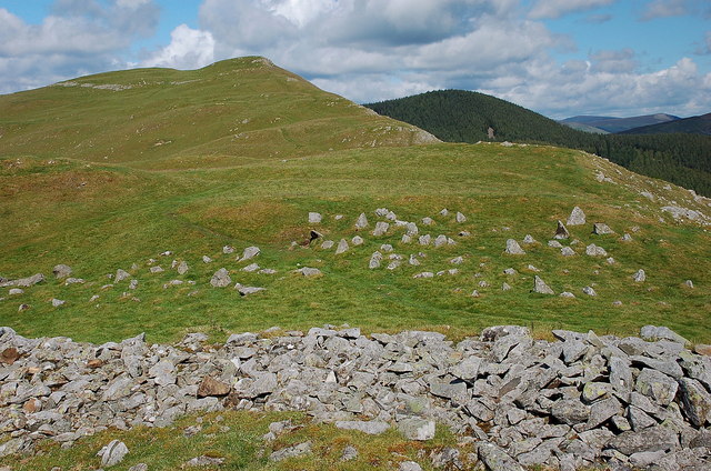
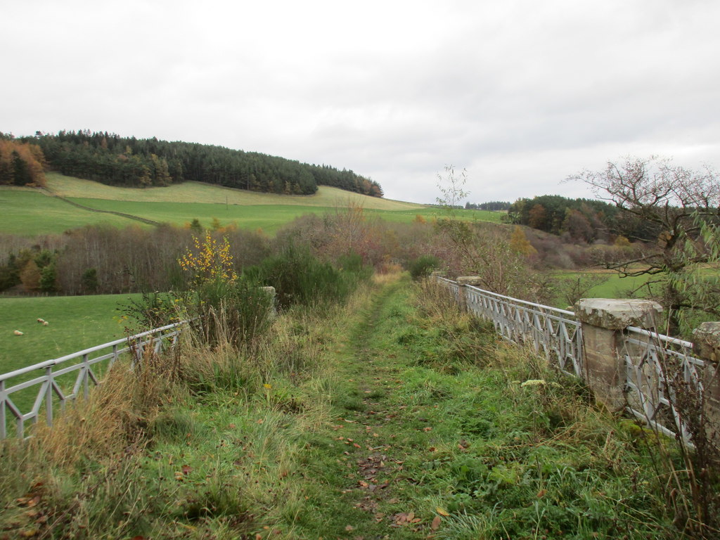
Crosshouses Wood is a picturesque forest located in Peeblesshire, Scotland. Covering an area of approximately 500 hectares, it is a haven for nature enthusiasts and a popular destination for outdoor activities. The woodland is situated on the eastern side of the Tweed Valley, near the town of Peebles.

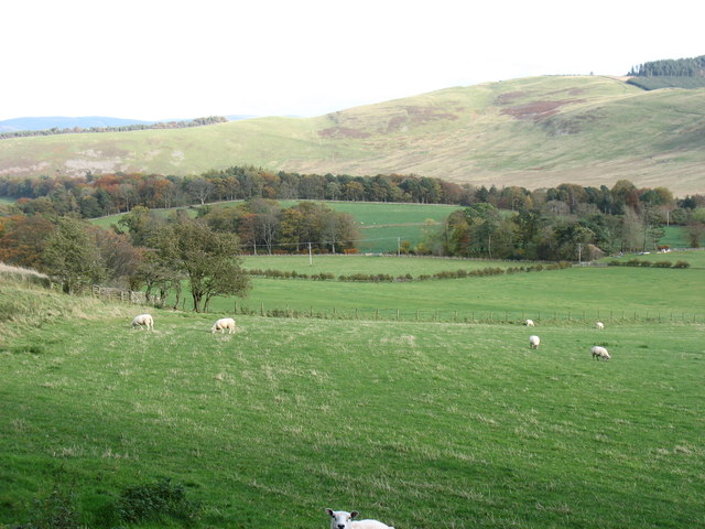
The forest is characterized by its diverse range of tree species, including oak, beech, and birch. The dense canopy provides shelter to a variety of wildlife, making it an ideal spot for birdwatching and wildlife spotting. Visitors may catch a glimpse of red squirrels, roe deer, and various species of birds such as woodpeckers and buzzards.

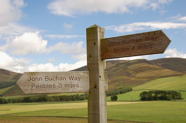
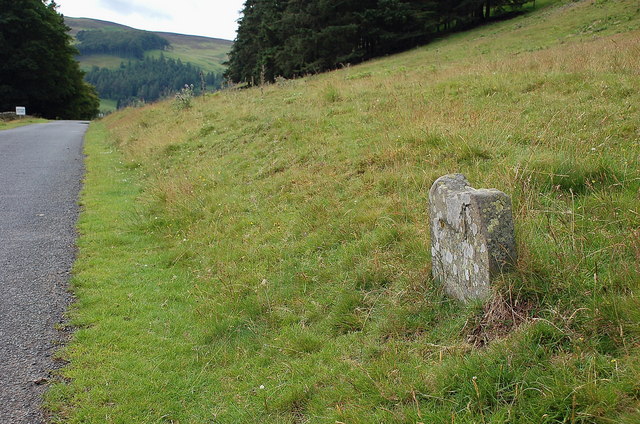
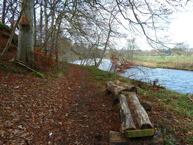
Crosshouses Wood offers a network of well-maintained trails that wind through the forest, allowing visitors to explore its natural beauty at their own pace. These trails are suitable for both walking and cycling, making it a popular spot for outdoor enthusiasts of all ages and abilities. The paths are clearly signposted, ensuring visitors can navigate the woodland easily.

In addition to its natural beauty, Crosshouses Wood also holds historical significance. The area was once part of the extensive hunting grounds of the Scottish kings and has remnants of ancient settlements. Archaeological finds have revealed evidence of human habitation dating back thousands of years.

Overall, Crosshouses Wood in Peeblesshire is a captivating woodland that offers a tranquil escape from the hustle and bustle of everyday life. With its diverse flora and fauna, well-maintained trails, and rich history, it is an ideal destination for nature lovers and those seeking a peaceful retreat.

If you have any feedback on the listing, please let us know in the comments section below.

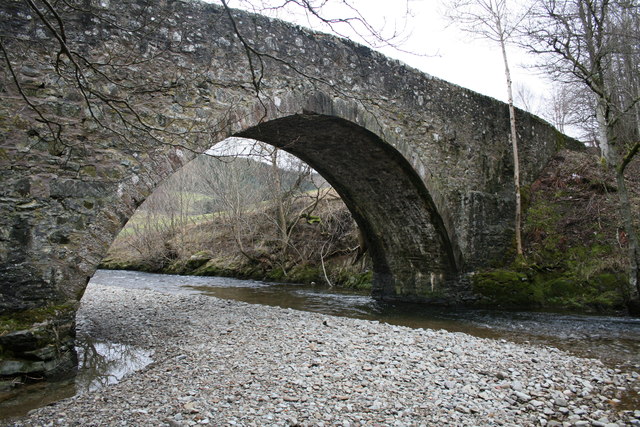
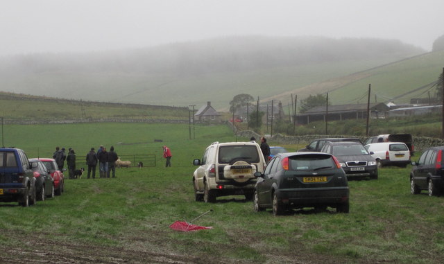
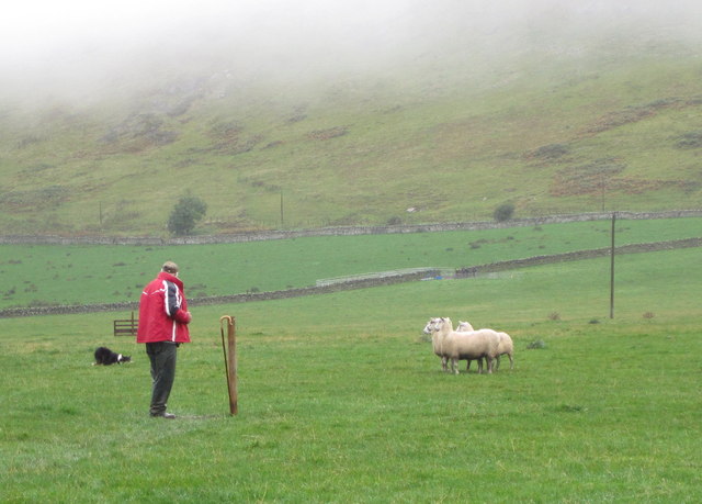
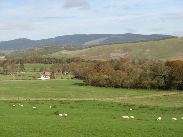
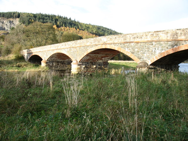
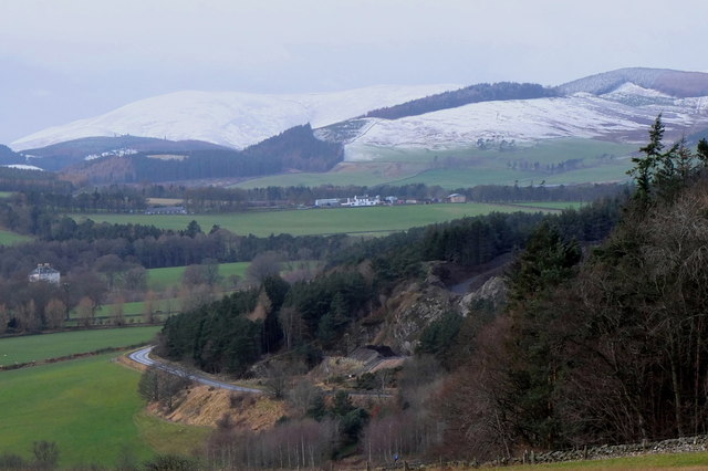
Crosshouses Wood Images

Images are sourced within 2km of 55.633482/-3.2424594 or Grid Reference NT2138. Thanks to Geograph Open Source API. All images are credited.

Signpost on the John Buchan Way Situated where the route leaves the tarmac road to take the track crossing the ridge of Cademuir and down into Peebles.
Signpost on the John Buchan Way
Situated where the route leaves the tarmac road to take the track crossing the ridge of Cademuir and down into Peebles.
Old milestone below Cademuir Shown as a milestone on the map, but any marking the stone might have had has now worn away.
Old milestone below Cademuir
Shown as a milestone on the map, but any marking the stone might have had has now worn away.
Iron Age hill fort defences on Cademuir The scattered boulders in the grass, beyond the nearest fringe of loose boulders, have been embedded across the ridge to impede attackers on foot or horseback - there are over 60 in this view, protruding up to 50cm or so above ground. Obstacles such as this are known as 'chevaux de frise' and the concept was still used in the Second World War in the form of large concrete anti-tank defences around our coasts.

<a href="https://www.geograph.org.uk/photo/1540932">NT2237 : Iron Age defensive structure, Cademuir Hill Fort</a> shows a different view of these defences.
Iron Age hill fort defences on Cademuir
The scattered boulders in the grass, beyond the nearest fringe of loose boulders, have been embedded across the ridge to impede attackers on foot or horseback - there are over 60 in this view, protruding up to 50cm or so above ground. Obstacles such as this are known as 'chevaux de frise' and the concept was still used in the Second World War in the form of large concrete anti-tank defences around our coasts. NT2237 : Iron Age defensive structure, Cademuir Hill Fort shows a different view of these defences.
Plaque on the Manor Bridge over the Tweed The plaque is on the SW side of the bridge. Its lettering is not too clear, but reads:

THIS BRIDGE
ERECTED BY THE COUNTY AND PRIVATE SUBSCRIBERS
WAS OPENED BY
MISS PRINGLE KIDD OF WOODHOUSE
AND NAMED BY HER
MANOR BRIDGE
20TH MARCH 1883
Plaque on the Manor Bridge over the Tweed
The plaque is on the SW side of the bridge. Its lettering is not too clear, but reads: THIS BRIDGE ERECTED BY THE COUNTY AND PRIVATE SUBSCRIBERS WAS OPENED BY MISS PRINGLE KIDD OF WOODHOUSE AND NAMED BY HER MANOR BRIDGE 20TH MARCH 1883
Manor Brig 18th Century bridge, Manor, Peebles.
Manor Brig
18th Century bridge, Manor, Peebles.
Sheepdog trials, Manor A damp day for the sheepdog trials at Woodhouse farm, Kirkton Manor. A simultaneous event is the Manor Water Hill Race, which starts from an adjacent field for a 10 mile round trip up to the summit of The Scrape (719m) and back.
Sheepdog trials, Manor
A damp day for the sheepdog trials at Woodhouse farm, Kirkton Manor. A simultaneous event is the Manor Water Hill Race, which starts from an adjacent field for a 10 mile round trip up to the summit of The Scrape (719m) and back.
Dog versus sheep, Manor Sheepdog trials at Woodhouse farm near Kirkton Manor; who is in charge here - man, dog, or sheep?
Dog versus sheep, Manor
Sheepdog trials at Woodhouse farm near Kirkton Manor; who is in charge here - man, dog, or sheep?
In the Manor Valley Looking towards Hallyards Farm
In the Manor Valley
Looking towards Hallyards Farm
Near Caverhill, Manor Valley Cademuir Hill is on the far side of the valley.
Near Caverhill, Manor Valley
Cademuir Hill is on the far side of the valley.
Manor Church, Kirkton Manor The church bell dates from 1485 and is one of the oldest, if not the oldest, in Scotland.
Manor Church, Kirkton Manor
The church bell dates from 1485 and is one of the oldest, if not the oldest, in Scotland.
A minor road to Peebles This road is seen leaving Kirkton Manor.
A minor road to Peebles
This road is seen leaving Kirkton Manor.
Old Manor Brig, built 1702 This bridge over Manor Water is now structurally unsound, and is open only to pedestrians and cyclists. Vehicular traffic crosses the Tweed nearby, and reaches Peebles on the north side of that river.
Old Manor Brig, built 1702
This bridge over Manor Water is now structurally unsound, and is open only to pedestrians and cyclists. Vehicular traffic crosses the Tweed nearby, and reaches Peebles on the north side of that river.
Manor Bridge This elegant bridge over the River Tweed was built in 1873 to serve the Manor valley, a cul-de-sac about 8 miles long. Prior to that, access was via the Old Manor Brig <a href="https://www.geograph.org.uk/photo/2694754">NT2339 : Old Manor Brig, built 1702</a>, now closed to all except pedestrians and cyclists, and a minor road to Peebles by way of Manor Sware.
Manor Bridge
This elegant bridge over the River Tweed was built in 1873 to serve the Manor valley, a cul-de-sac about 8 miles long. Prior to that, access was via the Old Manor Brig NT2339 : Old Manor Brig, built 1702, now closed to all except pedestrians and cyclists, and a minor road to Peebles by way of Manor Sware.
Log Seat A log seat by the River Tweed nestling in a bed of fallen leaves.  A good place to sit on a fine day and watch salmon leaping.
Log Seat
A log seat by the River Tweed nestling in a bed of fallen leaves. A good place to sit on a fine day and watch salmon leaping.
Winter approaching, Tweeddale Looking from Manor Sware across Edston Quarry and the A72 towards Haswellsykes farm (centre) and snow on the Stobo hills.
Winter approaching, Tweeddale
Looking from Manor Sware across Edston Quarry and the A72 towards Haswellsykes farm (centre) and snow on the Stobo hills.
Syke Hill silhouettes, Stobo Trees on the ridge west of Syke Hill silhouetted against the sunlit slopes of Black Meldon.
Syke Hill silhouettes, Stobo
Trees on the ridge west of Syke Hill silhouetted against the sunlit slopes of Black Meldon.
Border hillsides, Cademuir Hill Transient sunlight illuminating Cademuir Hill with Canada Hill beyond and Posso Craig in the distance across the Manor Valley.
Border hillsides, Cademuir Hill
Transient sunlight illuminating Cademuir Hill with Canada Hill beyond and Posso Craig in the distance across the Manor Valley.
Glack Hope Looking up Glack Hope towards the trees on Syke Hill.
Glack Hope
Looking up Glack Hope towards the trees on Syke Hill.
Show me another place!

Crosshouses Wood is located at Grid Ref: NT2138 (Lat: 55.633482, Lng: -3.2424594)

Unitary Authority: The Scottish Borders

Police Authority: The Lothians and Scottish Borders

What 3 Words

///submits.buyers.scrub. Near Peebles, Scottish Borders

Related Wikis

Manor, Scottish Borders

Manor is a parish in Peeblesshire in the Scottish Borders, whose church lies on the west bank of Manor Water 3 miles south-west of Peebles.The parish...

Manor Water

Manor Water is a river in the parish of Manor, Peeblesshire in the Scottish Borders. It rises in the Ettrick Forest and flows down through the Maynor valley...
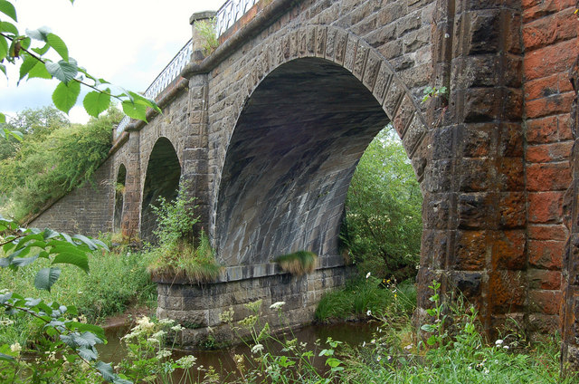
Lyne Viaduct

Lyne Viaduct is a viaduct at Lyne in the Scottish Borders of Scotland. It consists of three stone skew arches and a plate girder approach span over a minor...

Lyne railway station

Lyne railway station served the village of Lyne, Scottish Borders, Scotland from 1864 to 1950 on the Symington, Biggar and Broughton Railway. == History... ==

Nearby Amenities

Located within 500m of 55.633482,-3.2424594
Post Box
Colour: gold
Post Box Design: waggon_top
Post Box Mounting: telegraph_pole
Post Box Type: lamp
Ref: EH45 29
Royal Cypher: GVIR
Royal Cypher Wikidata: Q33102169
Lat/Long: 55.6292302/-3.2408114
Barrier: stile
Foot: yes
Lat/Long: 55.6367883/-3.2452813
Barrier: stile
Foot: yes
Lat/Long: 55.6377854/-3.2436944
Noexit: yes
Lat/Long: 55.6317547/-3.2478834
Caverhill
Place: locality
Lat/Long: 55.6322178/-3.2481759
Kirkton
Place: hamlet
Lat/Long: 55.629492/-3.2404619
Noexit: yes
Lat/Long: 55.6322327/-3.2481015
Power: pole
Lat/Long: 55.636168/-3.2474783
Power: pole
Lat/Long: 55.6357095/-3.2465962
Power: pole
Lat/Long: 55.6348499/-3.2456866
Power: pole
Lat/Long: 55.6341382/-3.2449526
Power: pole
Lat/Long: 55.6336463/-3.2444745
Power: pole
Lat/Long: 55.6331221/-3.2439288
Power: pole
Lat/Long: 55.6324462/-3.2432455
Power: pole
Lat/Long: 55.6333203/-3.2446607
Power: pole
Lat/Long: 55.6325238/-3.2451599
Power: pole
Lat/Long: 55.6323149/-3.2459087
Power: pole
Lat/Long: 55.6319901/-3.2470362
Power: pole
Lat/Long: 55.632199/-3.2425432
Power: pole
Lat/Long: 55.6319507/-3.2418135
Power: pole
Lat/Long: 55.631627/-3.2408954
Power: pole
Lat/Long: 55.6312796/-3.2398674
Power: pole
Lat/Long: 55.6309404/-3.238852
Power: pole
Lat/Long: 55.6305834/-3.2378472
Power: pole
Lat/Long: 55.6310491/-3.241805
Power: pole
Lat/Long: 55.6302645/-3.2423529
Power: pole
Lat/Long: 55.629548/-3.2427802
Power: pole
Lat/Long: 55.6328606/-3.2412592
Power: pole
Lat/Long: 55.636197/-3.2459742
Power: pole
Lat/Long: 55.6365495/-3.2455642
Power: pole
Lat/Long: 55.6372223/-3.2444752
Power: pole
Lat/Long: 55.6377243/-3.2435922
Telephone
Booth: K6
Covered: booth
Phone: +44 1721 740223
Lat/Long: 55.6296561/-3.2398027
The data included in this document is from www.openstreetmap.org. The data is made available under ODbL.

Have you been to Crosshouses Wood?

Leave your review of Crosshouses Wood below (or comments, questions and feedback).