Scroggy Plantation

Wood, Forest in Fife

Scotland

Scroggy Plantation

Fife fieldscape from Auchtertool Kirk Farm crops [barley, grass], Kirkton farm, woodland and, in the distance [3.3 km], Stoneyhall Hill.
Fife fieldscape from Auchtertool Kirk Credit: M J Richardson

Scroggy Plantation is a picturesque woodland located in Fife, Scotland. Situated on the southern edge of the county, the plantation covers an area of approximately 250 acres. The site is well-known for its diverse array of trees, making it a popular destination for nature enthusiasts and outdoor enthusiasts alike.

The woodland is predominantly composed of native species such as oak, beech, and birch, creating a rich and vibrant ecosystem. These trees provide a habitat for a wide range of wildlife, including deer, squirrels, and a variety of bird species. The plantation's well-maintained walking trails offer visitors an opportunity to explore the area and observe the flora and fauna in their natural habitat.

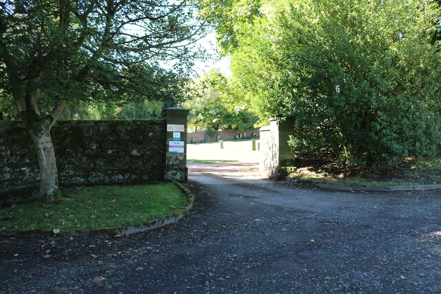
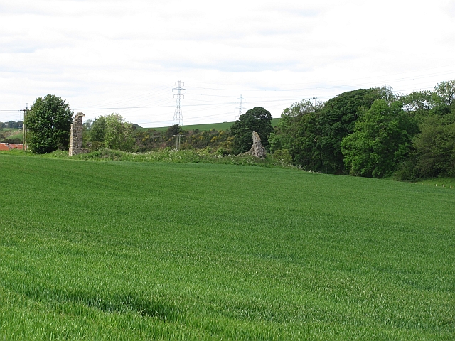
In addition to its natural beauty, Scroggy Plantation also holds historical significance. The site was once part of a larger estate that dates back to the 18th century. While the original grand mansion no longer stands, remnants of its existence can still be found in the form of stone walls and other architectural features.

Scroggy Plantation is managed by the local authorities, who work tirelessly to preserve its natural and historical heritage. The site is open to the public throughout the year, with well-marked trails and information boards providing visitors with insights into the woodland's history and ecology.

Whether one seeks a peaceful stroll amidst towering trees or a chance to observe Scotland's native wildlife, Scroggy Plantation offers a serene and captivating experience for all who visit.

If you have any feedback on the listing, please let us know in the comments section below.

Scroggy Plantation Images

Images are sourced within 2km of 56.084223/-3.2912576 or Grid Reference NT1988. Thanks to Geograph Open Source API. All images are credited.

Fife fieldscape from Auchtertool Kirk Farm crops [barley, grass], Kirkton farm, woodland and, in the distance [3.3 km], Stoneyhall Hill.
Fife fieldscape from Auchtertool Kirk
Farm crops [barley, grass], Kirkton farm, woodland and, in the distance [3.3 km], Stoneyhall Hill.
Auchtertool Parish Church For some, no doubt perfectly logical, reason a parish church a kilometre from the village. A relatively modern church on the site of an original 12th C Church <span class="nowrap"><a title="https://canmore.org.uk/site/52988/auchtertool-parish-church" rel="nofollow ugc noopener" href="https://canmore.org.uk/site/52988/auchtertool-parish-church">Link</a><img style="margin-left:2px;" alt="External link" title="External link - shift click to open in new window" src="https://s1.geograph.org.uk/img/external.png" width="10" height="10"/></span>.
Auchtertool Parish Church
For some, no doubt perfectly logical, reason a parish church a kilometre from the village. A relatively modern church on the site of an original 12th C Church LinkExternal link.
Auchtertool School Geology Project - 2010 A very competent account of a local primary school project displayed in Auchtertool churchyard.
Auchtertool School Geology Project - 2010
A very competent account of a local primary school project displayed in Auchtertool churchyard.
Auchtertool Kirk Burial ground extension - still plenty of vacancies!
Auchtertool Kirk
Burial ground extension - still plenty of vacancies!
Memorial to The Beadle's Daughter [1897-1987] Or possibly the Beadle's House, which stood on this site, just outside the entrance to Auchtertool Kirk. The plaque has a poem by Maureen Sangster [2010] <a href="https://www.geograph.org.uk/photo/7229928">NT2090 : The Beadle's Daughter</a>, one line of which reads:-

'Where I, as one of six, lived there stands the Kirk's portaloo'    [it was in a locked enclosure behind!]

and the refrain after each of the six verses is:-

And my Father rang the church bell
Mother cleaned the paint and pews
Getting rid of sticky fingerprints made by the Sunday School.

The poem was inspired by Mrs Jean Patterson, who was the youngest daughter of the last beadle of the church, John Hamilton; he lived with his family in the Beadle's house, built in 1897 and demolished in 1987 which stood near the kirk gate.
Memorial to The Beadle's Daughter [1897-1987]
Or possibly the Beadle's House, which stood on this site, just outside the entrance to Auchtertool Kirk. The plaque has a poem by Maureen Sangster [2010] NT2090 : The Beadle's Daughter, one line of which reads:- 'Where I, as one of six, lived there stands the Kirk's portaloo' [it was in a locked enclosure behind!] and the refrain after each of the six verses is:- And my Father rang the church bell Mother cleaned the paint and pews Getting rid of sticky fingerprints made by the Sunday School. The poem was inspired by Mrs Jean Patterson, who was the youngest daughter of the last beadle of the church, John Hamilton; he lived with his family in the Beadle's house, built in 1897 and demolished in 1987 which stood near the kirk gate.
The Beadle's Daughter A poem by Maureen Sangster, who was, I assume the Beadle's daughter, on a memorial at the entrance to Auchtertool Kirk <a href="https://www.geograph.org.uk/photo/7229921">NT2090 : Memorial to The Beadle's Daughter [1897-1987]</a>. The poem was inspired by Mrs Jean Patterson, who was the youngest daughter of the last beadle of the church, John Hamilton;  he lived with his family in the Beadle's house, built in 1897 and demolished in 1987 which stood near the kirk gate.
The Beadle's Daughter
A poem by Maureen Sangster, who was, I assume the Beadle's daughter, on a memorial at the entrance to Auchtertool Kirk NT2090 : Memorial to The Beadle's Daughter [1897-1987]. The poem was inspired by Mrs Jean Patterson, who was the youngest daughter of the last beadle of the church, John Hamilton; he lived with his family in the Beadle's house, built in 1897 and demolished in 1987 which stood near the kirk gate.
Auchtertool Kirk car park The gravel road which serves Auchtertool Kirk approaches the car parking area.
See article <a title="https://www.geograph.org.uk/article/Auchtertool-Kirk" href="https://www.geograph.org.uk/article/Auchtertool-Kirk">Link</a>
Auchtertool Kirk car park
The gravel road which serves Auchtertool Kirk approaches the car parking area. See article Link
Gates to former manse These gates guard the driveway of Candleford House which used to be the manse for Auchtertool Kirk.
See article <a title="https://www.geograph.org.uk/article/Auchtertool-Kirk" href="https://www.geograph.org.uk/article/Auchtertool-Kirk">Link</a>
Gates to former manse
These gates guard the driveway of Candleford House which used to be the manse for Auchtertool Kirk. See article Link
Cemetery gates From the car park of Auchtertool Kirk these gates lead to the current cemetery.
See article <a title="https://www.geograph.org.uk/article/Auchtertool-Kirk" href="https://www.geograph.org.uk/article/Auchtertool-Kirk">Link</a>
Cemetery gates
From the car park of Auchtertool Kirk these gates lead to the current cemetery. See article Link
Auchtertool Kirk Cemetery The small building is an equipment store.
See article <a title="https://www.geograph.org.uk/article/Auchtertool-Kirk" href="https://www.geograph.org.uk/article/Auchtertool-Kirk">Link</a>
Auchtertool Kirk Cemetery
The small building is an equipment store. See article Link
Auchtertool Kirk Cemetery See article <a title="https://www.geograph.org.uk/article/Auchtertool-Kirk" href="https://www.geograph.org.uk/article/Auchtertool-Kirk">Link</a>
Auchtertool Kirk Cemetery
See article Link
Auchtertool Kirk Cemetery These fallen gravestones are all relatively recent. Why they are lying down I have no idea.
See article <a title="https://www.geograph.org.uk/article/Auchtertool-Kirk" href="https://www.geograph.org.uk/article/Auchtertool-Kirk">Link</a>
Auchtertool Kirk Cemetery
These fallen gravestones are all relatively recent. Why they are lying down I have no idea. See article Link
Auchtertool Kirk Cemetery See article <a title="https://www.geograph.org.uk/article/Auchtertool-Kirk" href="https://www.geograph.org.uk/article/Auchtertool-Kirk">Link</a>
Auchtertool Kirk Cemetery
See article Link
Auchtertool Kirk car park The kirk is hidden in the trees to the right with only the access stairs visible. The blue roof of a portaloo can be seen behind a fence. It stands in a significant position.
See article <a title="https://www.geograph.org.uk/article/Auchtertool-Kirk" href="https://www.geograph.org.uk/article/Auchtertool-Kirk">Link</a>
Auchtertool Kirk car park
The kirk is hidden in the trees to the right with only the access stairs visible. The blue roof of a portaloo can be seen behind a fence. It stands in a significant position. See article Link
Auchtertool Kirk gates These gates lead to the stairs up to the kirk. Past the gates, in the centre of the image, is the beginning of a path (known as the 'Auchtertool Kirk path') which leads to the minor road between the B9157 and the B925. Known locally as the 'Puddledub Road' this minor road can be used to reach Auchtertool village.
See article <a title="https://www.geograph.org.uk/article/Auchtertool-Kirk" href="https://www.geograph.org.uk/article/Auchtertool-Kirk">Link</a>
Auchtertool Kirk gates
These gates lead to the stairs up to the kirk. Past the gates, in the centre of the image, is the beginning of a path (known as the 'Auchtertool Kirk path') which leads to the minor road between the B9157 and the B925. Known locally as the 'Puddledub Road' this minor road can be used to reach Auchtertool village. See article Link
Auchtertool Kirk path This is the beginning of the Auchtertool Kirk path which reaches the minor road known locally as 'Puddledub Road' which can be used to reach Auchtertool village.
See article <a title="https://www.geograph.org.uk/article/Auchtertool-Kirk" href="https://www.geograph.org.uk/article/Auchtertool-Kirk">Link</a>
Auchtertool Kirk path
This is the beginning of the Auchtertool Kirk path which reaches the minor road known locally as 'Puddledub Road' which can be used to reach Auchtertool village. See article Link
Auchtertool Kirk Seen from the Auchtertool Kirk path <a href="https://www.geograph.org.uk/photo/7261402">NT2090 : Auchtertool Kirk gates</a>
See article <a title="https://www.geograph.org.uk/article/Auchtertool-Kirk" href="https://www.geograph.org.uk/article/Auchtertool-Kirk">Link</a>
Auchtertool Kirk
Seen from the Auchtertool Kirk path NT2090 : Auchtertool Kirk gates See article Link
Show me another place!

Scroggy Plantation is located at Grid Ref: NT1988 (Lat: 56.084223, Lng: -3.2912576)

Unitary Authority: Fife

Police Authority: Fife

What 3 Words

///crowned.reshaping.prettiest. Near Aberdour, Fife

Related Wikis

Mossmorran

The Mossmorran Natural Gas Liquids (NGL) plant is part of the northern North Sea Brent oil and gas field system and is located on the outskirts of Cowdenbeath...

Kirkcaldy and Cowdenbeath (UK Parliament constituency)

Kirkcaldy and Cowdenbeath is a county constituency representing the areas around the towns of Kirkcaldy and Cowdenbeath, in Fife, Scotland, in the House...

Auchtertool

Auchtertool ( ; Scottish Gaelic: Uachdar Tuil) is a small village in Fife, Scotland. It is 4 miles west of Kirkcaldy. The name is from the Gaelic uachdar...

Hallyards Castle

Hallyards Castle (Scots: Hall yairds "the yards at the hall"), located to the north-west of the village of Auchtertool, is reputed to have been a hunting...

Nearby Amenities

Located within 500m of 56.084223,-3.2912576
Power: pole
Lat/Long: 56.0851894/-3.2845474
Power: pole
Lat/Long: 56.0850845/-3.2858135
Power: pole
Lat/Long: 56.0849863/-3.2868572
Power: pole
Lat/Long: 56.0849028/-3.2880122
Power: pole
Lat/Long: 56.0848193/-3.2889669
Power: pole
Lat/Long: 56.0847369/-3.2899094
Power: pole
Lat/Long: 56.0846274/-3.2912403
Power: pole
Lat/Long: 56.0845382/-3.2922011
Power: pole
Lat/Long: 56.0844378/-3.293354
Power: pole
Lat/Long: 56.0843035/-3.2945595
Power: pole
Lat/Long: 56.0841737/-3.2957185
Power: pole
Lat/Long: 56.0840563/-3.2967764
Power: pole
Lat/Long: 56.0839299/-3.2978605
Power: pole
Lat/Long: 56.0839548/-3.2991227
The data included in this document is from www.openstreetmap.org. The data is made available under ODbL.

Have you been to Scroggy Plantation?

Leave your review of Scroggy Plantation below (or comments, questions and feedback).