Colin's Den

Wood, Forest in Fife

Scotland

Colin's Den

Road to Corston Mill
Road to Corston Mill Credit: Steven Brown

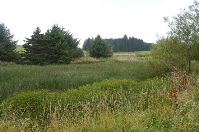
Colin's Den is a picturesque woodland located in the county of Fife, Scotland. With an area of approximately 100 acres, this tranquil forest offers visitors the perfect retreat from bustling city life. The den is situated near the village of Auchtermuchty, and its natural beauty and diverse wildlife make it a popular destination for nature enthusiasts.

The woodland is characterized by its dense canopy of trees, predominantly composed of oak, birch, and beech. This creates a serene atmosphere, with sunlight filtering through the leaves and casting beautiful patterns on the forest floor. The den boasts a network of well-maintained trails that allow visitors to explore its hidden corners, discover enchanting streams and waterfalls, and observe the rich biodiversity present within its boundaries.

Wildlife thrives in Colin's Den, with numerous species making their homes amidst the trees and undergrowth. Visitors may be fortunate enough to spot red squirrels, roe deer, and a variety of bird species, including woodpeckers and tawny owls. The den is also home to a diverse range of flora, with bluebells carpeting the forest floor in the spring and vibrant fungi appearing during the autumn months.

Colin's Den offers visitors the opportunity to connect with nature and enjoy the tranquility of the woodlands. It is a haven for walking, picnicking, and simply appreciating the beauty of the natural world. With its stunning scenery and abundant wildlife, Colin's Den is truly a hidden gem in the heart of Fife.

If you have any feedback on the listing, please let us know in the comments section below.

Colin's Den Images

Images are sourced within 2km of 56.270491/-3.3021296 or Grid Reference NO1909. Thanks to Geograph Open Source API. All images are credited.

Road to Corston Mill
A91 at Gateside
A91 at Gateside
Toll House, Gateside, Strathmiglo Thought to be an ex Toll House, though its position is not on the main route through the village. It would be more suited to a residence of the toll-keeper.

Milestone Society National ID: FF.STR
Toll House, Gateside, Strathmiglo
Thought to be an ex Toll House, though its position is not on the main route through the village. It would be more suited to a residence of the toll-keeper. Milestone Society National ID: FF.STR
The road to Wester and Easter Upper Urquhart Farms Looking south to West Lomond Hill.
The road to Wester and Easter Upper Urquhart Farms
Looking south to West Lomond Hill.
Fields at Easter Upper Urquhart The nearest appears to be a hay field regrowing after the first cut.
Fields at Easter Upper Urquhart
The nearest appears to be a hay field regrowing after the first cut.
A91 near Gornogrove
A91 near Gornogrove
Sheep on Kincraigie Law Feeding on a root crop, hence the bare earth.
Sheep on Kincraigie Law
Feeding on a root crop, hence the bare earth.
Strathmiglo Primary School
Minor road to Strathmiglo Minor road heading to Strathmiglo from Abernethy near Willandale Plantation at Pitlour.
Minor road to Strathmiglo
Minor road heading to Strathmiglo from Abernethy near Willandale Plantation at Pitlour.
A91 near Strathmiglo
Farmland west of Strathmiglo Farmland near Strathmiglo in Fife, viewed on a somewhat overcast and cold Christmas day.
Farmland west of Strathmiglo
Farmland near Strathmiglo in Fife, viewed on a somewhat overcast and cold Christmas day.
Pittuncarty straw rows A recently harvested field in Fife.
Pittuncarty straw rows
A recently harvested field in Fife.
Marsh, Kincraigie A rather vegetated pool.
Marsh, Kincraigie
A rather vegetated pool.
Marsh above Wellfield Wetland surrounded by coniferous stripwoods. A contrast to the arable land to the north.
Marsh above Wellfield
Wetland surrounded by coniferous stripwoods. A contrast to the arable land to the north.
House and walled garden at Pitlour
Track to Kincraigie Farm
Field near Pitlour East Lomond dominates the centre background.
Field near Pitlour
East Lomond dominates the centre background.
Old Milestone by the A91, west of Strathmiglo C type by the A91, in parish of Strathmiglo (Fife District), West of Stathmiglo near minor road, C47, on verge, South side of road.

Surveyed

Milestone Society National ID: FF_CPKR11
Old Milestone by the A91, west of Strathmiglo
C type by the A91, in parish of Strathmiglo (Fife District), West of Stathmiglo near minor road, C47, on verge, South side of road. Surveyed Milestone Society National ID: FF_CPKR11
Show me another place!

Colin's Den is located at Grid Ref: NO1909 (Lat: 56.270491, Lng: -3.3021296)

Unitary Authority: Fife

Police Authority: Fife

What 3 Words

///cuter.repeating.flush. Near Auchtermuchty, Fife

Nearby Locations

Colin's Den

Related Wikis

Nearby Amenities

Located within 500m of 56.270491,-3.3021296
Material: wood
Power: pole
Lat/Long: 56.271746/-3.3066589
Power: pole
Lat/Long: 56.2712918/-3.3057621
Power: pole
Lat/Long: 56.2708188/-3.3048654
Power: pole
Lat/Long: 56.2703646/-3.3039732
Power: pole
Lat/Long: 56.2699078/-3.3030809
Power: pole
Lat/Long: 56.2725597/-3.3038451
The data included in this document is from www.openstreetmap.org. The data is made available under ODbL.

Have you been to Colin's Den?

Leave your review of Colin's Den below (or comments, questions and feedback).