Whiteside Plantations

Wood, Forest in Midlothian

Scotland

Whiteside Plantations

Path beside Harlaw Reservoir Showing the north-west corner of Harlaw Reservoir, a popular spot for anglers. The path round the Reservoir is frequented by walkers and cyclists.

Black Hill <a href="https://www.geograph.org.uk/gridref/NT1863">NT1863</a> beyond.
Path beside Harlaw Reservoir Credit: Oliver Dixon

Whiteside Plantations is a stunning estate located in Midlothian, Scotland. Nestled amidst the picturesque woodlands and forests of the region, the plantation covers a vast area and is renowned for its natural beauty and rich history.

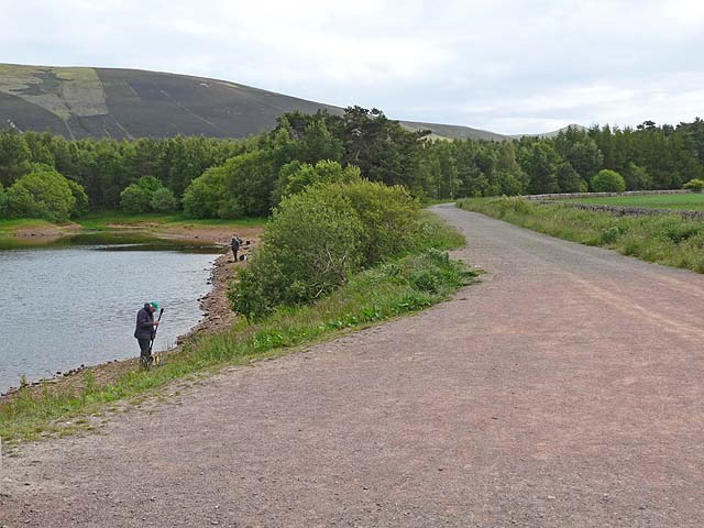
The plantation boasts a diverse range of flora and fauna, with ancient trees dominating the landscape. The forested areas are home to a variety of wildlife, including deer, foxes, and a wide array of bird species, making it a haven for nature enthusiasts and wildlife photographers.

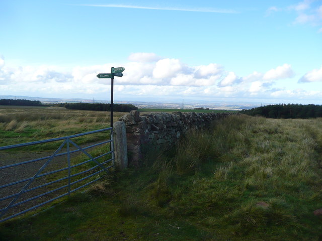
The estate also features well-maintained walking trails that wind through the woodlands, offering visitors the chance to explore and immerse themselves in the tranquil surroundings. These paths provide an opportunity to witness the awe-inspiring beauty of the ancient trees and experience the calming ambiance of the forest.

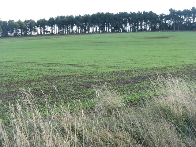
Whiteside Plantations has a fascinating past, with historical records dating back centuries. The estate was once a thriving agricultural center, with crops such as barley and oats cultivated on its fertile lands. The remnants of the old farm buildings and stone walls still stand, serving as a testament to the area's agricultural heritage.

In recent years, the plantation has become a popular destination for outdoor activities, attracting hikers, cyclists, and nature lovers. Its accessibility and proximity to Midlothian make it an ideal spot for a day trip or a weekend getaway.

Whiteside Plantations in Midlothian is a place of natural beauty, offering visitors an opportunity to immerse themselves in the enchanting woodlands and forests of Scotland. Whether it's exploring the walking trails, observing wildlife, or simply enjoying the serene surroundings, this plantation is a must-visit destination for nature enthusiasts and history buffs alike.

If you have any feedback on the listing, please let us know in the comments section below.

Whiteside Plantations Images

Images are sourced within 2km of 55.883215/-3.2896744 or Grid Reference NT1966. Thanks to Geograph Open Source API. All images are credited.
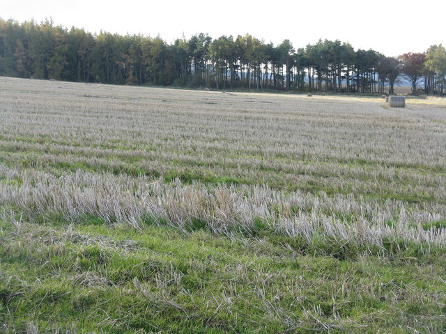
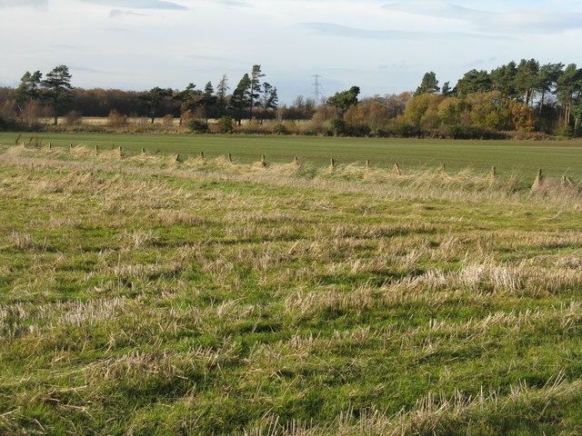
Path beside Harlaw Reservoir Showing the north-west corner of Harlaw Reservoir, a popular spot for anglers. The path round the Reservoir is frequented by walkers and cyclists.

Black Hill <a href="https://www.geograph.org.uk/gridref/NT1863">NT1863</a> beyond.
Path beside Harlaw Reservoir
Showing the north-west corner of Harlaw Reservoir, a popular spot for anglers. The path round the Reservoir is frequented by walkers and cyclists. Black Hill NT1863 beyond.
Inlet on Harlaw Reservoir A stream enters the reservoir at its easternmost point.
Inlet on Harlaw Reservoir
A stream enters the reservoir at its easternmost point.
Control valve on Harlaw Reservoir Bridge out from  Harlaw Reservoir dam to the control mechanism.  An angler fishes from the foot of the dam.

West Kip <a href="https://www.geograph.org.uk/gridref/NT1760">NT1760</a> in the Pentland Hills can be seen on the skyline.
Control valve on Harlaw Reservoir
Bridge out from Harlaw Reservoir dam to the control mechanism. An angler fishes from the foot of the dam. West Kip NT1760 in the Pentland Hills can be seen on the skyline.
Gabions by Harlaw Reservoir Adjoining the eastern end of the dam.
Gabions by Harlaw Reservoir
Adjoining the eastern end of the dam.
Harlaw Reservoir outflows Banks supported by gabions.
Harlaw Reservoir outflows
Banks supported by gabions.
Path junction at Cock Rig Right for Currie, left for Balerno.
Path junction at Cock Rig
Right for Currie, left for Balerno.
Through the trees to Harlaw Reservoir Threipmuir and Harlaw Reservoirs were completed in 1848 as a water supply for Edinburgh. Nowadays these reservoirs provide essential upstream flood storage to prevent flooding of the Water of Leith, but are no longer used for water supply.
Through the trees to Harlaw Reservoir
Threipmuir and Harlaw Reservoirs were completed in 1848 as a water supply for Edinburgh. Nowadays these reservoirs provide essential upstream flood storage to prevent flooding of the Water of Leith, but are no longer used for water supply.
Winter wheat at Kinleith Nicely germinated, and looking up the slope to the Whiteside Plantation.
Winter wheat at Kinleith
Nicely germinated, and looking up the slope to the Whiteside Plantation.
Shelter belt by the Kinleith Burn A group of pines, part of the Whiteside Plantations. The lean is genuine - looking south, so the prevailing winds come from the right and at 260 m a.s.l. in the Pentlands they can have quite an effect on the vegetation.
Shelter belt by the Kinleith Burn
A group of pines, part of the Whiteside Plantations. The lean is genuine - looking south, so the prevailing winds come from the right and at 260 m a.s.l. in the Pentlands they can have quite an effect on the vegetation.
Winter wheat at Kinleith Last harvest's stubble in the foreground and next year's crop just emerging in the field beyond. Capelaw Hill on the skyline, under some nice lenticular or wave clouds.
Winter wheat at Kinleith
Last harvest's stubble in the foreground and next year's crop just emerging in the field beyond. Capelaw Hill on the skyline, under some nice lenticular or wave clouds.
Farmland at Easter Kinleith Barley stubbles and pasture, leading up to Warklaw Hill.
Farmland at Easter Kinleith
Barley stubbles and pasture, leading up to Warklaw Hill.
Barley stubble at Easter Kinleith. Looking north to the Lomond Hills of Fife, just visible on the centre horizon 40km away.
Barley stubble at Easter Kinleith.
Looking north to the Lomond Hills of Fife, just visible on the centre horizon 40km away.
Winter wheat in the Pentland Hills A recently sown field where once there would only have been rough pasture. New cultivars allow winter cereals to be grown in quite severe conditions. This crop is not yet germinating, and there is evidence of erosion from rain run-off in the foreground. The long low hills in the distance are West and East Cairn Hills [10km to the southwest], the one on the left is Hare Hill, much nearer at 4km.
Winter wheat in the Pentland Hills
A recently sown field where once there would only have been rough pasture. New cultivars allow winter cereals to be grown in quite severe conditions. This crop is not yet germinating, and there is evidence of erosion from rain run-off in the foreground. The long low hills in the distance are West and East Cairn Hills [10km to the southwest], the one on the left is Hare Hill, much nearer at 4km.
Winter cereals at Kinleith Looking across the trees lining the Kinleith Burn towards Capelaw Hill.
Winter cereals at Kinleith
Looking across the trees lining the Kinleith Burn towards Capelaw Hill.
The view from the top of Currie Kirkgate A good viewpoint for the whole of western Edinburgh, with Currie in the valley of the Water of Leith beyond the field. Corstorphine Hill is the wooded hump on the right, and the Gyle and Hermiston Gait business and shopping areas provide most of the whiteness on the left.
The view from the top of Currie Kirkgate
A good viewpoint for the whole of western Edinburgh, with Currie in the valley of the Water of Leith beyond the field. Corstorphine Hill is the wooded hump on the right, and the Gyle and Hermiston Gait business and shopping areas provide most of the whiteness on the left.
Barley stubble at Kinleith With a pine and larch shelter belt running along the line of the Kinleith Burn.
Barley stubble at Kinleith
With a pine and larch shelter belt running along the line of the Kinleith Burn.
Farmland at Kinleith Looking west across barley stubble to a gappy shelter belt.
Farmland at Kinleith
Looking west across barley stubble to a gappy shelter belt.
Tramlines in winter wheat At Kinleith above Currie, which is on the outskirts of Edinburgh, where they have the same situation - tram lines, but no trams. Here, though, their absence is intentional.
Tramlines in winter wheat
At Kinleith above Currie, which is on the outskirts of Edinburgh, where they have the same situation - tram lines, but no trams. Here, though, their absence is intentional.
Show me another place!

Whiteside Plantations is located at Grid Ref: NT1966 (Lat: 55.883215, Lng: -3.2896744)

Unitary Authority: City of Edinburgh

Police Authority: Edinburgh

What 3 Words

///poems.fish.sugar. Near Currie, Edinburgh

Nearby Locations

Whiteside Plantations

Related Wikis

Edinburgh South West (UK Parliament constituency)

Edinburgh South West is a Scottish constituency of the House of Commons of the Parliament of the United Kingdom, first used at the 2005 UK general election...

Currie

Currie (Scottish Gaelic: Currach, IPA:[ˈkʰuːᵲəx]) is a village and suburb on the outskirts of Edinburgh, Scotland, situated 7 miles (11 kilometres) south...

Currie railway station

Currie railway station was opened in 1874 and served the area of the village of Currie that now forms part of the city of Edinburgh. Although primarily...

Torphin

Torphin ( tor-FIN) is a small area in the south-west of Edinburgh, Scotland, with its name deriving from the nearby Torphin Hill. It lies just south of...

Nearby Amenities

Located within 500m of 55.883215,-3.2896744
Design: three-level
Power: tower
Lat/Long: 55.8867885/-3.2894843
Design: three-level
Power: tower
Lat/Long: 55.8850304/-3.2941
The data included in this document is from www.openstreetmap.org. The data is made available under ODbL.

Have you been to Whiteside Plantations?

Leave your review of Whiteside Plantations below (or comments, questions and feedback).