Lacesston Muir
Wood, Forest in Fife
Scotland
Lacesston Muir
Lacesston Muir, located in Fife, Scotland, is a picturesque wood or forest that boasts a rich history and diverse natural beauty. Spread over an area of approximately 500 acres, this enchanting woodland is a popular destination for nature enthusiasts and outdoor lovers alike.
The woodland is primarily composed of native Scottish trees, including oak, birch, and pine, which create a lush and vibrant environment. Lacesston Muir is home to a wide variety of plant and animal species, making it an important habitat for wildlife conservation. Visitors can expect to encounter various bird species, such as woodpeckers and owls, as well as small mammals like squirrels and foxes.
Moreover, Lacesston Muir has a fascinating historical significance. It has been used for centuries as a source of timber and fuel, with evidence of human activity dating back to the medieval era. The woodland is also known for its ancient standing stones, which are believed to have served as markers or religious sites in the past.
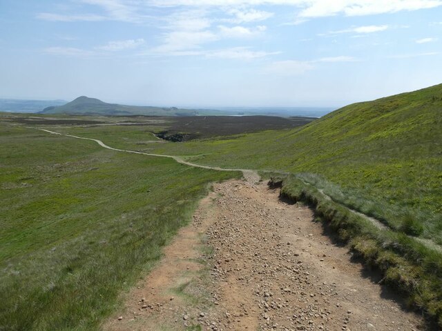
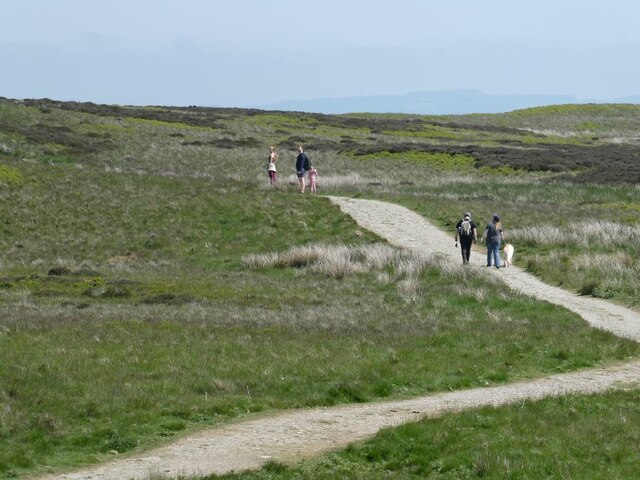
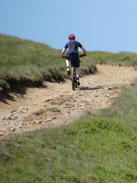
For those seeking outdoor activities, Lacesston Muir offers a network of well-maintained trails and pathways, making it an ideal location for walking, hiking, and cycling. The serene atmosphere and stunning natural surroundings provide a tranquil escape from the hustle and bustle of daily life.
In conclusion, Lacesston Muir in Fife is a captivating wood or forest that combines natural beauty, wildlife diversity, and historical significance. Whether for a leisurely stroll or a deeper exploration of its rich heritage, this woodland offers a memorable experience for all who visit.
If you have any feedback on the listing, please let us know in the comments section below.
Lacesston Muir Images
Images are sourced within 2km of 56.246977/-3.3139835 or Grid Reference NO1806. Thanks to Geograph Open Source API. All images are credited.
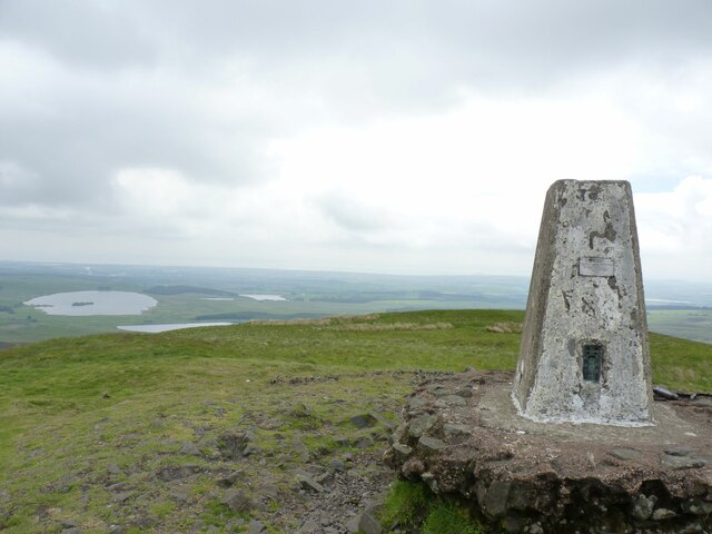
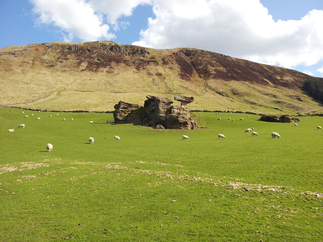
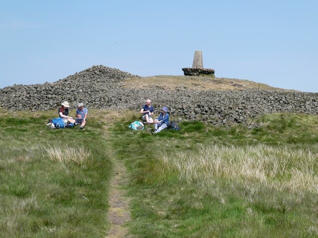
![Devil's Burdens The location of many prehistoric finds, over 100, mainly flint microliths and leaf-shaped and chisel arrowheads, including a Bronze Age battle-axe made of vesicular volcanic lava, two bladelets of pitchstone, and a single sherd of coarse pottery, probably prehistoric.
Sources:
‘Devil’s Burdens, West Lomond | Canmore’. 2022. Canmore.org.uk &lt;<span class="nowrap"><a title="https://canmore.org.uk/site/93889/devils-burdens-west-lomond" rel="nofollow ugc noopener" href="https://canmore.org.uk/site/93889/devils-burdens-west-lomond">Link</a><img style="margin-left:2px;" alt="External link" title="External link - shift click to open in new window" src="https://s1.geograph.org.uk/img/external.png" width="10" height="10"/></span> &gt; [accessed 29 October 2022]
‘Devil’s Burdens | Canmore’. 2022. Canmore.org.uk &lt;<span class="nowrap"><a title="https://canmore.org.uk/site/86522/devils-burdens" rel="nofollow ugc noopener" href="https://canmore.org.uk/site/86522/devils-burdens">Link</a><img style="margin-left:2px;" alt="External link" title="External link - shift click to open in new window" src="https://s1.geograph.org.uk/img/external.png" width="10" height="10"/></span> &gt; [accessed 29 October 2022]](https://s3.geograph.org.uk/geophotos/07/32/88/7328827_01792ad8.jpg)
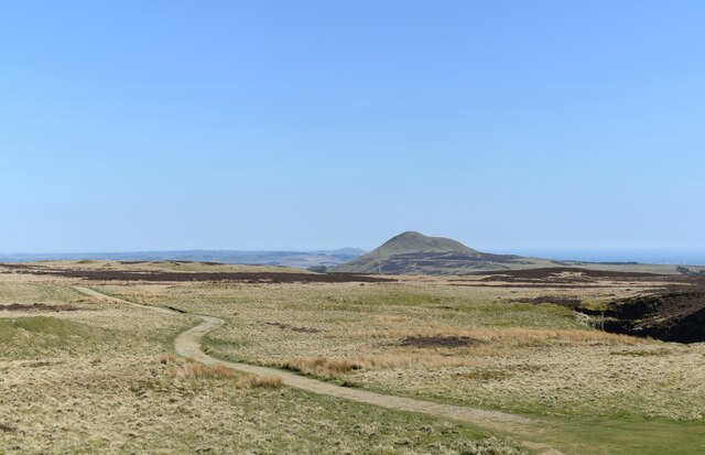
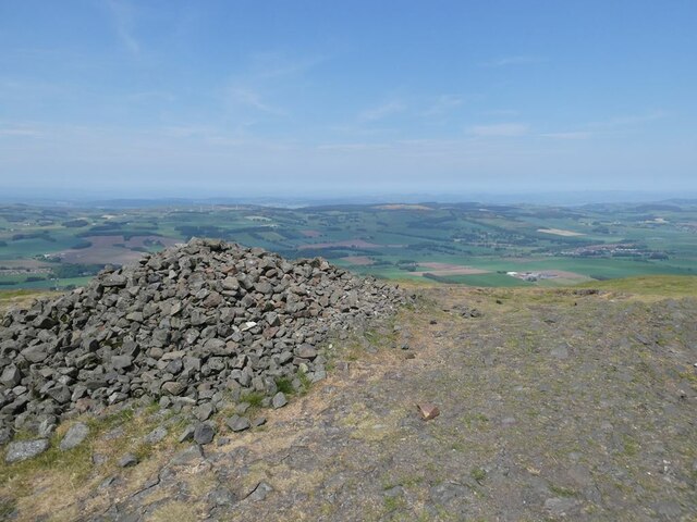
![Wind And Weather A small hillock with an intriguing name.
&quot;The name is reminiscent of the Scottish phrase commonly found in boundary charters and perambulations to indicate a water-shed, Englished as ‘where wind and weather shears’.&quot; ‘Fife Place-Name Data :: Wind and Weather’. 2022. Glasgow.ac.uk &lt;<span class="nowrap"><a title="https://fife-placenames.glasgow.ac.uk/placename/?id=3240" rel="nofollow ugc noopener" href="https://fife-placenames.glasgow.ac.uk/placename/?id=3240">Link</a><img style="margin-left:2px;" alt="External link" title="External link - shift click to open in new window" src="https://s1.geograph.org.uk/img/external.png" width="10" height="10"/></span> &gt; [accessed 1 November 2022]
](https://s0.geograph.org.uk/geophotos/07/32/88/7328852_3f435fa4.jpg)

Lacesston Muir is located at Grid Ref: NO1806 (Lat: 56.246977, Lng: -3.3139835)
Unitary Authority: Fife
Police Authority: Fife
What 3 Words
///remarking.richly.trudges. Near Falkland, Fife
Nearby Locations
Related Wikis

Bunnet Stane
The Bunnet Stane (or bonnet stone) is a rock formation near the hamlet of Gateside in Fife, at the foot of West Lomond. It sits upon one of the calciferous...

West Lomond
West Lomond is the highest point in the county of Fife, Scotland and the highest peak in the Lomond Hills. Its cone-shaped summit, which is the remains...

Gateside railway station
Gateside railway station served the village of Gateside, Fife, Scotland from 1858 to 1950 on the Fife and Kinross Railway. == History == The station opened...

Gateside, Fife
Gateside is a small village in the north east of Fife, Scotland. It is inhabited by around 200 people. It also comprises a school (which is currently closed...
Nearby Amenities
Located within 500m of 56.246977,-3.3139835Have you been to Lacesston Muir?
Leave your review of Lacesston Muir below (or comments, questions and feedback).