Dalebank Plantation
Wood, Forest in Dumfriesshire
Scotland
Dalebank Plantation

Dalebank Plantation is a picturesque woodland located in Dumfriesshire, Scotland. Covering an area of approximately 50 acres, it is nestled in the heart of the countryside and offers a peaceful retreat for nature enthusiasts and outdoor adventurers alike.
This enchanting plantation boasts a diverse range of tree species, including oak, beech, birch, and pine, creating a rich and vibrant woodland ecosystem. The dense canopy provides shelter and a habitat for various wildlife species, such as red squirrels, badgers, and a multitude of bird species, making it a haven for nature lovers and birdwatchers.
Visitors to Dalebank Plantation can explore the network of well-maintained footpaths that wind their way through the woodland. These paths offer stunning views of the surrounding countryside and provide a chance to immerse oneself in the tranquility of nature. The plantation also features a small, serene pond, adding to the natural beauty of the area.
In addition to its natural charm, Dalebank Plantation offers recreational activities for all ages. There are picnic areas dotted throughout the woodland, providing the perfect spot to relax and enjoy a meal amidst the peaceful surroundings. The plantation also offers opportunities for hiking, cycling, and wildlife spotting, allowing visitors to fully experience the beauty and serenity of this idyllic woodland.
Overall, Dalebank Plantation in Dumfriesshire is a hidden gem, offering a delightful escape from the hustle and bustle of everyday life. Its diverse flora and fauna, well-maintained paths, and recreational activities make it an ideal destination for nature lovers and outdoor enthusiasts seeking a peaceful and rejuvenating experience in the heart of Scotland's countryside.
If you have any feedback on the listing, please let us know in the comments section below.
Dalebank Plantation Images
Images are sourced within 2km of 55.012362/-3.2734697 or Grid Reference NY1869. Thanks to Geograph Open Source API. All images are credited.


Dalebank Plantation is located at Grid Ref: NY1869 (Lat: 55.012362, Lng: -3.2734697)
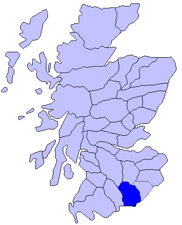
Unitary Authority: Dumfries and Galloway
Police Authority: Dumfries and Galloway
What 3 Words
///drilled.tissue.slips. Near Annan, Dumfries & Galloway
Nearby Locations
Related Wikis
Annandale, Dumfries and Galloway
Annandale (Gaelic: Srath Anann) is a strath in Dumfries and Galloway, Scotland, named after the dale of the River Annan. It runs north–south through the...

Brydekirk
Brydekirk (Scottish Gaelic: Eaglais Bhride) is a village in Annandale in Dumfries and Galloway, Scotland located approximately 4 km north of Annan. The...

Annandale distillery
Annandale distillery is a whisky distillery producing single malt Scotch whisky in Annan, Dumfries and Galloway, Scotland. == History == Annandale Distillery...
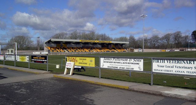
Galabank
Galabank is a football stadium in the town of Annan, Dumfries and Galloway, Scotland. It is the home ground of Scottish Professional Football League club...

Annan Castle
Annan Castle, was a castle that was located on the banks of the River Annan, in Annan, Scotland.A motte and bailey castle was built in the early 12th century...

Annan Town Hall
Annan Town Hall is a municipal building in the High Street in Annan, Dumfries and Galloway, Scotland. The structure, which accommodates the local library...
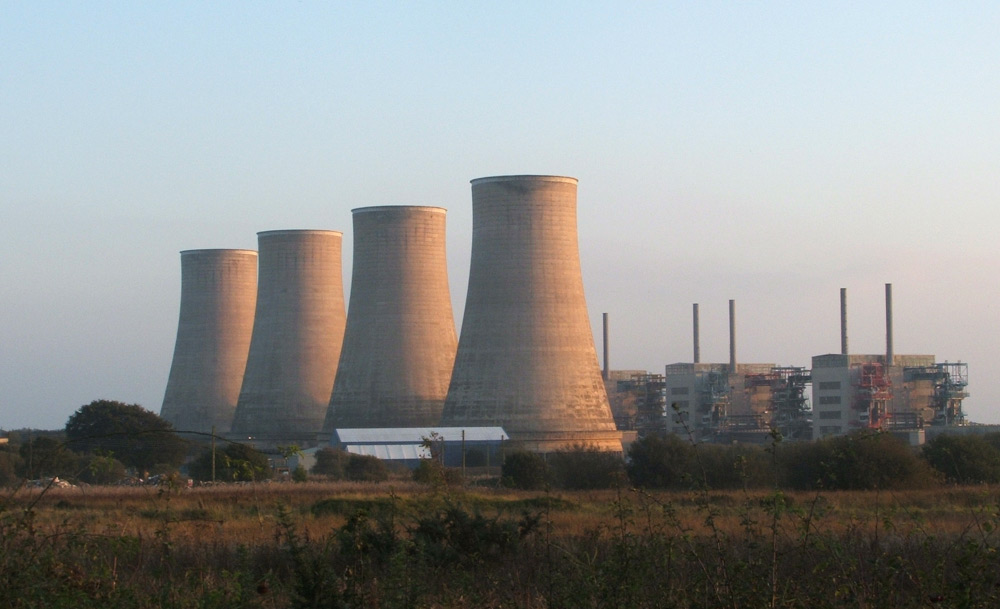
Chapelcross nuclear power station
Chapelcross nuclear power station is a former Magnox nuclear power station undergoing decommissioning. It is located in Annan in Dumfries and Galloway...

Newbie Junction Halt railway station
Newbie Junction Halt railway station was a railway station in Dumfries and Galloway, Scotland, located just west of Annan on the old Glasgow and South...
Nearby Amenities
Located within 500m of 55.012362,-3.2734697Have you been to Dalebank Plantation?
Leave your review of Dalebank Plantation below (or comments, questions and feedback).