Black Wood

Wood, Forest in Perthshire

Scotland

Black Wood

Moncreiffe Hill Track Looking eastwards down the track on the south side of Moncreiffe Hill.
Moncreiffe Hill Track Credit: Scott Cormie

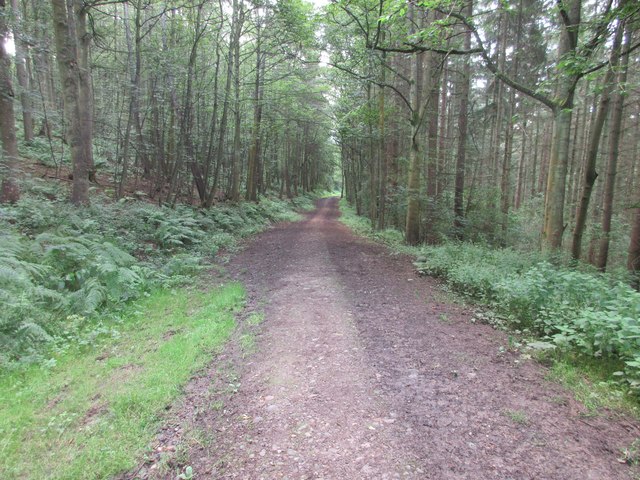
Black Wood is a small but enchanting forest located in Perthshire, Scotland. Situated on the eastern shores of Loch Rannoch, it covers an area of approximately 1,000 acres. The forest is predominantly composed of tall, dense pine trees, giving it a dark and mystical appearance, hence the name "Black Wood."

This ancient woodland has a rich history dating back thousands of years. It was originally part of the great Caledonian Forest, which once covered vast areas of Scotland. Today, Black Wood is one of the few remaining fragments of this once-extensive forest.

The forest is home to a diverse range of wildlife, including red squirrels, roe deer, and a variety of bird species. It is also a haven for nature enthusiasts and walkers, with several well-marked trails winding through the woodland. The most popular route is the Black Wood of Rannoch Trail, a circular path that takes visitors on a scenic journey through the forest, offering breathtaking views of Loch Rannoch.

In addition to its natural beauty, Black Wood holds historical significance. Hidden within its depths are the ruins of an ancient chapel, believed to have been built in the 16th century. The chapel once served as a place of worship for the local community.

Black Wood, Perthshire, offers a peaceful and tranquil escape from the hustle and bustle of everyday life. Its majestic pine trees, diverse wildlife, and historical remnants make it a must-visit destination for nature lovers and history enthusiasts alike.

If you have any feedback on the listing, please let us know in the comments section below.

Black Wood Images

Images are sourced within 2km of 56.369624/-3.3606196 or Grid Reference NO1620. Thanks to Geograph Open Source API. All images are credited.

Moncreiffe Hill Track Looking eastwards down the track on the south side of Moncreiffe Hill.
Moncreiffe Hill Track
Looking eastwards down the track on the south side of Moncreiffe Hill.
Start of the path The start of the path along the south side of Moncreiffe Hill from the Earn Car Park.
Start of the path
The start of the path along the south side of Moncreiffe Hill from the Earn Car Park.
Field of oats near Wallacetown Oat field south of Wallacetown, with the Ochil Hills in the distance.
Field of oats near Wallacetown
Oat field south of Wallacetown, with the Ochil Hills in the distance.
Wheat field near Mains of Kinmonth Field of wheat, with the wooded heights of the eastern side of Moncreiffe Hill beyond.
Wheat field near Mains of Kinmonth
Field of wheat, with the wooded heights of the eastern side of Moncreiffe Hill beyond.
Wheat field near Fingask Looking down a field of wheat towards the valley of the Earn and the Ochil Hills beyond.
Wheat field near Fingask
Looking down a field of wheat towards the valley of the Earn and the Ochil Hills beyond.
Moncreiffe Hill looking south
River Earn Looking east.
River Earn
Looking east.
Woodland walk The start of a woodland walk on Moncreiffe Hill.
Woodland walk
The start of a woodland walk on Moncreiffe Hill.
Cottages at Fingask Looking north east along the row of cottages.
Cottages at Fingask
Looking north east along the row of cottages.
Down from the viewpoint The start of the downhill section of the woodland walk on Moncreiffe Hill, leading from the eastern viewpoint back towards the car park.
Down from the viewpoint
The start of the downhill section of the woodland walk on Moncreiffe Hill, leading from the eastern viewpoint back towards the car park.
Park for the walk Car park where the various woodland walks around Moncreiffe Hill start and end.
Park for the walk
Car park where the various woodland walks around Moncreiffe Hill start and end.
Uprooted Beech Tree This uprooted Beech tree lies adjacent to the upper track in the woods on Moncreiffe Hill. Although uprooted and displaying grotesque patterns some branches have struck into the ground and those upright continue to show a vigorous growth. This attractive and varied wood with some superb views over the surrounding countryside is owned by the Woodland Trust Scotland.
Uprooted Beech Tree
This uprooted Beech tree lies adjacent to the upper track in the woods on Moncreiffe Hill. Although uprooted and displaying grotesque patterns some branches have struck into the ground and those upright continue to show a vigorous growth. This attractive and varied wood with some superb views over the surrounding countryside is owned by the Woodland Trust Scotland.
Waterlogged field Farmland covered by water from recently melted snow, now re-frozen as the January temperature falls.
Waterlogged field
Farmland covered by water from recently melted snow, now re-frozen as the January temperature falls.
Farmland near Fingask Ploughing underway in January after the winter snow has melted.
Farmland near Fingask
Ploughing underway in January after the winter snow has melted.
View across the Tay From Deuchny Hill towards Dow Hill and the Perth sewage treatment works.
View across the Tay
From Deuchny Hill towards Dow Hill and the Perth sewage treatment works.
Fingask Farmlands Between the Rivers Tay and Earn lies a peninsula - the demesne of the Moncreiffes.
Fingask Farmlands
Between the Rivers Tay and Earn lies a peninsula - the demesne of the Moncreiffes.
View of Cottages Pretty roadside cottages on the corner of the roads to Wester Rhynd and Easter Rhynd.
View of Cottages
Pretty roadside cottages on the corner of the roads to Wester Rhynd and Easter Rhynd.
To Easter Rhynd The unclassified road to the hamlet of Easter Rhynd with the cultivated farmlands of Fingask.
To Easter Rhynd
The unclassified road to the hamlet of Easter Rhynd with the cultivated farmlands of Fingask.
Show me another place!

Black Wood is located at Grid Ref: NO1620 (Lat: 56.369624, Lng: -3.3606196)

Unitary Authority: Perth and Kinross

Police Authority: Tayside

What 3 Words

///converter.isolated.braked. Near Bridge of Earn, Perth & Kinross

Nearby Locations

Black Wood Kippie Wood

Related Wikis

Rhynd

Rhynd () is a hamlet in Perth and Kinross, Scotland. It is located 3+1⁄4 miles (5.2 kilometres) southeast of Perth, on the south side of the River Tay...

Elcho Castle

Elcho Castle () is located close to the south bank of the River Tay approximately four miles south-east of Perth, Scotland, in the region of Perth and...

Kinfauns railway station

Kinfauns railway station served the village of Kinfauns, Perthshire, Scotland, from 1847 to 1950 on the Dundee and Perth Railway. == History == The station...

Kinfauns Parish Church

Kinfauns Parish Church is a Church of Scotland church in Kinfauns, Perth and Kinross, Scotland. Dating to 1869, the work of architect Andrew Heiton and...

Nearby Amenities

Located within 500m of 56.369624,-3.3606196
Power: pole
Lat/Long: 56.366859/-3.3615164
Power: pole
Lat/Long: 56.3667791/-3.36136
Power: pole
Lat/Long: 56.3694643/-3.366808
Power: pole
Lat/Long: 56.3674941/-3.3627385
Power: pole
Lat/Long: 56.366274/-3.3603731
Power: pole
Lat/Long: 56.3685225/-3.3647263
Power: pole
Lat/Long: 56.3690578/-3.3657808
Power: pole
Lat/Long: 56.3657223/-3.359299
Power: pole
Lat/Long: 56.3679945/-3.3637146
Power: pole
Lat/Long: 56.3698642/-3.3678321
Elcho
1860name: Mill Dam
Pont: no
Stobie1783: yes
Designation: Historic Mill
Historic: archaeological_site
Source: Stobie
Lat/Long: 56.3731479/-3.3561809
Power: pole
Lat/Long: 56.3658427/-3.3590777
Power: pole
Lat/Long: 56.3664535/-3.3586937
Power: pole
Lat/Long: 56.367042/-3.3583049
Power: pole
Lat/Long: 56.3677205/-3.3578573
Power: pole
Lat/Long: 56.3684369/-3.3573908
Power: pole
Lat/Long: 56.3691572/-3.3569196
Power: pole
Lat/Long: 56.3697705/-3.3565167
Power: pole
Lat/Long: 56.3703117/-3.3565153
Power: pole
Lat/Long: 56.3708158/-3.3565339
Power: pole
Lat/Long: 56.37128/-3.3565339
Power: pole
Lat/Long: 56.3715919/-3.3565316
Power: pole
Lat/Long: 56.3718124/-3.3556097
Power: pole
Lat/Long: 56.3725807/-3.3550301
Power: pole
Lat/Long: 56.3658945/-3.3650936
Power: pole
Lat/Long: 56.3657759/-3.3642672
Power: pole
Lat/Long: 56.3658442/-3.3632522
Power: pole
Lat/Long: 56.3659152/-3.3622396
Power: pole
Lat/Long: 56.3653839/-3.3622722
Power: pole
Lat/Long: 56.3658468/-3.361057
Power: pole
Lat/Long: 56.3657308/-3.3595392
Power: pole
Lat/Long: 56.3657037/-3.3592017
Power: pole
Lat/Long: 56.3656134/-3.3578981
The data included in this document is from www.openstreetmap.org. The data is made available under ODbL.

Have you been to Black Wood?

Leave your review of Black Wood below (or comments, questions and feedback).