Castley

Settlement in Yorkshire Harrogate

England

Castley

Wharfedale Viaduct shadows
Wharfedale Viaduct shadows Credit: Roy Hughes

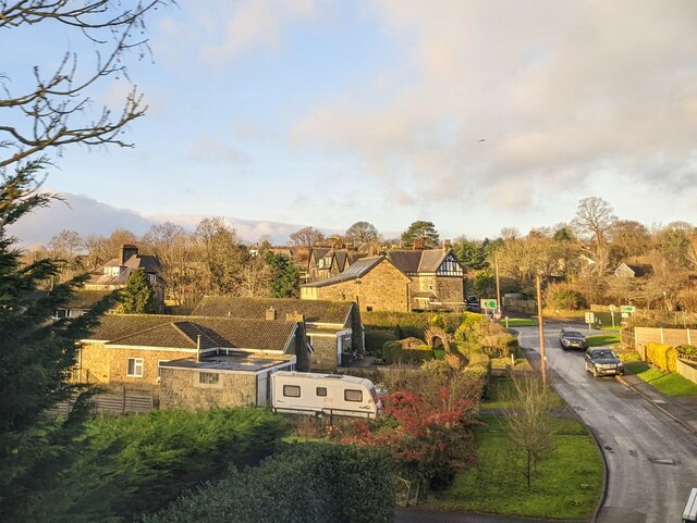
Castley is a charming village located in the county of Yorkshire, England. Situated approximately 10 miles northwest of the city of Leeds, Castley is nestled in the beautiful countryside of the Lower Wharfedale valley. The village is known for its picturesque landscapes, historical sites, and tranquil atmosphere.

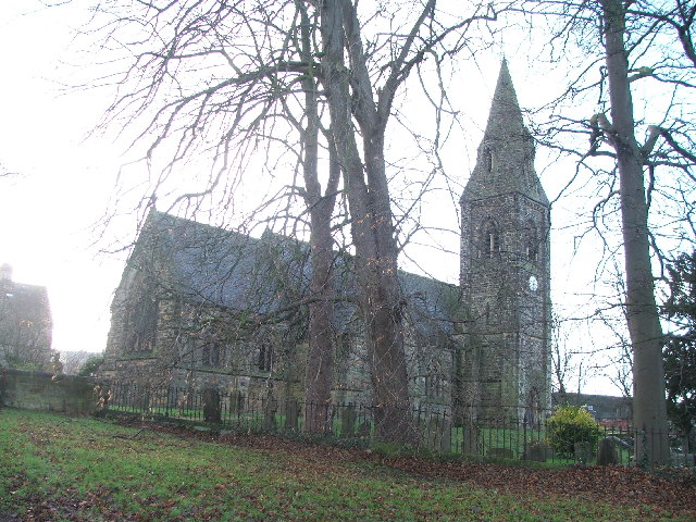
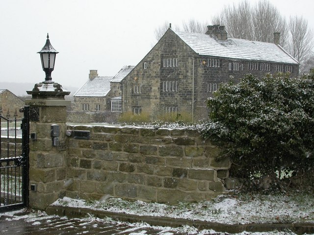
The village of Castley dates back to the medieval era, and its history is evident through its well-preserved architecture. Traditional stone houses and buildings line the streets, giving the village a quaint and timeless charm. The centerpiece of Castley is its ancient church, St. James' Church, which dates back to the 12th century and is a prominent feature in the village.

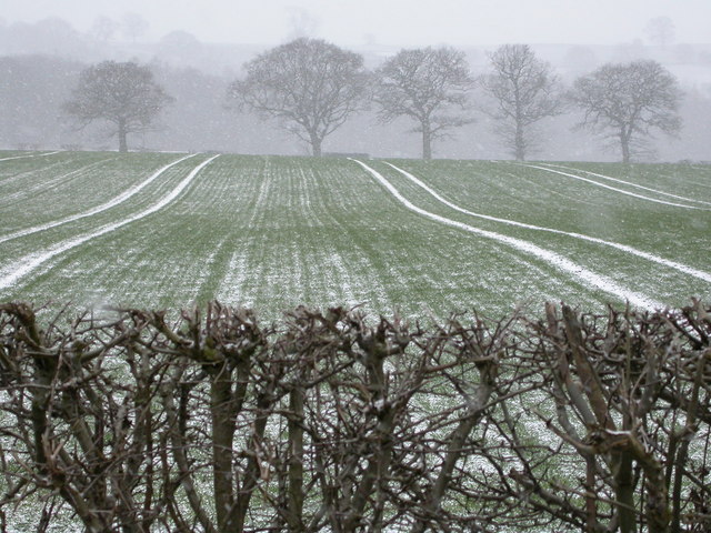
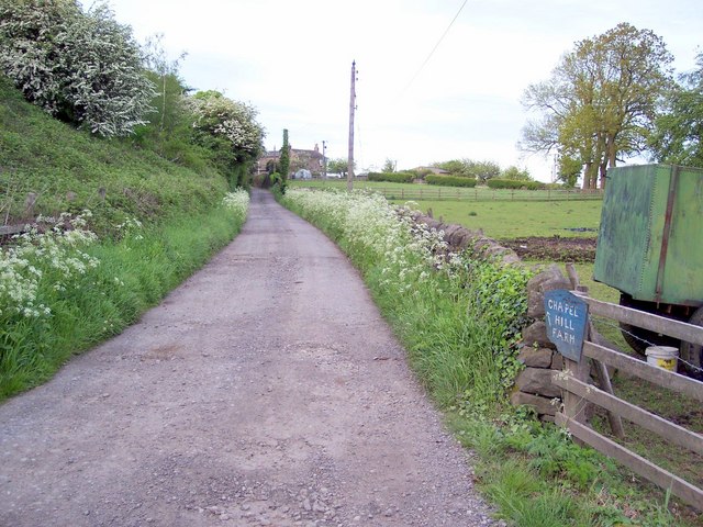
Surrounded by rolling hills and lush green fields, Castley offers stunning views of the Yorkshire countryside. The village is also home to a number of walking and cycling trails, making it a popular destination for outdoor enthusiasts. The nearby Golden Acre Park provides additional opportunities for leisurely walks and picnics.

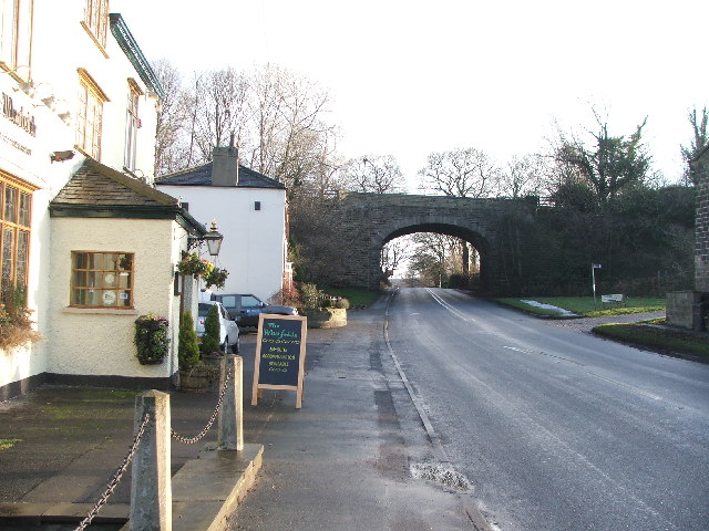
Despite its rural setting, Castley is conveniently located near major transportation links. The village is just a short drive from the A660 road, connecting it to nearby towns and cities. The city of Leeds is easily accessible by car or public transport, offering residents access to a wide range of amenities and cultural attractions.

With its rich history, charming architecture, and breathtaking scenery, Castley is a hidden gem in Yorkshire, offering a peaceful and idyllic setting for both residents and visitors alike.

If you have any feedback on the listing, please let us know in the comments section below.

Castley Images

Images are sourced within 2km of 53.90825/-1.592487 or Grid Reference SE2645. Thanks to Geograph Open Source API. All images are credited.

Wharfedale Viaduct shadows
Castley North Yorkshire
Wescoe Hill North Yorkshire
Huby North Yorkshire
Houses at Huby North Yorkshire
Arthington Viaduct Arthington Viaduct, built 1846, carries the Harrogate-Leeds railway line from North Yorkshire across the River Wharfe into West Yorkshire.  The viaduct, for the Leeds and Thirsk Railway, was engineered by Thomas Granger and built by James Bray. It was 1510 feet long, had 21 arches and required over 50,000 tons of stone to construct.
Arthington Viaduct
Arthington Viaduct, built 1846, carries the Harrogate-Leeds railway line from North Yorkshire across the River Wharfe into West Yorkshire. The viaduct, for the Leeds and Thirsk Railway, was engineered by Thomas Granger and built by James Bray. It was 1510 feet long, had 21 arches and required over 50,000 tons of stone to construct.
Weeton Rather a scattered little place, but this is the nearest to the centre you can get to - the road going towards Huby. The village boasts no shop, no pub - but does have a church and a railway station.
Weeton
Rather a scattered little place, but this is the nearest to the centre you can get to - the road going towards Huby. The village boasts no shop, no pub - but does have a church and a railway station.
Woodgate Lane, Weeton Looking north.
Woodgate Lane, Weeton
Looking north.
Riffa Wood Eastern boundary of Riffa Wood from the A658 Harrogate/Bradford Road
Riffa Wood
Eastern boundary of Riffa Wood from the A658 Harrogate/Bradford Road
Railway bridge by 'The Wharfedale'. Looking E along the A659.
Railway bridge by 'The Wharfedale'.
Looking E along the A659.
Mill Farm. with WHARFEDALE viaduct in the background.
Mill Farm.
with WHARFEDALE viaduct in the background.
St Peters, Arthington.
Arthington House Arthington House is a private residence between Pool and Arthington.
Arthington House
Arthington House is a private residence between Pool and Arthington.
Farm buildings belonging to Creskeld Home Farm The Creskeld Herd dates back to 1920
Farm buildings belonging to Creskeld Home Farm
The Creskeld Herd dates back to 1920
Snowy fields at Ingfield Farm The bare hedgerow, trees and snow-lined furrows make a wintry scene.
Snowy fields at Ingfield Farm
The bare hedgerow, trees and snow-lined furrows make a wintry scene.
The Nunnery Now a private residence, a Cluniac Nunnery was founded on this site in 1150 by Peter de Arthington.
The Nunnery
Now a private residence, a Cluniac Nunnery was founded on this site in 1150 by Peter de Arthington.
Huby Picture taken on rather a dull rainy May evening in Huby, looking west towards Weeton Station railway bridge.
Huby
Picture taken on rather a dull rainy May evening in Huby, looking west towards Weeton Station railway bridge.
Chapel Hill Farm Looking north east to Castle Hill Farm from just after the railway bridge.
Chapel Hill Farm
Looking north east to Castle Hill Farm from just after the railway bridge.
Show me another place!

Castley is located at Grid Ref: SE2645 (Lat: 53.90825, Lng: -1.592487)

Division: West Riding

Administrative County: North Yorkshire

District: Harrogate

Police Authority: North Yorkshire

What 3 Words

///strutted.regret.crowns. Near Pool, West Yorkshire

Nearby Locations

Castley

Related Wikis

Castley

Castley is a village and civil parish in the Harrogate district of North Yorkshire, England. It lies on a bend in the River Wharfe about 10 miles (16 km...
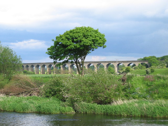
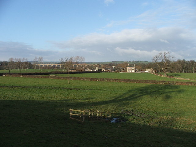
Arthington Viaduct

Arthington Viaduct, listed known as the Wharfedale Viaduct, carries the Harrogate Line across the Wharfe valley between Arthington in West Yorkshire...

Kirkstall Road Viaduct

Kirkstall Road Viaduct is a Grade II listed railway viaduct carrying the Harrogate line over the A65 Kirkstall Road, the River Aire, and the Leeds and...

Arthington

Arthington is a linear village in Wharfedale, in the City of Leeds metropolitan borough in West Yorkshire, England. It is a civil parish which, according...

Huby, Harrogate

Huby is a village in the Harrogate district of North Yorkshire that lies approximately 5 miles (8 km) south of the town of Harrogate and 8.63 miles (13...
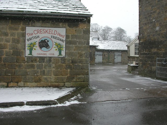
Creskeld Hall

Creskeld Hall is a grade II listed Country House located in Arthington, near Otley, West Yorkshire, England. == Etymology == The place-name is first attested...

Weeton railway station

Weeton railway station serves the villages of Weeton and Huby in North Yorkshire, England. It is located on the Harrogate Line 11.5 miles (19 km) north...

Arthington railway station

Arthington railway station served the village of Arthington in the English county of West Yorkshire, near the North Yorkshire town of Harrogate. ��2...

Nearby Amenities

Located within 500m of 53.90825,-1.592487
Castley
Is In: UK, Yorkshire, Wharfedale
Is In Country Code: GB
Is In County: North Yorkshire
Is In Historic County: West Riding of Yorkshire
Is In Municipality: Harrogate
Is In Valley: Wharfedale
Place: hamlet
Wikidata: Q5050669
Wikipedia: en:Castley
Lat/Long: 53.9082229/-1.5948251
Post Box
Collection Times: Mo-Fr 16:15, Sa 10:45
Ref: LS21 650
Royal Cypher: VR
Royal Cypher Wikidata: Q33102356
Source: survey
Lat/Long: 53.9082001/-1.5924517
Manor House
Building: house
Lat/Long: 53.907846/-1.5888869
Greengates
Building: house
Lat/Long: 53.9068835/-1.5926748
Power: pole
Source: Bing
Lat/Long: 53.9103523/-1.5989317
Chapel Hill
Natural: peak
Source: OS OpenData StreetView
Lat/Long: 53.9081919/-1.5891967
Power: pole
Source: Bing
Lat/Long: 53.9108274/-1.5973237
Barrier: stile
Stile: stepover
Lat/Long: 53.9085318/-1.5922518
Power: pole
Lat/Long: 53.9114547/-1.5951787
Power: pole
Lat/Long: 53.912027/-1.5922186
The data included in this document is from www.openstreetmap.org. The data is made available under ODbL.

Have you been to Castley?

Leave your review of Castley below (or comments, questions and feedback).