Castletown

Settlement in Caithness

Scotland

Castletown

Dunnet Bay looking eastwards
Dunnet Bay looking eastwards Credit: Roger Davies

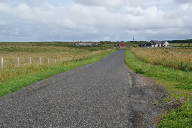
Castletown is a small village located in the historical county of Caithness, in the far north of Scotland. Situated on the eastern coast, Castletown is nestled between the towns of Wick and Thurso. With a population of around 1,000 residents, it is a close-knit community known for its picturesque surroundings and rich history.

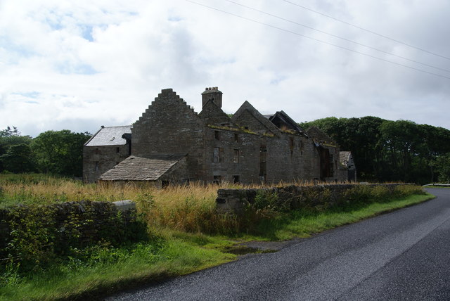
The village takes its name from the ruins of Old Castle, which overlooks the settlement. This medieval fortress, dating back to the 15th century, is a prominent landmark and a popular tourist attraction. Its imposing structure offers stunning views of the surrounding countryside and the North Sea.

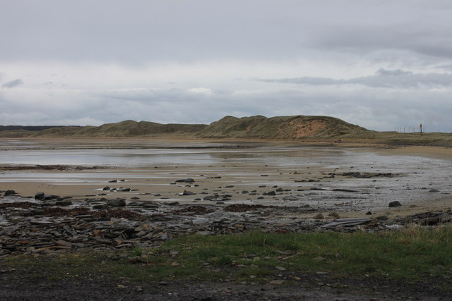
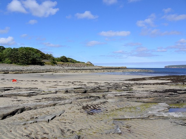
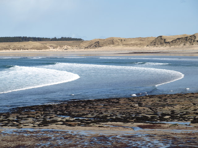
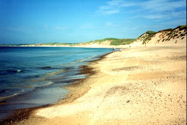
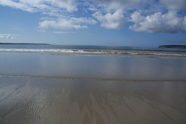
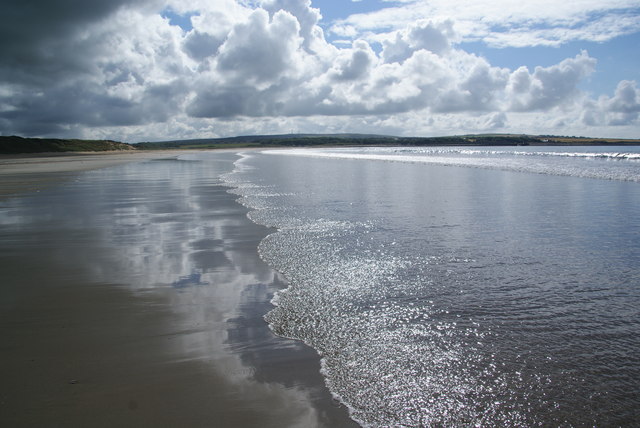
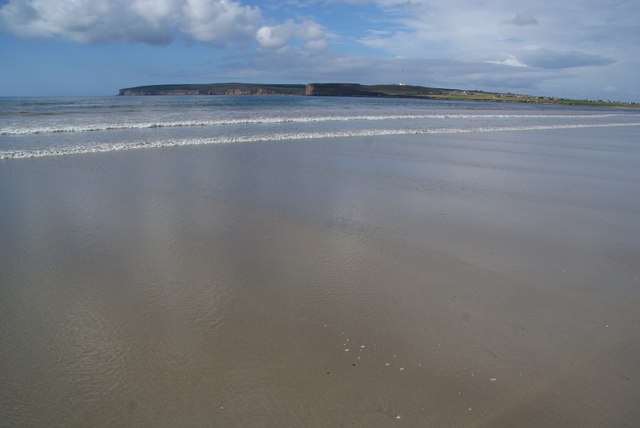
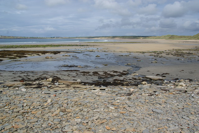
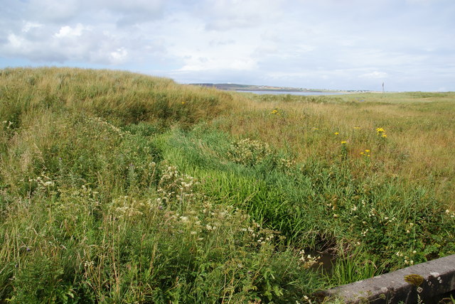
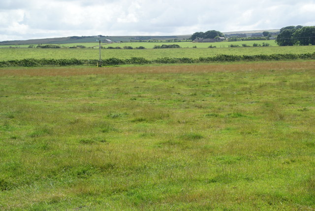
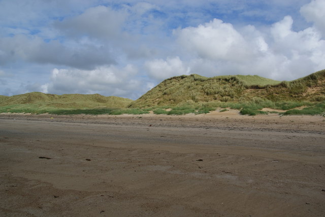
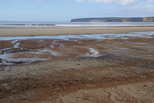
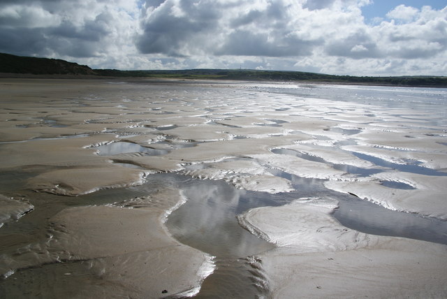
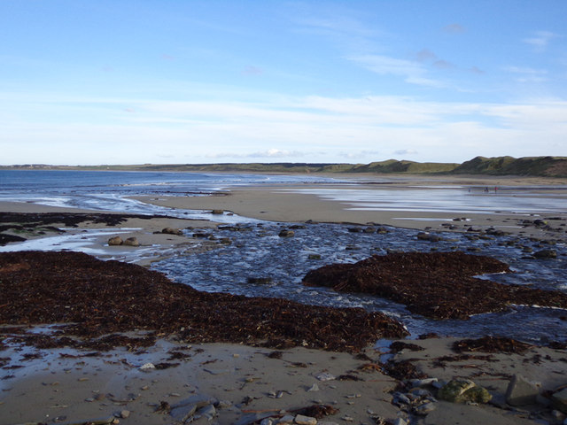
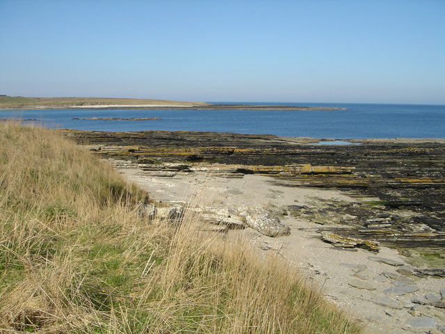
Castletown is blessed with natural beauty, with its rugged coastline, sandy beaches, and rolling hills. The nearby Dunnet Forest provides a peaceful retreat for nature enthusiasts, offering beautiful walking trails and a diverse range of flora and fauna.

The village boasts a range of amenities to cater to its residents and visitors. There are several shops, restaurants, and pubs, providing essential services and a warm community atmosphere. The local primary school is highly regarded, offering quality education to the younger population.

Castletown is also a gateway to numerous attractions in the area. The famous John O'Groats, the most northerly point of mainland Britain, is just a short drive away. Visitors can also explore the nearby Castle Sinclair Girnigoe, a stunning ruin perched dramatically on the cliffs overlooking the sea.

Overall, Castletown offers a charming blend of natural beauty, historical significance, and a welcoming community, making it an ideal destination for those seeking a peaceful retreat or a base to explore the wonders of Caithness.

If you have any feedback on the listing, please let us know in the comments section below.

Castletown Images

Images are sourced within 2km of 58.590759/-3.3839882 or Grid Reference ND1967. Thanks to Geograph Open Source API. All images are credited.

Dunnet Bay looking eastwards
Rocky shore at Dunnet Bay
RAF Castletown Derelict buildings at the site of the short lived air base of RAF Castletown, opened 1940 and closed 1945.
RAF Castletown
Derelict buildings at the site of the short lived air base of RAF Castletown, opened 1940 and closed 1945.
Dunnet  Bay from Castletown Small waves breaking
Dunnet Bay from Castletown
Small waves breaking
Dunnet Beach, summer 1994 Castletown end of the beach
Dunnet Beach, summer 1994
Castletown end of the beach
Dunnet Beach It needed GPS to get the position of this right as it is in the middle of a vast beach. This part is only accessible at low tide.
Dunnet Beach
It needed GPS to get the position of this right as it is in the middle of a vast beach. This part is only accessible at low tide.
Dunnet Beach A vast expanse of beach all to yourself. This is looking towards the southern end of the bay.
Dunnet Beach
A vast expanse of beach all to yourself. This is looking towards the southern end of the bay.
Dunnet Beach Looking towards the northern end of the bay, where the cliffs lead round eventually to Dunnet Head.
Dunnet Beach
Looking towards the northern end of the bay, where the cliffs lead round eventually to Dunnet Head.
Dunnet Beach As seen from the car park at the southern end.
Dunnet Beach
As seen from the car park at the southern end.
Derelict mill east of Castletown Once quite a large mill, but now standing forlornly by the A836.
Derelict mill east of Castletown
Once quite a large mill, but now standing forlornly by the A836.
Burn of Garth A small stream which wends its way through the dunes to the sea on Dunnet Beach.
Burn of Garth
A small stream which wends its way through the dunes to the sea on Dunnet Beach.
Thurdistoft A farm behind the dunes at Dunnet Bay.
Thurdistoft
A farm behind the dunes at Dunnet Bay.
Road to Thurdistoft This road behind the dunes also incorporates part of National Cycle Route 1.
Road to Thurdistoft
This road behind the dunes also incorporates part of National Cycle Route 1.
Flat farmland east of Castletown Part of a flat plain behind the dunes of Dunnet Bay which has revealed Viking and earlier relics.
Flat farmland east of Castletown
Part of a flat plain behind the dunes of Dunnet Bay which has revealed Viking and earlier relics.
Dunes behind Dunnet Beach Local information boards advise that the back of the beach once converted straight into farmland, and the dunes have only developed in the last 900 years or so.
Dunes behind Dunnet Beach
Local information boards advise that the back of the beach once converted straight into farmland, and the dunes have only developed in the last 900 years or so.
The middle of Dunnet Beach The texture of the sand has variety, and this part is covered by produce from seaweed.
The middle of Dunnet Beach
The texture of the sand has variety, and this part is covered by produce from seaweed.
Mottled effect in the sand on Dunnet Beach Patterns produced by draining water on the beach.
Mottled effect in the sand on Dunnet Beach
Patterns produced by draining water on the beach.
South side of Dunnet Bay View towards Dunnet.
South side of Dunnet Bay
View towards Dunnet.
Show me another place!

Castletown is located at Grid Ref: ND1967 (Lat: 58.590759, Lng: -3.3839882)

Unitary Authority: Highland

Police Authority: Highlands and Islands

What 3 Words

///muddy.holds.subplot. Near Thurso, Highland

Nearby Locations

Castletown

Related Wikis

Castletown, Highland

Castletown (Scottish Gaelic: Baile a' Chaisteil) is a village on the north coast of the Highland council area of Scotland, situated near Dunnet Bay. It...
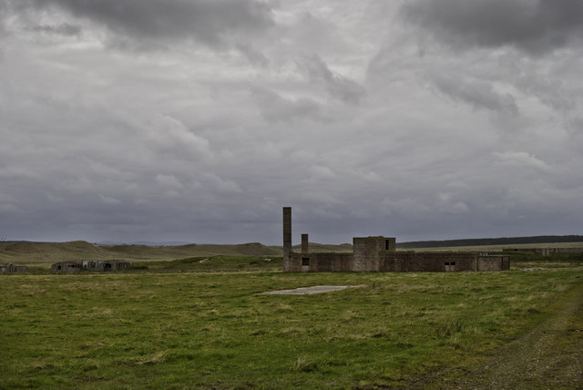
RAF Castletown

Royal Air Force Castletown or more simply RAF Castletown, is a former Royal Air Force station that operated during the Second World War. Built near to...

Murkle

Murkle (Murchill) is a small scattered hamlet, made up of East Murkle and West Murkle located one mile (1.6 km) east of Thurso, in Caithness, Scottish...

Dunnet Forest

Dunnet Forest in Dunnet, Caithness, Scotland, is the most northerly community woodland on the UK mainland, and has been managed since 2003 by Dunnet Forestry...

Olrig

Olrig is a parish in Caithness, Scotland. The main settlement in the parish is Castletown. Prior to the 19th century, the parish was sub-divided into...

Dunnet Church

Dunnet Parish Church is a Church of Scotland church in Dunnet, Caithness, northern Scotland. References to St Mary's Parish Church are known from as far...

Dunnet

Dunnet is a village in Caithness, in the Highland area of Scotland. It is within the Parish of Dunnet. == Village == The village centres on the A836–B855...

Haimer

Haimer is a small hamlet in Caithness, Scotland. It is located on a road just off the A836 and consists of several small settlements and farming facilities...

Nearby Amenities

Located within 500m of 58.590759,-3.3839882
Bus Stop
Post Office
Naptan AtcoCode: 6700600184
Naptan Bearing: SE
Naptan CommonName: Post Office
Naptan Indicator: opp
Naptan Landmark: Bus Shelter
Naptan NaptanCode: 45326253
Naptan Street: Main Street
Naptan Verified: no
Source: naptan_import
Lat/Long: 58.5910572/-3.3846658
Bus Stop
Drill Hall
Naptan AtcoCode: 6700712497
Naptan Bearing: NW
Naptan CommonName: Drill Hall
Naptan Indicator: opp
Naptan Landmark: Drill Hall
Naptan NaptanCode: 45326256
Naptan Street: Main Street
Naptan Verified: no
Source: naptan_import
Lat/Long: 58.592524/-3.3902467
Bus Stop
Primary School
Naptan AtcoCode: 6700712500
Naptan Bearing: NE
Naptan CommonName: Primary School
Naptan Indicator: o/s
Naptan Landmark: Primary House
Naptan NaptanCode: 45327867
Naptan Street: Olrig House Road
Naptan Verified: no
Source: naptan_import
Lat/Long: 58.5880112/-3.3839262
Bus Stop
Drill Hall
Naptan AtcoCode: 670085353
Naptan Bearing: SE
Naptan CommonName: Drill Hall
Naptan Indicator: o/s
Naptan Landmark: Drill Hall
Naptan NaptanCode: 45326254
Naptan Street: Main Street
Naptan Verified: no
Source: naptan_import
Lat/Long: 58.5927919/-3.3903949
Fuel
Gulf
Brand: Gulf
Brand Wikidata: Q5617505
Lat/Long: 58.5927826/-3.3908438
Castletown
Name En: Castletown
Name Gd: Baile a’ Chaisteil
Place: village
Population: 810
Source: os7
Wikidata: Q1970441
Wikipedia: en:Castletown, Highland
Lat/Long: 58.5924741/-3.38722
Fast Food
Castletown Chip Shop
Contact Phone: +44 1847 821778
Lat/Long: 58.5924615/-3.3869031
Atm
Lat/Long: 58.5929212/-3.3913289
Power: pole
Lat/Long: 58.5941104/-3.3885401
Power: pole
Lat/Long: 58.5936401/-3.3869931
Power: pole
Lat/Long: 58.5931811/-3.385489
Power: pole
Lat/Long: 58.5927085/-3.3839334
Power: pole
Lat/Long: 58.5922405/-3.3824079
Playground: slide
Lat/Long: 58.5887983/-3.3808764
Playground: swing
Lat/Long: 58.5887496/-3.3809211
Playground: seesaw
Lat/Long: 58.5888143/-3.3810492
Playground: slide
Lat/Long: 58.5887875/-3.3809811
Bench
Lat/Long: 58.5887059/-3.3808802
Waste Basket
Lat/Long: 58.5887622/-3.381074
Grit Bin
Lat/Long: 58.5874509/-3.3803507
Access: private
Leisure: garden
Lat/Long: 58.5890057/-3.381312
Post Box
Collection Times: Mo-Fr 13:00; Sa 12:30
Operator: Royal Mail
Post Box Type: lamp
Ref: KW14 71
Royal Cypher: scottish_crown
Lat/Long: 58.5929381/-3.3913086
Post Box
Collection Times: Mo-Fr 13:00; Sa 12:30
Operator: Royal Mail
Post Box Type: wall
Ref: KW14 25
Royal Cypher: scottish_crown
Lat/Long: 58.5914957/-3.3862138
Power: pole
Lat/Long: 58.5909026/-3.3763756
Power: pole
Lat/Long: 58.5907661/-3.3779837
Power: pole
Lat/Long: 58.5905852/-3.3799755
Power: pole
Lat/Long: 58.590836/-3.3809237
Power: pole
Lat/Long: 58.5900773/-3.3783126
Power: pole
Lat/Long: 58.5893863/-3.3786415
Power: pole
Lat/Long: 58.5886868/-3.3789908
Power: pole
Lat/Long: 58.5884456/-3.378075
Power: pole
Lat/Long: 58.588163/-3.377068
Power: pole
Lat/Long: 58.5911534/-3.3820018
Power: pole
Lat/Long: 58.5913047/-3.3825622
Power: pole
Lat/Long: 58.5915036/-3.3832526
The data included in this document is from www.openstreetmap.org. The data is made available under ODbL.

Have you been to Castletown?

Leave your review of Castletown below (or comments, questions and feedback).