Logan Wood

Wood, Forest in Peeblesshire

Scotland

Logan Wood

Farmland above Drumelzier
Farmland above Drumelzier Credit: Colin Park

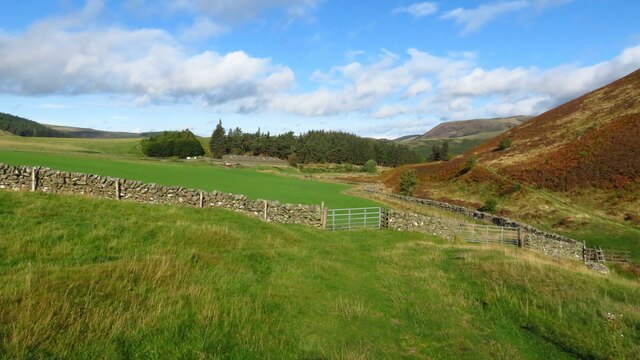
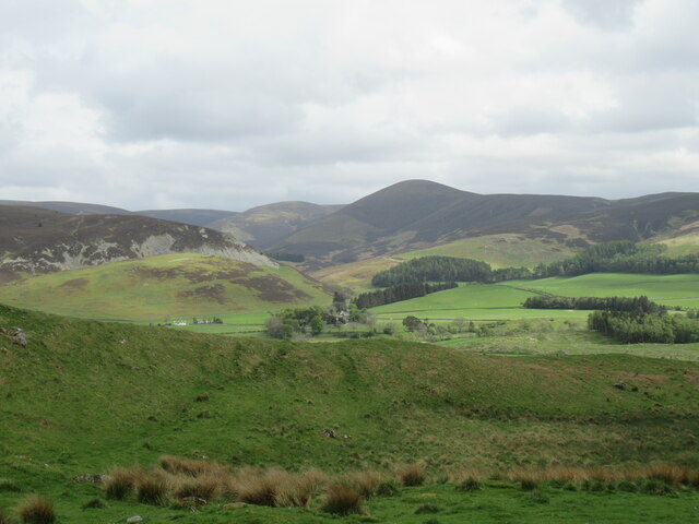
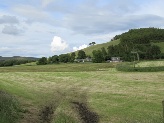
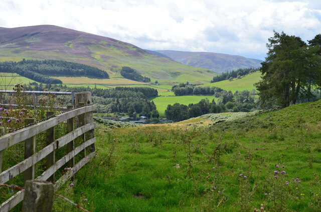
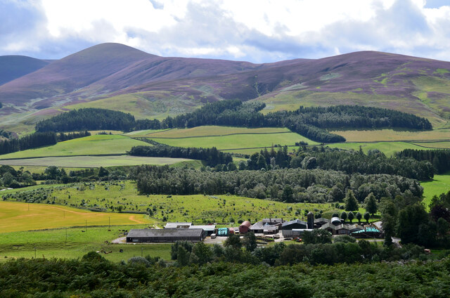
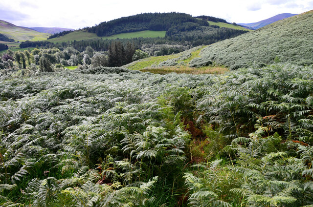
Logan Wood is a picturesque forest located in Peeblesshire, Scotland. Spanning over a vast area, it is renowned for its natural beauty and rich biodiversity. The wood is situated near the town of Peebles and is easily accessible for nature enthusiasts and hikers alike.

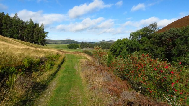
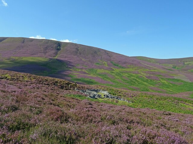
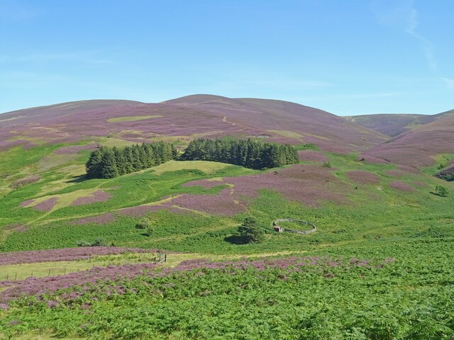
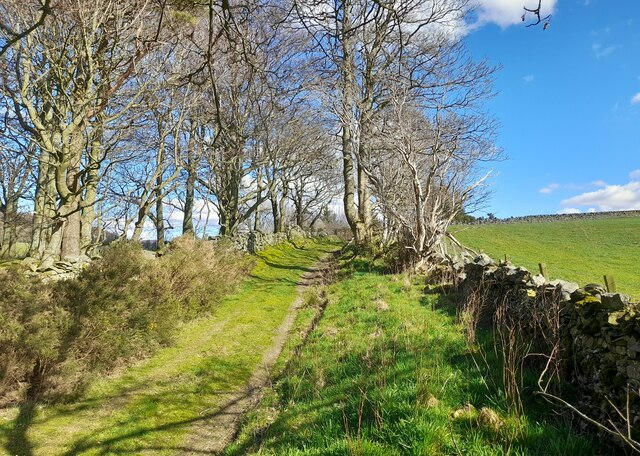
Covered in a dense canopy of trees, Logan Wood offers a peaceful and serene environment. The woodland is mainly composed of native species such as oak, birch, and pine, providing a habitat for various wildlife, including deer, squirrels, and a diverse range of bird species. It is a haven for birdwatchers and wildlife photographers, who can spot rare and endangered species within its boundaries.

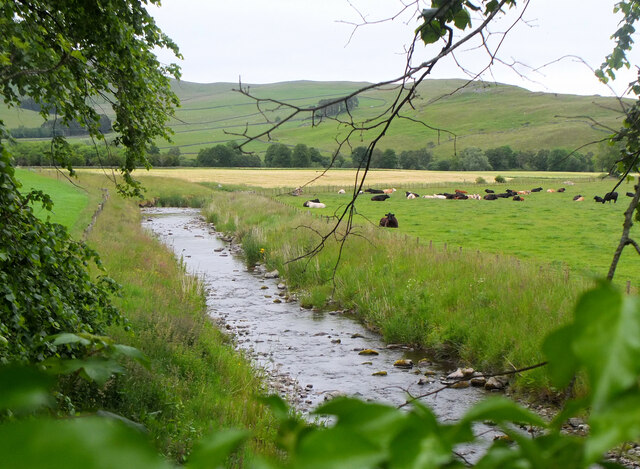
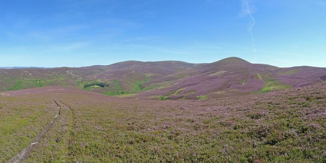
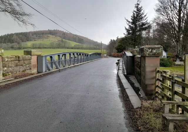
The forest is crisscrossed with well-maintained walking trails, allowing visitors to explore its hidden treasures. These paths wind through the woodland, offering breathtaking views of the surrounding countryside and the nearby Tweed Valley. Along the way, visitors may come across charming clearings and babbling streams, adding to the overall enchantment of the wood.

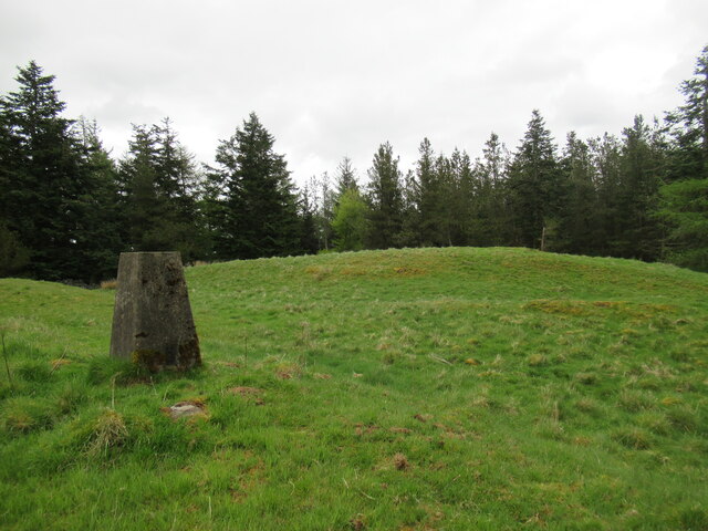
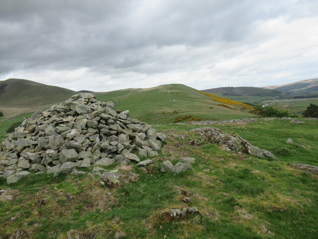
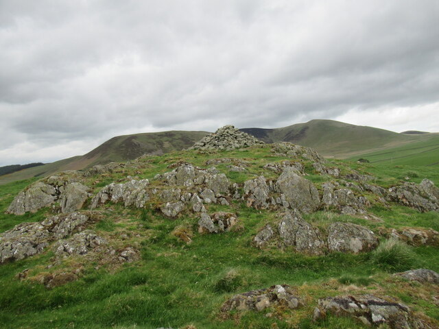
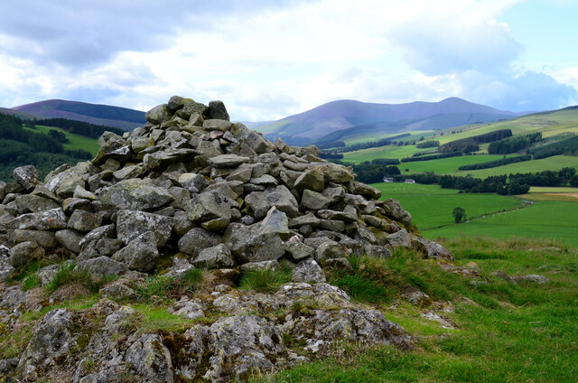
Logan Wood also holds historical significance, with remnants of ancient settlements and structures scattered throughout. Archaeological sites dating back to the Iron Age have been discovered within its boundaries, providing a glimpse into the region's rich past.

Overall, Logan Wood in Peeblesshire is a must-visit destination for nature lovers and history enthusiasts. Its stunning natural landscapes, abundant wildlife, and historical heritage make it a truly unique and captivating place to explore.

If you have any feedback on the listing, please let us know in the comments section below.

Logan Wood Images

Images are sourced within 2km of 55.587151/-3.3801418 or Grid Reference NT1333. Thanks to Geograph Open Source API. All images are credited.

Farmland above Drumelzier
Track beside Drumelzier Burn, southeast of Drumelzier
Trig point on Rachan Hill The remains of a prehistoric hill fort can be traced on the summit of this small hill, but it seems they have been damaged by afforestation in the twentieth century.

More details can be found at <span class="nowrap"><a title="https://canmore.org.uk/site/49911/rachan-hill" rel="nofollow ugc noopener" href="https://canmore.org.uk/site/49911/rachan-hill">Link</a><img style="margin-left:2px;" alt="External link" title="External link - shift click to open in new window" src="https://s1.geograph.org.uk/img/external.png" width="10" height="10"/></span>
Trig point on Rachan Hill
The remains of a prehistoric hill fort can be traced on the summit of this small hill, but it seems they have been damaged by afforestation in the twentieth century. More details can be found at LinkExternal link
View towards Drumelzier Law from Dreva Craig Drumelzier Law rises above low-lying farmland by the River Tweed.
View towards Drumelzier Law from Dreva Craig
Drumelzier Law rises above low-lying farmland by the River Tweed.
Cairn at Dreva Craig Dreva Craig has the extensive remnants of a prehistoric fort, settlement and protective structures.  For more information see <span class="nowrap"><a title="https://canmore.org.uk/site/49881/dreva-craig" rel="nofollow ugc noopener" href="https://canmore.org.uk/site/49881/dreva-craig">Link</a><img style="margin-left:2px;" alt="External link" title="External link - shift click to open in new window" src="https://s1.geograph.org.uk/img/external.png" width="10" height="10"/></span>
Cairn at Dreva Craig
Dreva Craig has the extensive remnants of a prehistoric fort, settlement and protective structures. For more information see LinkExternal link
Dreva Craig Dreva Craig is the site of a prehistoric fort, settlement and defences. For more information, see <span class="nowrap"><a title="https://canmore.org.uk/site/49881/dreva-craig" rel="nofollow ugc noopener" href="https://canmore.org.uk/site/49881/dreva-craig">Link</a><img style="margin-left:2px;" alt="External link" title="External link - shift click to open in new window" src="https://s1.geograph.org.uk/img/external.png" width="10" height="10"/></span>
Dreva Craig
Dreva Craig is the site of a prehistoric fort, settlement and defences. For more information, see LinkExternal link
Holms Water near Rachan Looking downstream from the bridge on the track from Rachan Home Farm.
Holms Water near Rachan
Looking downstream from the bridge on the track from Rachan Home Farm.
Hillside Cottages below Rachan Hill Viewed from the side of the Glenholm road.
Hillside Cottages below Rachan Hill
Viewed from the side of the Glenholm road.
Lower Slopes of Drumelzier Law Lovely early autumnal/late summer colours in the hills south of Drumelzier.
The differing shades of purple showing that both Common Heather and Bell Heather are in abundance on the hills here.
Lower Slopes of Drumelzier Law
Lovely early autumnal/late summer colours in the hills south of Drumelzier. The differing shades of purple showing that both Common Heather and Bell Heather are in abundance on the hills here.
All around the bloomin' heather Heather in full bloom on the hills south of Drumelzier. A grand day to be out in the bloomin' heather though not sure there is wild mountain thyme about.
Very different colours to this scene from October 2020 from about the same spot.
<a title="https://www.geograph.org.uk/photo/6627939" href="https://www.geograph.org.uk/photo/6627939">Link</a>
All around the bloomin' heather
Heather in full bloom on the hills south of Drumelzier. A grand day to be out in the bloomin' heather though not sure there is wild mountain thyme about. Very different colours to this scene from October 2020 from about the same spot. Link
Heather in Full Bloom Sheepfold above the Drumelzier Burn and the lower slopes of Pykestone Hill seen from Finglen Rig. Heather in full bloom and very different to the relatively drab colours seen here in October 2020:-
<a title="https://www.geograph.org.uk/photo/6627953" href="https://www.geograph.org.uk/photo/6627953">Link</a>
Heather in Full Bloom
Sheepfold above the Drumelzier Burn and the lower slopes of Pykestone Hill seen from Finglen Rig. Heather in full bloom and very different to the relatively drab colours seen here in October 2020:- Link
Scattered trees above Drumelzier
Merlindale Bridge Merlindale Bridge crosses the River Tweed on the B712 at Drumelzier . This minor road runs from Hallyn to Rachan. It is the first bridge to take a classified road over the Tweed downstream from the river's source
Merlindale Bridge
Merlindale Bridge crosses the River Tweed on the B712 at Drumelzier . This minor road runs from Hallyn to Rachan. It is the first bridge to take a classified road over the Tweed downstream from the river's source
Track near Rachan Mill Track near Rachan Mill.
Track near Rachan Mill
Track near Rachan Mill.
From the summit of the Dreva road Looking over Rachan Home Farm to the heathery upper slopes of Logan Head.
From the summit of the Dreva road
Looking over Rachan Home Farm to the heathery upper slopes of Logan Head.
Dreva Craig summit cairn The cairn is within the area of the hill fort and settlement overlooking the junction of the Biggar Gap and the Tweed. Compare with <a href="https://www.geograph.org.uk/photo/1714667">NT1235 : Summit cairn, Dreva Craig</a> taken in 2010.
Dreva Craig summit cairn
The cairn is within the area of the hill fort and settlement overlooking the junction of the Biggar Gap and the Tweed. Compare with NT1235 : Summit cairn, Dreva Craig taken in 2010.
Rachan Home Farm The farm seen from the summit of Dreva Craig with the ridge from Logan Head to Drumelzier Law in the background.
Rachan Home Farm
The farm seen from the summit of Dreva Craig with the ridge from Logan Head to Drumelzier Law in the background.
Dense bracken on Dreva Craig Getting to grips with a belt of bracken, head-high in places, on the southern slope.
Dense bracken on Dreva Craig
Getting to grips with a belt of bracken, head-high in places, on the southern slope.
Show me another place!

Logan Wood is located at Grid Ref: NT1333 (Lat: 55.587151, Lng: -3.3801418)

Unitary Authority: The Scottish Borders

Police Authority: The Lothians and Scottish Borders

What 3 Words

///bonkers.tokens.jolt. Near Biggar, South Lanarkshire

Nearby Locations

Logan Wood

Related Wikis

Drumelzier

Drumelzier (), is a village and civil parish on the B712 in the Tweed Valley in the Scottish Borders. The area of the village is extensive and includes...

Wrae Tower

Wrae Tower is a ruined 16th-century stone tower house, located in the upper Tweed Valley in the Scottish Borders area of Scotland, and similarly south...

Biggar Water

Biggar Water is a river in Lanarkshire and Peeblesshire, in the Southern Uplands of Scotland. It forms part of the River Tweed system. It rises, as Biggar...

Holms Water

The Holms Water is a river and a tributary of the Biggar Water, which is a tributary of the River Tweed, in the parish of Broughton, Glenholm and Kilbucho...

Nearby Amenities

Located within 500m of 55.587151,-3.3801418
Power: pole
Lat/Long: 55.5864117/-3.3871553
Power: pole
Lat/Long: 55.5870561/-3.3861273
Power: pole
Lat/Long: 55.5875307/-3.3853848
Power: pole
Lat/Long: 55.5882264/-3.3842785
Power: pole
Lat/Long: 55.5887967/-3.3833625
Power: pole
Lat/Long: 55.589435/-3.3823451
Power: pole
Lat/Long: 55.5900495/-3.3813678
Power: pole
Lat/Long: 55.5905204/-3.3809214
Power: pole
Lat/Long: 55.5913485/-3.3801765
The data included in this document is from www.openstreetmap.org. The data is made available under ODbL.

Have you been to Logan Wood?

Leave your review of Logan Wood below (or comments, questions and feedback).