Donkey Wood

Wood, Forest in Peeblesshire

Scotland

Donkey Wood

Lamb Rig Newly planted with trees.
Lamb Rig Credit: Richard Webb

Donkey Wood is a picturesque woodland located in Peeblesshire, a historic county in the Scottish Borders region of Scotland. Spanning over a vast area, the wood is a cherished natural gem known for its tranquility and scenic beauty.

The woodland is primarily composed of deciduous trees, including oak, birch, and beech, which create a dense canopy that provides shade and shelter to a diverse range of wildlife. Donkey Wood is also home to an array of flora, such as bluebells, wild garlic, and ferns, that carpet the forest floor during the spring and summer months.

The wood is intersected by several footpaths and trails, allowing visitors to explore its enchanting surroundings. These pathways provide a peaceful escape for walkers, hikers, and nature enthusiasts alike, offering opportunities to observe birds, squirrels, and other woodland creatures in their natural habitat. The area is also a popular spot for birdwatching, with species such as woodpeckers, owls, and various songbirds being frequently sighted.

Donkey Wood has a rich history, with evidence of human occupation stretching back thousands of years. The remains of ancient settlements and burial sites can be found within the woodland, serving as a testament to the area's cultural significance.

In summary, Donkey Wood is a stunning forest in Peeblesshire, Scotland, renowned for its natural beauty, diverse wildlife, and historical significance. Whether visitors seek a peaceful walk, a chance to connect with nature, or a glimpse into the past, Donkey Wood offers something for everyone.

If you have any feedback on the listing, please let us know in the comments section below.

Donkey Wood Images

Images are sourced within 2km of 55.778025/-3.3896723 or Grid Reference NT1254. Thanks to Geograph Open Source API. All images are credited.

Lamb Rig Newly planted with trees.
Lamb Rig
Newly planted with trees.
Sawmill, Baddinsgill
The dam, Baddinsgill Reservoir
Log stacks, Thieves Road
Pentland Hills near Baddinsgill Reservoir A field almost surrounded by a shelter belt.
Pentland Hills near Baddinsgill Reservoir
A field almost surrounded by a shelter belt.
Thieves Road The track that crosses the pass at Cauldstane Slap with East Cairn Hill in the background.
Thieves Road
The track that crosses the pass at Cauldstane Slap with East Cairn Hill in the background.
Quarry on Muckle Knock A rather uncomfortable stony road runs to the quarry. After the quarry there is a lovely grassy track into the moors below West Cairn Hill.
Quarry on Muckle Knock
A rather uncomfortable stony road runs to the quarry. After the quarry there is a lovely grassy track into the moors below West Cairn Hill.
Byrehope Mount Pentland Hills.  Byrehope is the hollow just beneath the summit.
Byrehope Mount
Pentland Hills. Byrehope is the hollow just beneath the summit.
The Baddinsgill Burn, Pentland Hills 2009 view here: <a href="https://www.geograph.org.uk/photo/1209261">NT1155 : Valley of the Baddinsgill Burn</a>
The Baddinsgill Burn, Pentland Hills
Track on Muckle Knock A very enjoyable grassy track - it leads nowhere. The early part is horribly stony but pass the quarry and you are rewarded.
Track on Muckle Knock
A very enjoyable grassy track - it leads nowhere. The early part is horribly stony but pass the quarry and you are rewarded.
Summit, Muckle Knock I am still finding the odd Pentland summit that I have not visited. Good view through to The Kips.
Summit, Muckle Knock
I am still finding the odd Pentland summit that I have not visited. Good view through to The Kips.
Log pile with buried roadsign Baddinsgill, Pentland Hills.
Log pile with buried roadsign
Baddinsgill, Pentland Hills.
Sheep grazing near Baddinsgill Farm The smoke is coming from a chimney at a timber and firewood business that operates from this site.
Sheep grazing near Baddinsgill Farm
The smoke is coming from a chimney at a timber and firewood business that operates from this site.
Baddinsgill Reservoir spillway
The road to Baddinsgill Farm
Baddinsgill Reservoir dam The lower slopes of Mount Maw rise beyond.
Baddinsgill Reservoir dam
The lower slopes of Mount Maw rise beyond.
The Western slopes of Mount Maw Part of Baddinsgill Reservoir is seen below, with West Cairn Hill in the distance.
The Western slopes of Mount Maw
Part of Baddinsgill Reservoir is seen below, with West Cairn Hill in the distance.
On Colin's Rig The easy track leads to the summit of Mount Maw <a href="https://www.geograph.org.uk/gridref/NT1455">NT1455</a>.
On Colin's Rig
The easy track leads to the summit of Mount Maw NT1455.
Show me another place!

Donkey Wood is located at Grid Ref: NT1254 (Lat: 55.778025, Lng: -3.3896723)

Unitary Authority: The Scottish Borders

Police Authority: The Lothians and Scottish Borders

What 3 Words

///auctioned.improving.foresight. Near West Linton, Scottish Borders

Related Wikis

Baddinsgill

Baddinsgill is a hamlet in the Scottish Borders area of Scotland. The Baddinsgill Reservoir is a few hundred metres north of the hamlet. == See also... ==

Baddinsgill Reservoir

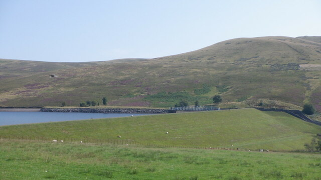
Baddinsgill Reservoir is a small reservoir in the Scottish Borders area of Scotland close to Carlops, West Linton, and the boundary with Midlothian. It...

West Water Reservoir

West Water Reservoir (sometimes Westwater Reservoir) is an artificial reservoir in the Pentland Hills, Scottish Borders, 3 kilometres (1.9 mi) west of...

Carlops

Carlops (Scottish Gaelic: Leum na Caillich) is a small village in the Pentland Hills, within the Scottish Borders area of Scotland, close to the boundary...
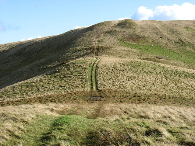
Pentland Hills

The Pentland Hills are a range of hills southwest of Edinburgh, Scotland. The range is around twenty miles (thirty kilometres) in length, and runs southwest...
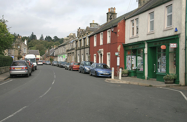
West Linton

West Linton (Scottish Gaelic: Liontan Ruairidh) is a village and civil parish in southern Scotland, on the A702. It was formerly in the county of Peeblesshire...

West Cairn Hill

West Cairn Hill is a hill in the Pentland Hills range of Scotland. With a height of 562 m (1,844 ft), it is the fifth highest elevation and lies on the...

Cauldstane Slap

Cauldstane Slap is a pass located in the Pentland Hills of Scotland. It marks the border between the neighboring council areas of West Lothian and Scottish...

Nearby Amenities

Located within 500m of 55.778025,-3.3896723
Barrier: cattle_grid
Lat/Long: 55.7769053/-3.3946037
Parking
Lat/Long: 55.7788002/-3.3948781
Power: pole
Lat/Long: 55.7741629/-3.3926438
Power: pole
Lat/Long: 55.7748357/-3.3928835
Power: pole
Lat/Long: 55.7754979/-3.3935794
Power: pole
Lat/Long: 55.7761198/-3.3942101
Power: pole
Lat/Long: 55.7767737/-3.3948892
Power: pole
Lat/Long: 55.7774276/-3.3955577
Power: pole
Lat/Long: 55.7779679/-3.3954589
Power: pole
Lat/Long: 55.7785248/-3.3953643
Power: pole
Lat/Long: 55.7790463/-3.3952844
Power: pole
Lat/Long: 55.7792236/-3.3953496
Power: pole
Lat/Long: 55.7796528/-3.3954946
Power: pole
Lat/Long: 55.7800784/-3.3956418
Power: pole
Lat/Long: 55.7805727/-3.3957785
The data included in this document is from www.openstreetmap.org. The data is made available under ODbL.

Have you been to Donkey Wood?

Leave your review of Donkey Wood below (or comments, questions and feedback).