Castlelaw

Settlement in Midlothian

Scotland

Castlelaw

Memorial to C.T.R. Wilson, Nobel Prize Winner See <a title="https://www.geograph.org.uk/photo/903255" href="https://www.geograph.org.uk/photo/903255">Link</a>
Memorial to C.T.R. Wilson, Nobel Prize Winner Credit: Becky Williamson

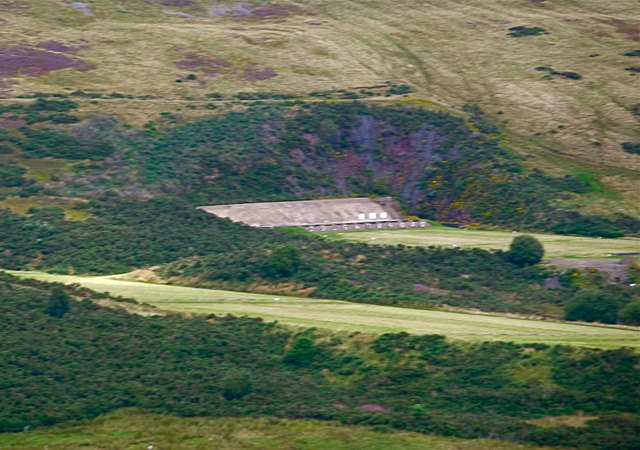
Castlelaw is a historic site located in Midlothian, Scotland. Situated approximately 7 miles south of Edinburgh, it lies within the Pentland Hills Regional Park. This ancient fortress dates back to the Iron Age and is perched on the summit of an impressive hill, offering panoramic views of the surrounding landscape.

The castle itself is a hillfort, a type of fortified settlement commonly found in Scotland during prehistoric times. It consists of a series of defensive earthworks, including ramparts and ditches, which enclose an area of around 1.5 hectares. These defensive features are well-preserved, providing valuable insights into the construction techniques and defensive strategies of the Iron Age inhabitants.

Castlelaw is surrounded by a diverse range of habitats, including grassland, heathland, and woodland. This natural environment supports a rich variety of flora and fauna, making it a popular spot for nature enthusiasts and hikers. The area is also home to several species of birds, including buzzards and kestrels, which can often be spotted soaring above the hills.

The site is easily accessible, with a car park located nearby, and a network of well-maintained footpaths leading visitors to the castle. These paths also provide access to other points of interest within the Pentland Hills, such as the nearby Cramond Roman Fort and the picturesque Glencorse Reservoir.

Castlelaw offers visitors a unique opportunity to step back in time and explore Scotland's ancient past. With its stunning views, archaeological significance, and natural beauty, it is a must-visit destination for history buffs and outdoor enthusiasts alike.

If you have any feedback on the listing, please let us know in the comments section below.

Castlelaw Images

Images are sourced within 2km of 55.853862/-3.2475191 or Grid Reference NT2263. Thanks to Geograph Open Source API. All images are credited.

Memorial to C.T.R. Wilson, Nobel Prize Winner See <a title="https://www.geograph.org.uk/photo/903255" href="https://www.geograph.org.uk/photo/903255">Link</a>
Memorial to C.T.R. Wilson, Nobel Prize Winner
See Link
Entrance to Kirkton Farm
Turnhouse hill Looking back at the summit of Turnhouse Hill from the ridge walk to Carnethy Hill and Scald Law.
Turnhouse hill
Looking back at the summit of Turnhouse Hill from the ridge walk to Carnethy Hill and Scald Law.
Skeletal tree on north-east flanks of Turnhouse Hill Looking north-east towards Edinburgh.
Skeletal tree on north-east flanks of Turnhouse Hill
Looking north-east towards Edinburgh.
Summit of Carnethy Hill Looking towards Scald Law and East Kip
Summit of Carnethy Hill
Looking towards Scald Law and East Kip
Logan Burn and Glencorse Reservoir Castlelaw Hill in the background, where military exercises often take place.
Logan Burn and Glencorse Reservoir
Castlelaw Hill in the background, where military exercises often take place.
Easy Life Rowing boat, I think available for hire, parked on Glencorse reservoir.
Easy Life
Rowing boat, I think available for hire, parked on Glencorse reservoir.
A Stell This is a representation of a stell built by a dry stone walling group whose name now escapes me.  A stell is a shelter for animals on the hillside.  The full size version would have been bigger with a turf roof.  This one has been constructed with a stone seat for 2 legged visitors.
A Stell
This is a representation of a stell built by a dry stone walling group whose name now escapes me. A stell is a shelter for animals on the hillside. The full size version would have been bigger with a turf roof. This one has been constructed with a stone seat for 2 legged visitors.
Flotterstone Inn The Flotterstone Inn, viewed from the west.  Unfortunately I never got to sample its wares.
Flotterstone Inn
The Flotterstone Inn, viewed from the west. Unfortunately I never got to sample its wares.
Fala Knowe A minor Pentlands summit lying to the south of Carnethy and Turnhouse hills.
Fala Knowe
A minor Pentlands summit lying to the south of Carnethy and Turnhouse hills.
Countryside Information Centre - Pentland Hills Unmanned Ranger Station with maps, local information, leaflets and toilets
Countryside Information Centre - Pentland Hills
Unmanned Ranger Station with maps, local information, leaflets and toilets
Memorial plaque to C.T.R.Wilson, physicist Born in the vicinity, at a farm near Glencorse and Easter Howgate.
Memorial plaque to C.T.R.Wilson, physicist
Born in the vicinity, at a farm near Glencorse and Easter Howgate.
Finger post at the start of several Pentland walks
Track to old filter beds plus the route to Scald Law via Turnhouse Hill - seen in the distance.
Track to old filter beds plus the route to Scald Law
via Turnhouse Hill - seen in the distance.
On the track to Turnhouse Hill, Pentlands
M.O.D. firing range on Castlelaw Hill, Pentlands Taken from the eastern slopes of Turnhouse Hill: the row of targets can be clearly seen below the dark green vegetation.
M.O.D. firing range on Castlelaw Hill, Pentlands
Taken from the eastern slopes of Turnhouse Hill: the row of targets can be clearly seen below the dark green vegetation.
Path to the upper slopes of Turnhouse Hill, Pentlands
Path approaching summit of Turnhouse Hill, Pentlands
Show me another place!

Castlelaw is located at Grid Ref: NT2263 (Lat: 55.853862, Lng: -3.2475191)

Unitary Authority: Midlothian

Police Authority: The Lothians and Scottish Borders

What 3 Words

///flame.bake.cuddled. Near Penicuik, Midlothian

Nearby Locations

Castlelaw The Glen

Related Wikis

Battle of Rullion Green

The Battle of Rullion Green took place on 28 November 1666, near the Pentland Hills, in Midlothian, Scotland. It was the only significant battle of the...

Glencorse Reservoir

Glencorse Reservoir is a reservoir in Midlothian, Scotland, two miles west of Glencorse, in the Pentland Hills. It is retained by an earth dam, and it...

Castle Law

Castle Law is a hill south west of Fairmilehead in the Pentland Hills in Midlothian, Scotland. It is best known for the Iron Age hill fort on its slopes...

Carnethy Hill

Carnethy Hill, the second highest of the Pentland Hills, is a hill 3 miles (5 km) north-west of Penicuik, Scotland. It lends its name to the Carnethy 5...

Nearby Amenities

Located within 500m of 55.853862,-3.2475191
Waterway: weir
Lat/Long: 55.8560647/-3.2424481
Bench
Lat/Long: 55.8553909/-3.2416897
The data included in this document is from www.openstreetmap.org. The data is made available under ODbL.

Have you been to Castlelaw?

Leave your review of Castlelaw below (or comments, questions and feedback).