Coille Cnoc Spàrdain

Wood, Forest in Caithness

Scotland

Coille Cnoc Spàrdain

Langwell Water From the track's high vantage point a wonderful view of the river with the backdrop of Morven.
Langwell Water Credit: Glen Breaden

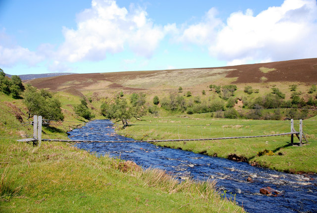
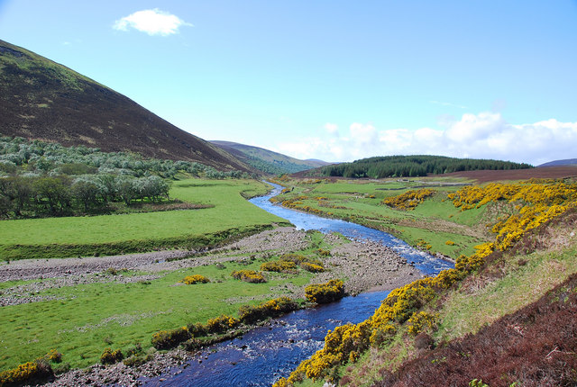
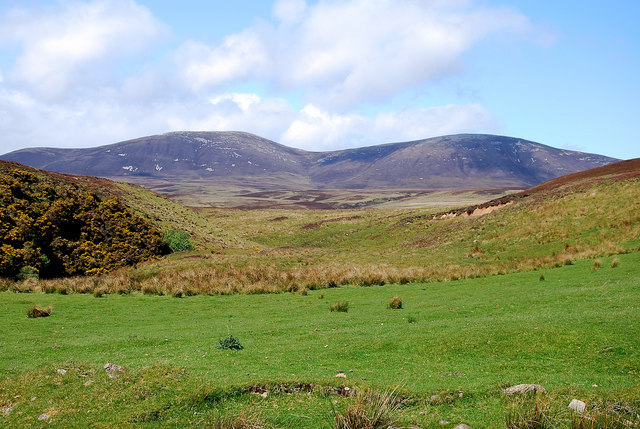
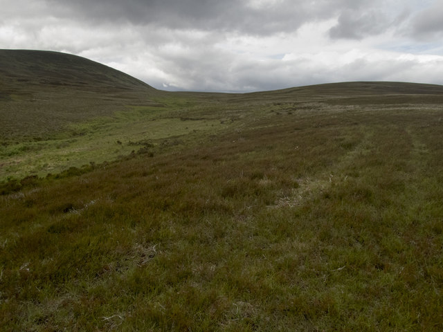
Coille Cnoc Spàrdain, located in the county of Caithness in Scotland, is a picturesque wood or forest that attracts nature enthusiasts and hikers alike. The name "Coille Cnoc Spàrdain" translates to "wood, forest" in the Gaelic language, which perfectly captures the essence of this beautiful natural area.

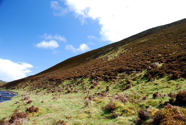
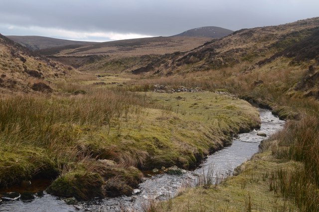
The woodland is characterized by its diverse ecosystem, encompassing a variety of tree species such as oak, birch, and pine. These trees provide a home to numerous bird species, including the majestic osprey and the elusive capercaillie. Additionally, the forest floor is carpeted with an array of wildflowers and ferns, enhancing the area's natural beauty.

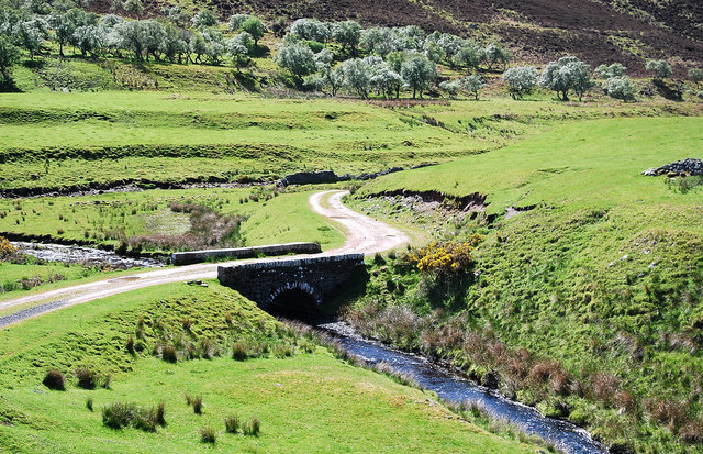
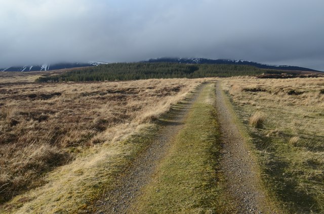
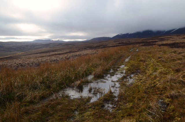
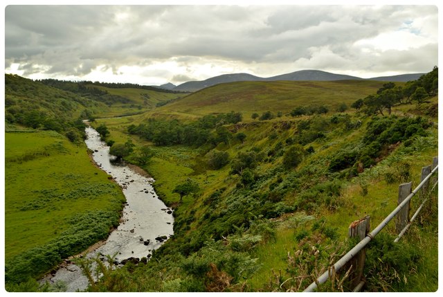
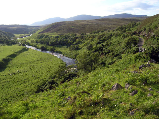
Coille Cnoc Spàrdain offers a network of well-maintained trails that wind through the forest, allowing visitors to explore its enchanting surroundings. These trails cater to different difficulty levels, accommodating both casual walkers and avid hikers. Along the paths, there are several viewpoints that provide panoramic vistas of the surrounding countryside, including rolling hills and distant mountains.

The woodland is not only a haven for flora and fauna but also a place of historical significance. Ruins of ancient settlements can be found within the forest, serving as a reminder of the area's rich heritage. These remnants offer an opportunity for visitors to delve into the history and culture of Caithness.

Coille Cnoc Spàrdain is a hidden gem in Caithness, offering a tranquil escape for those seeking a connection with nature. With its diverse ecosystem, breathtaking views, and historical significance, this wood or forest is a must-visit destination for nature lovers and history enthusiasts alike.

If you have any feedback on the listing, please let us know in the comments section below.

Coille Cnoc Spàrdain Images

Images are sourced within 2km of 58.184577/-3.559019 or Grid Reference ND0822. Thanks to Geograph Open Source API. All images are credited.

Langwell Water From the track's high vantage point a wonderful view of the river with the backdrop of Morven.
Langwell Water
From the track's high vantage point a wonderful view of the river with the backdrop of Morven.
Langwell River Looking down on the anglers' hut (Ladies Tent) and the river as it flows east to the coast.
Langwell River
Looking down on the anglers' hut (Ladies Tent) and the river as it flows east to the coast.
Langwell Water Looking north to one of the many wire bridges as the river meanders east.
Langwell Water
Looking north to one of the many wire bridges as the river meanders east.
Langdale Water This is a beautiful river.  The walk is to be highly recommended.
Langdale Water
This is a beautiful river. The walk is to be highly recommended.
Old Bridge Looking west and down on an old bridge which crosses a tributary of the Langwell Water.
Old Bridge
Looking west and down on an old bridge which crosses a tributary of the Langwell Water.
Braigh na h-Eaglaise Looking east the northern heather-clad braes (of the church!) from near the foot bridge
Braigh na h-Eaglaise
Looking east the northern heather-clad braes (of the church!) from near the foot bridge
Scaraben View Looking north to the twin tops of Scaraben.
Scaraben View
Looking north to the twin tops of Scaraben.
Moorland Track near Berriedale
The End of the Track The boggy end of a moorland track near Berriedale.
The End of the Track
The boggy end of a moorland track near Berriedale.
View down Badnachie Burn in Caithness
Moorland stream The brighter green of the ferns marks the route of the Allt Braigh nam Meur, marked on the 1:50000 but named only on the 1:25000 OS map. The track I was following from the gate in the deer fence to the south was not marked. It gave easy walking through occasionally boggy ground. There was evidence cattle had been grazed here, but I met none. The hill (Braigh na h-Eaglaise 422m) is in <a href="https://www.geograph.org.uk/gridref/ND0622">ND0622</a>, but the unnamed high ground to the right has its highest point (275m) near the northern edge of the square.
Moorland stream
The brighter green of the ferns marks the route of the Allt Braigh nam Meur, marked on the 1:50000 but named only on the 1:25000 OS map. The track I was following from the gate in the deer fence to the south was not marked. It gave easy walking through occasionally boggy ground. There was evidence cattle had been grazed here, but I met none. The hill (Braigh na h-Eaglaise 422m) is in ND0622, but the unnamed high ground to the right has its highest point (275m) near the northern edge of the square.
Langwell Water, Caithness View upstream along the Langwell Water in Caithness, in the north of Scotland.
Langwell Water, Caithness
View upstream along the Langwell Water in Caithness, in the north of Scotland.
Lookout Post among felled trees above Langwell, Caithness This wooden platform would at one time have been hidden among the trees.  It has now been exposed by tree felling.
Lookout Post among felled trees above Langwell, Caithness
This wooden platform would at one time have been hidden among the trees. It has now been exposed by tree felling.
Track on the Langwell Estate, Caithness
Driveways at Langwell An abundance of bluebells graced the roads.
Driveways at Langwell
An abundance of bluebells graced the roads.
Summit of Braigh na h-Eaglasie A short easy climb on close cropped heather to get a view into the immense nothingness of the Caithness Hills beyond.
Summit of Braigh na h-Eaglasie
A short easy climb on close cropped heather to get a view into the immense nothingness of the Caithness Hills beyond.
Forest track North of Badbea This lovely view is just a few yards North of the busy A9
Forest track North of Badbea
This lovely view is just a few yards North of the busy A9
Langwell Water The ridge in the distance is Scaraben
Langwell Water
The ridge in the distance is Scaraben
Show me another place!

Coille Cnoc Spàrdain is located at Grid Ref: ND0822 (Lat: 58.184577, Lng: -3.559019)

Unitary Authority: Highland

Police Authority: Highlands and Islands

What 3 Words

///sandpaper.shield.flame. Near Dunbeath, Highland

Related Wikis

Badbea

Badbea (pronounced bad-bay) is a former clearance village perched on the steep slopes above the cliff tops of Berriedale on the east coast of Caithness...

Berriedale Castle

Berriedale Castle is a ruined castle located on a promontory on the south of the entrance to the Berriedale Water, Caithness in Scotland. == Structure... ==

Berriedale Church

Berriedale Church is a former church in the parish of Latheron, in Berriedale, Caithness, Scotland. Built in 1826, the T-plan building was closed as a...

Berriedale Water

Berriedale Water is a short river in Caithness in northern Scotland. It arises as the Feith Gaineimh Mhor, Feith Chaorunn Mhor and Feith Fhuaran come together...

Berriedale, Highland

Berriedale (Scottish Gaelic: Bearghdal) is a small estate village on the northern east coast of Caithness, Scotland, on the A9 road between Helmsdale and...

Ousdale Broch

Ousdale Broch, also known as Ousdale Burn or Allt a’ Bhurg (Scots Gaelic: ‘stream of the fort’) Broch, is an Iron Age broch (drystone tower) located between...

Scaraben

Scaraben (626 m) is a hill in the Northwest Highlands of Scotland. It lies in the Caithness region, in the far north. Taking the form of a long ridge over...

Borgue, Highland

Borgue is a village in the historical county of Caithness, 3 miles (5 km) south of Dunbeath in the local authority are of Highland, Scotland.Rev Samuel...

Have you been to Coille Cnoc Spàrdain?

Leave your review of Coille Cnoc Spàrdain below (or comments, questions and feedback).