Crow Wood

Wood, Forest in Dumfriesshire

Scotland

Crow Wood

Track through strip of woodland giving access to fields Looking southward.
Track through strip of woodland giving access to fields Credit: Peter Wood

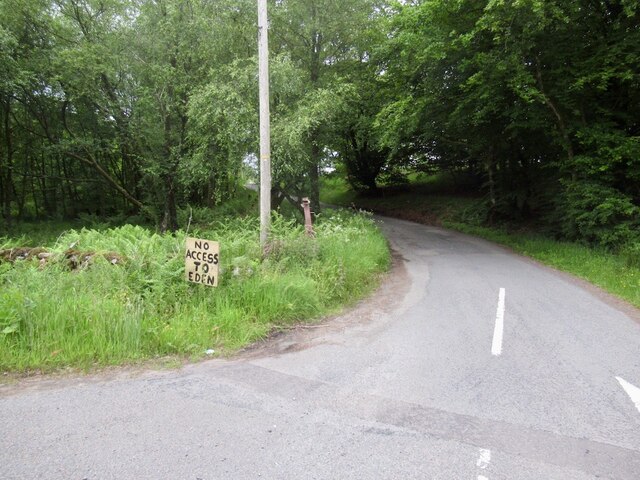
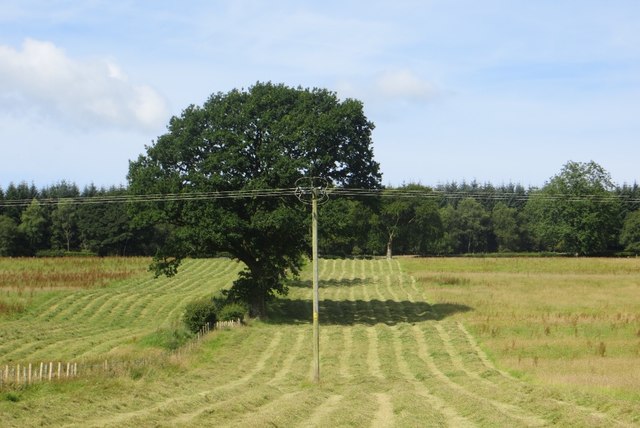
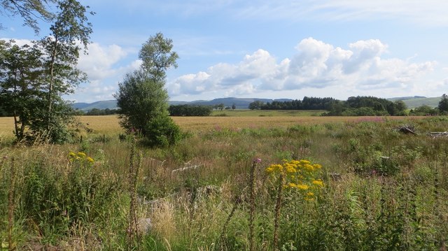
Crow Wood is a serene and expansive forest located in the picturesque region of Dumfriesshire, Scotland. Covering an area of approximately 1,500 acres, this ancient woodland is a haven for nature enthusiasts and outdoor adventurers alike.

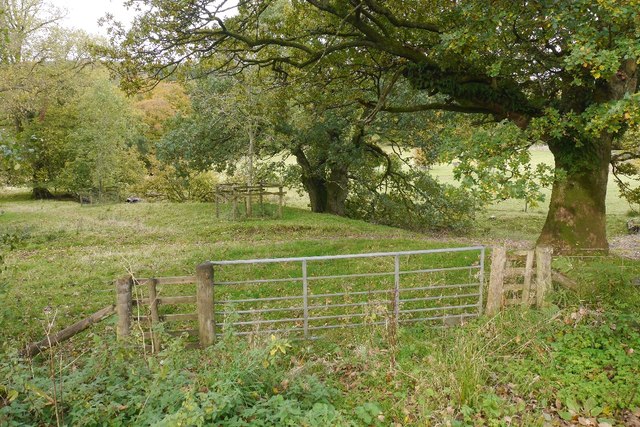
The wood is primarily composed of towering native trees such as oak, birch, and beech, providing a rich and diverse habitat for an array of flora and fauna. Walking through the wood, visitors are greeted with a tranquil atmosphere and a sense of being immersed in nature's embrace.

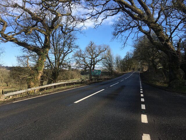
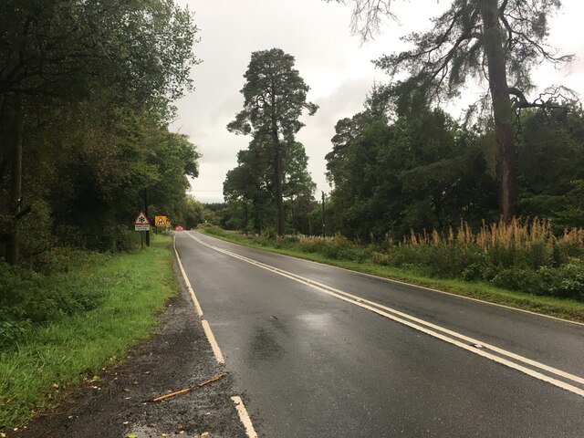
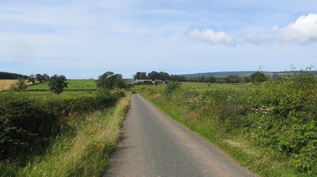
Numerous paths and trails crisscross the wood, offering opportunities for leisurely strolls or more challenging hikes. The enchanting atmosphere of Crow Wood is further enhanced by the presence of a meandering river, which adds a touch of serenity to the already picturesque landscape.

Wildlife thrives within the wood, with a variety of bird species, including woodpeckers and owls, making it their home. The forest floor is teeming with life, as squirrels scurry among the trees, and deer gracefully roam through the understory. It is not uncommon for visitors to spot the occasional fox or badger if they venture into the wood during quieter hours.

Crow Wood is a popular destination for nature lovers, photographers, and those seeking a peaceful retreat from the hustle and bustle of everyday life. With its breathtaking scenery, diverse wildlife, and well-maintained trails, it offers an immersive experience in the heart of nature. Whether you come to admire the vibrant autumn colors or enjoy a leisurely picnic by the river, Crow Wood is a true gem in Dumfriesshire's natural landscape.

If you have any feedback on the listing, please let us know in the comments section below.

Crow Wood Images

Images are sourced within 2km of 55.216626/-3.4539277 or Grid Reference NY0792. Thanks to Geograph Open Source API. All images are credited.

Track through strip of woodland giving access to fields Looking southward.
Track through strip of woodland giving access to fields
Looking southward.
Woodland track giving access to fields near Beastocking Looking northward.
Woodland track giving access to fields near Beastocking
Looking northward.
Road junction, St Ann's Due to the high wholesale costs of gas, the flaming sword has been replaced by a sign.   (Refers to a festival up the road)
Road junction, St Ann's
Due to the high wholesale costs of gas, the flaming sword has been replaced by a sign. (Refers to a festival up the road)
A701 towards Beattock
A701 towards Dumfries
Old Milestone by the A701, St Ann's Bridge, Johnstone parish Dumfries red sandstone with plate by the A701, in parish of Johnstone (Annandale District), St Ann's, just West of bridge over Kinnel Water. South side of road.

Inscription reads:-
EDINBURGH
{<-arrow} 59.
DUMFRIES
13 {arrow->}

Milestone Society National ID: DG_DFMF13
Old Milestone by the A701, St Ann's Bridge, Johnstone parish
Dumfries red sandstone with plate by the A701, in parish of Johnstone (Annandale District), St Ann's, just West of bridge over Kinnel Water. South side of road. Inscription reads:- EDINBURGH {<-arrow} 59. DUMFRIES 13 {arrow->} Milestone Society National ID: DG_DFMF13
A701 towards Dumfries
Gated farm track near Blackacre
Mown grass Silage or hay making under Hazelbank Plantation, Annandale.
Mown grass
Silage or hay making under Hazelbank Plantation, Annandale.
Field, Linhead Annandale grassland.
Field, Linhead
Annandale grassland.
Felled woodland Felled plantation beside the B7020.
Felled woodland
Felled plantation beside the B7020.
B7020, Kilnpot Wood
B7020, Kilnpot Wood
Field, Greenbeck Annandale grassland.
Field, Greenbeck
Annandale grassland.
Yellow road, Greenback Road to Kerse.
Yellow road, Greenback
Road to Kerse.
Greenbeck Grass fields in Annandale. View from the B7020.
Greenbeck
Grass fields in Annandale. View from the B7020.
B7020 Passing Chapel Wood.
B7020
Passing Chapel Wood.
Parkland, Raehills There are a lot of mature oaks here. View from the A701.
Parkland, Raehills
There are a lot of mature oaks here. View from the A701.
Old Milestone by the A701, St Ann's Bridge, Johnstone parish Dumfries red sandstone with plate by the A701, in parish of Johnstone (Annandale District), St Ann&amp;#039;s, just West of bridge over Kinnel Water. South side of road.

Inscription reads:-
EDINBURGH
{&amp;lt;-arrow} 59.
DUMFRIES
13 {arrow-&amp;gt;}

Surveyed

Milestone Society National ID: DG_DFMF13
Old Milestone by the A701, St Ann's Bridge, Johnstone parish
Dumfries red sandstone with plate by the A701, in parish of Johnstone (Annandale District), St Ann's, just West of bridge over Kinnel Water. South side of road. Inscription reads:- EDINBURGH {<-arrow} 59. DUMFRIES 13 {arrow->} Surveyed Milestone Society National ID: DG_DFMF13
Show me another place!

Crow Wood is located at Grid Ref: NY0792 (Lat: 55.216626, Lng: -3.4539277)

Unitary Authority: Dumfries and Galloway

Police Authority: Dumfries and Galloway

What 3 Words

///procured.resorting.healers. Near Johnstonebridge, Dumfries & Galloway

Nearby Locations

Crow Wood

Related Wikis

Johnstonebridge

Johnstonebridge is a village in Dumfries and Galloway, Scotland.It is roughly halfway between Moffat and Lockerbie, and lies on the A74(M) motorway. The...

Annandale Water services

Annandale Water services is a motorway service station in the village of Johnstonebridge, Scotland. The service station is located next to the A74(M) motorway...

Annandale Water

Annandale Water is a loch in Annandale, Dumfries and Galloway, in the south west of Scotland. It is part of Annandale Water service station at Junction...

Dumfriesshire, Clydesdale and Tweeddale (UK Parliament constituency)

Dumfriesshire, Clydesdale and Tweeddale is a constituency of the House of Commons, located in the South of Scotland, within the Dumfries and Galloway,...

Dinwoodie railway station

Dinwoodie railway station was a station which served the rural area around the settlement of Dinwoodie, 6 miles north of Lockerbie in Applegarth parish...

Wallace's House

Wallace's House is an earthen rampart, located near Lochmaben, Scotland, that is associated with William Wallace. The promontory fort is a scheduled item...

Newton Wamphray

Newton Wamphray is a village in Dumfries and Galloway. Wamphray is the name of the surrounding parish and of the Wamphray Water, which flows south-west...

Lochwood Tower

Lochwood Tower, also known as Lochwood Castle, is a ruined 16th-century L-plan tower house situated in Annandale (Valley of the River Annan) about 6 miles...

Nearby Amenities

Located within 500m of 55.216626,-3.4539277
Goodhope
Place: hamlet
Lat/Long: 55.2191093/-3.4537911
Blackburn
Place: hamlet
Source: OS7
Lat/Long: 55.2128907/-3.451817
Power: pole
Lat/Long: 55.2127413/-3.4579033
Power: pole
Lat/Long: 55.2131723/-3.4569948
Power: pole
Lat/Long: 55.2137197/-3.45586
Power: pole
Lat/Long: 55.2143344/-3.4545371
Power: pole
Lat/Long: 55.2152383/-3.4534756
Power: pole
Lat/Long: 55.2155129/-3.4531727
Power: pole
Lat/Long: 55.2161657/-3.4523854
Power: pole
Lat/Long: 55.2169168/-3.4521048
Power: pole
Lat/Long: 55.2176333/-3.4518243
Power: pole
Lat/Long: 55.2184734/-3.4515374
Power: pole
Lat/Long: 55.2191953/-3.4512696
Power: pole
Lat/Long: 55.22001/-3.4509572
Power: pole
Lat/Long: 55.2138611/-3.4537702
Power: pole
Lat/Long: 55.2133585/-3.4530309
Power: pole
Lat/Long: 55.2126325/-3.451864
The data included in this document is from www.openstreetmap.org. The data is made available under ODbL.

Have you been to Crow Wood?

Leave your review of Crow Wood below (or comments, questions and feedback).