Castle Craig
Settlement in Peeblesshire
Scotland
Castle Craig

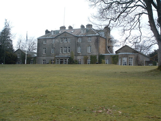
Castle Craig is a historic castle located in Peeblesshire, Scotland. Situated on a prominent hilltop, it overlooks the picturesque Tweed Valley and provides breathtaking panoramic views of the surrounding countryside. The castle has a rich history dating back to the 14th century, making it a significant landmark in the area.
Originally built as a defensive stronghold, Castle Craig has undergone several transformations over the centuries. Today, it stands as a magnificent example of Scottish architecture, blending elements of both medieval and Renaissance styles. The castle features a tall tower, fortified walls, and a courtyard, all of which have been well-preserved.
The castle has witnessed various historical events and has been associated with several prominent figures throughout its existence. It is said that Mary, Queen of Scots, stayed at Castle Craig during her visit to the region, adding to its historical significance.
In recent years, Castle Craig has been converted into a luxury hotel and is a popular destination for tourists seeking a unique and tranquil retreat. The hotel offers comfortable accommodations, exquisite dining options, and a range of activities for guests to enjoy, such as hiking, fishing, and exploring the nearby natural beauty.
Castle Craig is also a favored venue for weddings and events due to its stunning setting and historical charm. Its well-manicured gardens provide a picturesque backdrop for special occasions and create an unforgettable atmosphere.
Overall, Castle Craig in Peeblesshire is a captivating destination that seamlessly blends history, natural beauty, and modern luxury, making it a must-visit for travelers seeking a unique Scottish experience.
If you have any feedback on the listing, please let us know in the comments section below.
Castle Craig Images
Images are sourced within 2km of 55.681656/-3.3851707 or Grid Reference NT1344. Thanks to Geograph Open Source API. All images are credited.


Castle Craig is located at Grid Ref: NT1344 (Lat: 55.681656, Lng: -3.3851707)
Unitary Authority: The Scottish Borders
Police Authority: The Lothians and Scottish Borders
What 3 Words
///voucher.bleach.subtitle. Near West Linton, Scottish Borders
Nearby Locations
Related Wikis

Kirkurd
Kirkurd is a parish in Peeblesshire in the Scottish Borders situated 3 miles south-east of Dolphinton and 6 miles north-east of Broughton. Tarth Water...
Castle Craig Hospital
Castle Craig Hospital is a private residential drug and alcohol rehabilitation clinic. It is located in Peeblesshire, Scotland. Castle Craig is an 18th...
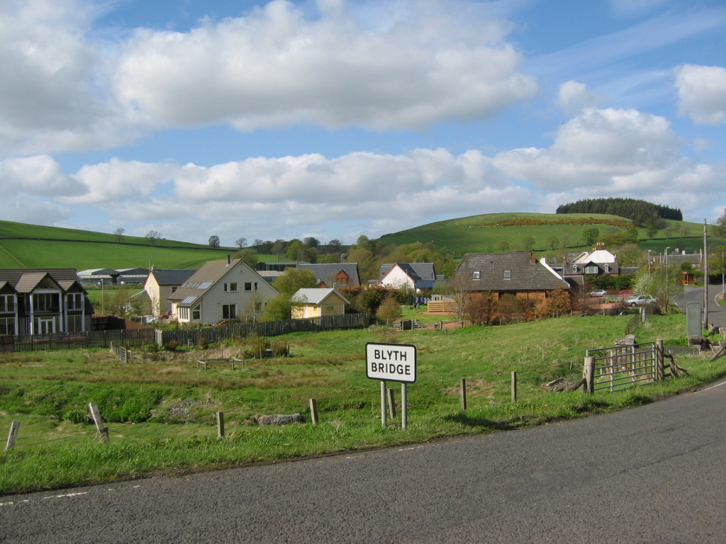
Blyth Bridge
Blyth Bridge is a small hamlet in the Scottish Borders area of Scotland, near to West Linton. It is located in a bend on the A701 which goes from Moffat...

Drochil Castle
Drochil Castle is a ruined castle in the Scottish Borders. It is located above the Lyne Water, 10 kilometres (6.2 mi) north-west of Peebles, and 8 kilometres...

Tarth Water
The Tarth Water is a river in Peebleshire, in the Scottish Borders. It forms part of the River Tweed system. The river with a total length of 7.1 miles...

Dolphinton
Dolphinton is a village and parish in Lanarkshire, Scotland. It is located 7 miles (11 km) northeast of Biggar, 11 miles (18 km) northeast of Carstairs...
Bordlands
Bordlands is a village in the Parish of Newlands in the Scottish Borders area of Scotland. The former name of Bordlands was Boreland. == See also == List...
Newlands, Scottish Borders
Newlands is a parish in the Tweeddale committee area of the Scottish Borders council area, in southeastern Scotland. == Geography == Newlands is on the...
Related Videos

Woodland walk through Castle Craig estate
Catch a glimpse of one of our woodland walks on timelapse. The calming effects of nature and walking have proven ...
Kirkurd Church and Exploration of Surrounding Hills
Take an epic hike with me as I start at the ancient border church of Kirkurd, climb some hills and discover ancient structures and ...
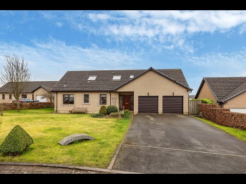
Old Smiddyfield Park Blyth Bridge
https://www.remax-tweeddale.net/properties-for-sale/property/10211301-old-smiddyfield-park-blyth-bridge-west-linton Situated in ...
Castle Craig Rehab - Over 35 Years of Addiction Treatment
No treatment centre develops and grows for 35 years without offering treatment that genuinely works. Thousands of patients have ...
Nearby Amenities
Located within 500m of 55.681656,-3.3851707Have you been to Castle Craig?
Leave your review of Castle Craig below (or comments, questions and feedback).