Castle Camps

Settlement in Cambridgeshire South Cambridgeshire

England

Castle Camps

Mill Green Water Tower This photo was taken with a DJI mini 2 at 50m of altitude.
Mill Green Water Tower Credit: Aidan

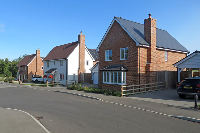
Castle Camps is a small village located in the county of Cambridgeshire, England. Situated approximately 16 miles south-east of Cambridge, the village is known for its rich history and picturesque surroundings. With a population of around 800 residents, Castle Camps offers a peaceful and tight-knit community.

The village is named after its historic castle, which dates back to the 11th century. The castle, now in ruins, was once a motte and bailey structure built by the Normans. Today, visitors can explore the remnants of the castle, which include the impressive earthworks and the remains of the curtain wall.

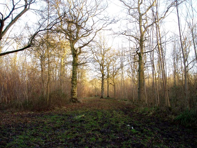
Surrounded by beautiful countryside, Castle Camps boasts stunning views and ample opportunities for outdoor activities. The village is located within the East Anglian Heights, offering a variety of walking and cycling routes for nature enthusiasts. The nearby river Granta provides a tranquil setting for fishing and boating.

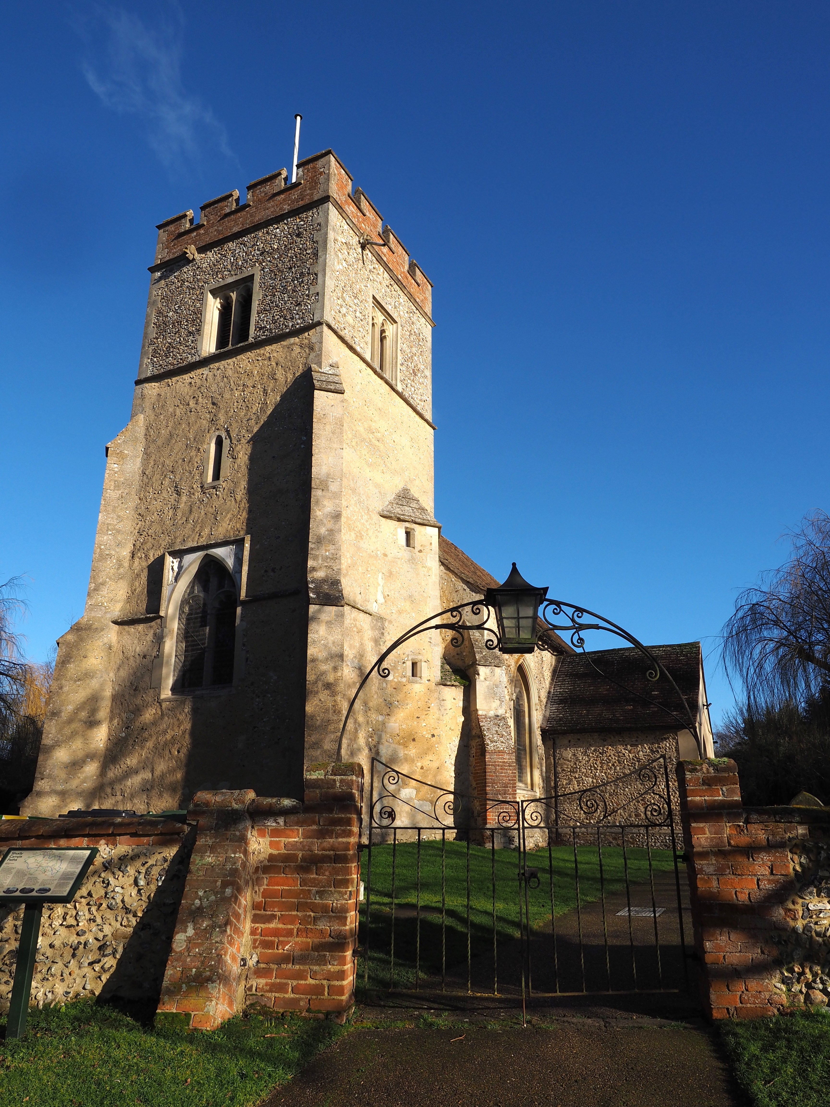
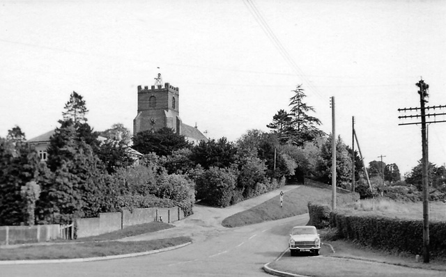
Castle Camps is served by a local primary school, providing education for children in the village and the surrounding area. The village also has a church, St. Peter's, which is of medieval origins and holds regular services.

Although Castle Camps is a small village, it is conveniently located near major towns and cities such as Cambridge and Haverhill. This allows residents to enjoy the benefits of rural living while still having easy access to amenities and employment opportunities. Overall, Castle Camps offers a charming and historic setting for those seeking a peaceful countryside lifestyle.

If you have any feedback on the listing, please let us know in the comments section below.
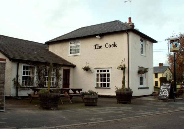
Castle Camps Images

Images are sourced within 2km of 52.067015/0.381955 or Grid Reference TL6343. Thanks to Geograph Open Source API. All images are credited.

Mill Green Water Tower This photo was taken with a DJI mini 2 at 50m of altitude.
Mill Green Water Tower
This photo was taken with a DJI mini 2 at 50m of altitude.
Drapers Green: Board Barn A number of businesses are based here, including a purveyor of bespoke firepits. The road links Castle Camps and Helions Bumpstead (right).
Drapers Green: Board Barn
A number of businesses are based here, including a purveyor of bespoke firepits. The road links Castle Camps and Helions Bumpstead (right).
A farm track with a history During the Second World War this concrete farm track was part of the perimeter road of RAF Castle Camps. Hawker Hurricanes were flown from here during the Battle of Britain.
A farm track with a history
During the Second World War this concrete farm track was part of the perimeter road of RAF Castle Camps. Hawker Hurricanes were flown from here during the Battle of Britain.
Castle Camps: near Moat Farm On the eastern edge of the village,
Castle Camps: near Moat Farm
On the eastern edge of the village,
Castle Camps: The Old Inn, Park Lane The Grade II listing begins "House, originally an inn. Late C17, extended on south-east and south-west side C19 and renovated mid-late C20. Timber-framed, rendered. Tiled roof with red-brick ridge stack and end and side stack."
Castle Camps: The Old Inn, Park Lane
The Grade II listing begins "House, originally an inn. Late C17, extended on south-east and south-west side C19 and renovated mid-late C20. Timber-framed, rendered. Tiled roof with red-brick ridge stack and end and side stack."
Castle Camps: Castle Meadow Suburban-looking houses on the edge of a Cambridgeshire village.
Castle Camps: Castle Meadow
Suburban-looking houses on the edge of a Cambridgeshire village.
Castle Camps: new houses going up Bartlow Road, on the eastern edge of the village.
Castle Camps: new houses going up
Bartlow Road, on the eastern edge of the village.
Castle Camps: Hill Farm Just outside the village, on Bartlow Road. Several businesses are based here.
Castle Camps: Hill Farm
Just outside the village, on Bartlow Road. Several businesses are based here.
Footpath to Shudy Camps The path crosses a bridge over a ditch. Beyond, the field has been ploughed after harvest and the path has not yet been reinstated.
Footpath to Shudy Camps
The path crosses a bridge over a ditch. Beyond, the field has been ploughed after harvest and the path has not yet been reinstated.
Track to Lordship Farm North of the road from Bartlow to Castle Camps.
Track to Lordship Farm
North of the road from Bartlow to Castle Camps.
Shudy Camps, St Mary <span class="nowrap"><a title="http://www.druidic.org/camchurch/churches/shudy.htm" rel="nofollow ugc noopener" href="http://www.druidic.org/camchurch/churches/shudy.htm">Link</a><img style="margin-left:2px;" alt="External link" title="External link - shift click to open in new window" src="https://s1.geograph.org.uk/img/external.png" width="10" height="10"/></span>
Shudy Camps, St Mary
Castle Camps, All Saints <span class="nowrap"><a title="http://www.druidic.org/camchurch/churches/castlecamps.htm" rel="nofollow ugc noopener" href="http://www.druidic.org/camchurch/churches/castlecamps.htm">Link</a><img style="margin-left:2px;" alt="External link" title="External link - shift click to open in new window" src="https://s1.geograph.org.uk/img/external.png" width="10" height="10"/></span>
Castle Camps, All Saints
Old house at Drapers Green According to the O/S map, this house is called Ivytodd. This view is from the road that leads to Draper's Farm and the road in the picture is called Camps Road.
Old house at Drapers Green
According to the O/S map, this house is called Ivytodd. This view is from the road that leads to Draper's Farm and the road in the picture is called Camps Road.
R.A.F. War Memorial
R.A.F. War Memorial
'The Cock' public house, in Castle Camps, Cambs. This pub stands in the High Street.
'The Cock' public house, in Castle Camps, Cambs.
This pub stands in the High Street.
A row of houses at Nosterfield End This junction is where Haverhill Road approaches Horseheath Green.
A row of houses at Nosterfield End
This junction is where Haverhill Road approaches Horseheath Green.
Public Bridleway
Public Bridleway
Water Tower This is of an unusual design and can be seen for many miles around.
Water Tower
This is of an unusual design and can be seen for many miles around.
Show me another place!

Castle Camps is located at Grid Ref: TL6343 (Lat: 52.067015, Lng: 0.381955)

Administrative County: Cambridgeshire

District: South Cambridgeshire

Police Authority: Cambridgeshire

What 3 Words

///dares.stems.sundial. Near Haverhill, Suffolk

Nearby Locations

Castle Camps

Related Wikis

Castle Camps (village)

Castle Camps is a village and civil parish in the South Cambridgeshire district, in the county of Cambridgeshire, England. It is 15 miles (24 km) south...

Castle Camps

Castle Camps was a Norman Castle located in what is now the civil parish of Castle Camps, Cambridgeshire. == Owners == Castle Camps was originally a Saxon...

RAF Castle Camps

RAF Castle Camps was listed as being in Cambridgeshire as it is close to its namesake Cambridgeshire village. It is very near the Suffolk border and the...

Shudy Camps

Shudy Camps is a village in the south-east corner of Cambridgeshire, England, near the border of Essex and Suffolk, and is part of the Chilford Hundred...

Helions Bumpstead

Helions Bumpstead is a small village in Essex located near Haverhill and the meeting-point of the Essex, Suffolk and Cambridgeshire borders. It is 2 miles...

Langley Wood, Cambridgeshire

Langley Wood is a 31.6-hectare (78-acre) biological Site of Special Scientific Interest in Cambridgeshire, but lying between Saffron Walden in Essex and...

Castle Manor Academy

Castle Manor Academy (formerly Castle Manor Business and Enterprise College) is a secondary phase converter academy school in Haverhill, Suffolk. ��2...

Bragg's Mill, Ashdon

Bragg's Mill, William Bragg's Mill, Bartlow Hamlet Mill or Stevington End Mill is a grade II listed post mill at Ashdon, Essex, England which has been...

Nearby Amenities

Located within 500m of 52.067015,0.381955
Castle Camps
Created By: POI Editor
Place: village
Population: 640
Source: npe
Source Population: http://www.scambs.gov.uk/CommunityandLiving/VillageServicesAndAmenities/
Wikidata: Q2406469
Lat/Long: 52.0637247/0.3816194
Place Of Worship
Castle Camps United Reform Church
Created By: xybot
Denomination: united_reformed
Religion: christian
Source Name: dictaphone
Lat/Long: 52.0644878/0.3812336
Post Box
Collection Times: Mo-Fr 16:00; Sa 10:45
Operator: Royal Mail
Post Box Type: lamp
Ref: CB21 256
Royal Cypher: EIIR
Royal Cypher Wikidata: Q33102113
Source: survey
Lat/Long: 52.0652764/0.3812855
Pub
The Oak
Lat/Long: 52.0657647/0.3813089
Park Farm
Landuse: farm
Note Retag: CS #48756035
Lat/Long: 52.0692329/0.3802708
Post Box
Collection Times: Mo-Fr 09:00; Sa 07:00
Operator: Royal Mail
Post Box Type: wall
Ref: CB21 255
Royal Cypher: EIIR
Royal Cypher Wikidata: Q33102113
Source: survey
Lat/Long: 52.0632746/0.3797693
Bus Stop
The Manse
Naptan AtcoCode: 0500SCAST001
Naptan Bearing: S
Naptan BusStopType: CUS
Naptan CommonName: The Manse
Naptan Indicator: near
Naptan Landmark: The Manse
Naptan NaptanCode: cmbdtwmw
Naptan ShortCommonName: The Manse
Naptan Street: High Street
Naptan Verified: no
Source: naptan_import
Lat/Long: 52.0654052/0.3814038
Bus Stop
The Manse
Naptan AtcoCode: 0500SCAST002
Naptan Bearing: N
Naptan CommonName: The Manse
Naptan Indicator: opp
Naptan Landmark: The Manse
Naptan NaptanCode: cmbdtwpa
Naptan Street: High Street
Naptan Verified: no
Public Transport: platform
Source: naptan_import
Lat/Long: 52.06541/0.3813301
Bus Stop
High Street
Naptan AtcoCode: 0500SCAST003
Naptan Bearing: NW
Naptan CommonName: High Street
Naptan Indicator: opp
Naptan Landmark: High Street
Naptan NaptanCode: cmbdtwpd
Naptan ShortCommonName: High Street
Naptan Street: Bartlow Road
Naptan Verified: no
Public Transport: platform
Source: naptan_import
Lat/Long: 52.0632945/0.379695
High Street
Naptan AtcoCode: 0500SCAST004
Naptan Bearing: SE
Naptan BusStopType: CUS
Naptan CommonName: High Street
Naptan Indicator: near
Naptan Landmark: High Street
Naptan NaptanCode: cmbgdtpm
Naptan ShortCommonName: High Street
Naptan Street: Bartlow Road
Naptan Verified: no
Public Transport: platform
Source: naptan_import
Lat/Long: 52.0633478/0.379727
Power: pole
Lat/Long: 52.0714547/0.383019
Power: pole
Lat/Long: 52.0712863/0.3840812
Power: pole
Lat/Long: 52.0636473/0.3783429
Power: pole
Lat/Long: 52.0644127/0.3790235
Power: pole
Lat/Long: 52.0640109/0.3820993
Power: pole
Lat/Long: 52.0641609/0.3814208
Power: pole
Lat/Long: 52.0646407/0.3781994
Power: pole
Lat/Long: 52.0633241/0.3836845
Power: pole
Lat/Long: 52.0649829/0.3770366
Power: pole
Lat/Long: 52.0637915/0.3828208
Power: pole
Lat/Long: 52.0635026/0.3774592
Power: pole
Lat/Long: 52.0628772/0.3845106
Post Office
Castle Camps Post Office
Addr City: Cambridge
Addr Housename: Village Hall
Addr Postcode: CB21 4SR
Addr Street: Park Lane
Addr Village: Castle Camps
Brand: Post Office
Brand Wikidata: Q1783168
Fixme: Check precise location in hall
Opening Hours: Mo 10:00-12:00; Th 13:30-15:30
Ref Pol Id: 110230
Source: pol_branch_list_2018-02
Lat/Long: 52.0631642/0.3814609
Public Bookcase
Booth: K6
Colour: red
Disused Amenity: telephone
Man Made: telephone_box
Public Bookcase Type: phone_box
Lat/Long: 52.0653696/0.3813095
Man Made: village_sign
Tourism: artwork
Lat/Long: 52.0632119/0.3802491
Historic: memorial
Memorial: war_memorial
Lat/Long: 52.0633448/0.3803098
The data included in this document is from www.openstreetmap.org. The data is made available under ODbL.

Have you been to Castle Camps?

Leave your review of Castle Camps below (or comments, questions and feedback).