Binnyside Strips

Wood, Forest in West Lothian

Scotland

Binnyside Strips

Cut grass, West Binney Silage production in West Lothian.
Cut grass, West Binney Credit: Richard Webb

Binnyside Strips, located in West Lothian, Scotland, is a picturesque woodland area known for its beauty and tranquility. Nestled within the larger Binn Wood, this particular section is a popular destination for nature enthusiasts and hikers alike.

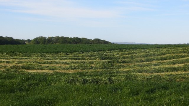
The woodland is characterized by its dense forest cover, which consists primarily of broadleaf trees such as oak, beech, and birch. These towering trees create a lush canopy that offers shade and shelter to a variety of plant and animal species. The forest floor is carpeted with a diverse array of flora, including ferns, wildflowers, and mosses, adding to the natural charm of the area.

Binnyside Strips is crisscrossed by a network of well-maintained trails, making it easily accessible for visitors. These paths wind through the woodland, offering scenic views and opportunities to spot wildlife, such as deer, squirrels, and a multitude of bird species. The chirping of birds and the rustling of leaves create a serene ambiance that is perfect for those seeking a peaceful escape from the hustle and bustle of everyday life.

In addition to its natural beauty, Binnyside Strips also has historical significance. The area was once used for coal mining, and remnants of this industrial past can still be seen, with old mine shafts and spoil heaps scattered throughout the woodland. These remnants serve as a reminder of the area's rich history and provide an interesting contrast to the surrounding natural landscape.

Overall, Binnyside Strips offers a unique combination of natural beauty, recreational opportunities, and historical interest. Whether one seeks a leisurely walk, a chance to connect with nature, or a glimpse into West Lothian's past, this woodland area is sure to captivate visitors with its enchanting allure.

If you have any feedback on the listing, please let us know in the comments section below.

Binnyside Strips Images

Images are sourced within 2km of 55.936228/-3.5673018 or Grid Reference NT0272. Thanks to Geograph Open Source API. All images are credited.

Cut grass, West Binney Silage production in West Lothian.
Cut grass, West Binney
Silage production in West Lothian.
Fishing boats at Beecraigs Loch A trout fishery is run from the loch, but the adjacent fish farm has been closed for some years.
Fishing boats at Beecraigs Loch
A trout fishery is run from the loch, but the adjacent fish farm has been closed for some years.
Field archery targets at Beecraigs In the woods south of Beecraigs Loch.
Field archery targets at Beecraigs
In the woods south of Beecraigs Loch.
Old Wood Old Wood is traversed by a reasonable track wide enough to let in the sunshine. A pleasant short walk for a bright spring day.
Old Wood
Old Wood is traversed by a reasonable track wide enough to let in the sunshine. A pleasant short walk for a bright spring day.
Open Woodland Judging by the shape of the trees, these Scots Pines are left over from when their fellows were felled.
Open Woodland
Judging by the shape of the trees, these Scots Pines are left over from when their fellows were felled.
Pheasant Pheeders These were three of the numerous blue pheasant phood drums abandoned at various places in Old Wood.
Pheasant Pheeders
These were three of the numerous blue pheasant phood drums abandoned at various places in Old Wood.
Fallen Conifers I was surprised how many fallen trees there were in the middle of Old Wood. Conifers don't grow a tap root, so when they are blown over you get this sort of flat root exposed.
Fallen Conifers
I was surprised how many fallen trees there were in the middle of Old Wood. Conifers don't grow a tap root, so when they are blown over you get this sort of flat root exposed.
Woodland Ride A gap for access, or for fire prevention measures.
Woodland Ride
A gap for access, or for fire prevention measures.
Burn in Old Wood The burn doesn't seem to have a name, though it is one of the headwaters of the Brox Burn.
Burn in Old Wood
The burn doesn't seem to have a name, though it is one of the headwaters of the Brox Burn.
Limpid Waters A little surprisingly after the recent wet weather, the water in the burn is running very clear.
Limpid Waters
A little surprisingly after the recent wet weather, the water in the burn is running very clear.
Shifting Bales The farmer was stacking the bales before moving them to make shelter for lambs in the forecast cold wet weather next week.
Shifting Bales
The farmer was stacking the bales before moving them to make shelter for lambs in the forecast cold wet weather next week.
Bale Stacks It takes skill to balance three large bales on top of one another, and then move them. Quite apart from the balancing act, you can't easily see where you are going with three bales in your line of sight. You just have to keep your eyes on the ground immediately in front of you.
Bale Stacks
It takes skill to balance three large bales on top of one another, and then move them. Quite apart from the balancing act, you can't easily see where you are going with three bales in your line of sight. You just have to keep your eyes on the ground immediately in front of you.
The Gullet I think the name probably applies to the gorge in the trees on the right, where the burn flows. The farm is not named on the maps.
The Gullet
I think the name probably applies to the gorge in the trees on the right, where the burn flows. The farm is not named on the maps.
Boat House Boat House is behind the trees. To its left is the lodge at the trout fishery at Bangour Reservoir.
Boat House
Boat House is behind the trees. To its left is the lodge at the trout fishery at Bangour Reservoir.
Bangour Reservoir The reservoir served Bangour Hospital, but since the closure of the hospital it has been turned into a trout fishery.  See <span class="nowrap"><a title="http://www.bangourtroutfishery.com/" rel="nofollow ugc noopener" href="http://www.bangourtroutfishery.com/">Link</a><img style="margin-left:2px;" alt="External link" title="External link - shift click to open in new window" src="https://s1.geograph.org.uk/img/external.png" width="10" height="10"/></span>.
Bangour Reservoir
The reservoir served Bangour Hospital, but since the closure of the hospital it has been turned into a trout fishery. See LinkExternal link.
Cross Blading at North Mains During a walk along the quiet country road at North Mains two enthusiasts of Cross Blading (a combination of roller blades and ski poles) were an unusual sight.
Cross Blading at North Mains
During a walk along the quiet country road at North Mains two enthusiasts of Cross Blading (a combination of roller blades and ski poles) were an unusual sight.
Bangour Hospital Church Bangour Village Hospital Church.
Bangour Hospital Church
Bangour Village Hospital Church.
Beecraigs Loch near Linlithgow - fishing boats
Show me another place!

Binnyside Strips is located at Grid Ref: NT0272 (Lat: 55.936228, Lng: -3.5673018)

Unitary Authority: West Lothian

Police Authority: The Lothians and Scottish Borders

What 3 Words

///steadier.skewed.used. Near Livingston, West Lothian

Related Wikis

Bangour General Hospital

Bangour General Hospital was a hospital just west of the village of Dechmont, West Lothian, Scotland. It had its origins during the Second World War when...

Bangour Village Hospital

Bangour Village Hospital was a psychiatric hospital located west of Dechmont in West Lothian, Scotland. During the First World War it formed part of the...

Bangour railway station

Bangour railway station was a railway station in West Lothian, Scotland. It was located on a short branch of the Edinburgh and Bathgate Railway. ��2�...

Ochiltree Castle, West Lothian

Ochiltree Castle (previously: Uchiltre; meaning: the high town or high dwelling place) is a 16th-century tower house a few miles south east of Linlithgow...

Nearby Amenities

Located within 500m of 55.936228,-3.5673018
Tourism: guest_house
Lat/Long: 55.9360177/-3.5597785
Power: pole
Lat/Long: 55.9355646/-3.5604957
Power: pole
Lat/Long: 55.9356768/-3.5619648
Power: pole
Lat/Long: 55.9351765/-3.5632608
Power: pole
Lat/Long: 55.9347007/-3.5645338
Power: pole
Lat/Long: 55.9350385/-3.5657608
Power: pole
Lat/Long: 55.9353413/-3.5669002
Power: pole
Lat/Long: 55.9356207/-3.5679458
Power: pole
Lat/Long: 55.9359363/-3.5691102
Power: pole
Lat/Long: 55.935893/-3.5704479
Power: pole
Lat/Long: 55.9358474/-3.5718127
Power: pole
Lat/Long: 55.9357048/-3.5727768
Power: pole
Lat/Long: 55.935554/-3.5739058
Power: pole
Lat/Long: 55.9353647/-3.575185
The data included in this document is from www.openstreetmap.org. The data is made available under ODbL.

Have you been to Binnyside Strips?

Leave your review of Binnyside Strips below (or comments, questions and feedback).