Castell

Settlement in Pembrokeshire

Wales

Castell

Part of the Pembrokeshire Coast Path Yes, that little grey figure down there is a walker ahead of me on the coastal path, no doubt also enjoying this section of varied coastline, even if the harmless St. Mark's flies are thick in the air, the gorse tugs at your clothing and small loose stones slip under your boots.
Part of the Pembrokeshire Coast Path Credit: Jeremy Bolwell

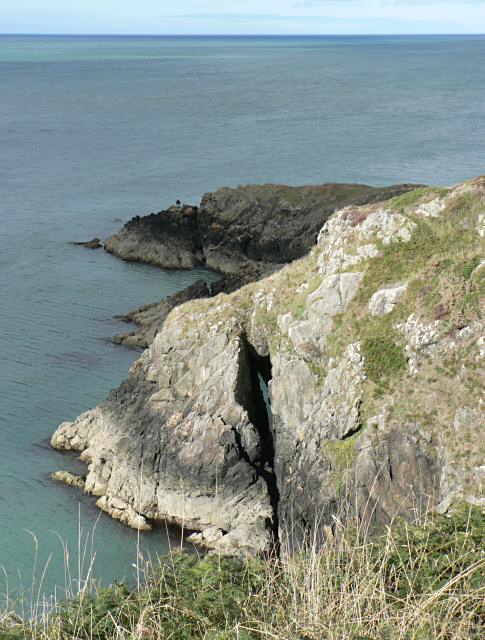
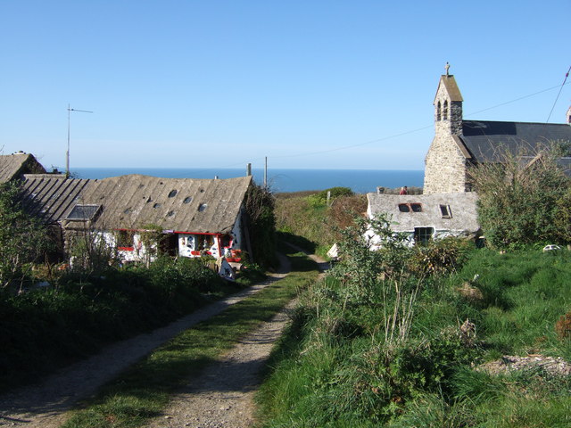
Castell is a small village located in the county of Pembrokeshire, Wales. Situated on the western coast of the country, it is nestled between the towns of Fishguard and Newport. The village is known for its picturesque beauty and proximity to the stunning Pembrokeshire Coast National Park.

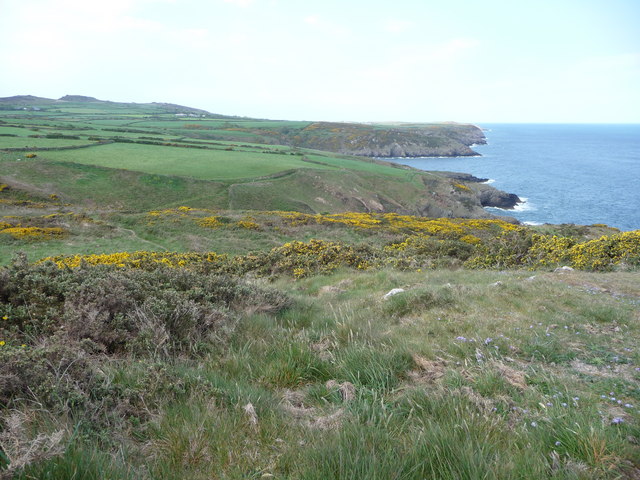
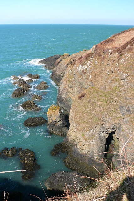
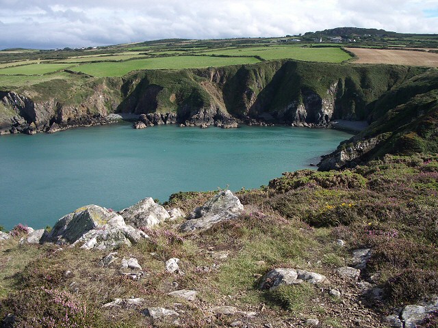
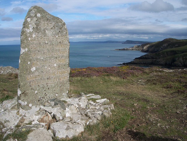
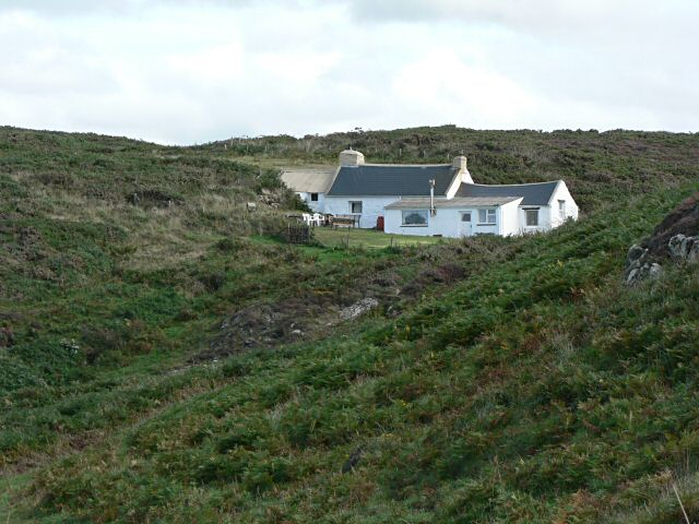
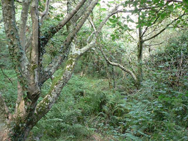
Castell is characterized by its charming, traditional Welsh cottages that dot the landscape, creating a quaint and peaceful atmosphere. The village is surrounded by rolling green hills and offers breathtaking views of the nearby coastline. Its idyllic location has made it a popular destination for nature lovers and outdoor enthusiasts.

One of the main attractions in Castell is the historic Castell Henllys Iron Age Fort. This reconstructed hillfort provides visitors with a unique opportunity to step back in time and experience life as it was thousands of years ago. The fort features several replica Iron Age roundhouses and offers guided tours, educational activities, and interactive displays.

In addition to its rich history, Castell boasts a variety of outdoor activities. The village is a gateway to the Pembrokeshire Coast Path, a renowned long-distance trail that spans 186 miles along the coast. This makes Castell an ideal base for hikers and walkers looking to explore the breathtaking landscapes and rugged cliffs of the national park.

Overall, Castell, Pembrokeshire, offers a charming, tranquil escape with its stunning natural surroundings, historic sites, and access to the beautiful Pembrokeshire Coast National Park.

If you have any feedback on the listing, please let us know in the comments section below.

Castell Images

Images are sourced within 2km of 52.010351/-5.0322004 or Grid Reference SM9239. Thanks to Geograph Open Source API. All images are credited.

Part of the Pembrokeshire Coast Path Yes, that little grey figure down there is a walker ahead of me on the coastal path, no doubt also enjoying this section of varied coastline, even if the harmless St. Mark's flies are thick in the air, the gorse tugs at your clothing and small loose stones slip under your boots.
Part of the Pembrokeshire Coast Path
Yes, that little grey figure down there is a walker ahead of me on the coastal path, no doubt also enjoying this section of varied coastline, even if the harmless St. Mark's flies are thick in the air, the gorse tugs at your clothing and small loose stones slip under your boots.
Monument stone on Carregwastad Point An ideal place for a rest, a brew, something to eat and a chat with some Aussie backpackers doing the whole Pembrokeshire Coast Path, a couple with huge rucksacks and an indomitable Aussie spirit to match.
Monument stone on Carregwastad Point
An ideal place for a rest, a brew, something to eat and a chat with some Aussie backpackers doing the whole Pembrokeshire Coast Path, a couple with huge rucksacks and an indomitable Aussie spirit to match.
Beach flotsam below Carregwastad Point I had seen a grey seal bottling in Aber Felin cove here and scanning the beach for other seals I spied what appears to be a large portion of dead pony. A grey pony seems to have fallen down the very steep gully above this beach and either been injured or trapped on the beach (though I can't believe that if this was the case that a rescue wasn't attempted) and subsequently died. Gulls were interested in the carcase and vulture-like hopped on and off, chased each other and generally set off a macabre scene.
Beach flotsam below Carregwastad Point
I had seen a grey seal bottling in Aber Felin cove here and scanning the beach for other seals I spied what appears to be a large portion of dead pony. A grey pony seems to have fallen down the very steep gully above this beach and either been injured or trapped on the beach (though I can't believe that if this was the case that a rescue wasn't attempted) and subsequently died. Gulls were interested in the carcase and vulture-like hopped on and off, chased each other and generally set off a macabre scene.
On Carregwastad Point The memorial marks the invasion on 22 February 1797 by a small French force. It is difficult to work out what they hoped to achieve, landing in such a remote spot, though they no doubt assumed that it would take some time for a defending army to be sent there. However they appear to have been a somewhat ill-disciplined bunch, for it is said that they got drunk and surrendered to the local population two days later!
On Carregwastad Point
The memorial marks the invasion on 22 February 1797 by a small French force. It is difficult to work out what they hoped to achieve, landing in such a remote spot, though they no doubt assumed that it would take some time for a defending army to be sent there. However they appear to have been a somewhat ill-disciplined bunch, for it is said that they got drunk and surrendered to the local population two days later!
Aber Felin
Aber Felin
Aber Felin View from Carregwastad Point
Aber Felin
View from Carregwastad Point
Last invasion of Britain - Carregwastad Point The inscription on the stone reads:
1897 CARREG GOFFA GLANIAD Y FFRANCOD CHWEFROR 22 1797
MEMORIAL STONE OF THE LANDING OF THE FRENCH FEBRUARY 22 1797
The story of this invasion can be read from information boards in Goodwick. It failed; the French troops discovered a cache of liquor saved from a shipwreck and were easily overcome by local men and women.
Last invasion of Britain - Carregwastad Point
The inscription on the stone reads: 1897 CARREG GOFFA GLANIAD Y FFRANCOD CHWEFROR 22 1797 MEMORIAL STONE OF THE LANDING OF THE FRENCH FEBRUARY 22 1797 The story of this invasion can be read from information boards in Goodwick. It failed; the French troops discovered a cache of liquor saved from a shipwreck and were easily overcome by local men and women.
Cottage The Pembrokeshire Coastal Path runs in front of the cottage. A beautiful location, seen from the north.
Cottage
The Pembrokeshire Coastal Path runs in front of the cottage. A beautiful location, seen from the north.
Cwm Felin This deep wooded george makes a striking contrast to the rest of the coastal path in this area.
Cwm Felin
This deep wooded george makes a striking contrast to the rest of the coastal path in this area.
Natural arch
Natural arch
Seal pups, late September Just east of Carreg Wastad, the deep inlet of which it is part makes this little bay ideal for seals to rear their pups. Note the small one at the back of the beach.
Seal pups, late September
Just east of Carreg Wastad, the deep inlet of which it is part makes this little bay ideal for seals to rear their pups. Note the small one at the back of the beach.
Cliffs at Carreg Wastad The prospect facing the French when they landed in February 1797. Not an easy climb, with cannon and barrels of gunpowder....
Cliffs at Carreg Wastad
The prospect facing the French when they landed in February 1797. Not an easy climb, with cannon and barrels of gunpowder....
Carregwastad and Aberfelin Looking inland in a southerly direction: the memorial stone stands in the foreground with the deep, wooded, Aberfelin valley behind, the outlying houses of Llanwnda beyond, to the left in the image.
This is a rocky coastal zone of heathland vegetation but further inland the upland pastures of Pencaer provide good grazing.
Carregwastad and Aberfelin
Looking inland in a southerly direction: the memorial stone stands in the foreground with the deep, wooded, Aberfelin valley behind, the outlying houses of Llanwnda beyond, to the left in the image. This is a rocky coastal zone of heathland vegetation but further inland the upland pastures of Pencaer provide good grazing.
The bridge in Cwm Felin Looking down into the valley. The steep sides provide one of the few sheltered locations on Pencaer, hence the trees (mostly sycamore) and other vegetation.
This is the route of the coast path.
The bridge in Cwm Felin
Looking down into the valley. The steep sides provide one of the few sheltered locations on Pencaer, hence the trees (mostly sycamore) and other vegetation. This is the route of the coast path.
Aberfelin and Carregwastad Showing the deep valley cut by the stream flowing from the west (left) and running down to the sea at Aberfelin bay where the French invasion party landed in 1797. From this point on the coast path the invasion memorial stone on Carregwastad point is just visible on the skyline, right of centre.
Aberfelin and Carregwastad
Showing the deep valley cut by the stream flowing from the west (left) and running down to the sea at Aberfelin bay where the French invasion party landed in 1797. From this point on the coast path the invasion memorial stone on Carregwastad point is just visible on the skyline, right of centre.
Grey Seal from the Pembrokeshire Coast Path This seal was perched on a rock in a very quiet inlet. On average I suppose I see one seal for every 25 miles of coastal walking in Pembs. I'm sure I miss many more.
Grey Seal from the Pembrokeshire Coast Path
This seal was perched on a rock in a very quiet inlet. On average I suppose I see one seal for every 25 miles of coastal walking in Pembs. I'm sure I miss many more.
View inland from the Pembrokeshire Coast Path The drystone faced bank backs the footpath here.
View inland from the Pembrokeshire Coast Path
The drystone faced bank backs the footpath here.
Obelisk on Carregwastad Point On 22 February 1797 a small French force calling themselves La Legion Noire landed here in what was the last hostile invasion of Britain. They pushed a kilometre inland but were apparently distracted by their find of a hoard of liquor recently salvaged from a ship and became so intoxicated that they surrendered two days later. Vive La France!
Obelisk on Carregwastad Point
On 22 February 1797 a small French force calling themselves La Legion Noire landed here in what was the last hostile invasion of Britain. They pushed a kilometre inland but were apparently distracted by their find of a hoard of liquor recently salvaged from a ship and became so intoxicated that they surrendered two days later. Vive La France!
Show me another place!

Castell is located at Grid Ref: SM9239 (Lat: 52.010351, Lng: -5.0322004)

Unitary Authority: Pembrokeshire

Police Authority: Dyfed Powys

Also known as: Y Castell

What 3 Words

///wired.fuse.coast. Near Goodwick, Pembrokeshire

Related Wikis

Llanwnda, Pembrokeshire

Llanwnda is a rural village and parish to the north of the Welsh county of Pembrokeshire and part of the community of Pencaer. It lies some two miles northwest...

Pencaer

Pencaer is a community which covers an area of dispersed settlement in Pembrokeshire, Wales, on the peninsula of Pen Caer and comprises the village of...

Fishguard and Goodwick railway station

Fishguard and Goodwick railway station is a railway station sited 1 mile from Fishguard in the neighbouring town of Goodwick, Pembrokeshire, Wales. It...

Strumble Head - Llechdafad Cliffs

Strumble Head - Llechdafad Cliffs is a Site of Special Scientific Interest (SSSI) in Pembrokeshire, South Wales. It has been designated as a SSSI since...

Nearby Amenities

Located within 500m of 52.010351,-5.0322004
Pontiago
Place: hamlet
Lat/Long: 52.0100347/-5.0282361
The data included in this document is from www.openstreetmap.org. The data is made available under ODbL.

Have you been to Castell?

Leave your review of Castell below (or comments, questions and feedback).