Cassington

Settlement in Oxfordshire West Oxfordshire

England

Cassington

Wytham Woods Wytham Woods is an area of long-established mixed woodland noted for their high population of badgers and long-term monitoring of great tits. It is on rising ground to the west of the village. The woods are a Site of Special Scientific Interest. The University of Oxford owns the woods and uses them for research in zoology and climate change. The University also has a field station north of the village.
Website: <span class="nowrap"><a title="https://www.wythamwoods.ox.ac.uk/home" rel="nofollow ugc noopener" href="https://www.wythamwoods.ox.ac.uk/home">Link</a><img style="margin-left:2px;" alt="External link" title="External link - shift click to open in new window" src="https://s1.geograph.org.uk/img/external.png" width="10" height="10"/></span>
Wytham Woods Credit: N Chadwick

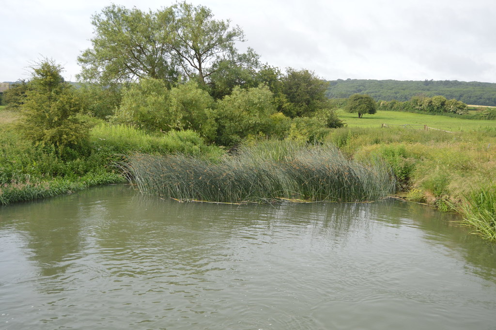
Cassington is a charming village located in the county of Oxfordshire, England. Situated approximately five miles northwest of the historic city of Oxford, it lies on the banks of the River Evenlode. With a population of around 1,000 residents, Cassington offers a peaceful and picturesque setting for those seeking a tranquil countryside lifestyle.

The village boasts a rich history, dating back to the Roman period, with evidence of a Roman villa discovered nearby. Cassington also played a significant role in the English Civil War, with a skirmish occurring in the area in 1644.

One of the prominent landmarks in Cassington is the St. Peter's Church, a Grade I listed building dating back to the 12th century. This stunning example of medieval architecture features a Norman doorway and several interesting historical artifacts.

The village is well-served by a range of amenities including a primary school, a local pub called "The Chequers," and a community-run village hall that hosts various events and activities throughout the year. Cassington is also known for its vibrant community spirit, with several clubs and societies catering to different interests.

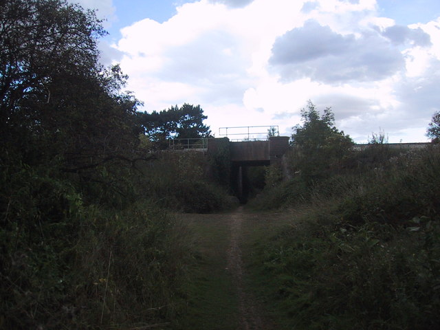
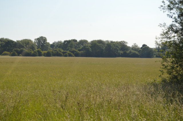
Surrounded by beautiful countryside, Cassington offers plenty of opportunities for outdoor activities such as walking, cycling, and fishing. The nearby Wytham Woods and Port Meadow provide stunning natural landscapes for residents and visitors to explore.

With its rich history, idyllic setting, and strong sense of community, Cassington is a delightful place to live or visit for those seeking a quintessential English village experience.

If you have any feedback on the listing, please let us know in the comments section below.

Cassington Images

Images are sourced within 2km of 51.794876/-1.342481 or Grid Reference SP4510. Thanks to Geograph Open Source API. All images are credited.

Wytham Woods Wytham Woods is an area of long-established mixed woodland noted for their high population of badgers and long-term monitoring of great tits. It is on rising ground to the west of the village. The woods are a Site of Special Scientific Interest. The University of Oxford owns the woods and uses them for research in zoology and climate change. The University also has a field station north of the village.
Website: <span class="nowrap"><a title="https://www.wythamwoods.ox.ac.uk/home" rel="nofollow ugc noopener" href="https://www.wythamwoods.ox.ac.uk/home">Link</a><img style="margin-left:2px;" alt="External link" title="External link - shift click to open in new window" src="https://s1.geograph.org.uk/img/external.png" width="10" height="10"/></span>
Wytham Woods
Wytham Woods is an area of long-established mixed woodland noted for their high population of badgers and long-term monitoring of great tits. It is on rising ground to the west of the village. The woods are a Site of Special Scientific Interest. The University of Oxford owns the woods and uses them for research in zoology and climate change. The University also has a field station north of the village. Website: LinkExternal link
Thames floodplain
Thames floodplain
River Thames The River Thames rises at Thames Head in Gloucestershire on the slopes of the Cotswolds and flows generally eastward to its mouth near Southend in Essex. At 215 miles long it is one of the longest rivers in Britain, and the longest entirely within England. It is one of the most important rivers in Britain. <span class="nowrap"><a title="http://en.wikipedia.org/wiki/River_Thames" rel="nofollow ugc noopener" href="http://en.wikipedia.org/wiki/River_Thames">Link</a><img style="margin-left:2px;" alt="External link" title="External link - shift click to open in new window" src="https://s1.geograph.org.uk/img/external.png" width="10" height="10"/></span>
River Thames
The River Thames rises at Thames Head in Gloucestershire on the slopes of the Cotswolds and flows generally eastward to its mouth near Southend in Essex. At 215 miles long it is one of the longest rivers in Britain, and the longest entirely within England. It is one of the most important rivers in Britain. LinkExternal link
Thames Path This National Trail is 184 miles (294 km) long, following the River Thames from its source in the Cotswolds almost to the sea, finishing at the Thames Barrier in Greenwich.
The trail keeps to the banks of the river most of the route.
Website: <span class="nowrap"><a title="http://www.nationaltrail.co.uk/ThamesPath/" rel="nofollow ugc noopener" href="http://www.nationaltrail.co.uk/ThamesPath/">Link</a><img style="margin-left:2px;" alt="External link" title="External link - shift click to open in new window" src="https://s1.geograph.org.uk/img/external.png" width="10" height="10"/></span>
Thames Path
This National Trail is 184 miles (294 km) long, following the River Thames from its source in the Cotswolds almost to the sea, finishing at the Thames Barrier in Greenwich. The trail keeps to the banks of the river most of the route. Website: LinkExternal link
Geese on the Thames floodplain
River Thames The River Thames rises at Thames Head in Gloucestershire on the slopes of the Cotswolds and flows generally eastward to its mouth near Southend in Essex. At 215 miles long it is one of the longest rivers in Britain, and the longest entirely within England. It is one of the most important rivers in Britain. <span class="nowrap"><a title="http://en.wikipedia.org/wiki/River_Thames" rel="nofollow ugc noopener" href="http://en.wikipedia.org/wiki/River_Thames">Link</a><img style="margin-left:2px;" alt="External link" title="External link - shift click to open in new window" src="https://s1.geograph.org.uk/img/external.png" width="10" height="10"/></span>
River Thames
The River Thames rises at Thames Head in Gloucestershire on the slopes of the Cotswolds and flows generally eastward to its mouth near Southend in Essex. At 215 miles long it is one of the longest rivers in Britain, and the longest entirely within England. It is one of the most important rivers in Britain. LinkExternal link
Wytham Woods Wytham Woods is an area of long-established mixed woodland noted for their high population of badgers and long-term monitoring of great tits. It is on rising ground to the west of the village. The woods are a Site of Special Scientific Interest. The University of Oxford owns the woods and uses them for research in zoology and climate change. The University also has a field station north of the village.
Website: <span class="nowrap"><a title="https://www.wythamwoods.ox.ac.uk/home" rel="nofollow ugc noopener" href="https://www.wythamwoods.ox.ac.uk/home">Link</a><img style="margin-left:2px;" alt="External link" title="External link - shift click to open in new window" src="https://s1.geograph.org.uk/img/external.png" width="10" height="10"/></span>
Wytham Woods
Wytham Woods is an area of long-established mixed woodland noted for their high population of badgers and long-term monitoring of great tits. It is on rising ground to the west of the village. The woods are a Site of Special Scientific Interest. The University of Oxford owns the woods and uses them for research in zoology and climate change. The University also has a field station north of the village. Website: LinkExternal link
Thames Path This National Trail is 184 miles (294 km) long, following the River Thames from its source in the Cotswolds almost to the sea, finishing at the Thames Barrier in Greenwich.
The trail keeps to the banks of the river most of the route.
Website: <span class="nowrap"><a title="http://www.nationaltrail.co.uk/ThamesPath/" rel="nofollow ugc noopener" href="http://www.nationaltrail.co.uk/ThamesPath/">Link</a><img style="margin-left:2px;" alt="External link" title="External link - shift click to open in new window" src="https://s1.geograph.org.uk/img/external.png" width="10" height="10"/></span>
Thames Path
This National Trail is 184 miles (294 km) long, following the River Thames from its source in the Cotswolds almost to the sea, finishing at the Thames Barrier in Greenwich. The trail keeps to the banks of the river most of the route. Website: LinkExternal link
Thames meadow
Thames meadow
Wytham Woods
Wytham Woods
Thames meadow
Thames meadow
Thames Path This National Trail is 184 miles (294 km) long, following the River Thames from its source in the Cotswolds almost to the sea, finishing at the Thames Barrier in Greenwich.
The trail keeps to the banks of the river most of the route.
Website: <span class="nowrap"><a title="http://www.nationaltrail.co.uk/ThamesPath/" rel="nofollow ugc noopener" href="http://www.nationaltrail.co.uk/ThamesPath/">Link</a><img style="margin-left:2px;" alt="External link" title="External link - shift click to open in new window" src="https://s1.geograph.org.uk/img/external.png" width="10" height="10"/></span>
Thames Path
This National Trail is 184 miles (294 km) long, following the River Thames from its source in the Cotswolds almost to the sea, finishing at the Thames Barrier in Greenwich. The trail keeps to the banks of the river most of the route. Website: LinkExternal link
Confluence of River Evenlode and River Thames The River Evenlode is a tributary of the Thames in Oxfordshire. It rises near Moreton-in-Marsh, Gloucestershire in the Cotswold Hills and flows south-east passing near Stow-on-the-Wold, Charlbury, Bladon, and Cassington, and its valley provides the route of the southern part of the Cotswold Line.
Confluence of River Evenlode and River Thames
The River Evenlode is a tributary of the Thames in Oxfordshire. It rises near Moreton-in-Marsh, Gloucestershire in the Cotswold Hills and flows south-east passing near Stow-on-the-Wold, Charlbury, Bladon, and Cassington, and its valley provides the route of the southern part of the Cotswold Line.
Wytham Woods Wytham Woods is an area of long-established mixed woodland noted for their high population of badgers and long-term monitoring of great tits. It is on rising ground to the west of the village. The woods are a Site of Special Scientific Interest. The University of Oxford owns the woods and uses them for research in zoology and climate change. The University also has a field station north of the village.
Website: <span class="nowrap"><a title="https://www.wythamwoods.ox.ac.uk/home" rel="nofollow ugc noopener" href="https://www.wythamwoods.ox.ac.uk/home">Link</a><img style="margin-left:2px;" alt="External link" title="External link - shift click to open in new window" src="https://s1.geograph.org.uk/img/external.png" width="10" height="10"/></span>
Wytham Woods
Wytham Woods is an area of long-established mixed woodland noted for their high population of badgers and long-term monitoring of great tits. It is on rising ground to the west of the village. The woods are a Site of Special Scientific Interest. The University of Oxford owns the woods and uses them for research in zoology and climate change. The University also has a field station north of the village. Website: LinkExternal link
River Thames The River Thames rises at Thames Head in Gloucestershire on the slopes of the Cotswolds and flows generally eastward to its mouth near Southend in Essex. At 215 miles long it is one of the longest rivers in Britain, and the longest entirely within England. It is one of the most important rivers in Britain. <span class="nowrap"><a title="http://en.wikipedia.org/wiki/River_Thames" rel="nofollow ugc noopener" href="http://en.wikipedia.org/wiki/River_Thames">Link</a><img style="margin-left:2px;" alt="External link" title="External link - shift click to open in new window" src="https://s1.geograph.org.uk/img/external.png" width="10" height="10"/></span>
River Thames
The River Thames rises at Thames Head in Gloucestershire on the slopes of the Cotswolds and flows generally eastward to its mouth near Southend in Essex. At 215 miles long it is one of the longest rivers in Britain, and the longest entirely within England. It is one of the most important rivers in Britain. LinkExternal link
Thames Path This National Trail is 184 miles (294 km) long, following the River Thames from its source in the Cotswolds almost to the sea, finishing at the Thames Barrier in Greenwich.
The trail keeps to the banks of the river most of the route.
Website: <span class="nowrap"><a title="http://www.nationaltrail.co.uk/ThamesPath/" rel="nofollow ugc noopener" href="http://www.nationaltrail.co.uk/ThamesPath/">Link</a><img style="margin-left:2px;" alt="External link" title="External link - shift click to open in new window" src="https://s1.geograph.org.uk/img/external.png" width="10" height="10"/></span>
Thames Path
This National Trail is 184 miles (294 km) long, following the River Thames from its source in the Cotswolds almost to the sea, finishing at the Thames Barrier in Greenwich. The trail keeps to the banks of the river most of the route. Website: LinkExternal link
Show me another place!

Cassington is located at Grid Ref: SP4510 (Lat: 51.794876, Lng: -1.342481)

Administrative County: Oxfordshire

District: West Oxfordshire

Police Authority: Thames Valley

What 3 Words

///hopes.bends.picturing. Near Yarnton, Oxfordshire

Related Wikis

Nearby Amenities

Located within 500m of 51.794876,-1.342481
Cassington
Is In: Oxfordshire, England, UK
Place: village
Lat/Long: 51.7934189/-1.3433055
Post Box
Brand: Royal Mail
Brand Wikidata: Q638098
Brand Wikipedia: en:Royal Mail
Collection Times: Mo-Fr 16:30; Sa 09:00
Operator: Royal Mail
Operator Wikidata: Q638098
Post Box Type: pillar
Ref: OX29 18
Royal Cypher: GVIR
Royal Cypher Wikidata: Q33102169
Source: survey
Survey Date: 2013-01-07
Lat/Long: 51.7939572/-1.3432109
Fixme: This telephone box appears to be missing on Street Level Imagery. Please confirm if it has been removed or is in a different location.
Mapillary: 822011752065433
Removed Amenity: telephone
Source: survey
Survey Date: 2021-05-05
Lat/Long: 51.7939355/-1.3432251
Pub
Chequers Inn
Source: photograph
Lat/Long: 51.7925898/-1.3432152
Red Lion PH
Naptan AtcoCode: 340000168ORL
Naptan Bearing: SW
Naptan BusStopType: CUS
Naptan CommonName: Red Lion PH
Naptan Indicator: Opposite
Naptan Landmark: Red Lion PH
Naptan NaptanCode: oxfgajpg
Naptan Street: The Green
Naptan Verified: no
Source: naptan_import
Lat/Long: 51.7938302/-1.3433023
Alan Aston Roofing Supplies Ltd
Opening Hours: Mo-Fr 07:00-17:30; Sa 07:30-12:00
Shop: doityourself
Lat/Long: 51.7951457/-1.3403089
Waste Basket
Source: survey
Lat/Long: 51.7939177/-1.3432464
Grit Bin
Source: survey
Lat/Long: 51.7939244/-1.3432225
Bus Stop
Red Lion PH
Bus: yes
Naptan AtcoCode: 340000168RDL
Naptan Bearing: NE
Naptan CommonName: Red Lion PH
Naptan Indicator: Outside
Naptan Landmark: Red Lion PH
Naptan NaptanCode: oxfampgt
Naptan Street: The Green
Naptan Verified: no
Public Transport: platform
Source: naptan_import
Lat/Long: 51.7939451/-1.3431796
Power: pole
Source: Bing
Lat/Long: 51.7927017/-1.3466657
Power: pole
Source: Bing
Lat/Long: 51.7931788/-1.3484041
Power: pole
Source: Bing
Lat/Long: 51.7939322/-1.347504
Power: pole
Source: Bing
Lat/Long: 51.7933374/-1.3470975
Power: pole
Source: Bing
Lat/Long: 51.7979333/-1.3424118
Power: pole
Source: Bing
Lat/Long: 51.7984393/-1.341296
Power: pole
Source: Bing
Lat/Long: 51.7977177/-1.3427203
Turning Loop
Lat/Long: 51.7959324/-1.3428345
Cassington allotments
Place: plot
Lat/Long: 51.7945453/-1.3447576
Power: pole
Lat/Long: 51.7946814/-1.3465598
Power: pole
Lat/Long: 51.7948976/-1.3462894
Power: pole
Lat/Long: 51.7952119/-1.345889
The data included in this document is from www.openstreetmap.org. The data is made available under ODbL.

Have you been to Cassington?

Leave your review of Cassington below (or comments, questions and feedback).