Ann's Well Strip

Wood, Forest in West Lothian

Scotland

Ann's Well Strip

Interesting and Worrying Writing on Gate This gate is one of two leading into the Petershill Wildlife Reserve just North of Bathgate. The writing on the top of the gate says:
AGGRESSIVE OLD MAN IN(?) BLUE BERGHAUS JACKET & BLONDE LABRADOR BITING PEOPLE AND CHASING WILDLIFE REPORTED TO POLICE 17/04/22 12PM
Apart from never having seen anything like this on a metal gate before, two things struck me - (1) The writer used all the space available but never looked like running out of gate, and  (2) To own an aggressive labrador you must surely be some kind of psychopath - luckily he was unarmed!
Interesting and Worrying Writing on Gate Credit: Ian Dodds

Ann's Well Strip is a picturesque woodland area located in West Lothian, Scotland. Spanning over a vast expanse of land, this natural haven is known for its dense forest and serene atmosphere. The strip is named after a well that was discovered in the area, believed to have been used by Ann, a local resident in the early 19th century.

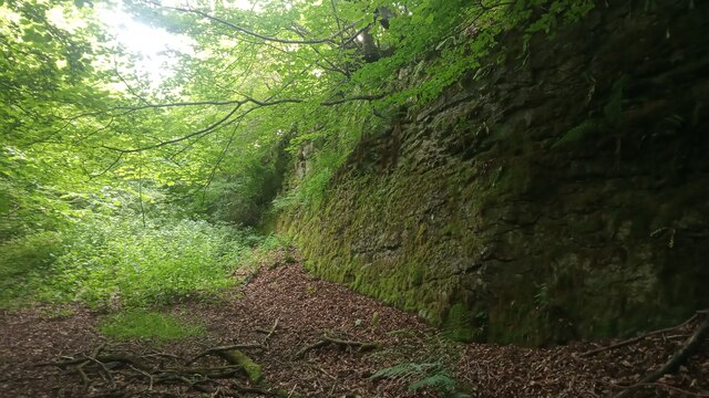
The woodland is predominantly composed of towering oak, birch, and beech trees, creating a lush canopy that provides shade and shelter to a variety of wildlife. The forest floor is covered in a rich carpet of moss, ferns, and wildflowers, adding to the charm and beauty of the surroundings.

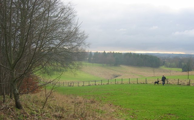
Visitors to Ann's Well Strip can indulge in a range of activities to immerse themselves in nature. There are well-maintained walking trails that wind through the woods, offering opportunities for leisurely strolls and peaceful hikes. The area is also popular among birdwatchers, as it is home to a diverse array of bird species, including woodpeckers, thrushes, and owls.

Nature enthusiasts and photographers will find Ann's Well Strip a haven for capturing the beauty of the Scottish woodland. The changing seasons bring a kaleidoscope of colors, with vibrant autumn foliage and delicate wildflowers in the springtime.

Overall, Ann's Well Strip in West Lothian is a hidden gem for those seeking solace in nature. Its tranquil ambiance, diverse flora and fauna, and well-maintained trails make it a perfect destination for outdoor enthusiasts and individuals looking to reconnect with the natural world.

If you have any feedback on the listing, please let us know in the comments section below.

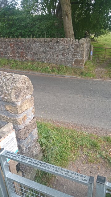
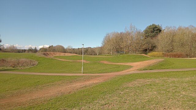
Ann's Well Strip Images

Images are sourced within 2km of 55.921456/-3.6288143 or Grid Reference NS9871. Thanks to Geograph Open Source API. All images are credited.

Interesting and Worrying Writing on Gate This gate is one of two leading into the Petershill Wildlife Reserve just North of Bathgate. The writing on the top of the gate says:
AGGRESSIVE OLD MAN IN(?) BLUE BERGHAUS JACKET & BLONDE LABRADOR BITING PEOPLE AND CHASING WILDLIFE REPORTED TO POLICE 17/04/22 12PM
Apart from never having seen anything like this on a metal gate before, two things struck me - (1) The writer used all the space available but never looked like running out of gate, and  (2) To own an aggressive labrador you must surely be some kind of psychopath - luckily he was unarmed!
Interesting and Worrying Writing on Gate
This gate is one of two leading into the Petershill Wildlife Reserve just North of Bathgate. The writing on the top of the gate says: AGGRESSIVE OLD MAN IN(?) BLUE BERGHAUS JACKET & BLONDE LABRADOR BITING PEOPLE AND CHASING WILDLIFE REPORTED TO POLICE 17/04/22 12PM Apart from never having seen anything like this on a metal gate before, two things struck me - (1) The writer used all the space available but never looked like running out of gate, and (2) To own an aggressive labrador you must surely be some kind of psychopath - luckily he was unarmed!
The Hidden Part of Petershill Reserve Petershill Wildlife Reserve occupies most of the site of a former limestone quarry. The bit on the left of the very steep road leading North from Bathgate has two gates and is mostly situated where two former reservoirs had been created from the quarry ponds. The bit on the right of the road caught my attention because of the steep drops down from the stone wall that runs alongside the road, and the lack of any obvious water down below.
There is a stone wall surrounding this sunken area - broken in a few places, with the usual agricultural makeshift defences in place to avoid the rescuing of livestock.
I discovered upon my return that this bit was once part of the quarry too . The stone face pictured isn't actually a part of the perimeter wall as I, disoriented as usual, had initially thought, but is further South. Old maps, at the time of the reservoirs simply denote it as pond (with an area of 0.24 acres). Presumably this was drained at the same time the reservoirs were - in the 1980s. I am always intrigued as to how they manage to drain places that have turned into ponds and lakes, considering that the bodies of water  have formed due to the ground having been excavated to the bedrock. Anyway, all that remains of the pond today  is a big muddy puddle.
And this is actually a part of the Scottish Wildlife Trust managed reserve, they just don't tell anybody.
The Hidden Part of Petershill Reserve
Petershill Wildlife Reserve occupies most of the site of a former limestone quarry. The bit on the left of the very steep road leading North from Bathgate has two gates and is mostly situated where two former reservoirs had been created from the quarry ponds. The bit on the right of the road caught my attention because of the steep drops down from the stone wall that runs alongside the road, and the lack of any obvious water down below. There is a stone wall surrounding this sunken area - broken in a few places, with the usual agricultural makeshift defences in place to avoid the rescuing of livestock. I discovered upon my return that this bit was once part of the quarry too . The stone face pictured isn't actually a part of the perimeter wall as I, disoriented as usual, had initially thought, but is further South. Old maps, at the time of the reservoirs simply denote it as pond (with an area of 0.24 acres). Presumably this was drained at the same time the reservoirs were - in the 1980s. I am always intrigued as to how they manage to drain places that have turned into ponds and lakes, considering that the bodies of water have formed due to the ground having been excavated to the bedrock. Anyway, all that remains of the pond today is a big muddy puddle. And this is actually a part of the Scottish Wildlife Trust managed reserve, they just don't tell anybody.
Short cycle track Depending on which large-scale online map you go to, this part of the oddly named 'Park of Peace' at the NorthWest edge of Bathgate (more research is required here, but I think the name has something to do with the fact that there are some war memorials within the park) is either broadly described as a play area, or specifically described as a 'cycle racing facility'.
It is obviously designed with fun in mind as, despite the bumps and berms, it is downhill all the way. However, the starting point and finishing point must only be 50 feet apart. So why not join them up, thereby facilitating (pun intended) proper races over several laps. As every true fan of cycling knows, it is the uphill struggles that are the most exciting. There is a vague grassy route between the two ends but it is obviously not designed to be ridden up.
I passed by on the first proper T-Shirt day of spring. Therefore all the targeted users were just drinking and socializing. Good on 'em - I have to admit I felt  twinge of jealousy!
Short cycle track
Depending on which large-scale online map you go to, this part of the oddly named 'Park of Peace' at the NorthWest edge of Bathgate (more research is required here, but I think the name has something to do with the fact that there are some war memorials within the park) is either broadly described as a play area, or specifically described as a 'cycle racing facility'. It is obviously designed with fun in mind as, despite the bumps and berms, it is downhill all the way. However, the starting point and finishing point must only be 50 feet apart. So why not join them up, thereby facilitating (pun intended) proper races over several laps. As every true fan of cycling knows, it is the uphill struggles that are the most exciting. There is a vague grassy route between the two ends but it is obviously not designed to be ridden up. I passed by on the first proper T-Shirt day of spring. Therefore all the targeted users were just drinking and socializing. Good on 'em - I have to admit I felt twinge of jealousy!
Path over Glenmavis The path winds across the park with skateboard ramps, complete with the usual graffiti, ahead.
Path over Glenmavis
The path winds across the park with skateboard ramps, complete with the usual graffiti, ahead.
Shelter in Glenmavis This facility has evidently received the attention of vandals - who would want to sit in here?
Shelter in Glenmavis
This facility has evidently received the attention of vandals - who would want to sit in here?
Shelter in Glenmavis Unfortunately, this facility has evidently received the attention of vandals.
Shelter in Glenmavis
Unfortunately, this facility has evidently received the attention of vandals.
Glenmavis Bowling Club An attractive gate design marks the entrance to this sports facility.
Glenmavis Bowling Club
An attractive gate design marks the entrance to this sports facility.
Houses on Glenmavis Drive, Bathgate Looking at the backs of houses on Glenmavis Drive from Drumcross Road with a spectacular view beyond.
Houses on Glenmavis Drive, Bathgate
Looking at the backs of houses on Glenmavis Drive from Drumcross Road with a spectacular view beyond.
The Green, Bathgate Attractive suburban street high above the town. Clearly a great deal of effort has been put into the gardening.
The Green, Bathgate
Attractive suburban street high above the town. Clearly a great deal of effort has been put into the gardening.
Drumcross Road, Bathgate Drumcross Road descends steeply into the town where The Green leads off to the right.
Drumcross Road, Bathgate
Drumcross Road descends steeply into the town where The Green leads off to the right.
East Kirkton Quarry An outcrop of limestone, discontinuous as a result of faulting, runs through the Bathgate Hills, roughly south to north, and has been extensively quarried. The quarries are all long and narrow, abandoned, and mostly very overgrown. East Kirkton is of international importance because it has yielded a quantity of very significant fossils, including 'Westlothiana lizziae', popularly known as 'Lizzie', which is a key link between amphibians and reptiles. 'Lizzie' was found in 1988 and is now in the National Museum of Scotland.
East Kirkton Quarry
An outcrop of limestone, discontinuous as a result of faulting, runs through the Bathgate Hills, roughly south to north, and has been extensively quarried. The quarries are all long and narrow, abandoned, and mostly very overgrown. East Kirkton is of international importance because it has yielded a quantity of very significant fossils, including 'Westlothiana lizziae', popularly known as 'Lizzie', which is a key link between amphibians and reptiles. 'Lizzie' was found in 1988 and is now in the National Museum of Scotland.
Petershill Wildlife Reserve An outcrop of limestone, discontinuous as a result of faulting, runs through the Bathgate Hills, roughly south to north, and has been extensively quarried. The quarries are all linear because they follow the limestone seam, abandoned, and mostly very overgrown. This is the Petershill Quarry, which exploited the Petershill Limestone. After quarrying ended it became a reservoir, and it is now a wildlife reserve. See <span class="nowrap"><a title="http://scottishwildlifetrust.org.uk/reserve/petershill" rel="nofollow ugc noopener" href="http://scottishwildlifetrust.org.uk/reserve/petershill">Link</a><img style="margin-left:2px;" alt="External link" title="External link - shift click to open in new window" src="https://s1.geograph.org.uk/img/external.png" width="10" height="10"/></span> - though this gives no indication of the nature of the geology referred to. Or, for that matter, of the species of birds and plants!
Petershill Wildlife Reserve
An outcrop of limestone, discontinuous as a result of faulting, runs through the Bathgate Hills, roughly south to north, and has been extensively quarried. The quarries are all linear because they follow the limestone seam, abandoned, and mostly very overgrown. This is the Petershill Quarry, which exploited the Petershill Limestone. After quarrying ended it became a reservoir, and it is now a wildlife reserve. See LinkExternal link - though this gives no indication of the nature of the geology referred to. Or, for that matter, of the species of birds and plants!
Petershill Reservoir This is the north end of what was a reservoir occupying the former quarry at Petershill. The bare ground at upper right is the most accessible part of the interesting geological features of the site. See <a href="https://www.geograph.org.uk/photo/3670303">NS9869 : Petershill Limestone</a>.
Petershill Reservoir
This is the north end of what was a reservoir occupying the former quarry at Petershill. The bare ground at upper right is the most accessible part of the interesting geological features of the site. See NS9869 : Petershill Limestone.
Petershill Limestone This is the most accessible of the interesting geological features of Petershill Reserve. It is the bedding surface of a limestone which has been tilted so that it dips towards the west. This is a marine limestone, formed as a reef round a volcanic island some 300 million years ago in the late Carboniferous. It contains an abundance of fossils including corals, brachiopods, echinoids, crinoids, bryozoa and sponges. See <a href="https://www.geograph.org.uk/photo/3670307">NS9869 : Spirifer Fossil</a>.
Petershill Limestone
This is the most accessible of the interesting geological features of Petershill Reserve. It is the bedding surface of a limestone which has been tilted so that it dips towards the west. This is a marine limestone, formed as a reef round a volcanic island some 300 million years ago in the late Carboniferous. It contains an abundance of fossils including corals, brachiopods, echinoids, crinoids, bryozoa and sponges. See NS9869 : Spirifer Fossil.
Spirifer Fossil Spirifers are a type of brachiopod. They are extinct bivalves that lived from Ordovician to Permian times. Notice the ribs, still well preserved after 300 or so million years buried in the limestone, and many years' exposure to the elements. I wish I'd taken a soft brush with me to shift the sand out of it. See <a href="https://www.geograph.org.uk/photo/3670308">NS9869 : Productus Fossil</a>.
Spirifer Fossil
Spirifers are a type of brachiopod. They are extinct bivalves that lived from Ordovician to Permian times. Notice the ribs, still well preserved after 300 or so million years buried in the limestone, and many years' exposure to the elements. I wish I'd taken a soft brush with me to shift the sand out of it. See NS9869 : Productus Fossil.
Productus Fossil This is one of the shells of a Productus, a common type of brachiopod. This bed of the Petershill limestone is stuffed full of these brachiopods, among other fossils. See <a href="https://www.geograph.org.uk/photo/3670310">NS9869 : Colonial Coral</a>.
Productus Fossil
This is one of the shells of a Productus, a common type of brachiopod. This bed of the Petershill limestone is stuffed full of these brachiopods, among other fossils. See NS9869 : Colonial Coral.
Colonial Coral There are lumps of coral like this, and vast numbers of pieces eroded out of the Petershill Limestone, all just lying around on the slope east of the pond at Petershill Reserve. See <a href="https://www.geograph.org.uk/photo/3670312">NS9869 : Solitary Corals</a>.
Colonial Coral
There are lumps of coral like this, and vast numbers of pieces eroded out of the Petershill Limestone, all just lying around on the slope east of the pond at Petershill Reserve. See NS9869 : Solitary Corals.
Solitary Corals All the dark conical shapes in this view are the remains of solitary corals - so many that one might question the term 'solitary'. The point is that unlike a colonial coral colony, each of these was a separate organism, not part of an interdependent multiple organism.
Solitary Corals
All the dark conical shapes in this view are the remains of solitary corals - so many that one might question the term 'solitary'. The point is that unlike a colonial coral colony, each of these was a separate organism, not part of an interdependent multiple organism.
Show me another place!

Ann's Well Strip is located at Grid Ref: NS9871 (Lat: 55.921456, Lng: -3.6288143)

Unitary Authority: West Lothian

Police Authority: The Lothians and Scottish Borders

What 3 Words

///marketing.secures.clearing. Near Bathgate, West Lothian

Related Wikis

Cairnpapple Hill

Cairnpapple Hill is a hill with a dominating position in central lowland Scotland with views from coast to coast. It was used and re-used as a major ritual...

Hilderston, West Lothian

Hilderston or Hilderstone in West Lothian, Scotland, was the site of the discovery of a vein of silver in 1606 and a mining operation that attracted international...

Ballencrieff, West Lothian

Ballencrieff is a settlement in West Lothian, Scotland, situated equidistant between the towns of Bathgate and Torphichen and seven miles south of Linlithgow...

Balbardie House

Balbardie House was an 18th-century Scottish mansion house in West Lothian, Scotland, near to the town of Bathgate. == History == The house stood on the...

Nearby Amenities

Located within 500m of 55.921456,-3.6288143
Restaurant
The Vu
Addr Full: Ballencrieff Reservoir
Addr Postcode: EH48 4LD
Note: Also a bar and wedding venue. Fishery next door, if I recall correctly.
Source: GPS
Url: http://www.thevu.co.uk/
Lat/Long: 55.9220775/-3.6336034
Crossing
Lat/Long: 55.9217096/-3.6337088
Turning Circle
Lat/Long: 55.921862/-3.6326749
Entrance: yes
Lat/Long: 55.921471/-3.6338123
Entrance: yes
Lat/Long: 55.9218912/-3.6333461
Material: wood
Power: pole
Lat/Long: 55.9247444/-3.6330991
Material: wood
Power: pole
Lat/Long: 55.9252763/-3.6328161
Ballencrieff Hill
Ele: 312
Man Made: survey_point
Ref: S3241
Lat/Long: 55.9227298/-3.6218519
Power: pole
Lat/Long: 55.9186003/-3.634499
Power: pole
Lat/Long: 55.9192225/-3.6338407
Power: pole
Lat/Long: 55.9198459/-3.6331866
Power: pole
Lat/Long: 55.9204926/-3.6324804
Power: pole
Lat/Long: 55.9210388/-3.6318659
Power: pole
Lat/Long: 55.9216552/-3.6321117
Power: pole
Lat/Long: 55.9222318/-3.6322638
Power: pole
Lat/Long: 55.9229181/-3.6324846
Power: pole
Lat/Long: 55.9235729/-3.6326971
Power: pole
Lat/Long: 55.9241741/-3.6329116
Power: pole
Lat/Long: 55.9238869/-3.6350063
Power: pole
Lat/Long: 55.9240713/-3.6337085
The data included in this document is from www.openstreetmap.org. The data is made available under ODbL.

Have you been to Ann's Well Strip?

Leave your review of Ann's Well Strip below (or comments, questions and feedback).