Tynreich Wood

Wood, Forest in Perthshire

Scotland

Tynreich Wood

Looking south along the A9 near Ballinluig A fine display of daffodils on the roadside bank.
Looking south along the A9 near Ballinluig Credit: Rod Allday

Tynreich Wood is a picturesque forest located in Perthshire, Scotland. It is situated near the town of Crieff, surrounded by the stunning landscape of the Highlands. Covering an expansive area, the wood is a popular destination for nature enthusiasts and outdoor enthusiasts alike.

The woodland boasts a diverse range of flora and fauna, with a mix of broadleaf and coniferous trees creating a rich and vibrant ecosystem. Visitors can expect to encounter an array of native Scottish wildlife, including red squirrels, roe deer, and a variety of bird species. Birdwatchers particularly appreciate the wood for its resident population of woodpeckers and owls.

For those looking to explore the area, there are several well-maintained walking trails and paths that wind their way through the wood. These trails offer breathtaking views of the surrounding countryside and provide opportunities for peaceful walks and hikes. Additionally, there are designated picnic areas, allowing visitors to take a break and enjoy a meal amidst the tranquil surroundings.

Tynreich Wood is also home to a number of historical and cultural landmarks. Ruins of old settlements and ancient stone circles can be found within the forest, providing a glimpse into the area's rich history. These sites are often of interest to history enthusiasts and archaeology buffs.

Overall, Tynreich Wood offers a serene and captivating experience, allowing visitors to immerse themselves in the natural beauty and history of Perthshire.

If you have any feedback on the listing, please let us know in the comments section below.

Tynreich Wood Images

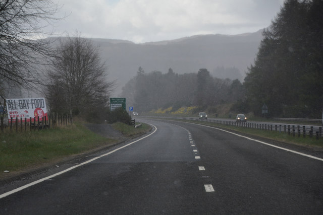
Images are sourced within 2km of 56.663555/-3.66874 or Grid Reference NN9753. Thanks to Geograph Open Source API. All images are credited.

Looking south along the A9 near Ballinluig A fine display of daffodils on the roadside bank.
Looking south along the A9 near Ballinluig
A fine display of daffodils on the roadside bank.
Lay-by on the A9 southbound near Ballinluig Looking north.
Lay-by on the A9 southbound near Ballinluig
Looking north.
Level crossing at Moulinearn
Railway line at Moulinearn The house behind the trees was a coaching inn or kingshouse on General Wade's military road which was built following the Jacobite Uprising of 1715. The Athole Arms Inn was an alternative designation. It continued to serve as a coaching inn until the advent of the railway which runs between the old military road and the A9.
Railway line at Moulinearn
The house behind the trees was a coaching inn or kingshouse on General Wade's military road which was built following the Jacobite Uprising of 1715. The Athole Arms Inn was an alternative designation. It continued to serve as a coaching inn until the advent of the railway which runs between the old military road and the A9.
Rural Perthshire : Prisoner Exchange At Tullimet Road End, Ballinluig Tullimet road end in Ballinluig is the place in the Stagecoach bus timetables where the services 23 (Aberfeldy-Perth) and 24 (Pitlochry - Perth) meet to exchange passengers. 

A passenger wishing to make a return trip from Dunkeld to Pitlochry has to change buses at Ballinluig on both the outward and return journeys.
Rural Perthshire : Prisoner Exchange At Tullimet Road End, Ballinluig
Tullimet road end in Ballinluig is the place in the Stagecoach bus timetables where the services 23 (Aberfeldy-Perth) and 24 (Pitlochry - Perth) meet to exchange passengers. A passenger wishing to make a return trip from Dunkeld to Pitlochry has to change buses at Ballinluig on both the outward and return journeys.
Rural Perthshire : Logierait Primary School, Ballinluig
Hawthorn by the road to Logierait Mill
Church at Logierait
Church at Logierait
Minor road by Pitcastle
Perth and Kinross : The A9 Looking along the A9 road.
Perth and Kinross : The A9
Looking along the A9 road.
Perth and Kinross : The A9 Approaching the turn of for various attractions.
Perth and Kinross : The A9
Approaching the turn of for various attractions.
Perth and Kinross : The A9 Looking along the A9 road.
Perth and Kinross : The A9
Looking along the A9 road.
Perth and Kinross : The A9 Looking along the A9 road.
Perth and Kinross : The A9
Looking along the A9 road.
Perth and Kinross : The A9 Approaching a turn off for the A9.
Perth and Kinross : The A9
Approaching a turn off for the A9.
Perth and Kinross : The A827 Looking along the A9 with the turn off to the A827 to Ballinluig.
Perth and Kinross : The A827
Looking along the A9 with the turn off to the A827 to Ballinluig.
Perth and Kinross : The A9 Looking along the A9 road.
Perth and Kinross : The A9
Looking along the A9 road.
Ballinluig The road through the village was a section of the A9 prior to its upgrade in the 1970's. The A9 bypasses the village to the west.
Ballinluig
The road through the village was a section of the A9 prior to its upgrade in the 1970's. The A9 bypasses the village to the west.
Show me another place!

Tynreich Wood is located at Grid Ref: NN9753 (Lat: 56.663555, Lng: -3.66874)

Unitary Authority: Perth and Kinross

Police Authority: Tayside

What 3 Words

///tilts.strongman.argued. Near Pitlochry, Perth & Kinross

Nearby Locations

Tynreich Wood

Related Wikis

Ballinluig

Ballinluig (Gaelic: Baile an Luig) is a village in Perth and Kinross, Scotland. It lies on the banks of the River Tummel in Logierait Parish, and is approximately...

Ballinluig railway station

Ballinluig railway station served the village of Ballinluig, Perth and Kinross, Scotland from 1863 to 1965 on the Inverness and Perth Junction Railway...

Logierait

Logierait (Scottish Gaelic: Lag an Ratha - 'Hollow of the [Earth-Walled] Fort/Enclosure') is a village and parish in Atholl, Scotland. It is situated...

River Tummel

The River Tummel (Scottish Gaelic: Uisge Theimheil) is a river in Perth and Kinross, Scotland. Water from the Tummel is used in the Tummel hydro-electric...

Nearby Amenities

Located within 500m of 56.663555,-3.66874
Traffic Calming: hump
Lat/Long: 56.6599033/-3.6722498
Created By: Merkaartor 0.12
Lat/Long: 56.661714/-3.672201
Tigh Na Ruaich
Access: private
Archaeological Site: megalith
Historic: archaeological_site
Man Made: stone_circle
Megalith Type: stone_circle
Tourism: attraction
Lat/Long: 56.6616625/-3.6717757
Power: tower
Lat/Long: 56.6599298/-3.6652976
Power: tower
Lat/Long: 56.6610088/-3.669557
Power: tower
Lat/Long: 56.6621203/-3.673988
Traffic Calming: hump
Lat/Long: 56.6603072/-3.6722446
Traffic Calming: hump
Lat/Long: 56.6595141/-3.6722472
Location: indoor
Power: substation
Substation: minor_distribution
Lat/Long: 56.6603838/-3.6711469
Power: pole
Lat/Long: 56.6604166/-3.6710456
Power: pole
Lat/Long: 56.6593575/-3.667823
Power: pole
Lat/Long: 56.6601774/-3.6676266
Power: pole
Lat/Long: 56.6608389/-3.6677383
Power: pole
Lat/Long: 56.6614905/-3.6677977
Power: pole
Lat/Long: 56.6623173/-3.667196
Power: pole
Lat/Long: 56.6630391/-3.6665041
Power: pole
Lat/Long: 56.6637867/-3.6658068
Power: pole
Lat/Long: 56.6645213/-3.6651006
Power: pole
Lat/Long: 56.6652481/-3.6644231
Power: pole
Lat/Long: 56.6660025/-3.6637168
Power: pole
Lat/Long: 56.6666698/-3.6630754
The data included in this document is from www.openstreetmap.org. The data is made available under ODbL.

Have you been to Tynreich Wood?

Leave your review of Tynreich Wood below (or comments, questions and feedback).