Cascob

Settlement in Radnorshire

Wales

Cascob

Llan Fawr Piler triongli ar gopa Llan Fawr (Lan Fawr?). Yn y pellter gellir gweld Bryn Bache a'r Domen Ddu / Micsen Ddu, dau Hewitt sy dros 2,000 o droedfeddi. 

A triangulation pillar on the summit of Llan Fawr (probably 'Y Lan Fawr' meaning 'The Big Hill'). In the distance one can see Bache Hill and Black Mixen, two Hewitts over 2,000 ft.
Llan Fawr Credit: Alan Richards

Cascob is a small village located in the county of Radnorshire, Wales. Situated in the picturesque countryside, Cascob is surrounded by rolling hills and lush green pastures, making it an idyllic rural retreat. The village is part of the wider community of Radnor Valley, which comprises several small settlements.

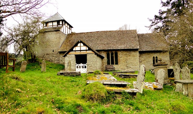
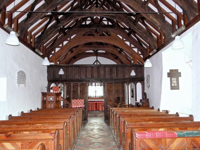
Cascob has a rich history dating back many centuries. Evidence of early settlements can be found in the form of ancient burial mounds and earthworks in the surrounding area. The village itself features a mix of traditional stone cottages and more modern houses, creating a charming blend of old and new.

While Cascob is predominantly residential, it does have a few amenities to offer its residents. There is a small village hall that serves as a community hub, hosting various events and gatherings throughout the year. The village also has a primary school, providing education to the local children.

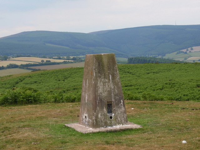
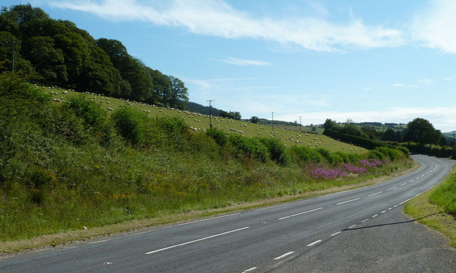
The natural beauty of Cascob and its surroundings makes it an ideal destination for outdoor enthusiasts. The rolling hills and meandering streams offer plenty of opportunities for walking, hiking, and fishing. The area is also home to a variety of wildlife, including birds of prey, deer, and otters, making it a haven for nature lovers.

Overall, Cascob is a peaceful and scenic village that offers a tranquil lifestyle amidst the stunning Welsh countryside. Its rich history, picturesque setting, and community spirit make it a truly special place to live or visit.

If you have any feedback on the listing, please let us know in the comments section below.

Cascob Images

Images are sourced within 2km of 52.291491/-3.11707 or Grid Reference SO2366. Thanks to Geograph Open Source API. All images are credited.

Llan Fawr Piler triongli ar gopa Llan Fawr (Lan Fawr?). Yn y pellter gellir gweld Bryn Bache a'r Domen Ddu / Micsen Ddu, dau Hewitt sy dros 2,000 o droedfeddi. 

A triangulation pillar on the summit of Llan Fawr (probably 'Y Lan Fawr' meaning 'The Big Hill'). In the distance one can see Bache Hill and Black Mixen, two Hewitts over 2,000 ft.
Llan Fawr
Piler triongli ar gopa Llan Fawr (Lan Fawr?). Yn y pellter gellir gweld Bryn Bache a'r Domen Ddu / Micsen Ddu, dau Hewitt sy dros 2,000 o droedfeddi. A triangulation pillar on the summit of Llan Fawr (probably 'Y Lan Fawr' meaning 'The Big Hill'). In the distance one can see Bache Hill and Black Mixen, two Hewitts over 2,000 ft.
A488 below Hivron Looking west at the edge of the gridsquare.  The hamlet is on the hillside.
A488 below Hivron
Looking west at the edge of the gridsquare. The hamlet is on the hillside.
A488 towards Monaughty The road is at the foot of a hillside field, full of sheep when I passed by, in the next square.
A488 towards Monaughty
The road is at the foot of a hillside field, full of sheep when I passed by, in the next square.
St Michael and All Angels, Cascob In a huge, unkempt and magical churchyard, the mound on which the squat tower stands is intriguing. The place has that indefinable quality that many ancient Welsh churches possess.
St Michael and All Angels, Cascob
In a huge, unkempt and magical churchyard, the mound on which the squat tower stands is intriguing. The place has that indefinable quality that many ancient Welsh churches possess.
St Michael and All Angels, Cascob
A488 west of Tan-y-Coed Double bend at end of straight
A488 west of Tan-y-Coed
Double bend at end of straight
Monaughty ahead A488 northbound
Monaughty ahead
A488 northbound
Lugg Valley from Pilleth Oaks This view was taken from Pilleth Oaks bed and breakfast.Sheep farming predominates around here. The structure in the bottom right corner of the photo is the end of a series of solar panels.
Lugg Valley from Pilleth Oaks
This view was taken from Pilleth Oaks bed and breakfast.Sheep farming predominates around here. The structure in the bottom right corner of the photo is the end of a series of solar panels.
Valley of the River Lugg from Pilleth Oaks
Valley of the River Lugg from Pilleth Oaks Note the Welsh Mountain sheep in this photograph. Sheep farming dominates here.
Valley of the River Lugg from Pilleth Oaks
Note the Welsh Mountain sheep in this photograph. Sheep farming dominates here.
Track to the pumping station from Pilleth Oaks B&B To the right of this track the Battle of Pilleth  was fought in 1402.
The Welsh forces of Owain Glyndŵr defeated the English forces of Sir Edmund Mortimer.
Track to the pumping station from Pilleth Oaks B&B
To the right of this track the Battle of Pilleth was fought in 1402. The Welsh forces of Owain Glyndŵr defeated the English forces of Sir Edmund Mortimer.
The Tiny Hamlet of Cascob
Telephone Box in Cascob
An Ancient Yew Tree Sitting within the bounds of the Churchyard in the Tiny hamlet of Cascob is a fine specimen of a Yew tree that must surely sit around 1000 year old. A pleasure to see.
An Ancient Yew Tree
Sitting within the bounds of the Churchyard in the Tiny hamlet of Cascob is a fine specimen of a Yew tree that must surely sit around 1000 year old. A pleasure to see.
Ancient Yew at Cascob Church
Cascob Churchyard
Cascob Churchyard
Remains of a Stone built sluice at The Pentre Unknown date but probably 18th Century
Remains of a Stone built sluice at The Pentre
Unknown date but probably 18th Century
Llan-Fawr Hill
Llan-Fawr Hill
Show me another place!

Cascob is located at Grid Ref: SO2366 (Lat: 52.291491, Lng: -3.11707)

Unitary Authority: Powys

Police Authority: Dyfed Powys

Also known as: Casgob

What 3 Words

///kitchen.imperious.envy. Near Whitton, Powys

Related Wikis

Cascob

Cascob (Welsh: Casgob) is a small village in Powys. It is located in a valley five miles to the south-west of Knighton. The village is part of Whitton...

Battle of Bryn Glas

The Battle of Bryn Glas (also known as the Battle of Pilleth) was a battle between the Welsh and English on 22 June 1402, near the towns of Knighton and...

Pilleth

Pilleth is a small village south of Knighton in Powys, Wales in the traditional county of Radnorshire. It is the site of the ancient church and holy well...

Whitton, Powys

Whitton (Welsh: Llanddewi-yn-Hwytyn) is a village and a community in Radnorshire, Powys, Wales. It is located on the B4356 road 4 miles (6.4 km) south...

Nearby Amenities

Located within 500m of 52.291491,-3.11707
Cascob
Place: hamlet
Wikidata: Q13126874
Lat/Long: 52.2909852/-3.1159462
Telephone
Booth: K6
Covered: booth
Listed Status: Grade II
Operator: BT
Phone: +44 1547 560212
Lat/Long: 52.2906407/-3.1166199
The data included in this document is from www.openstreetmap.org. The data is made available under ODbL.

Have you been to Cascob?

Leave your review of Cascob below (or comments, questions and feedback).