Drumour Wood

Wood, Forest in Perthshire

Scotland

Drumour Wood

River Braan downstream from Trochry
River Braan downstream from Trochry Credit: Alan Reid

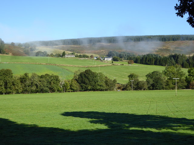
Drumour Wood is a picturesque forest located in Perthshire, Scotland. Covering an area of approximately 50 acres, it is a haven for nature enthusiasts and those seeking tranquility amidst the beauty of the Scottish countryside.

The wood is predominantly made up of native deciduous trees, including oak, birch, and beech, which create a vibrant tapestry of colors throughout the seasons. A network of well-maintained paths winds its way through the woodland, allowing visitors to explore its hidden gems. These paths are suitable for walkers of all abilities, making the wood accessible to everyone.

One of the highlights of Drumour Wood is its diverse range of wildlife. The forest provides a habitat for an array of bird species, including woodpeckers, owls, and various songbirds. Deer can often be spotted grazing in the clearings, and if you're lucky, you may even catch a glimpse of a red squirrel darting through the trees.

For those interested in the history of the area, Drumour Wood offers a glimpse into the past. In some areas, the remnants of old stone walls can be seen, hinting at the wood's former use as agricultural land. There are also several archaeological sites nearby, including the remains of an Iron Age hillfort, adding to the sense of intrigue and history.

Overall, Drumour Wood is a captivating natural wonderland, inviting visitors to immerse themselves in its beauty and tranquility. Whether you're a keen birdwatcher, a nature lover, or simply looking for a peaceful escape, this enchanting forest is sure to leave a lasting impression.

If you have any feedback on the listing, please let us know in the comments section below.
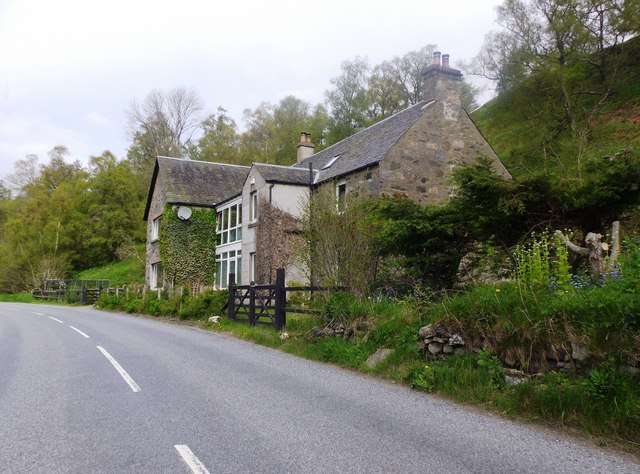
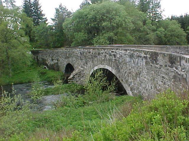
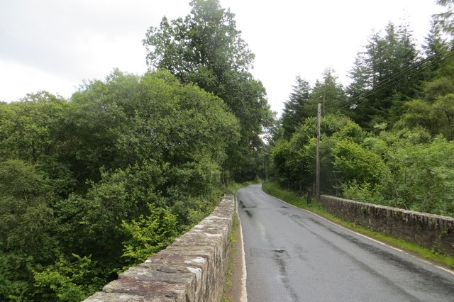
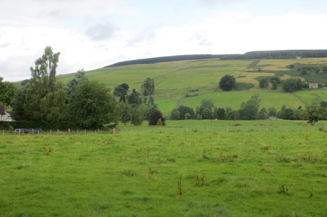
Drumour Wood Images

Images are sourced within 2km of 56.540123/-3.6694366 or Grid Reference NN9739. Thanks to Geograph Open Source API. All images are credited.

River Braan downstream from Trochry
Drumour Schoolhouse Converted to a residence; by the A822.
Drumour Schoolhouse
Converted to a residence; by the A822.
Drumour Bridge carries the A822 across the River Braan
Entrance to Trochry
Entrance to Trochry
Strath Braan A fertile farmed glen in Highland Perthshire.  Here the A822 passes Borelick.
Strath Braan
A fertile farmed glen in Highland Perthshire. Here the A822 passes Borelick.
Haugh, Drumour Fields beside the Braan.
Haugh, Drumour
Fields beside the Braan.
River Braan, Drumour
River Braan, Drumour The river is far below Drumour Bridge on the A822.
River Braan, Drumour
The river is far below Drumour Bridge on the A822.
Drumour Bridge The bridge builders took advantage of a narrow gorge to cross the Braan,
Drumour Bridge
The bridge builders took advantage of a narrow gorge to cross the Braan,
Field, Trochry Pasture in Strath Braan.
Field, Trochry
Pasture in Strath Braan.
Wooded mound, Little Trochry Antiquity or glacial mound?  Beside the A822 in Strath Braan.
Wooded mound, Little Trochry
Antiquity or glacial mound? Beside the A822 in Strath Braan.
Beside the Braan A wet, ungrazed strip of land between the A822 and the River Braan.
Beside the Braan
A wet, ungrazed strip of land between the A822 and the River Braan.
Farmland in Strath Braan Some morning mist is just clearing the hillside above Meikle Logie.
Farmland in Strath Braan
Some morning mist is just clearing the hillside above Meikle Logie.
Meikle Logie, Strath Braan Looking across from the opposite side of the River Braan as morning mist clears.
Meikle Logie, Strath Braan
Looking across from the opposite side of the River Braan as morning mist clears.
Old Milestone by the A822, Wester Drumour, Little Dunkeld parish Stone post by the A822, in parish of Little Dunkeld (District), Wester Drumour, on verge near hedge.

Inscription once read:-
: (Amulree / 4¾) : : (Dunkeld / 5) :

Surveyed

Milestone Society National ID: PK_DKAM05
Old Milestone by the A822, Wester Drumour, Little Dunkeld parish
Stone post by the A822, in parish of Little Dunkeld (District), Wester Drumour, on verge near hedge. Inscription once read:- : (Amulree / 4¾) : : (Dunkeld / 5) : Surveyed Milestone Society National ID: PK_DKAM05
Old Milestone by the A822, Trochry, Little Dunkeld parish Stone post by the A822, in parish of Little Dunkeld (District), Trochry, on verge, Southeast side of road.

Inscription once read:-
: Amulree / 5¾ : : Dunkeld / 4 :

Surveyed

Milestone Society National ID: PK_DKAM04
Old Milestone by the A822, Trochry, Little Dunkeld parish
Stone post by the A822, in parish of Little Dunkeld (District), Trochry, on verge, Southeast side of road. Inscription once read:- : Amulree / 5¾ : : Dunkeld / 4 : Surveyed Milestone Society National ID: PK_DKAM04
Field adjacent to A822 in Strath Braan The A822 lies on the far side of the low wall and fence; beyond that is the River Braan. The long grass will be cut, presumably for hay or silage.
Field adjacent to A822 in Strath Braan
The A822 lies on the far side of the low wall and fence; beyond that is the River Braan. The long grass will be cut, presumably for hay or silage.
Show me another place!

Drumour Wood is located at Grid Ref: NN9739 (Lat: 56.540123, Lng: -3.6694366)

Unitary Authority: Perth and Kinross

Police Authority: Tayside

What 3 Words

///scoop.reader.influencing. Near Bankfoot, Perth & Kinross

Nearby Locations

Drumour Wood

Related Wikis

Falls of the Braan

Falls of the Braan is a waterfall of Scotland located in the Hermitage at the National Trust for Scotland-protected site in Dunkeld, Perth and Kinross...

Hermitage Douglas-fir

The Hermitage Douglas-fir (also known as Ossian's Douglas-fir) was a Douglas-fir tree which stood in The Hermitage pleasure ground, in Dunkeld, Scotland...

The Hermitage, Dunkeld

The Hermitage (officially The Hermitage pleasure ground) is a National Trust for Scotland-protected site in Dunkeld, Perth and Kinross. Located just to...

Black Linn Falls

Black Linn Falls is a waterfall on the River Braan in The Hermitage, Dunkeld, Scotland. After the falls, the river passes beneath the Hermitage Bridge...

Nearby Amenities

Located within 500m of 56.540123,-3.6694366
Post Box
Collection Times: Mo-Fr 11:45; Sa 11:30
Manufacturer: Machan Scotland
Operator: Royal Mail
Post Box Mounting: pier
Post Box Type: lamp
Ref: PH8 155
Royal Cypher: scottish_crown
Source: survey;local knowledge
Lat/Long: 56.5411261/-3.6620277
Trochry
Pont: no
Stobie1783: no
Designation: Historic Mill
Historic: archaeological_site
Old Name: Turning Mill, Woollen Mill
Source: OS Six inch First Series
Lat/Long: 56.5404988/-3.6641546
New World Order
Artist Name: Andy Jackson
Artwork Type: installation
Description: Arch with inscriptions from Andy Jackson's poem New World Order in an arch over the route.
Operator: Corbenic Camphill Community
Tourism: artwork
Website: https://www.corbenicpoetrypath.com
Lat/Long: 56.5406264/-3.6742485
Start of Corbenic Poetry Path
Board Type: notice
Information: board
Tourism: information
Website: https://www.corbenicpoetrypath.com/
Lat/Long: 56.5372586/-3.6719024
Trochry
Name Gd: Trochraidh
Place: village
Lat/Long: 56.5412381/-3.6627879
Entrance: yes
Lat/Long: 56.5393885/-3.6712398
Entrance: yes
Lat/Long: 56.5393249/-3.6713968
Leisure: picnic_table
Material: wood
Lat/Long: 56.5394687/-3.6713397
Playground: swing
Lat/Long: 56.5396135/-3.6712038
Playground: swing
Lat/Long: 56.5394436/-3.6727212
Entrance: main
Lat/Long: 56.5385902/-3.6730581
Entrance: yes
Lat/Long: 56.538474/-3.6731723
Entrance: yes
Lat/Long: 56.5381668/-3.6733457
Entrance: yes
Lat/Long: 56.538254/-3.6732851
Power: pole
Transformer: distribution
Lat/Long: 56.5391097/-3.6735751
Power: pole
Lat/Long: 56.5390106/-3.6749108
Power: pole
Lat/Long: 56.5389026/-3.6761768
Power: pole
Lat/Long: 56.539227/-3.6727788
Power: pole
Lat/Long: 56.5394913/-3.6719507
Power: pole
Lat/Long: 56.5397856/-3.6717576
Entrance: secondary
Lat/Long: 56.5395223/-3.6714333
Power: pole
Lat/Long: 56.543053/-3.6754925
Material: wood
Power: pole
Lat/Long: 56.5433394/-3.6742689
Power: pole
Lat/Long: 56.54361/-3.67309
Power: pole
Lat/Long: 56.5438961/-3.6718562
Power: pole
Lat/Long: 56.5441741/-3.6706465
Power: pole
Lat/Long: 56.5444373/-3.6695307
Man Made: manhole
Manhole: telecom
Lat/Long: 56.5385065/-3.6729849
Man Made: manhole
Manhole: telecom
Lat/Long: 56.5393448/-3.6720912
Man Made: manhole
Manhole: telecom
Lat/Long: 56.5396797/-3.6720644
Man Made: manhole
Manhole: telecom
Lat/Long: 56.5401611/-3.673722
Man Made: manhole
Manhole: telecom
Lat/Long: 56.5400841/-3.6741633
Man Made: manhole
Manhole: telecom
Lat/Long: 56.5399533/-3.6746246
Man Made: manhole
Manhole: telecom
Lat/Long: 56.539812/-3.6754481
Man Made: manhole
Manhole: telecom
Lat/Long: 56.5400095/-3.6759832
Man Made: manhole
Manhole: telecom
Lat/Long: 56.5401145/-3.6726802
Man Made: manhole
Manhole: telecom
Lat/Long: 56.5399591/-3.6722473
Man Made: manhole
Manhole: telecom
Lat/Long: 56.5392277/-3.6720264
Man Made: manhole
Manhole: telecom
Lat/Long: 56.5390513/-3.6718308
Man Made: manhole
Manhole: telecom
Lat/Long: 56.5388916/-3.6715681
Man Made: manhole
Manhole: telecom
Lat/Long: 56.5388037/-3.6716452
Man Made: manhole
Manhole: telecom
Lat/Long: 56.5387007/-3.6720756
Man Made: manhole
Manhole: telecom
Lat/Long: 56.5385436/-3.6727276
Entrance: staircase
Lat/Long: 56.5394011/-3.6714511
Entrance: main
Lat/Long: 56.5394385/-3.671568
Entrance: yes
Lat/Long: 56.5393746/-3.6710918
Entrance: yes
Lat/Long: 56.5394513/-3.6709633
Entrance: secondary
Lat/Long: 56.5394876/-3.6714389
Entrance: main
Lat/Long: 56.5394139/-3.6720919
Entrance: main
Lat/Long: 56.5394344/-3.6719255
Entrance: secondary
Lat/Long: 56.5394729/-3.6718463
Entrance: emergency
Lat/Long: 56.5395175/-3.6716838
Power: pole
Lat/Long: 56.5400325/-3.6718719
Entrance: secondary
Lat/Long: 56.5400865/-3.6720235
Entrance: main
Lat/Long: 56.5399977/-3.6720115
Entrance: exit
Lat/Long: 56.5385497/-3.673224
Entrance: yes
Lat/Long: 56.5384338/-3.6733102
Entrance: yes
Lat/Long: 56.5385125/-3.6740962
Direction: 90
Tourism: viewpoint
Lat/Long: 56.5380025/-3.6726591
Entrance: yes
Lat/Long: 56.5397828/-3.6760336
Access: private
Man Made: yes
Outdoor: yes
Sport: climbing
Lat/Long: 56.5405655/-3.6739367
Entrance: yes
Lat/Long: 56.5391696/-3.6722207
Entrance: yes
Lat/Long: 56.5391872/-3.6722792
Man Made: manhole
Manhole: telecom
Lat/Long: 56.5385664/-3.6734409
Man Made: manhole
Manhole: telecom
Lat/Long: 56.5386944/-3.6736164
Man Made: water_tap
Lat/Long: 56.5393213/-3.6715014
Man Made: water_tap
Lat/Long: 56.5393588/-3.6712633
Man Made: water_tap
Lat/Long: 56.539675/-3.6710344
Bench
Material: wood
Seats: 3
Lat/Long: 56.5394317/-3.6707716
Entrance: yes
Lat/Long: 56.5382057/-3.6732088
Defibrillator
Defibrillator Location: Inside the foyer of the office entrance.
Emergency: defibrillator
Indoor: yes
Operator: Corbenic Camphill
Lat/Long: 56.5385857/-3.6730454
Defibrillator
Access: yes
Emergency: defibrillator
Indoor: no
Lat/Long: 56.5418109/-3.662881
Waterway: waterfall
Lat/Long: 56.5366276/-3.6712252
Waterway: waterfall
Lat/Long: 56.536579/-3.6710323
Leisure: picnic_table
Lat/Long: 56.5357723/-3.6689714
Ford: yes
Lat/Long: 56.536409/-3.6702549
Who Cares
Artist Name: Chrys Salt
Artwork Type: poem
Author: Chrys Salt
Ele: 182
Inscription: how well you walk on metric feet...
Material: wood
Operator: Corbenic Camphill Community
Tourism: artwork
Website: https://www.corbenicpoetrypath.com
Lat/Long: 56.5370688/-3.6728813
Field Holler
Artist Name: Jim Carruth
Artwork Type: poem
Inscription: today I stand in a field and shout...
Material: stone
Operator: Corbenic Camphill Community
Tourism: artwork
Website: https://www.corbenicpoetrypath.com
Lat/Long: 56.537866/-3.6739918
Artwork Type: poem
Inscription: It is all grass...
Material: wood
Operator: Corbenic Camphill Community
Tourism: artwork
Website: https://www.corbenicpoetrypath.com
Lat/Long: 56.5382268/-3.6749694
Island
Artist Name: Kenneth Steven
Artwork Type: poem
Inscription: In all the hurry of our lives...
Operator: Corbenic Camphill Community
Tourism: artwork
Website: https://www.corbenicpoetrypath.com
Lat/Long: 56.5386658/-3.67542
Artist Name: Sally Evans
Artwork Type: poem
Inscription: real thistles
Operator: Corbenic Camphill Community
Tourism: artwork
Website: https://www.corbenicpoetrypath.com
Lat/Long: 56.5395637/-3.6768135
Entrance: main
Lat/Long: 56.5400849/-3.6750343
Entrance: main
Lat/Long: 56.5399827/-3.6749096
Entrance: main
Lat/Long: 56.5401601/-3.6750642
Bench
Lat/Long: 56.539002/-3.6712975
The Philosopher's Stone
Natural: rock
Lat/Long: 56.5405441/-3.6677009
Barrier: yes
Fixme: tree across path
Lat/Long: 56.5363385/-3.6654381
MC-NA ST-RY
Artwork Type: sculpture
Material: stone
Tourism: artwork
Lat/Long: 56.5384032/-3.6683337
Leisure: firepit
Lat/Long: 56.538381/-3.6683257
The River
Artist Name: John Glenday
Artwork Type: poem
Tourism: artwork
Lat/Long: 56.5383559/-3.6683444
Ivy
Artist Name: Elizabeth Rimmer
Artwork Type: poem
Tourism: artwork
Lat/Long: 56.5386886/-3.6662389
Artist Name: Anne Connolly
Artwork Type: poem
Tourism: artwork
Lat/Long: 56.5383041/-3.6701871
Artwork Type: sculpture
Material: stone
Tourism: artwork
Lat/Long: 56.5383366/-3.6702005
Artist Name: Daniel Csaba Kravsz
Artwork Type: sculpture
Material: wood
Tourism: artwork
Lat/Long: 56.5385777/-3.6675773
Tick
Artist Name: Hazel Buchan
Artwork Type: poem
Tourism: artwork
Lat/Long: 56.5383396/-3.6708147
Reposed Face in the Wall
Artist Name: Bendeguz Sventesi
Artwork Type: bust
Material: stone
Operator: Corbenic Camphill Community
Tourism: artwork
Website: https://www.corbenicpoetrypath.com
Lat/Long: 56.5406858/-3.6740578
Hope
Artist Name: Geza Sallai
Artwork Type: installation
Description: The word HOPE against the Strathbraan backdrop.
Material: metal
Operator: Corbenic Camphill Community
Tourism: artwork
Website: https://www.corbenicpoetrypath.com
Lat/Long: 56.5406576/-3.6715334
Arboreal
Artist Name: Richard Livermore
Artwork Type: poem
Operator: Corbenic Camphill Community
Tourism: artwork
Website: https://www.corbenicpoetrypath.com
Lat/Long: 56.5394739/-3.6680789
Artist Name: Emiko Csaszi
Artwork Type: sculpture
Operator: Corbenic Camphill Community
Tourism: artwork
Website: https://www.corbenicpoetrypath.com
Lat/Long: 56.5396721/-3.6678885
Artwork Type: bust
Inscription: Locked in the eyes of wisdom...
Material: stone
Operator: Corbenic Camphill Community
Tourism: artwork
Website: https://www.corbenicpoetrypath.com
Lat/Long: 56.5405801/-3.6675103
Firedamp
Artist Name: John Glenday
Artwork Type: poem
Operator: Corbenic Camphill Community
Tourism: artwork
Website: https://www.corbenicpoetrypath.com
Lat/Long: 56.5408226/-3.6677168
The Inner Citadel
Artist Name: Margaret Gillies Brown
Artwork Type: poem
Operator: Corbenic Camphill Community
Tourism: artwork
Website: https://www.corbenicpoetrypath.com
Lat/Long: 56.5407294/-3.6690659
Pith
Artist Name: Jon Plunkett
Artwork Type: poem
Operator: Corbenic Camphill Community
Tourism: artwork
Website: https://www.corbenicpoetrypath.com
Lat/Long: 56.5411894/-3.6682908
Deserted Village
Artist Name: Anne Connolly
Artwork Type: poem
Operator: Corbenic Camphill Community
Tourism: artwork
Website: https://www.corbenicpoetrypath.com
Lat/Long: 56.5407937/-3.6731244
Barrier: stile
Material: wood
Stile: ladder
Lat/Long: 56.5382291/-3.6749901
What?
Artist Name: Tim Turnbull
Artwork Type: poem
Operator: Corbenic Camphill Community
Tourism: artwork
Website: https://www.corbenicpoetrypath.com
Lat/Long: 56.5414124/-3.67576
Entrance: yes
Lat/Long: 56.5389471/-3.6719103
Entrance: yes
Lat/Long: 56.5387616/-3.6722643
Man Made: manhole
Manhole: telecom
Operator: BT
Lat/Long: 56.5367657/-3.6732504
Entrance: yes
Lat/Long: 56.5396998/-3.6761456
Entrance: emergency
Lat/Long: 56.5395669/-3.6764017
Man Made: manhole
Manhole: sewer
Lat/Long: 56.5390549/-3.6758062
Man Made: manhole
Manhole: sewer
Lat/Long: 56.5390439/-3.6757935
Entrance: yes
Lat/Long: 56.5388473/-3.6717078
Silver Birch
Artist Name: Ann Craig
Artwork Type: poem
Tourism: artwork
Lat/Long: 56.5406207/-3.6696719
Poem In Space
Artist Name: Kelemen Gesrtenkorn
Artwork Type: sculpture
Tourism: artwork
Lat/Long: 56.5411398/-3.6676223
Description: Observation point of Hector's Bird geoglyph. The artwork in the facing field slope recreates a drawing by Hector of a bird in flight.
Direction: 270
Tourism: viewpoint
Lat/Long: 56.5407984/-3.6746412
Material: stone
Tourism: sculpture
Lat/Long: 56.5397525/-3.6667216
Bench
Backrest: yes
Colour: grey
Direction: E
Material: wood
Seats: 3
Lat/Long: 56.5405473/-3.6663137
Artist Name: Lucian Farkas
Artwork Type: sculpture
Material: wood
Tourism: artwork
Lat/Long: 56.5385706/-3.6676234
Artwork Type: sculpture
Tourism: artwork
Lat/Long: 56.5385272/-3.6681631
Sick Again
Artist Name: Tim Turnbull
Artwork Type: poem
Tourism: artwork
Lat/Long: 56.538547/-3.6681317
Artist Name: Bori Gheorghita
Artwork Type: sculpture
Material: stones
Tourism: artwork
Lat/Long: 56.5392316/-3.6654831
Natural: boulder
Lat/Long: 56.5378434/-3.6732552
Street Lamp
Height: 1.1
Lat/Long: 56.5392548/-3.672553
Street Lamp
Height: 1.1
Lat/Long: 56.5390246/-3.6729352
Street Lamp
Height: 1.1
Lat/Long: 56.5397678/-3.6732035
Street Lamp
Height: 1.1
Lat/Long: 56.5393978/-3.6730691
Street Lamp
Height: 1.1
Lat/Long: 56.5386719/-3.6733848
Street Lamp
Height: 1.1
Lat/Long: 56.5401024/-3.6732097
Street Lamp
Height: 1.1
Lat/Long: 56.5397268/-3.6755042
Street Lamp
Height: 1.1
Lat/Long: 56.5378077/-3.6729672
Street Lamp
Height: 1.1
Lat/Long: 56.5379593/-3.6734058
Street Lamp
Height: 1.1
Lat/Long: 56.5387029/-3.6728926
Street Lamp
Height: 1.1
Lat/Long: 56.538039/-3.6729796
Street Lamp
Height: 1.1
Lat/Long: 56.5377777/-3.6735983
Street Lamp
Height: 1.1
Lat/Long: 56.5400997/-3.6738147
Street Lamp
Height: 1.1
Lat/Long: 56.5401094/-3.6735225
Street Lamp
Height: 1.1
Lat/Long: 56.5398836/-3.6747515
Street Lamp
Height: 1.1
Lat/Long: 56.5397232/-3.6757416
Street Lamp
Height: 1.1
Lat/Long: 56.5399916/-3.6744208
Street Lamp
Height: 1.1
Lat/Long: 56.5397947/-3.6750913
Street Lamp
Height: 1.1
Lat/Long: 56.539869/-3.6758455
Street Lamp
Height: 1.1
Lat/Long: 56.5398281/-3.6756386
Street Lamp
Height: 1.1
Lat/Long: 56.5381935/-3.6731158
Street Lamp
Height: 1.1
Lat/Long: 56.537807/-3.6733495
Street Lamp
Height: 1.1
Lat/Long: 56.5382895/-3.6730243
Street Lamp
Height: 1.1
Lat/Long: 56.5387668/-3.6726221
Street Lamp
Height: 1.1
Lat/Long: 56.5396704/-3.6756889
Street Lamp
Height: 1.1
Lat/Long: 56.5383995/-3.672956
Street Lamp
Height: 1.1
Lat/Long: 56.5400567/-3.6741474
Street Lamp
Height: 1.1
Lat/Long: 56.5379192/-3.6730887
Street Lamp
Height: 1.1
Lat/Long: 56.5397737/-3.6754507
Power: transformer
Lat/Long: 56.5399308/-3.6758796
Entrance: yes
Lat/Long: 56.5389419/-3.6724236
Entrance: yes
Lat/Long: 56.5388315/-3.6724296
Entrance: yes
Lat/Long: 56.5403011/-3.674083
Man Made: water_tap
Lat/Long: 56.5393308/-3.6716284
Man Made: water_tap
Lat/Long: 56.5400155/-3.6752119
Charging Station
Access: destination
Capacity: 1
Fee: yes
Operator: Pod Point
Operator Wikidata: Q42888154
Payment App: yes
Power: 7kW
Lat/Long: 56.5386091/-3.6731357
Entrance: emergency
Lat/Long: 56.538326/-3.6731312
Entrance: yes
Lat/Long: 56.5385/-3.6733516
Entrance: yes
Lat/Long: 56.5385052/-3.6734129
Entrance: yes
Lat/Long: 56.538449/-3.6735496
Entrance: emergency
Lat/Long: 56.5384924/-3.6730064
Entrance: yes
Lat/Long: 56.5389879/-3.6722148
Entrance: yes
Lat/Long: 56.5389851/-3.6721253
Assembly Point
Assembly Point Fire: yes
Emergency: assembly_point
Image: https://upload.wikimedia.org/wikipedia/commons/8/86/E011.svg
Lat/Long: 56.5393342/-3.6716231
Assembly Point
Assembly Point Fire: yes
Emergency: assembly_point
Image: https://upload.wikimedia.org/wikipedia/commons/8/86/E011.svg
Lat/Long: 56.5386869/-3.6725749
Assembly Point
Assembly Point Fire: yes
Emergency: assembly_point
Image: https://upload.wikimedia.org/wikipedia/commons/8/86/E011.svg
Lat/Long: 56.5386983/-3.673302
Assembly Point
Assembly Point Fire: yes
Emergency: assembly_point
Image: https://upload.wikimedia.org/wikipedia/commons/8/86/E011.svg
Lat/Long: 56.5383094/-3.6725967
Assembly Point
Assembly Point Fire: yes
Emergency: assembly_point
Image: https://upload.wikimedia.org/wikipedia/commons/8/86/E011.svg
Lat/Long: 56.5385498/-3.6740193
Assembly Point
Assembly Point Fire: yes
Emergency: assembly_point
Image: https://upload.wikimedia.org/wikipedia/commons/8/86/E011.svg
Lat/Long: 56.538646/-3.6739562
Assembly Point
Assembly Point Fire: yes
Emergency: assembly_point
Image: https://upload.wikimedia.org/wikipedia/commons/8/86/E011.svg
Lat/Long: 56.5399114/-3.6759027
Assembly Point
Assembly Point Fire: yes
Emergency: assembly_point
Image: https://upload.wikimedia.org/wikipedia/commons/8/86/E011.svg
Lat/Long: 56.5403668/-3.6739585
Assembly Point
Assembly Point Fire: yes
Emergency: assembly_point
Lat/Long: 56.5398785/-3.6750753
Street Lamp
Height: 1.1
Lat/Long: 56.5395267/-3.672217
Charging Station
Access: destination
Capacity: 1
Fee: yes
Operator: Pod Point
Operator Wikidata: Q42888154
Payment App: yes
Power: 7kW
Lat/Long: 56.5385985/-3.6731893
Man Made: manhole
Lat/Long: 56.5401015/-3.6741534
Man Made: manhole
Lat/Long: 56.539821/-3.6760431
Man Made: manhole
Lat/Long: 56.539638/-3.6763555
Man Made: manhole
Lat/Long: 56.5398593/-3.6720306
Man Made: manhole
Lat/Long: 56.5399548/-3.6746528
Man Made: manhole
Lat/Long: 56.5397947/-3.6762918
Man Made: manhole
Lat/Long: 56.5378115/-3.6727868
Man Made: manhole
Lat/Long: 56.5384123/-3.6728259
Man Made: manhole
Lat/Long: 56.5399658/-3.6746423
Man Made: manhole
Lat/Long: 56.5385825/-3.6742252
Man Made: manhole
Lat/Long: 56.5380714/-3.6732325
Man Made: manhole
Manhole: sewer
Lat/Long: 56.5383392/-3.6729001
Man Made: manhole
Lat/Long: 56.5384785/-3.6742443
Man Made: manhole
Lat/Long: 56.5397787/-3.676437
Man Made: manhole
Lat/Long: 56.5389813/-3.6717649
Man Made: control_unit
Lat/Long: 56.5378115/-3.6728957
Man Made: manhole
Lat/Long: 56.5402903/-3.6737757
Man Made: manhole
Lat/Long: 56.5384917/-3.6728237
Man Made: manhole
Lat/Long: 56.53959/-3.6759377
Man Made: manhole
Lat/Long: 56.5384082/-3.673244
Man Made: manhole
Lat/Long: 56.539986/-3.6745238
Man Made: manhole
Lat/Long: 56.5397595/-3.675827
Man Made: manhole
Lat/Long: 56.5395961/-3.6763268
Man Made: manhole
Lat/Long: 56.5401827/-3.6737802
Man Made: manhole
Lat/Long: 56.539781/-3.6759507
Man Made: manhole
Lat/Long: 56.5379281/-3.6729684
Man Made: manhole
Material: concrete
Lat/Long: 56.5396958/-3.6754373
Man Made: manhole
Lat/Long: 56.5388134/-3.6718087
Man Made: manhole
Lat/Long: 56.5387776/-3.6720427
Man Made: manhole
Lat/Long: 56.5397911/-3.6759533
Man Made: manhole
Lat/Long: 56.5381163/-3.6734433
Man Made: manhole
Lat/Long: 56.5387479/-3.6721476
Man Made: manhole
Lat/Long: 56.5396684/-3.6763037
Man Made: manhole
Lat/Long: 56.5393609/-3.671685
Man Made: manhole
Lat/Long: 56.5398777/-3.6746318
Man Made: manhole
Lat/Long: 56.5402405/-3.6737824
Man Made: manhole
Lat/Long: 56.5381151/-3.6734103
Man Made: manhole
Lat/Long: 56.539683/-3.6762177
Man Made: manhole
Lat/Long: 56.5389283/-3.6724264
Man Made: manhole
Shape: round
Lat/Long: 56.5386749/-3.6752221
Man Made: manhole
Shape: square
Lat/Long: 56.5386889/-3.6752342
Man Made: manhole
Manhole: sewer
Lat/Long: 56.5386666/-3.672534
Man Made: manhole
Lat/Long: 56.5379329/-3.6735545
Man Made: manhole
Lat/Long: 56.5394144/-3.6716583
Man Made: manhole
Lat/Long: 56.5389482/-3.6719309
Trochrie Castle
Access: private
Archaeological Site: fortification
Historic: archaeological_site
Historic Civilization: modern
Lat/Long: 56.5427371/-3.6632493
Man Made: manhole
Lat/Long: 56.5393914/-3.6719597
Man Made: manhole
Lat/Long: 56.5406929/-3.6770527
Man Made: manhole
Lat/Long: 56.5401362/-3.6740121
Man Made: manhole
Lat/Long: 56.5393826/-3.6762578
Entrance: yes
Lat/Long: 56.5396889/-3.6696387
Man Made: manhole
Lat/Long: 56.5400075/-3.6741337
Man Made: manhole
Manhole: water
Lat/Long: 56.539458/-3.6761799
The data included in this document is from www.openstreetmap.org. The data is made available under ODbL.

Have you been to Drumour Wood?

Leave your review of Drumour Wood below (or comments, questions and feedback).