Mill Green

Wood, Forest in Clackmannanshire

Scotland

Mill Green

Dollar glen
Dollar glen Credit: Chris

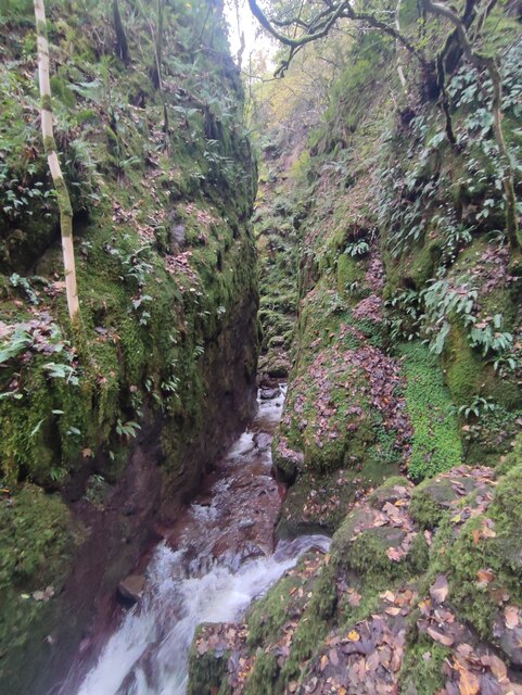
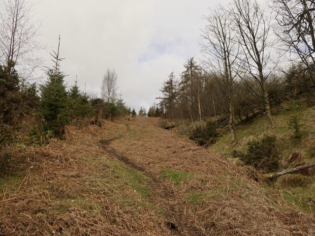
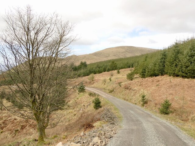
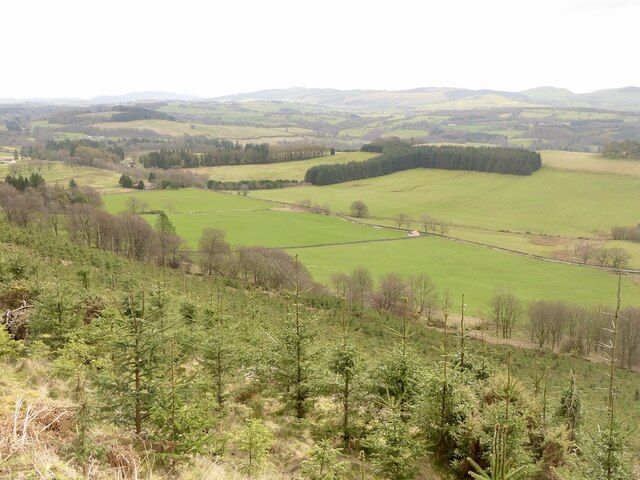
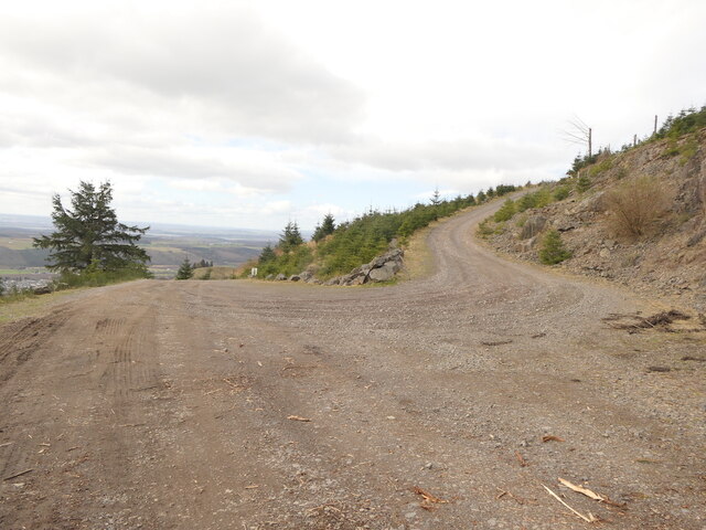
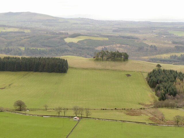
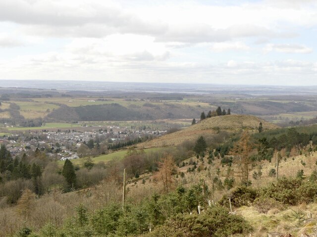
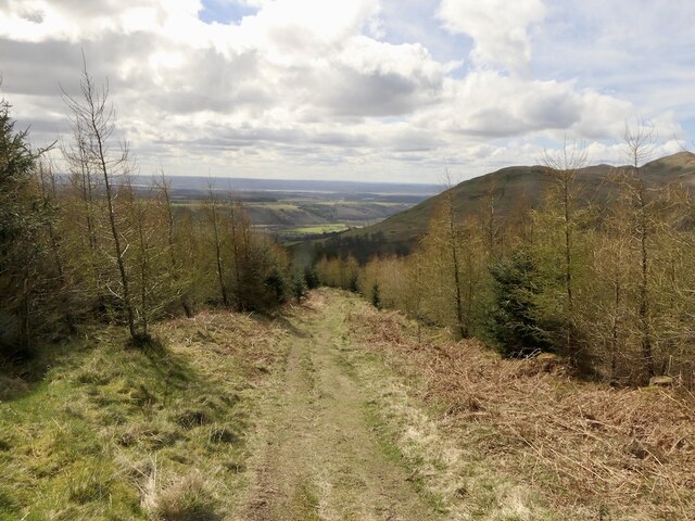
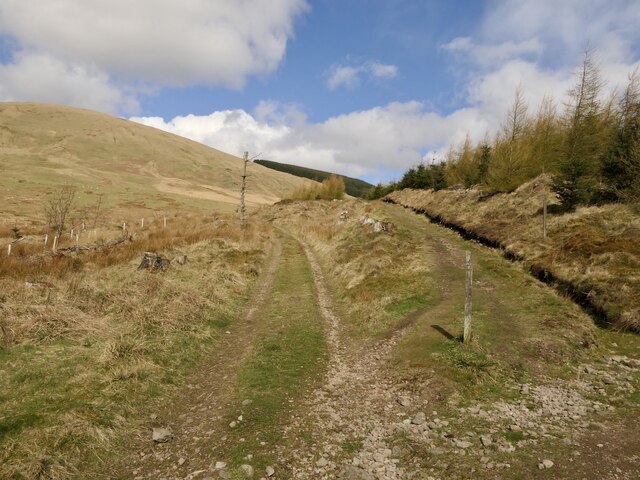
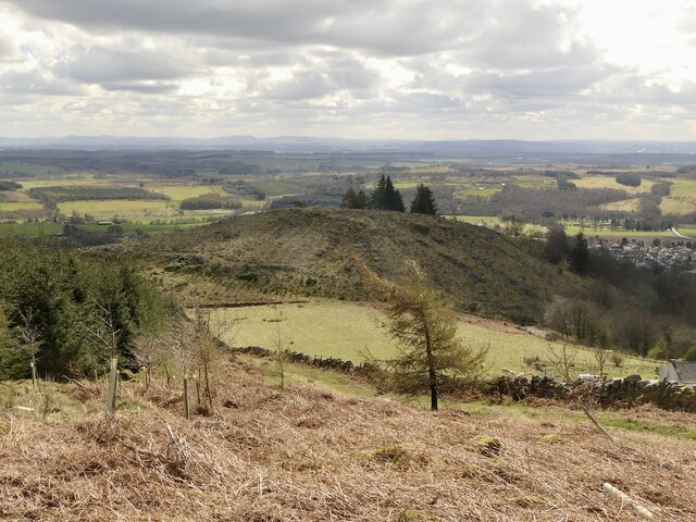
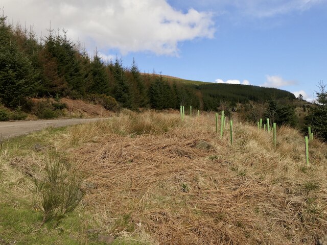
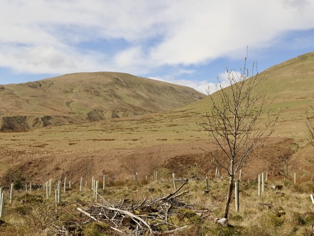
Mill Green is a picturesque woodland located in the region of Clackmannanshire, Scotland. Known for its natural beauty and serene ambiance, this forested area covers an approximate area of 150 acres. The woodland is primarily composed of a diverse mix of deciduous and coniferous trees, creating a rich and vibrant ecosystem.

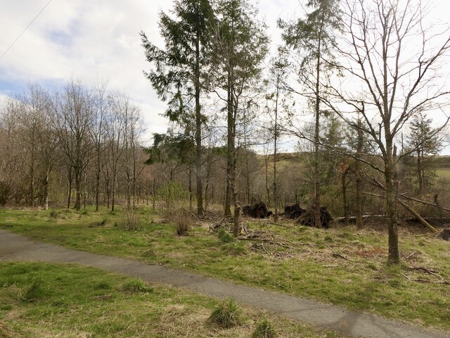
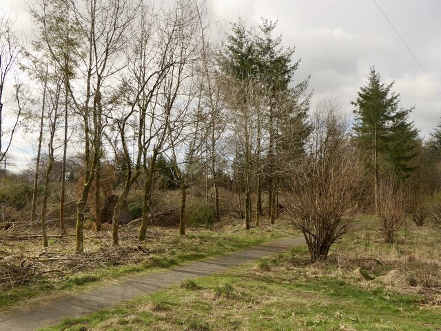
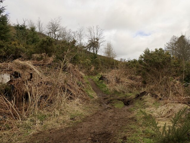
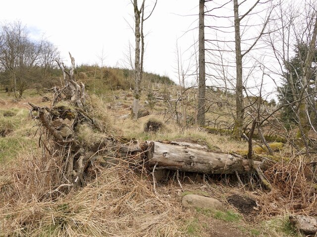
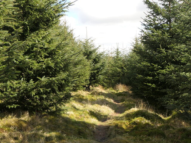
The main entrance to Mill Green is accessible from a well-maintained path that winds through the trees, offering visitors a pleasant and peaceful walk. The forest floor is adorned with a thick carpet of moss, ferns, and wildflowers, providing a stunning display of colors during the spring and summer months.

Within Mill Green, visitors can find a variety of wildlife, including red squirrels, roe deer, and a wide range of bird species. The forest is also home to several small streams and ponds, adding to the tranquility and charm of the area. These water features not only provide a habitat for various aquatic creatures but also create a soothing soundtrack as the water gently flows through the woodland.

Mill Green is a popular destination for nature enthusiasts and outdoor lovers. It offers numerous walking and hiking trails that cater to all levels of experience, from leisurely strolls to more challenging treks. The forest is well-maintained, with clear signage and designated picnic areas for visitors to relax and enjoy the surroundings.

Overall, Mill Green in Clackmannanshire is a haven of natural beauty, offering a peaceful escape from the hustle and bustle of everyday life. Its diverse flora and fauna, coupled with its well-kept trails, make it a must-visit destination for those seeking a tranquil and rejuvenating experience in the heart of nature.

If you have any feedback on the listing, please let us know in the comments section below.

Mill Green Images

Images are sourced within 2km of 56.169275/-3.67091 or Grid Reference NS9698. Thanks to Geograph Open Source API. All images are credited.

Dollar glen
Dollar glen
Law Hill Community Woodland View into the woods from the car park which was full this morning. There has been some windthrow.
Law Hill Community Woodland
View into the woods from the car park which was full this morning. There has been some windthrow.
Path and windthrow, Law Hill Community Woodland
Path, Hillfoot A mountainbike track crossing the boundary mapped by the Ordnance Survey, an old ruined wall.
Path, Hillfoot
A mountainbike track crossing the boundary mapped by the Ordnance Survey, an old ruined wall.
Mountain bike path, Hillfoot Steep with some gap jumps further up.
Mountain bike path, Hillfoot
Steep with some gap jumps further up.
Bike jump, Hillfoot Hill There are a few informal downhill routes on the hill although the summit area trails have for now been removed by clear felling.
Bike jump, Hillfoot Hill
There are a few informal downhill routes on the hill although the summit area trails have for now been removed by clear felling.
Logging road, Hillfoot Hill In use taking out timber from the felled summit area.
Logging road, Hillfoot Hill
In use taking out timber from the felled summit area.
Young trees, Hillfoot Hill
Road junction The road on the right was in use taking timber off the big clear felled area around the summit of Hillfoot Hill.
Road junction
The road on the right was in use taking timber off the big clear felled area around the summit of Hillfoot Hill.
Law Hill View from the slopes of Hillhead Hill.
Law Hill
View from the slopes of Hillhead Hill.
Woodland, Hillfoot Hill View over young trees towards Dollar.
Woodland, Hillfoot Hill
View over young trees towards Dollar.
Path on Hillfoot Hill Descent to Dollar Glen.
Path on Hillfoot Hill
Descent to Dollar Glen.
Path junction, Dollar Glen Paths for Glen Quey and off shot to the right one for Hillfoot Hill.
Path junction, Dollar Glen
Paths for Glen Quey and off shot to the right one for Hillfoot Hill.
Field beneath Gloom Hill The Ochil Hills above Dollar.
Field beneath Gloom Hill
The Ochil Hills above Dollar.
Path, Hillfoot A useful link between the car park at Law Hill and the Dollar Glen.
Path, Hillfoot
A useful link between the car park at Law Hill and the Dollar Glen.
Logging road, Hillfoot Hill Inside of a sharp bend.
Logging road, Hillfoot Hill
Inside of a sharp bend.
View towards King's Seat Looking out of the forest on Hillfoot Hill.
View towards King's Seat
Looking out of the forest on Hillfoot Hill.
Dollar Museum The museum occupies the left-hand part of the building; unfortunately only open at weekends for a short period each day. The right-hand part of the building is residential; the diamond plaque above the door reads 'Castle Campbell Hall'.
Dollar Museum
The museum occupies the left-hand part of the building; unfortunately only open at weekends for a short period each day. The right-hand part of the building is residential; the diamond plaque above the door reads 'Castle Campbell Hall'.
Show me another place!

Mill Green is located at Grid Ref: NS9698 (Lat: 56.169275, Lng: -3.67091)

Unitary Authority: Clackmannanshire

Police Authority: Forth Valley

What 3 Words

///expand.defenders.positions. Near Dollar, Clackmannanshire

Related Wikis

Dollar Glen

Dollar Glen is a small glen (valley) owned by the National Trust for Scotland. It is located in the Ochils that dramatically mark the Highland fault. It...
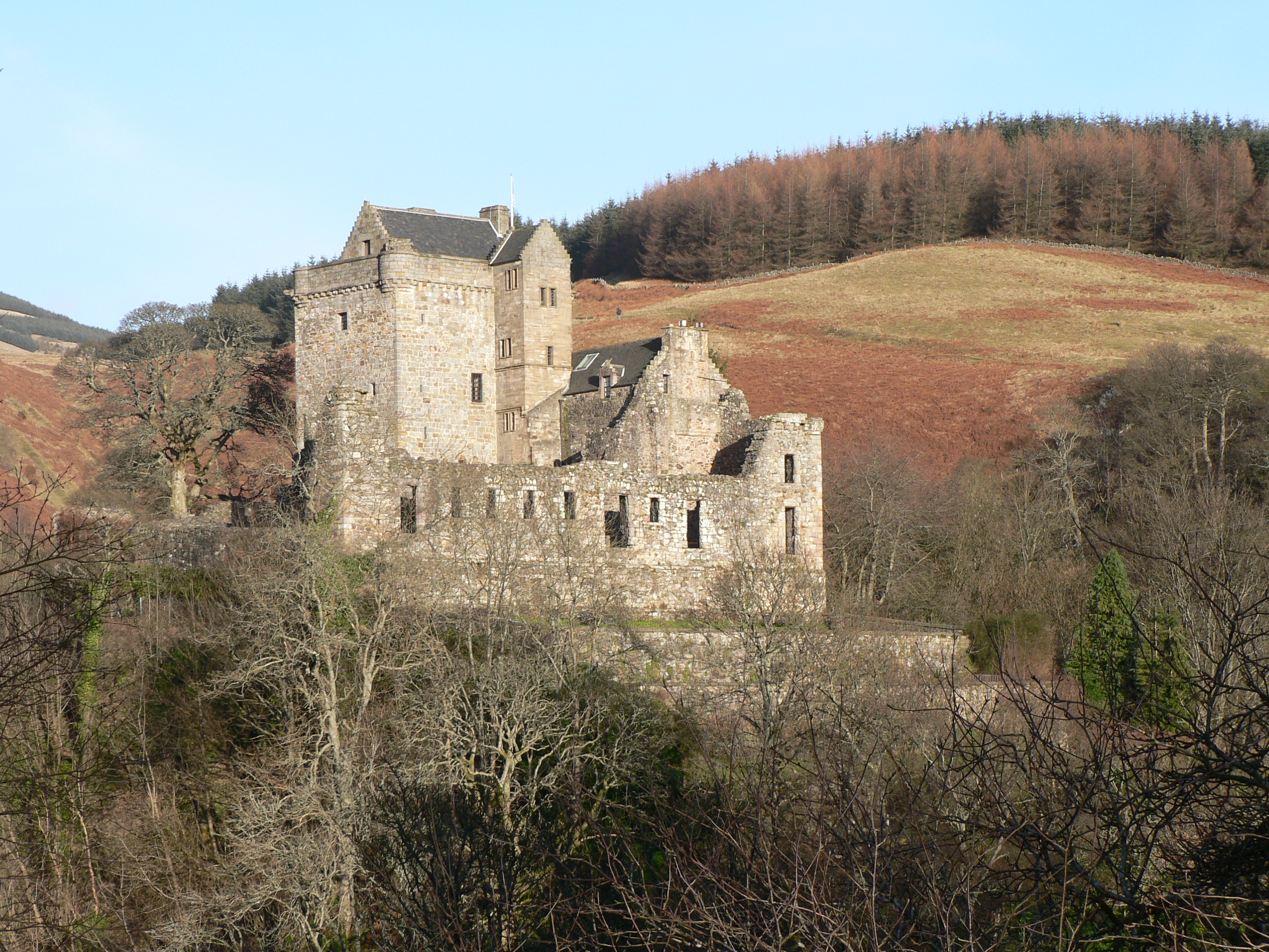
Castle Campbell

Castle Campbell is a medieval castle situated above the town of Dollar, Clackmannanshire, in central Scotland. It was the lowland seat of the earls and...

Dollar, Clackmannanshire

Dollar (Scottish Gaelic: Dolair) is a small town with a population of 2,800 people in Clackmannanshire, Scotland. It is 12 miles (19 kilometres) east of...

Dollar railway station

Dollar railway station served the village of Dollar, Clackmannanshire, Scotland from 1869 to 1964 on the Devon Valley Railway. == History == The station...

Devon Way

Devon Way is a pathway in Clackmannanshire, Central Scotland. It lies on the southern section of the former Devon Valley Railway from Dollar to Tillicoultry...

Blairingone

Blairingone is a village in Perth and Kinross, Scotland. It lies on the A977 road at its intersection with Vicar's Bridge Road near the extreme south-westerly...

Harviestoun

Harviestoun is an estate in Tillicoultry parish, Clackmannanshire, central Scotland. It lies at the base of the Ochil Hills, around 1.5 kilometres (0.93...

Roman Catholic Archdiocese of St Andrews and Edinburgh

The Archdiocese of Saint Andrews & Edinburgh (Latin: Archidioecesis Sancti Andreae et Edimburgensis) is an archdiocese of the Latin Church of the Catholic...

Nearby Amenities

Located within 500m of 56.169275,-3.67091
Post Box
Source: survey
Lat/Long: 56.1663426/-3.6756711
Information: map
Tourism: information
Lat/Long: 56.1703256/-3.6719855
Bench
Backrest: yes
Lat/Long: 56.169353/-3.6710107
Covered: no
Leisure: picnic_table
Lat/Long: 56.1687442/-3.6706548
Board Type: history
Information: board
Tourism: information
Lat/Long: 56.1678529/-3.6703824
Covered: no
Leisure: picnic_table
Lat/Long: 56.1679307/-3.6702923
Power: pole
Lat/Long: 56.1728856/-3.6665138
Power: pole
Lat/Long: 56.1726841/-3.6663464
Power: pole
Lat/Long: 56.1724326/-3.6660808
Bench
Lat/Long: 56.1690436/-3.6697633
Bench
Backrest: yes
Lat/Long: 56.1687749/-3.6708664
Bench
Backrest: yes
Lat/Long: 56.1684697/-3.6705724
Leisure: picnic_table
Lat/Long: 56.1702775/-3.6714239
Bench
Lat/Long: 56.1696388/-3.6701813
Bench
Backrest: no
Lat/Long: 56.1690802/-3.6714816
Bench
Backrest: yes
Lat/Long: 56.1681871/-3.6704259
Bench
Lat/Long: 56.1703437/-3.6708513
Bench
Backrest: no
Lat/Long: 56.1706765/-3.6732885
The data included in this document is from www.openstreetmap.org. The data is made available under ODbL.

Have you been to Mill Green?

Leave your review of Mill Green below (or comments, questions and feedback).